


Bonneville Shoreline Trail - Northern Salt Lake City
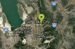
Salt Lake City, Utah
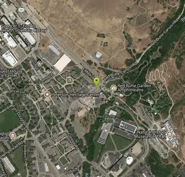
| Address: | ~300 Red Butte Canyon Rd, Salt Lake City, UT 84108, USA |
| GPS: |
40°45'59.5"N 111°49'40.2"W Maps | Directions |
| State: | Utah |
| Trail Length: | 15.00 miles |
| Trail Type: | Network |
| MTB Trail Type: | Singletrack |
Mountain Bike
The Bonneville Shoreline Trail is a series of trails along the slope of the Wasatch Mountains where the old shoreline of Lake Bonneville met the hills. Good aerobic ride. Can be rideable in winter, but tread carefully. Great views of Salt Lake City and beyond! Can be busy. Descending Bobsled trails is the best option to leave the BST. Courtesy of Singletracks.com
More Information
Never modify trail features. Ride trails when they're dry enough that you won't leave ruts. Speak up when you see others on the trail and always yield to hikers, horses, and others coming uphill. Always ride on the established trail.
Read More- Plan Ahead and Prepare
- Travel & camp on durable surfaces
- Dispose of waste properly
- Leave what you find
- Minimize campfire impacts
- Respect wildlife
- Be considerate of other visitors
Directions
From Salt Lake City, Utah
- Head southwest on 400 S/University Blvd toward Main St (0.2 mi)
- Continue straight onto UT-186 E/400 S/University BlvdContinue to follow UT-186 E(3.0 mi)
- Turn left onto Wakara Way (0.6 mi)
- Turn left onto Chipeta Way (0.2 mi)
- Continue onto Connor Rd (0.2 mi)
- Connor Rd turns right and becomes Red Butte Canyon RdDestination will be on the right(0.2 mi)
Other Mountain Bike Trails Nearby
Mt. Wire
Salt Lake City, Utah
1.4 miles SEThe Mt. Wire Pipeline Trail is a great singletrack away from the crowds. The lower portion is steep with loose rock. The Pipeline itself is loose gravel and has more hills then a...
Mountain Bike
Bobsled Trail
Salt Lake City, Utah
1.4 miles NWThe Bobsled Trail is a famous, fast-paced biking trail that will keep your heart racing and send you flying over your handlebars if you're not vigilant. It extends from the Bonneville...
Mountain Bike 4.7 mi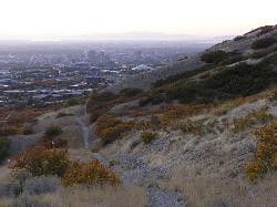
Bonneville Shoreline Trail
Salt Lake City, Utah
3.2 miles NWBonneville Shoreline Trail is a great place for hiking, biking, and trail running. It stretches from North Salt Lake to Parley's Canyon. The trail follows the shoreline of ancient Lake...
Hike, Mountain Bike
Wild Rose Trailhead Park
North Salt Lake, Utah
5.4 miles NWThe Wild Rose trail park has several trails with varying uphill and downhill portions. There are a few single track routes taht are good for early intermediate riders, and a more technical...
Mountain Bike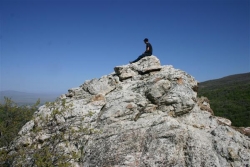
Mueller Park Trail
Bountiful, Utah
6.7 miles NThe Mueller Park Trail is a great year-round trail that's almost right off the road. It's considered moderate difficulty. It's a gradual grade with beautiful views. It's a popular...
Cross-country Ski, Hike, Mountain Bike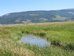
Mormon Flats
Salt Lake City, Utah
7.3 miles EPersonal favorite, this trail has a little bit of everything that i consider Wasatch riding. Start by crossing a bridge and heading up into a historic pioneer trail that turns a hair northshore a...
Mountain Bike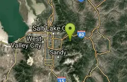
Mill Creek Pipeline
Salt Lake City, Utah
7.6 miles SEthere are quite a few hiking trails that connect into this trail coming up the mountain from your left you will go about 6.5 miles and then a sign post will mark the Rattlesnake down...
Mountain Bike
Storm Mountain
Salt Lake City, Utah
10.8 miles SEStorm Mountain is on of the smaller peaks included in the Wasatch Range. Storm Mountain is located in Cottonwood Canyon. Storm Mountain Day Use Area is just 3 miles up Big Cottonwood Canyon,...
Hike, Mountain Bike, Rock Climb
Ferguson Canyon
Cottonwood Heights, Utah
11.0 miles SFerguson canyon is small canyon between Big and Little Cottonwood Canyons. This canyon has gained popularity over the last few year and is a popular destination for rock climbers. This is one hike...
Hike, Mountain Bike, Rock Climb
Parrish Canyon Trail
Centerville, Utah
11.0 miles NParrish Canyon Trail goes long the Wasatch Mountains; from the top of the mountain, this trail has beautiful views of Salt Lake City from a distance and interconnects with the Barnard Creek. It's...
Hike, Mountain Bike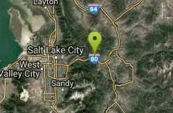
Glenwild
Park City, Utah
12.7 miles EThis easy to follow 8.4 mile loop is located just across from I-80 in Park City. Starting at 6350 feet, the loop has 800 feet of elevation change, with a total of 1200 feet of climbing....
Mountain Bike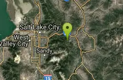
Ambush
Park City, Utah
13.7 miles EAmbush starts up near the Mid Mountain trail, connected to Rob's, and then drops into The Canyons Ski Resort, connecting to Holly's and Rosebud Heaven.
Mountain Bike 3.2 mi
Little Cottonwood Pipeline Trail
Sandy, Utah
13.7 miles SLocated in Sandy, UT, Little Cottonwood Pipeline trail starts at the mouth of Little Cottonwood Canyon and is a single-track trail with some rocky situations on the trail. The first portion of the...
Mountain Bike 1.1-4.7 mi
Bells Canyon
Sandy, Utah
14.0 miles SBells Canyon is a moderate, 4.5 mile hike that begins in a residential area and ends at a waterfall in the enter of the canyon's forest. The first 1/2 mile of the hike is relatively...
Backpack, Hike, Mountain Bike, Snowshoe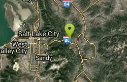
Stealth
Park City, Utah
14.0 miles EThe best rout is to go clockwise. Take the Stealth trail and follow it to the top of the ridge. Cross the road at the top of the ridge and look for a single track near the cell towers....
Mountain Bike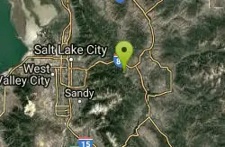
Rob's Trail
Park City, Utah
14.4 miles EMost people ride this trail from the Sun Peak Recreation Center, and connect with Mid Mountain or Ambush for a great loop. From the Sun Peak Recreation Center, you ride up DuBois and Collins to...
Mountain Bike
Rosebud's Heaven
Park City, Utah
14.5 miles ERosebud's Heaven is an intermediate single track trail in Park City, Utah. The trail is about 2.1 miles. It is relatively flat for most of the ride, but has a great switchback trail through a...
Mountain Bike
Colin's Trail
Park City, Utah
14.5 miles ELocated near The Canyons Ski Resort, Colin's trail connects to Rob's and Rosebud Heaven.
Mountain Bike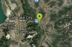
Silver Springs
Park City, Utah
15.3 miles EPartially paved, double track. Very easy. Excellent for beginners or casual riders.
Mountain Bike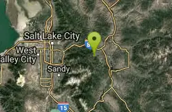
The Canyons Area
Park City, Utah
15.3 miles EThe Canyons Ski Resort-area trails extend from Iron Mountain south. This area includes The Canyons Bike Park, Holly's, Rob's, Ambush, and other trails. Some of these trails are gnarly...
Mountain BikeNearby Campsites

Mill Creek Canyon
Salt Lake City, Utah
7.5 miles SEMill Creek is an out and back with over 1000 ft of elevation gain. The lower section of the ski trail gets a lot of foot traffic, but the upper section (above Elbow Fork) is generally very quiet....
Camp, Cross-country Ski, Snowshoe
Holbrook Trailhead
Bountiful, Utah
8.0 miles Nairsoft feaild woth bunkers
Airsoft, Backpack, Camp, Paintball, Snowshoe
Spruces Campground
Salt Lake City, Utah
13.2 miles SECamping isn't free. See USDA.gov for details. If you know the coordinates of the sledding hill here, please comment.
Camp, Sled 1.6-14.1 mi
Mount Timpanogas
Provo, Utah
25.2 miles SEMt. Timp, as the locals call it, is the 2nd highest mountain in the Wasatch range (only Mt. Nebo is higher). What sets "Timp" apart is its location. It towers over the Provo, Orem, Pleasant...
Camp, Hike, Horseback, Swim 5.6 mi
Antelope Island Lakeside Trail
Syracuse, Utah
27.8 miles NWThe Lakeside Trail is a kid-friendly trail with great views and many bugs. This is a gorgeous scenic hike winding around part of the Great Salt Lake. The trail on Antelope Island that runs about...
Camp, Hike, Horseback
Antelope Island State Park
Syracuse, Utah
28.1 miles NWLocated just 41 miles north of Salt Lake City, Antelope Island State Park encompasses a vast selection of outdoor activities and spectacular scenery providing a peaceful nature experience. Experience...
Backpack, Camp, Hike, Horseback, Mountain Bike 2.9 mi
Pineview Reservoir
Eden, Utah
36.6 miles NLocated on the backside of the Wasatch Front, Pineview Reservoir in the Ogden River Canyon is home to stunning views of the water, sandy beaches, the Southern Skyline trail, paved ramps, and...
Camp, Canoe, Hike, Kayak, Mountain Bike, Swim
Y-Mountain Summit Trail
Provo, Utah
37.8 miles SY Mountain is located directly east of Brigham Young University (BYU) in Provo, Utah, United States. The Slide Canyon/Y Mountain Trail leads to a large block Y located 1.2 miles (1.9 km) from a...
Camp, Hike


