


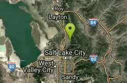
Bountiful to Farmington ATV Trail
Bountiful, Utah
Motorcycle
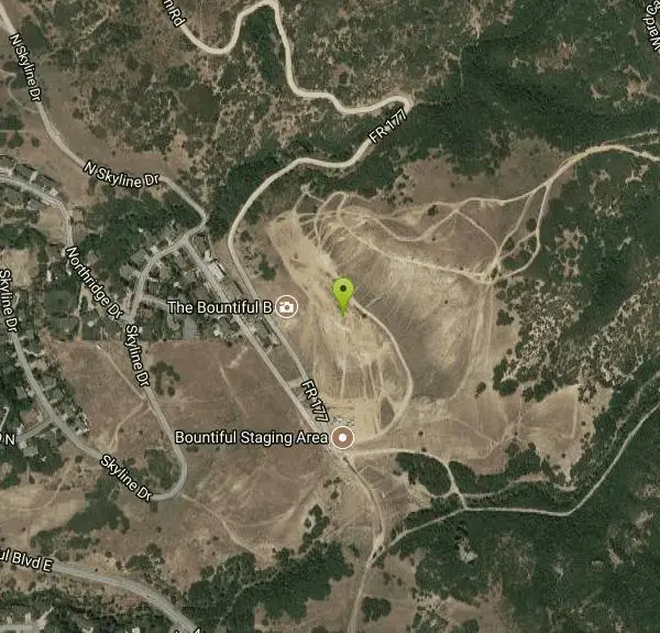
The Farmington Canyon (or Skyline Drive) trail system ties into the same trail system as the Skyline Drive trail system in Bountiful. This is a fun trail that's close to home (if you live along the Wasatch Front) and is a good trail for the family. The trail is moderate, but if you take some of the branches there are more difficult areas. This trail offers some great views of the valley and mountain scenery.
- Plan Ahead and Prepare
- Travel & camp on durable surfaces
- Dispose of waste properly
- Leave what you find
- Minimize campfire impacts
- Respect wildlife
- Be considerate of other visitors
Directions
From Bountiful, Utah
- Head east on W Center St toward N Main St (0.4 mi)
- Turn left onto 400 E (0.3 mi)
- Turn right onto E 400 N (1.0 mi)
- Turn left onto N 1300 E (0.2 mi)
- Turn right onto E 600 N (0.1 mi)
- Turn right onto Skyline Dr (0.4 mi)
- Turn right onto N Eagle Ridge Dr E (0.3 mi)
- N Eagle Ridge Dr E turns sharply left and becomes FR 177/Ward Canyon Rd (0.1 mi)
Up Farmington Canyon (take 100 East until it turns into Skyline Drive).
Nearby Campsites

Holbrook Trailhead
Bountiful, Utah
1.1 miles SThe Holbrook Trailhead is a popular access point for the Bonneville Shoreline Trail and Holbrook Canyon above Bountiful, Utah, on the western face of the Wasatch. Perched on the bench right at the...
Airsoft, Backpack, Camp, Paintball, Snowshoe
Mill Creek Canyon
Salt Lake City, Utah
15.3 miles SEAn out-and-back canyon trail with over 1,000 feet of elevation gain — the lower ski trail sees heavy traffic while the upper section above Elbow Fork stays quiet, with a reservable Yurt at the top December through April.
Camp, Cross-country Ski, Snowshoe
Spruces Campground
Salt Lake City, Utah
20.7 miles SEA fee campground in Big Cottonwood Canyon near Salt Lake City — check USDA.gov for current rates and seasonal availability.
Camp, Sled 5.6 mi
Antelope Island Lakeside Trail
Syracuse, Utah
22.0 miles NWAn easy 2-hour loop on Antelope Island around the Great Salt Lake, with rock formations, views of the Sierra Nevadas, and the GSL — kid-friendly and good for bug fans.
Camp, Hike, Horseback
Antelope Island State Park
Syracuse, Utah
22.5 miles NWTwenty miles of trails cross Utah's Great Salt Lake island alongside free-roaming bison, antelope, and bobcats — best visited in early spring or late fall to beat the bugs.
Backpack, Camp, Hike, Horseback, Mountain Bike 2.9 mi
Pineview Reservoir
Eden, Utah
27.6 miles NA stunning Wasatch reservoir with three sandy beaches, boating, kayaking, paddleboarding, water skiing, and 18 miles of paved trail — the ultimate summer base behind the Ogden front.
Camp, Canoe, Hike, Kayak, Mountain Bike, Swim 1.6-14.1 mi
Mount Timpanogas
Provo, Utah
34.0 miles SUtah's most-climbed mountain towers 7,000 feet above the Provo valley, stretching seven miles north to south with multiple peaks over 11,000 feet — a Wasatch landmark.
Camp, Hike, Horseback, Swim
Y-Mountain Summit Trail
Provo, Utah
46.7 miles SA 1.2-mile climb east of BYU leads to a massive block Y on the hillside and sweeping panoramas over Provo, Orem, Utah Valley, and Utah Lake below.
Camp, Hike


