


Holbrook Trailhead
Bountiful, Utah
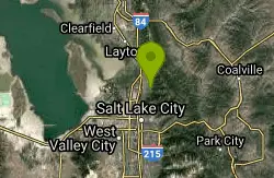
| Address: | Holbrook Trailhead, 701, 799 Bonneville Shoreline Trail, Bountiful, UT 84010, USA |
| GPS: |
40°52'54.0"N 111°50'39.0"W Maps | Directions |
| State: | Utah |
| Field Type: | Public Land |
Restrooms Streams Trails Wildflowers Fall Colors Paintball Permitted Pet Friendly Lakes Rivers Waterfalls Glaciers Rocks Ponds Skateboarding Fishing
Airsoft, Backpack, Camp, Paintball, and Snowshoe
The Holbrook Trailhead is a popular access point for the Bonneville Shoreline Trail and Holbrook Canyon above Bountiful, Utah, on the western face of the Wasatch. Perched on the bench right at the edge of town, it's a favorite of local hikers, trail runners, and dog walkers looking for a quick escape into the mountains with big valley views — and a gateway to some genuinely rugged canyon terrain for those who want more.
From the trailhead you have options. A moderate loop of about 3.3 miles (roughly 800 feet of climbing) links the lower Holbrook Canyon trail with the Bonneville Shoreline Trail, making a satisfying half-day outing. For a much bigger day, the full Holbrook Canyon Trail pushes deep up the drainage — around 10 miles round trip with over 3,000 feet of gain — following a shaded, creek-side route that crosses the stream on small bridges seven or eight times as it climbs into the high country. The Bonneville Shoreline descent is gentler, winding down a long series of switchbacks.
The trailhead itself sits on Bountiful Boulevard, just past the Bountiful LDS Temple, with a parking lot that fits about 12 to 15 cars and restrooms on site — though it fills quickly on nice mornings and weekends, so arrive early.
One quirk worth knowing: the hills and old bunkers above the trailhead have long been used informally for airsoft and paintball games. If you're here to hike, be aware that you may encounter players in the area around the bunkers, and it's best to steer clear of that zone; if you're coming to play, wear proper eye and face protection and be mindful of hikers, since the two uses share the same ground. It's an unofficial, unsupervised activity, so use good judgment.
Part of what makes the Holbrook Trailhead so popular is simply how accessible it is: it sits minutes from Bountiful's neighborhoods yet delivers a real mountain experience, from a gentle shoreline stroll to a serious canyon workout. The Bonneville Shoreline Trail it connects to is a growing regional path that traces the ancient shoreline of prehistoric Lake Bonneville along the Wasatch Front, so you can extend a hike for miles in either direction, linking to other canyons and trailheads.
Come prepared for a Wasatch-front outing: carry plenty of water (the lower canyon is shaded but the shoreline stretches are hot and exposed), wear sturdy shoes, and start early in summer to beat the heat. The trail is used year-round, though the canyon can be snowy and icy in winter. Keep dogs under control, yield on the shared trail, and pack out everything you bring. Whether you want a quick shoreline stroll, a lung-busting canyon climb, or a round of airsoft at the bunkers, the Holbrook Trailhead is one of Bountiful's most-used doorways to the mountains.
More Information
Hiking Davis County: Holbrook Canyon | Discover Davis
The trailhead and parking lot for Holbrook Canyon is on Bountiful Boulevard, just past the Bountiful LDS Temple. Follow the trail on the south side of the
https://discoverdavis.com/holbrook-canyon/
- Plan Ahead and Prepare
- Travel & camp on durable surfaces
- Dispose of waste properly
- Leave what you find
- Minimize campfire impacts
- Respect wildlife
- Be considerate of other visitors
Directions
From Bountiful, Utah
- Head east on W Center St toward N Main St (0.4 mi)
- Turn left onto 400 E (0.3 mi)
- Turn right onto E 400 N (1.6 mi)
- Continue onto Bountiful BlvdDestination will be on the left(0.6 mi)
you start up the trail but then at the first turn right there is a mini trail that is to the left. there are bunkers for airspft and i go there every friday
Nicholas johnson
6/6/22 1:16 am25btoomey
3/17/21 9:58 am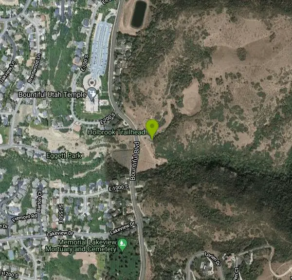
Other Paintball Fields, Airsoft Fields, Snowshoe Trails, and Backpacking Trails Nearby
Mill Creek Canyon
Salt Lake City, Utah
14.3 miles SEAn out-and-back canyon trail with over 1,000 feet of elevation gain — the lower ski trail sees heavy traffic while the upper section above Elbow Fork stays quiet, with a reservable Yurt at the top December through April.
Camp, Cross-country Ski, Snowshoe 16.6 mi
Antelope Island Figure 8
Layton, Utah
20.0 miles WSmooth, open trail across Antelope Island's backcountry with awesome rock formations and desert silence — best ridden in spring and fall; nearly zero shade, so beat the heat and yield to horses and runners.
Hike, Mountain Bike, Snowshoe 1.1-4.7 mi
Bells Canyon
Sandy, Utah
22.0 miles SA 4.5-mile moderate hike up to a canyon waterfall through gorgeous fall foliage, meadows, wildflowers, and a creekside trail — the last 1.2 miles involve serious climbing over large rocks.
Backpack, Hike, Mountain Bike, Snowshoe
Bonneville Shoreline Trail, Ogden, UT, USA
Ogden, Utah
22.6 miles NBackpack, Hike, and Mountain Bike near Ogden, Utah
Backpack, Hike, Mountain Bike
Pfeiferhorn Peak
Provo, Utah
22.8 miles SAn easily accessible Wasatch peak east of Salt Lake City with alpine lakes below and mountain goats spotted regularly above — breathtaking views of the Salt Lake valley from one of the range's highest points.
Backpack, Hike
Antelope Island State Park
Syracuse, Utah
23.0 miles NWTwenty miles of trails cross Utah's Great Salt Lake island alongside free-roaming bison, antelope, and bobcats — best visited in early spring or late fall to beat the bugs.
Backpack, Camp, Hike, Horseback, Mountain Bike 7.2 mi
White Rock Loop
Syracuse, Utah
23.4 miles NWAn easy loop around Antelope Island with sweeping landscape views, wildlife like bison and birds, and leashed-dog access — no shade, so pack sunscreen.
Hike, Mountain Bike, Snowshoe 1.6 mi
Corner Canyon Trail
Draper, Utah
26.0 miles SA go-to mountain biking area in South Salt Lake mixing beginner training trails in Little Valley with big table tops and wall rides in Maple Hollow.
Backpack, Hike, Mountain Bike 1.2 mi
Ghost Falls Trail
Sandy, Utah
26.8 miles SA family-friendly hike in Corner Canyon that winds through sandy rocky slopes and dry creek beds to the Ghost Falls loop, with helpful trail signs at the confusing intersections.
Hike, Mountain Bike, Snowshoe 1.5 mi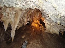
Timpanogas Cave
Provo, Utah
31.1 miles SColorful cave formations — cave bacons, columns, flowstone, and drapery — inside a Timpanogos mountain cave, reached by a 1.5-mile paved trail; tours run May through September.
Backpack, Cave, Hike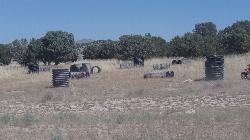
Eagle Mountain Paintball Field
Eagle Mountain, Utah
38.2 miles SA natural paintball field with culvert-pipe bunkers built into the brush just south of the Eagle Mountain trailhead — an off-the-beaten-path spot for backyard-style play.
Airsoft, Paintball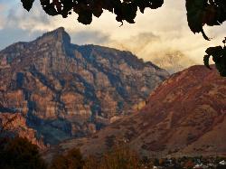
Kyhv Peak
Provo, Utah
41.7 miles SKyhv Peak is the dramatic 7,876-foot summit that towers over the mouth of Rock Canyon, rising steeply behind Brigham Young University and the city of Provo on the western front of Utah's Wasatch...
Airsoft, PaintballNearby Campsites
Mill Creek Canyon
Salt Lake City, Utah
14.3 miles SEAn out-and-back canyon trail with over 1,000 feet of elevation gain — the lower ski trail sees heavy traffic while the upper section above Elbow Fork stays quiet, with a reservable Yurt at the top December through April.
Camp, Cross-country Ski, Snowshoe
Spruces Campground
Salt Lake City, Utah
19.8 miles SEA fee campground in Big Cottonwood Canyon near Salt Lake City — check USDA.gov for current rates and seasonal availability.
Camp, Sled 5.6 mi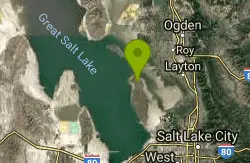
Antelope Island Lakeside Trail
Syracuse, Utah
22.6 miles NWAn easy 2-hour loop on Antelope Island around the Great Salt Lake, with rock formations, views of the Sierra Nevadas, and the GSL — kid-friendly and good for bug fans.
Camp, Hike, Horseback
Antelope Island State Park
Syracuse, Utah
23.0 miles NWTwenty miles of trails cross Utah's Great Salt Lake island alongside free-roaming bison, antelope, and bobcats — best visited in early spring or late fall to beat the bugs.
Backpack, Camp, Hike, Horseback, Mountain Bike 2.9 mi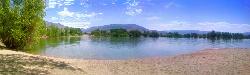
Pineview Reservoir
Eden, Utah
28.7 miles NA stunning Wasatch reservoir with three sandy beaches, boating, kayaking, paddleboarding, water skiing, and 18 miles of paved trail — the ultimate summer base behind the Ogden front.
Camp, Canoe, Hike, Kayak, Mountain Bike, Swim 1.6-14.1 mi
Mount Timpanogas
Provo, Utah
32.9 miles SUtah's most-climbed mountain towers 7,000 feet above the Provo valley, stretching seven miles north to south with multiple peaks over 11,000 feet — a Wasatch landmark.
Camp, Hike, Horseback, Swim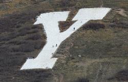
Y-Mountain Summit Trail
Provo, Utah
45.7 miles SA 1.2-mile climb east of BYU leads to a massive block Y on the hillside and sweeping panoramas over Provo, Orem, Utah Valley, and Utah Lake below.
Camp, Hike


