


222 Things to do near Buckhorn Campground Nature Trail
first prev 3 4 5 6 7 8 9 10 11 12 next lastShowing results within 50 miles Distance miles of Nature Trail, Apache Junction, AZ 85120, USA City, Zip, or Address

Ocotillo/Ridgeback/Sidewinder Loop Trail
Phoenix, Arizona
31.8 miles NWGreat moderate loop which includes a summit, great views and Classic Sonoran Desert scenery. Multiple access points and other connecting trails allows for the loop to be changed if...
Hike, Horseback, Mountain Bike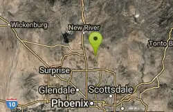
Apache Wash Trail
Phoenix, Arizona
31.8 miles NWStart west on Ocitillo to Ridgeback north till you get to the crossing of Sidewinder then head west. Keep on Sidewinder toil you come to the crossing of Octillio and head east back to...
Hike
Apache Wash Sidewinder Loop Trail
Phoenix, Arizona
31.8 miles NWHorseback and Mountain Bike near Phoenix, Arizona
Horseback, Mountain Bike 12.6 mi
National Trail
Phoenix, Arizona
31.8 miles WNational Trail is the gem of South Mountain and home to the infamous Waterfall. It’s a local favorite as well as a destination trail for MTB snowbirds. Like most trails in the Sonoran...
Hike, Mountain Bike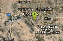
Alta Trail And Bajada Trail
Phoenix, Arizona
31.8 miles WHike near Phoenix, Arizona
Hike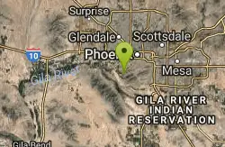
South Mountain Park / National Trail
Phoenix, Arizona
32.1 miles WNational trail can be acended or decended. Both require expert skills and fitness. You cannot and will not find a climb this technical, challenging and fun in AZ. It will kick your...
Mountain Bike

Hawk's Nest Trail and Dixie Mountain Loop
Phoenix, Arizona
33.1 miles NWModerate Trail providing access from the Car Park to all other trails. Directly links to Desert Tortoise Trail and Dixie Mountain Loop. Good hiking shoes/boots recommended....
Hike, Horseback, Mountain Bike 5.8 mi
Go John Trail
Cave Creek, Arizona
33.1 miles NWThe Go John Trail is a 5.8 mile loop trail outside of Cave Creek, Arizona, that is moderately trafficked, used by both hikers and mountain bikers. It is an excellent opportunity to view the desert...
Hike, Horseback, Mountain Bike
Western Vista Trail
Phoenix, Arizona
33.1 miles NWFairly difficult short Trail to one of the summits on the Dixie Mountain Loop. Great views from the top as well as a birds eye view of the gravel pit below.
Hike
Dixie Mountain Loop with Two Summits
Phoenix, Arizona
33.1 miles NWHike, Horseback, and Mountain Bike near Phoenix, Arizona
Hike, Horseback, Mountain Bike
Dixie Summit Trail
Phoenix, Arizona
33.1 miles NWA steep and difficult short trail using many switchbacks to get to the summit. You will be rewarded with spectacular views of the surrounding area.
Hike 2.8 mi
Desert Tortoise
Phoenix, Arizona
33.1 miles NWAt just over a mile long, Desert Tortoise is a doubletrack connector to the Valle Verde Trail. Very good hiking area with a good range of difficulty levels. Starts with a short climb from the...
Hike, Mountain Bike
Dixie Mountain Loop Trail
Phoenix, Arizona
33.1 miles NWThe main loop trail at Phoenix's Sonoran Preserve provides plenty of options for either a short walk or a longer hike. The elevation gain is accumulated through small ups-and-downs along the...
Hike, Horseback, Mountain Bike
Hawk's Nest/Desert Tortoise/Dixie Mountain Loop
Phoenix, Arizona
33.1 miles NWA nice moderate trail through great desert scenery crossing creeks and twisting and turning around the hills. Provides a loop opportunity between Hawk's Nest Trail, Valle Verde Trail,...
Hike, Horseback, Mountain Bike
Union Peak Loop
Phoenix, Arizona
33.1 miles NWHike near Phoenix, Arizona
Hike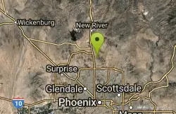
Sonoran Trail
Phoenix, Arizona
33.1 miles NWThe Sonora Trail is smooth, but hilly, and has a 10-12 mile loop course that is well marked at intersections. This ride is suitable for many levels, but beginners should have good...
Mountain Bike
Desert West Skateboard Plaza
Phoenix, Arizona
33.5 miles W25,000 sq.feet: concrete bowl, street course, ramps, pads and helmets required, free. Open every day 7am to 10pm. one of the first parks built in phoenix, fun for beginners, boring if you really...
Skateboard
Clay Mine Trail
Cave Creek, Arizona
33.5 miles NWClay Mine Trail is a 1.6 mile out-and-back, beginner friendly trail in Cave Creek Regional Park. This is a trail that is very close to the Visitor Center. It's not too difficult but there...
Hike
Thunderbird-Paseo
Glendale, Arizona
33.9 miles WIn a drainage canal with mostly side hill pins. Starts and ends at playground/restroom area. A range of difficulty - with some length and uphill approaches. Pack water. Some tees are on blacktop...
Disc Golf
Slate Creek Divide Loop
Phoenix, Arizona
34.1 miles NVarious routes available - Alternative #1 (From above): 13 Mi. (22 km) Alternative #2 (From above): 10 Mi. (16 km) Loop top half only (Inc. dirt. to 8 from SR 87): 12 Mi. (19 km) Figure eight: 16 Mi....
Mountain Bike


