


83 Things to do near Cape Final
first prev 1 2 3 4 5 next lastShowing results within 50 miles Distance miles of 43W7+5P North Rim, AZ, USA City, Zip, or Address
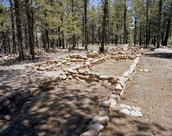
Walhalla Ruins
North Rim, Arizona
0.9 miles SA short walk to authentic 900-year-old ancestral Pueblo ruins on Grand Canyon's North Rim, surrounded by canyon vistas on three sides at the lower-elevation Walhalla Plateau.
Hike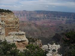
Walhalla Overlook
North Rim, Arizona
1.0 miles SHistory and geology converge at Walhalla Overlook on the Grand Canyon's North Rim, where sweeping views take in the Unkar Delta and the ancient farmland of those who once lived here.
Hike 0.8 mi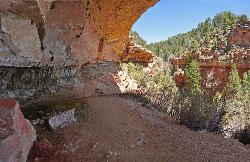
Cliff Springs
North Rim, Arizona
1.6 miles SWA hike past a granary ruin, overhanging rocks, and stunning Grand Canyon views to an alcove filled with Anasazi pictograph hand prints — some unfortunately defaced.
Hike 0.5-0.8 mi
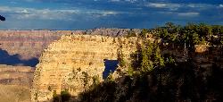
Cape Royal Trail
North Rim, Arizona
1.8 miles SWA flat, paved under-a-mile stroll to the tip of the North Rim's Cape Royal peninsula with sweeping canyon views, Angels Window, and the Colorado River framed in a natural arch.
Hike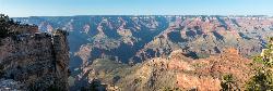
Roosevelt Point Trail
North Rim, Arizona
5.1 miles NA short 0.2-mile flat woodland loop on the Grand Canyon's North Rim delivers big views of Tritle Peak and the surrounding canyon — benches included for unhurried gazing.
Hike 0.4 mi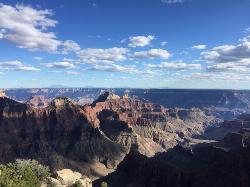
Bright Angel Point Trail
North Rim, Arizona
7.4 miles NWA steep, fully paved path at Grand Canyon's North Rim leading to a breathtaking viewpoint, with large climbable rocks, canyon views from all angles, and far fewer crowds than the South Rim.
Hike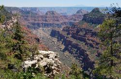
Transept Trail
North Rim, Arizona
7.4 miles NWA 3.4-mile rim hike on the North Rim connecting Grand Canyon Lodge to the campground through aspens, ponderosa pines, and an ancestral Puebloan ruin — relaxing canyon views throughout.
Hike 1.9 mi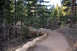
Bridle Trail
North Rim, Arizona
7.5 miles NWA peaceful rock-lined path connecting Grand Canyon Lodge to the North Kaibab Trailhead — easy enough near the campground and visitor center, gaining difficulty over distance.
Hike, Horseback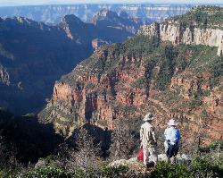
Uncle Jim Trail
North Rim, Arizona
8.3 miles NWThe Uncle Jim Trail is an easy 4.7-mile North Rim loop to Uncle Jim Point, with jaw-dropping views over Roaring Springs and Bright Angel canyons.
Backpack, Camp, Hike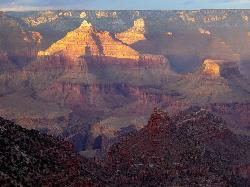
Rim-to-Rim: North Kaibab to Grand Canyon Village
North Rim, Arizona
8.4 miles NWA four-day rim-to-rim Grand Canyon hike with stops at Ribbon Falls, Phantom Ranch, Cottonwood Camp, and a sunset at Plateau Point that must be seen to be believed.
Backpack, Camp, Hike
Rim-to-Rim: North to South Kaibab Trail
North Rim, Arizona
8.4 miles NWThe iconic Grand Canyon Rim-to-Rim hike from the North Rim to the South Kaibab Trail — one of the most breathtaking and demanding hikes in North America.
Camp, Hike, Horseback
Phantom Ranch to Ribbon Falls on North Kaibab Trail
North Rim, Arizona
8.4 miles NWA classic Grand Canyon corridor hike on the North Kaibab Trail from Phantom Ranch to Ribbon Falls.
Camp, Hike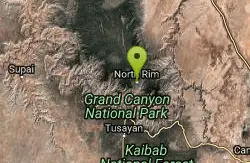
North Kaibab Trail to Colorado River
North Rim, Arizona
8.4 miles NWA steep, well-maintained, and well-marked trail dropping from the North Rim to the Colorado River — perfect for experienced hikers ready for serious elevation change.
Backpack, Camp, Hike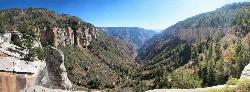
North Kaibab Trail to Supai Tunnel
North Rim, Arizona
8.4 miles NWThe North Rim's only maintained inner-canyon trail descends moderately through all of the Grand Canyon's life zones, with wide, manageable tread and dramatic landscapes at every turn.
Backpack, Hike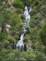
North Kaibab Trail to Roaring Springs
North Rim, Arizona
8.4 miles NWA well-shaded, mule-frequented descent on the North Rim of the Grand Canyon, with incredible views, wildflowers, birdwatching, and water stations — a 6-to-9-hour day hike.
Backpack, Hike 6.3 mi
Tiyo Point Trail
North Rim, Arizona
8.7 miles NWA lightly traveled primitive North Rim trail through encroaching forest with old markers on trees, wildflowers, gentle rolling terrain, and a single picnic area near the end.
Backpack, Camp, Hike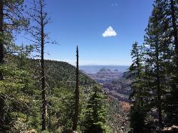
Widforss Trail
North Rim, Arizona
9.0 miles NWA peaceful 10-mile forested hike along the North Rim to Widforss Point, weaving in and out of the woods with stunning Grand Canyon views and rock ledges to rest and soak it all in.
Backpack, Hike
Widforss Trail - Short Option
North Rim, Arizona
9.0 miles NWA short option on the Widforss Trail at the Grand Canyon's North Rim — a scenic rim hike with views into the canyon.
Hike
Tanner Trail
Grand Canyon Village, Arizona
9.1 miles SEA rigorous rim-to-river backpacking route recommended only for seasoned hikers — relentlessly steep, rocky, shadeless, and waterless until the Colorado River, with access to one of the canyon's most scenic beach campsites.
Backpack, Camp, Hike
The Escalante Route Trail
Grand Canyon Village, Arizona
9.1 miles SEA demanding technical route along the Colorado River from Tanner Beach to Escalante Creek — narrow traverses on steep slopes require careful footing and a calm, unhurried pace.
Backpack, Hike


