


Roosevelt Point Trail
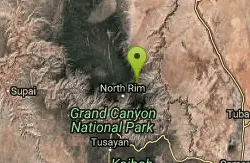
North Rim, Arizona
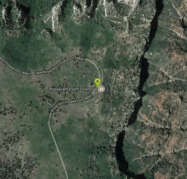
| Address: | ~Cape Royal Rd, North Rim, AZ 86052, USA |
| GPS: |
36°13'4.5"N 111°57'9.6"W Maps | Directions |
| State: | Arizona |
| Trail Length: | 0.30 miles |
| Trail Type: | Loop |
| Hike Difficulty: | Beginner |
| Elevation Gain: | 3 feet |
Pet Friendly
Hike
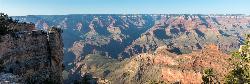
Roosevelt Point Trail on Grand Canyon National Park's North Rim is a 0.2 mile short, relatively flat woodland loop trail offering spectacular views. Roosevelt Point Trail on Grand Canyon National Park's North Rim is a short, relatively flat 0.2 mi. woodland loop offering spectacular views; 20 minutes approximate round-trip hiking time. Offers benches for relaxed enjoyment of the canyon. Fires in recent years have taken out many of the trees leaving smaller brush and open areas. Good views of Tritle Peak and surrounding canyon areas. Courtesy of AllTrails.com
More Information
Grand Canyon National Park Itinerary
This Grand Canyon National Park Itinerary will help you get started as you plan your vacation to Grand Canyon National Park.
https://www.justgotravelstudios.com/collections/national-park-itineraries/products/grand-canyon-national-park-itinerary?ref=9zpxis0diinBe courteous, informed, and prepared. Read trailhead guidelines, stay on the trail, and don't feed the wildlife.
Read More
- Plan Ahead and Prepare
- Travel & camp on durable surfaces
- Dispose of waste properly
- Leave what you find
- Minimize campfire impacts
- Respect wildlife
- Be considerate of other visitors
Directions
From North Rim, Arizona
- Head northwest on AZ-67 N toward Bridle PathMay be closed at certain times or days(1.9 mi)
- Turn rightMay be closed at certain times or days(5.4 mi)
- Turn right toward Cape Royal Rd (171 ft)
- Continue onto Cape Royal RdMay be closed at certain times or daysDestination will be on the left(6.3 mi)


Other Hiking Trails Nearby
Ken Patrick Trail South from Point Imperial
North Rim, Arizona
4.5 miles NA North Rim hike from the Kaibab Trailhead leading to Point Imperial, with Grand Canyon views along the way.
Hike 0.2 mi
Point Imperial Viewpoint
North Rim, Arizona
4.5 miles NThe highest viewpoint on the North Rim at 8,803 feet, with sweeping eastern views, Mount Hayden's Coconino Sandstone spire, Vermilion Cliffs, and Marble Canyon stretching before you.
Hike 
Ken Patrick Trail North from Point Imperial
North Rim, Arizona
4.5 miles NA 4-mile out-and-back hike from Point Imperial on the Grand Canyon's North Rim with scenic views suitable for all skill levels.
Hike 
Nankoweap Trail
North Rim, Arizona
4.5 miles NThe Nankoweap Trail is a remote, demanding Grand Canyon route on the North Rim — a serious undertaking for experienced backcountry hikers.
Backpack, Camp, Hike 
Cape Final
North Rim, Arizona
5.1 miles SA gentle climb through open ponderosa pine forest on the North Rim leads to a dramatic 180-degree canyon panorama at Cape Final — with a designated backcountry campsite right at the rim's edge.
Camp, Hike 
Uncle Jim Trail
North Rim, Arizona
5.7 miles WThe Uncle Jim Trail is an easy 4.7-mile North Rim loop to Uncle Jim Point, with jaw-dropping views over Roaring Springs and Bright Angel canyons.
Backpack, Camp, Hike 1.9 mi
Bridle Trail
North Rim, Arizona
5.7 miles WA peaceful rock-lined path connecting Grand Canyon Lodge to the North Kaibab Trailhead — easy enough near the campground and visitor center, gaining difficulty over distance.
Hike, Horseback 0.4 mi
Bright Angel Point Trail
North Rim, Arizona
5.8 miles WA steep, fully paved path at Grand Canyon's North Rim leading to a breathtaking viewpoint, with large climbable rocks, canyon views from all angles, and far fewer crowds than the South Rim.
Hike 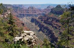
Transept Trail
North Rim, Arizona
5.8 miles WA 3.4-mile rim hike on the North Rim connecting Grand Canyon Lodge to the campground through aspens, ponderosa pines, and an ancestral Puebloan ruin — relaxing canyon views throughout.
Hike 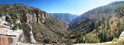
North Kaibab Trail to Supai Tunnel
North Rim, Arizona
5.8 miles WThe North Rim's only maintained inner-canyon trail descends moderately through all of the Grand Canyon's life zones, with wide, manageable tread and dramatic landscapes at every turn.
Backpack, Hike 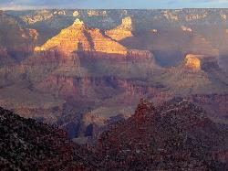
Rim-to-Rim: North Kaibab to Grand Canyon Village
North Rim, Arizona
5.8 miles WA four-day rim-to-rim Grand Canyon hike with stops at Ribbon Falls, Phantom Ranch, Cottonwood Camp, and a sunset at Plateau Point that must be seen to be believed.
Backpack, Camp, Hike 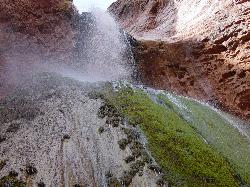
Phantom Ranch to Ribbon Falls on North Kaibab Trail
North Rim, Arizona
5.8 miles WA classic Grand Canyon corridor hike on the North Kaibab Trail from Phantom Ranch to Ribbon Falls.
Camp, Hike 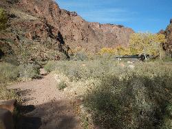
North Kaibab Trail to Colorado River
North Rim, Arizona
5.8 miles WA steep, well-maintained, and well-marked trail dropping from the North Rim to the Colorado River — perfect for experienced hikers ready for serious elevation change.
Backpack, Camp, Hike 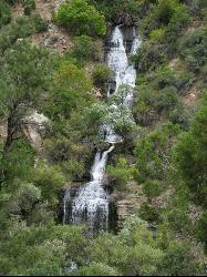
North Kaibab Trail to Roaring Springs
North Rim, Arizona
5.8 miles WA well-shaded, mule-frequented descent on the North Rim of the Grand Canyon, with incredible views, wildflowers, birdwatching, and water stations — a 6-to-9-hour day hike.
Backpack, Hike 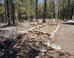
Walhalla Ruins
North Rim, Arizona
5.9 miles SA short walk to authentic 900-year-old ancestral Pueblo ruins on Grand Canyon's North Rim, surrounded by canyon vistas on three sides at the lower-elevation Walhalla Plateau.
Hike 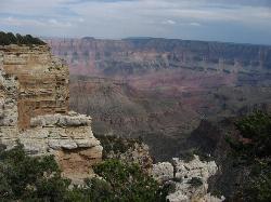
Walhalla Overlook
North Rim, Arizona
6.0 miles SHistory and geology converge at Walhalla Overlook on the Grand Canyon's North Rim, where sweeping views take in the Unkar Delta and the ancient farmland of those who once lived here.
Hike 6.3 mi
Tiyo Point Trail
North Rim, Arizona
6.1 miles WA lightly traveled primitive North Rim trail through encroaching forest with old markers on trees, wildflowers, gentle rolling terrain, and a single picnic area near the end.
Backpack, Camp, Hike 
Widforss Trail
North Rim, Arizona
6.3 miles WA peaceful 10-mile forested hike along the North Rim to Widforss Point, weaving in and out of the woods with stunning Grand Canyon views and rock ledges to rest and soak it all in.
Backpack, Hike 
Widforss Trail - Short Option
North Rim, Arizona
6.3 miles WA short option on the Widforss Trail at the Grand Canyon's North Rim — a scenic rim hike with views into the canyon.
Hike 0.8 mi
Cliff Springs
North Rim, Arizona
6.4 miles SA hike past a granary ruin, overhanging rocks, and stunning Grand Canyon views to an alcove filled with Anasazi pictograph hand prints — some unfortunately defaced.
HikeNearby Campsites
Nankoweap Trail
North Rim, Arizona
4.5 miles NThe Nankoweap Trail is a remote, demanding Grand Canyon route on the North Rim — a serious undertaking for experienced backcountry hikers.
Backpack, Camp, Hike
Cape Final
North Rim, Arizona
5.1 miles SA gentle climb through open ponderosa pine forest on the North Rim leads to a dramatic 180-degree canyon panorama at Cape Final — with a designated backcountry campsite right at the rim's edge.
Camp, Hike
Uncle Jim Trail
North Rim, Arizona
5.7 miles WThe Uncle Jim Trail is an easy 4.7-mile North Rim loop to Uncle Jim Point, with jaw-dropping views over Roaring Springs and Bright Angel canyons.
Backpack, Camp, Hike
Rim-to-Rim: North Kaibab to Grand Canyon Village
North Rim, Arizona
5.8 miles WA four-day rim-to-rim Grand Canyon hike with stops at Ribbon Falls, Phantom Ranch, Cottonwood Camp, and a sunset at Plateau Point that must be seen to be believed.
Backpack, Camp, Hike
Phantom Ranch to Ribbon Falls on North Kaibab Trail
North Rim, Arizona
5.8 miles WA classic Grand Canyon corridor hike on the North Kaibab Trail from Phantom Ranch to Ribbon Falls.
Camp, Hike
North Kaibab Trail to Colorado River
North Rim, Arizona
5.8 miles WA steep, well-maintained, and well-marked trail dropping from the North Rim to the Colorado River — perfect for experienced hikers ready for serious elevation change.
Backpack, Camp, Hike 6.3 mi
Tiyo Point Trail
North Rim, Arizona
6.1 miles WA lightly traveled primitive North Rim trail through encroaching forest with old markers on trees, wildflowers, gentle rolling terrain, and a single picnic area near the end.
Backpack, Camp, Hike 
The Grand Canyon: Kaibab to Bright Angel Trail
Grand Canyon Village, Arizona
13.5 miles SWAn unforgettable 2-3 day hike combining the South Kaibab's unbeatable views with the shaded, water-rich Bright Angel Trail — staring up at the canyon from the river below.
Backpack, Camp, Hike 
South Kaibab to Phantom Ranch to Bright Angel Trail
Grand Canyon Village, Arizona
13.5 miles SWA difficult but spectacular multi-day Grand Canyon hike combining South Kaibab's stunning rim views with Phantom Ranch's riverside oasis and Bright Angel's shaded water stations.
Backpack, Camp, Hike 13.6 mi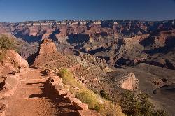
South Kaibab Trails
Grand Canyon Village, Arizona
13.5 miles SWSeven miles of ridgeline descent from Yaki Point to the canyon floor — no shade, no water on trail, and the best unobstructed Grand Canyon panoramas you'll find on any hike.
Camp, Hike, Horseback 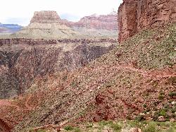
South Kaibab to North Kaibab to Bright Angel Trail
Grand Canyon Village, Arizona
13.6 miles SWThe Grand Canyon's legendary Rim-to-Rim-to-Rim route — 44 miles and 20,000 feet of elevation change combining South Kaibab, North Kaibab, and Bright Angel trails for an epic multi-day adventure.
Backpack, Camp, Hike 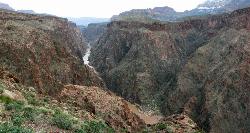
Clear Creek Trail
Grand Canyon Village, Arizona
13.6 miles SWA 4–6 day Grand Canyon backpack deep into a fascinating, off-the-beaten-track drainage — bring plenty of water, as Clear Creek is the only reliable source on trail.
Backpack, Camp, Hike 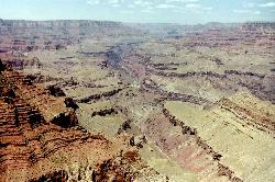
Tanner Trail
Grand Canyon Village, Arizona
13.9 miles SEA rigorous rim-to-river backpacking route recommended only for seasoned hikers — relentlessly steep, rocky, shadeless, and waterless until the Colorado River, with access to one of the canyon's most scenic beach campsites.
Backpack, Camp, Hike 9.1 mi
New Hance Trail
Grand Canyon Village, Arizona
14.8 miles SA 9-mile out-and-back through Red Canyon to the Colorado River — one of the most difficult Grand Canyon trails with a 4,500-ft elevation change and very limited water sources.
Backpack, Camp, Hike 0.6 mi
Mather Campground Trail
Grand Canyon Village, Arizona
14.9 miles SWA 1-mile connector trail adjacent to Mather Campground on the Grand Canyon South Rim — flat and easy for biking, running, or walking with pets on leash; campground has RV options nearby.
Camp, Hike, Mountain Bike 
Grandview Trail Loop
Grand Canyon Village, Arizona
15.3 miles SA scenic Grand Canyon hiking trail — mountain bikes are illegal on Canyon trails, so lace up your boots and enjoy the views on foot.
Backpack, Camp, Cross-country Ski, Hike 
Tonto Trail from Grandview Point to South Kaibab Trailhead
Grand Canyon Village, Arizona
15.3 miles SA rigorous four-to-five-day point-to-point backpack along the scenic, remote Tonto Trail from Grandview Point to the South Kaibab Trailhead — recommended for experienced Grand Canyon backpackers with careful water planning.
Backpack, Camp, Hike 1.5-9.8 mi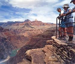
The Bright Angel Trails
Grand Canyon Village, Arizona
15.4 miles SWMultiple Bright Angel Trail routes range from a 5.4-mile out-and-back to the Three-Mile Resthouse to a 19-mile trek to the river, with the 12.4-mile South Kaibab–Tonto–Bright Angel point-to-point offering over 3,000 feet of Grand Canyon grandeur.
Backpack, Camp, Hike, Horseback 4.5 mi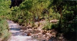
Bright Angel Trail to Bright Angel Campground and River Trail
Grand Canyon Village, Arizona
15.4 miles SWThe Bright Angel Trail is the Grand Canyon's most storied hike — South Rim to the Colorado River past tunnels, pictographs, Havasupai Gardens, and the Devil's Corkscrew.
Backpack, Camp, Hike, Rock Climb 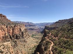
Bright Angel Trail to Three-Mile Rest house
Grand Canyon Village, Arizona
15.4 miles SWA steep 5.4-mile out-and-back trail descending into the Grand Canyon with 360-degree canyon views and extreme switchbacks — water and pit toilets at the Three-Mile Resthouse turnaround point.
Backpack, Camp, Hike


