


10 Things to do near McHood Park Clear Creek Reservoir
first prev 1 next lastShowing results within 50 miles Distance miles of McHood Park Clear Creek Reservoir near Winslow, Arizona City, Zip, or Address
Tall Timbers Disc Golf Course
Heber-Overgaard, Arizona
39.5 miles SA short, beginner-friendly disc golf course through beautiful Ponderosa pines near Heber-Overgaard, with elevated baskets mounted in pine logs and discs available locally.
Disc Golf 0.8-1.8 mi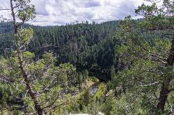
Kinder Crossing Trail #19
Happy Jack, Arizona
39.7 miles SWA short but steep 0.75-mile hike dropping 500 feet to beautiful East Clear Creek — high-clearance vehicle required on FR 95T, no motorized vehicles past the trailhead, closed in winter snow.
Hike, Swim 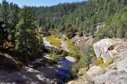
East Clear Creek
Happy Jack, Arizona
41.2 miles SWA Wild and Scenic river winding through the Mogollon Rim with canyon views, cliff-scaling canyoneers, trout fishing, and deep swimming holes for a full adventure day.
Canyoneer, Hike, Swim 
Arizona Trail: Gooseberry Springs to Blueridge
Happy Jack, Arizona
45.8 miles WA singletrack-and-dirt-road route along the Arizona Trail corridor, winding south through open terrain with AZ Trail markers guiding the way to Highway 87 at Blue Ridge Campground.
Mountain Bike 4.0 mi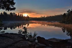
Woods Canyon Lake
Payson, Arizona
46.9 miles SA trout-fishing lake near Payson with a scenic loop hike and Mogollon Rim views — swimming is not recommended, but the scenery and fishing make it well worth the visit.
Camp, Hike, Swim 1.7 mi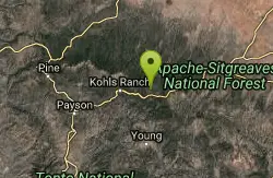
Meadow Trail #505
Payson, Arizona
47.0 miles SMeadow Trail #505 is a short, paved, wheelchair-accessible path along the rim of Woods Canyon Lake, high on Arizona's Mogollon Rim.
Hike 
Aspen Campground
Payson, Arizona
47.5 miles SA large, popular campground near Woods Canyon Lake in the Apache-Sitgreaves National Forest — note that Rim Road closes in winter, so the site is inaccessible during that time.
Camp 
Sinkhole Campground
Payson, Arizona
47.8 miles SSinkhole Campground sits in cool ponderosa pines atop the Mogollon Rim, a short walk from the trout waters of Willow Springs Lake.
Camp, Hike, Mountain Bike 3.3 mi
See Canyon Trail
Payson, Arizona
48.5 miles SWA wooded Arizona trail climbing from Christopher Creek to the Mogollon Rim — easy and flat for the first mile (great for kids), then progressively steeper, with a side trail to See Spring for water.
Hike 0.8 mi
Promontory Butte
Payson, Arizona
48.8 miles SWSpectacularly scenic views from the edge of the Mogollon Rim, reached via old forest roads — a remote destination said to offer the best vantage over the forest below.
Hike


