


Arizona Trail: Gooseberry Springs to Blueridge
Happy Jack, Arizona
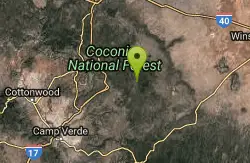
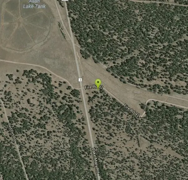
| Address: | ~Fire Rd 92, Happy Jack, AZ 86024, USA |
| GPS: |
34°49'21.9"N 111°26'5.4"W Maps | Directions |
| State: | Arizona |
| Trail Length: | 30.00 miles |
| MTB Difficulty: | Intermediate |
| Trail Type: | Shuttle |
| MTB Trail Type: | Singletrack |
Mountain Bike
Follow single track south. Trail made up of single track, old 2-tracks, and dirt roads. Make sure to be on the look out for AZ Trail markers. Can take trail to Highway 87 at Blue Ridge campground. Courtesy of Singletracks.com
More Information
Never modify trail features. Ride trails when they're dry enough that you won't leave ruts. Speak up when you see others on the trail and always yield to hikers, horses, and others coming uphill. Always ride on the established trail.
Read More- Plan Ahead and Prepare
- Travel & camp on durable surfaces
- Dispose of waste properly
- Leave what you find
- Minimize campfire impacts
- Respect wildlife
- Be considerate of other visitors
Directions
From Happy Jack, Arizona
- Head northwest toward Lake Mary Rd (0.2 mi)
- Turn right onto Lake Mary Rd (6.5 mi)
- Turn right onto Fire Rd 92Destination will be on the right(335 ft)
Other Mountain Bike Trails Nearby

Munds Wagon Trail
Sedona, Arizona
15.9 miles WMunds Wagon Trail is different from many of the other more “classic†rides around Sedona. If you come from somewhere else and are missing the feel of loose rocks...
Hike, Mountain Bike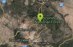
Cow Pies
Sedona, Arizona
16.1 miles WThe Cow Pies trail functions as a climb up to the Hangover trail from the Munds Wagon Trail. Much of this trail is sweet, sweet slickrock, with awesome views.
Mountain Bike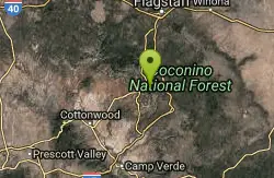
Schnebly Hill Trail
Sedona, Arizona
16.2 miles WThe Schnebly Hill Trail dead ends at the wilderness area, but can be accessed from a road at the top. Essentially this trail functions as the upper half of the Munds Wagon trail,...
Mountain Bike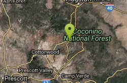
Hangover
Sedona, Arizona
18.0 miles WUpdated description by Greg Heil:Hangover is an incredibly technical trail, with high consequences if you mess up. With serious exposure, technical features, steep rock rolls, tight...
Mountain Bike 6.0 mi
Huckaby Trail
Sedona, Arizona
18.1 miles WOn the hunt for adventure? Established in 1998, Huckaby Trail is just the adventuresome route for both avid hikers and mountain bikers. It offers up forestry of Arizona Sycamores and picturesque...
Canoe, Hike, Mountain Bike
Bell Rock Area Trails
Sedona, Arizona
18.7 miles WThe Bell Rock Area Trails is a trail system that extends from south of Courthouse Butte all the way up to the Little Horse Trail on the eastern side of Hwy 179. While this trail system...
Mountain Bike
Bell Rock Trailway
Sedona, Arizona
18.7 miles WThis 3.5 mile trail is smooth & wide and built for multiple user groups, its very popular with hikers and dog walkers. The main reason for posting it here is that it acts like a...
Mountain Bike
Courthouse Butte Loop
Sedona, Arizona
18.7 miles WCourthouse Butte Loop: To get to this wonderful trail, take the wide Bell Rock Pathway from the kiosk toward Bell Rock. It climbs gently and at ½ mile there is a signed...
Mountain Bike
Made In The Shade
Sedona, Arizona
18.7 miles WThis is a singletrack connector that joins the Templeton Trail with the Village of Oak Creek. It is great either way but probably more fun from north to south. It has moderate climbs,...
Mountain Bike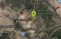
Cathedral Rock Trail
Sedona, Arizona
18.8 miles WStart off on the Bell Rock trail, go about 1.25 to 1.5 miles untill you locate the tunnel under Hwy 179 ( kinda hard to find without a map ). Go through the tunnel to start this fast...
Mountain Bike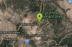
Slim Shady
Sedona, Arizona
18.8 miles WMeasuring 2.4 miles one-way, the Slim Shady trail forms the backbone of the Yavapai Point trail system and connects to Made in the Shade, Hiline, and more.
Mountain Bike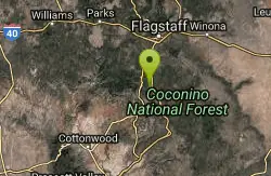
Willard Springs
Sedona, Arizona
18.9 miles NWMultiple forest roads that are in poor driving condition. There are about 1' deep ruts and washouts.
Mountain Bike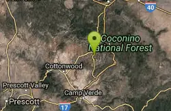
Broken Arrow Trail / Chicken Point
Sedona, Arizona
19.0 miles WThis trail is definitely not for beginners. It has a lot of technical climbs and descents- drop offs and stairs, etc. A lot of narrow singletrack along cliffs. This trail takes you...
Mountain Bike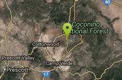
Yavapai Point Trails
Sedona, Arizona
19.0 miles WThe Yavapai Point Trails feature some tightly-wound singeltrack trails near the trailhead, with longer trails like Slim Shady located further out.
Mountain Bike
Hiline
Sedona, Arizona
19.0 miles WHighline Trail is an expert-level mountain bike trail that is best ridden from the Village of Oak Creek side -- finishing on the Baldwin Trail loop. There is some exposure along the...
Mountain Bike
Pig Tail
Sedona, Arizona
19.1 miles WPig Tail is a short one-way downhill-only trail full of jumps, drops, berms, and rocks. A riot of a descent!
Mountain Bike
Broken Arrow Trail System
Sedona, Arizona
19.1 miles WThe Broken Arrow Trail system incorporates a number of classic Sedona rides, such as Broken Arrow, Hog Heaven, Hog Wash, Pig Tail, and more. While some of these trails are relatively...
Mountain Bike
Jim Thompson
Sedona, Arizona
19.3 miles WThis trail is best ridden west to east unless you like a serious climb. Either way, you'll be treated to some great scenery. Much of the trail is wide and covered with loose rocks....
Mountain Bike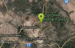
Templeton
Sedona, Arizona
19.3 miles WThis challenging, fun & exciting singletrack rewards you with some of the most scenic vistas of the Sedona area. Leaving the B.R. Pathway you twist & turn downhill through the forest...
Mountain Bike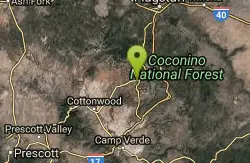
Soldier Wash Trails
Sedona, Arizona
19.6 miles WWhat locals once called the "Secret Trails" isn't so secret anymore. The USFS has adopted many of them into what is now called "Soldier Wash Trails." You may not see them yet on the...
Mountain BikeNearby Campsites

Beaver Creek Campground
Camp Verde, Arizona
19.0 miles SWCamp, Canoe, Kayak, and Swim near Camp Verde, Arizona
Camp, Canoe, Kayak, Swim
Chavez Crossing
Sedona, Arizona
19.5 miles WChavez Crossing is a campground in Sedona, Arizona. It sits perfectly nestled in Arizona's most beautiful red rock attractions along with the grand summer sunsets. If that didn't sound...
Camp, Hike, Swim
Beaver Creek Dispersed Camping
19.7 miles SW
Free dispersed camping on the cliffs above Beaver Creek.
Camp 0.1-0.7 mi
Cave Springs
Sedona, Arizona
21.0 miles NWCave Springs Campground is a scenic campground that sits in Oak Creek Canyon. Cave Springs is nestled perfectly in the town of Sedona, giving the campground the notorious Sedona red views. Uniquely,...
Camp, Hike, Swim 0.4 mi
Clear Creek Campground
Camp Verde, Arizona
28.4 miles SWWest Clear Creek flows along the boundary of this desert canyon country camp and is a popular place for hiking, swimming, wading and fishing. Cool water species such as smallmouth bass and green...
Camp, Hike, Swim
Verde Hot Springs
Camp Verde, Arizona
36.1 miles SWVerde Hot Springs are a few natural hot spring pools located along the Verde River, near Sedona, Arizona. Once a resort, now all that remains are the foundations and the hot pools...
Camp, Hike, Hot Springs 1.1-3.5 mi
Horton Springs
Payson, Arizona
38.6 miles SEHorton Springs is a spring on the Mogollon Rim that leads into Horton Creek. There are campsites near the springs, and several hiking trails in the area that lead to the spring itself. Between the...
Backpack, Camp, Hike
Upper Tonto Creek Campground
Payson, Arizona
38.8 miles SEUpper Tonto Creek Campground is a beautiful place to camp at the intersection of Tonto and Horton Creeks. In addition to camping, this is a popular destination to both fish and hike. The campground...
Camp, Hike 1.1 mi
Christopher Creek Campground
Payson, Arizona
41.9 miles SEChristopher Creek is a popular campground situated just east of Payson, nestled between the Christopher Creek river, and the town of the same name. This site is used for both overnight and day-use...
Camp, Canyoneer, Cross-country Ski, Hike, Swim 4.0 mi
Woods Canyon Lake
Payson, Arizona
43.7 miles SEWoods Canyon Lake is a fishing lake near Payson, Arizona located near the Mogollon Rim. The lake has a hike that loops around it, and several other hikes nearby to look at the particularly scenic...
Camp, Hike, Swim
Aspen Campground
Payson, Arizona
44.2 miles SEAspen Campground is a large campground near Payson, Arizona. Between the proximity to Woods Canyon Lake and the seclusion of the encompassing Apache-Sitgreaves National Forest, this is a...
Camp
McHood Park Clear Creek Reservoir
Winslow, Arizona
45.8 miles ELocated just outside of Winslow, Arizona, McHood Park may not initially seem like much. However, with the companion reservoir, it hosts a large variety of potential activities. This area allows for...
Camp, Canoe, Canyoneer, Kayak, Rock Climb, Swim
Hell's Gate
Payson, Arizona
45.8 miles SEThis Wilderness was established in 1984, and contains approximately 37,440 rough acres with a major canyon and perennial stream extending its entire length. Deep pools of water may be separated by...
Backpack, Camp, Hike, Swim
Sinkhole Campground
Payson, Arizona
47.5 miles SESinkhole Campground is a camping area near Willow Springs Lake. There are also hikes, mountain biking trails, and fishing opportunities nearby. There are 26 campsites in total at this...
Camp, Hike, Mountain Bike
Haigler Canyon Campground
Payson, Arizona
49.6 miles SEThis campground was constructed in 2007 and offers 2 day-use sites and 2 campground areas with 14 overnight sites. This campground boasts a diversity of trees. Fishing for rainbow trout is a popular...
Camp, Hike, Swim


