


234 Things to do near Fountain Park Trail
first prev 2 3 4 5 6 7 8 9 10 11 next lastShowing results within 50 miles Distance miles of 17001 N Panorama Dr, Fountain Hills, AZ 85268, USA City, Zip, or Address

Arizona Canal Trail
Phoenix, Arizona
18.8 miles WMulti-purpose canal trails set apart from normal city traffic and noise. The Arizona Canal is one of the many canals used to supply the valley with its water needs (irrigation). These canals were...
Hike, Horseback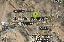
Los Olivos
Phoenix, Arizona
19.3 miles SWFlat, grassy neighborhood park (used to be an olive orchard). Lots of trees. Busy on weekends. Easy to navigate. Public (No Fee)
Disc Golf
Scarlett Canyon
Phoenix, Arizona
19.3 miles WScarlett Canyon trail (not officially named) is an unmarked trail adjacent to the Scarlett Canyon residential neighborhood. This is a 3 mile loop trail considered to be easy to...
Hike, Horseback, Mountain Bike, Rock Climb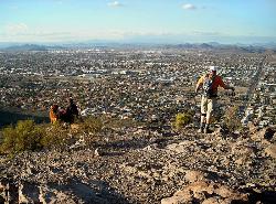
Lookout Mountain Summit Trail
Phoenix, Arizona
19.3 miles WLookout Mountain Summit Trail is a short, 1 mile trail in Phoenix, Arizona. The trail is steep, especially towards the summit, but it's manageable, and well worth the...
Hike
Lookout Mountain Circumference Trail
Phoenix, Arizona
19.3 miles WHike near Phoenix, Arizona
Hike 4.6 mi
Perl Charles Memorial Trail (#1A)
Phoenix, Arizona
19.4 miles WThis is a technical singletrack loop with some very steep up and down sections located in the Phoenix Mountain Preserves. This trail is for advanced riders who like to bleed and leave their skin on...
Hike, Horseback, Mountain Bike
Buffalo Ridge Park
Phoenix, Arizona
19.5 miles WOffering elevation, rugged terrain, blind holes and great views. Begins near the restrooms, then a long 27 alongside the mountain back to the parking lot. Bring plenty of water. * Nov 2011. New holes...
Disc Golf
North Mountain National Trail
Phoenix, Arizona
20.3 miles WNorth Mountain National Trail is a 2.3 mile moderate, loop trail near Phoenix. It's easy to travel on if you go up the paved sections. The inclines are steep in parts, making it a real...
Hike
Shaw Butte and Charles M Christiansen Loop Trail
Phoenix, Arizona
20.3 miles WWhen you say "North Mountain," I think most Arizonans know where it is or can find it. When you say "Shaw Butte," it seems like you get a lot more questioning glances and "huh?". Shaw...
Hike, Mountain Bike
Murphy Bridle Path Trail
Phoenix, Arizona
20.5 miles WHorseback near Phoenix, Arizona
Horseback 21.4 mi
Spur Cross to Lake Pleasant
Cave Creek, Arizona
20.7 miles NWStart at the Flat Tire Bike Shop and head north on Spur Cross Road. You will arrive at the Spur Cross Conservation Ranch in 3.2mi. From there enter the Maricopa Trail system and follow the signs...
Mountain Bike
Cave Creek Park
Cave Creek, Arizona
20.7 miles NWMultiple singletrack loops, just explore and find what works best for you. Watch out for hikers and horses.
Mountain Bike
Maxine Lakin Nature Trail
Phoenix, Arizona
21.3 miles WHike near Phoenix, Arizona
Hike

Sidewinder, Apache Vista, Ocotillo Loop Trail
Phoenix, Arizona
22.0 miles NWThis is an excellent loop that is very well maintained, well sign posted and if you include the vista summit trail, a moderate work out. Massive Car Park, good restrooms, and plenty of...
Hike, Horseback, Mountain Bike
Ocotillo/Ridgeback/Sidewinder Loop Trail
Phoenix, Arizona
22.0 miles NWGreat moderate loop which includes a summit, great views and Classic Sonoran Desert scenery. Multiple access points and other connecting trails allows for the loop to be changed if...
Hike, Horseback, Mountain Bike
Apache Wash Trail
Phoenix, Arizona
22.1 miles NWStart west on Ocitillo to Ridgeback north till you get to the crossing of Sidewinder then head west. Keep on Sidewinder toil you come to the crossing of Octillio and head east back to...
Hike
Apache Wash Sidewinder Loop Trail
Phoenix, Arizona
22.1 miles NWHorseback and Mountain Bike near Phoenix, Arizona
Horseback, Mountain Bike
K-trail & Vortex
Gold Canyon, Arizona
22.4 miles SEThis is definitely a challenging way to ride both the entire K and Vortex trails. They are best ridden from the North to the South but to do this you need to get to the North end of the...
Mountain Bike
Lost Goldmine & Cougar Loop
Gold Canyon, Arizona
22.4 miles SEThis is a short, fun but pretty technical ride. The technical part is the fact that it starts out with a ride on the Lost Goldmine trail which is a very rocky trail built for hiking....
Mountain Bike
Cloudview
Gold Canyon, Arizona
22.4 miles SEThis parking area is used primarily for the very popular Hieroglyphs hiking trail and the Lost Goldmine hiking trail which connects with Peralta Road seven miles to the East. It is also...
Mountain Bike


