


229 Things to do near Shaw Butte and Charles M Christiansen Loop Trail
first prev 1 2 3 4 5 6 7 8 9 10 next lastShowing results within 50 miles Distance miles of 12950 N 7th St, Phoenix, AZ 85022, USA City, Zip, or Address

North Mountain National Trail
Phoenix, Arizona
0.6 miles SNorth Mountain National Trail is a 2.3 mile moderate, loop trail near Phoenix. It's easy to travel on if you go up the paved sections. The inclines are steep in parts, making it a real...
Hike

Maxine Lakin Nature Trail
Phoenix, Arizona
1.6 miles SWHike near Phoenix, Arizona
Hike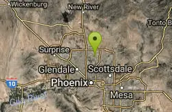
Lookout Mountain Circumference Trail
Phoenix, Arizona
2.2 miles NEHike near Phoenix, Arizona
Hike
Lookout Mountain Summit Trail
Phoenix, Arizona
2.3 miles NELookout Mountain Summit Trail is a short, 1 mile trail in Phoenix, Arizona. The trail is steep, especially towards the summit, but it's manageable, and well worth the...
Hike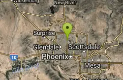
Sweetwater
Phoenix, Arizona
2.6 miles WHilly and challenging moderate length course in a dry lake bed. Not well marked - bring the map. Concrete tees on front 9. Public (No Fee)
Disc Golf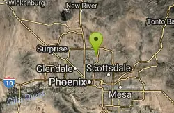
Shadow Mountain Trail
Phoenix, Arizona
2.7 miles NEThis particular route trailhead starts at 23rd place and Sweetwater rd it's a great wildlife trail.
Hike
Murphy Bridle Path Trail
Phoenix, Arizona
2.8 miles SHorseback near Phoenix, Arizona
Horseback
Trail #100
Phoenix, Arizona
3.1 miles SEFrom Dreamy Draw you can head NW on Trail 100 and immeadiately hit a ridge with good views. Ride on for 5 - 6 miles of nice single track and great views, to 7th and return. If you...
Mountain Bike 1.3 mi
Dreamy Draw Loop Trail
Phoenix, Arizona
3.2 miles SEThe Dreamy Draw Nature Trail is a short multi-access loop trail that provides a true Sonoran Desert experience. The trail crosses a number of desert washes and, at times, becomes somewhat rocky....
Hike, Horseback, Mountain Bike 4.8 mi
Trail 1A
Phoenix, Arizona
3.3 miles SEThe trail can be accessed from the Dreamy Draw Park parking lot. From there, the trail can be ridden south towards its origin, or east (the trail makes an "L" shape). It is a mix of double...
Mountain Bike 4.6 mi
Perl Charles Memorial Trail (#1A)
Phoenix, Arizona
4.1 miles SThis is a technical singletrack loop with some very steep up and down sections located in the Phoenix Mountain Preserves. This trail is for advanced riders who like to bleed and leave their skin on...
Hike, Horseback, Mountain Bike
Conocido Park
Phoenix, Arizona
4.2 miles NWMostly flat grassy holes with trees in play. Dual tees. Requires hyzers, anhyzers, rollers and tubes. Play backwards for 18. Alt. pins vary difficulty. Public (No Fee)
Disc Golf
Buffalo Ridge Park
Phoenix, Arizona
4.4 miles NOffering elevation, rugged terrain, blind holes and great views. Begins near the restrooms, then a long 27 alongside the mountain back to the parking lot. Bring plenty of water. * Nov 2011. New holes...
Disc Golf 4.6 mi
Mystery Loop
Phoenix, Arizona
4.5 miles SEThe trail is a nice combination of technical rock trail, washes, and climbs. There is a large network of trails to make the ride longer or shorter depending upon your needs. These trails cross over...
Mountain Bike
L.V. Yates to "Two Bit" Peak Loop
Phoenix, Arizona
4.5 miles SEWell this time of the year there really was not a lot of wild life to see, just to hot. Starting from the 40st trailhead gave me a different view of the preserve. I really enjoyed...
Hike, Horseback 2.6 mi
L.V. Yates Trail (#8)
Phoenix, Arizona
4.6 miles SEThe trail is strewn with large rocks and gulleys from recent torrential rains. Not impassable on foot, but definitely some hike-a-bike areas. Keep in mind there's no ridge hiking...
Hike, Horseback, Mountain Bike 2.2 mi
Piestewa Peak Summit Trail #300
Phoenix, Arizona
4.7 miles SESome people still refer to the Peak by its original name of "Squaw Peak" before its name changed to "Piestewa Peak" in honor of Lori Piestewa who died serving her country in the...
Hike 3.8 mi
Freedom Loop Trail (#302)
Phoenix, Arizona
4.7 miles SEFreedom Trail (#302), also known as Piestewa Circumference, is a 3.8 mile, moderate loop trail. You can access this trail from all the inner trailheads. The easiest and least...
Hike 1.4 mi
Mohave Trail (#200)
Phoenix, Arizona
4.8 miles SEAn invigorating swift hike is what Mohave Trail 200 provides for anyone looking for a free and quick escape. Though the main attraction of the Phoenix Mountain’s Preserve is the larger Piestewa...
Hike, Horseback
Paradise Valley Skatepark
Phoenix, Arizona
5.2 miles NEThis place is really good, has a decent flow to it, some great bowls with a spine. Some good rails and fun transitions, worth checking out if in the area. Free pads required. This park covers...
Skateboard


