


Trail #100
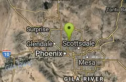
Phoenix, Arizona
| Address: | ~Trail 100, Phoenix, AZ 85028, USA |
| GPS: |
33°33'53.1"N 112°1'44.7"W Maps | Directions |
| State: | Arizona |
| Trail Length: | 10.00 miles |
| MTB Difficulty: | Intermediate |
| Trail Type: | Out & Back |
| MTB Trail Type: | Singletrack |
Mountain Bike
From Dreamy Draw you can head NW on Trail 100 and immeadiately hit a ridge with good views. Ride on for 5 - 6 miles of nice single track and great views, to 7th and return. If you head east you go up gentle climbs and nice track all the way to Tatum. This side is not technical. There are great options for more technical riding on the east side on other trails such as trails 8, 304, 302. Trail 1A is nice smooth singletrack also.Enjoy. Courtesy of Singletracks.com
Never modify trail features. Ride trails when they're dry enough that you won't leave ruts. Speak up when you see others on the trail and always yield to hikers, horses, and others coming uphill. Always ride on the established trail.
Read More- Plan Ahead and Prepare
- Travel & camp on durable surfaces
- Dispose of waste properly
- Leave what you find
- Minimize campfire impacts
- Respect wildlife
- Be considerate of other visitors
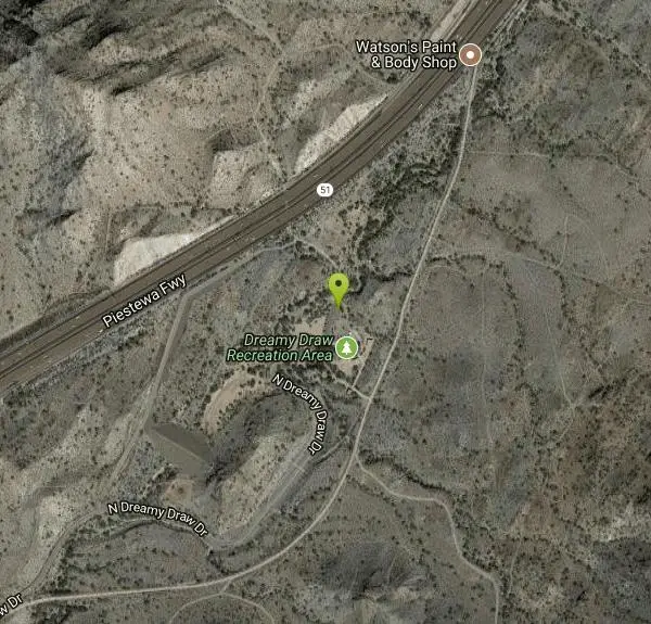
Directions
From Phoenix, Arizona
- Head west on W Washington St toward 1st Ave (0.5 mi)
- Turn right onto N 7th Ave (0.2 mi)
- Continue straight to stay on N 7th Ave (0.6 mi)
- Turn right to merge onto I-10 E toward Tucson (2.3 mi)
- Take exit 147A-147B for AZ-51 N (0.6 mi)
- Continue onto AZ-51 N (6.3 mi)
- Take exit 7 for Northern Ave (0.3 mi)
- Keep right at the fork, follow signs for Dreamy Draw Park (95 ft)
- Turn right onto N Dreamy Draw Dr (0.8 mi)
- Turn left (279 ft)
Other Mountain Bike Trails Nearby

Dreamy Draw Loop Trail
Phoenix, Arizona
0.0 miles SThe Dreamy Draw Nature Trail is a short multi-access loop trail that provides a true Sonoran Desert experience. The trail crosses a number of desert washes and, at times, becomes somewhat rocky....
Hike, Horseback, Mountain Bike 4.8 mi
Trail 1A
Phoenix, Arizona
0.1 miles SThe trail can be accessed from the Dreamy Draw Park parking lot. From there, the trail can be ridden south towards its origin, or east (the trail makes an "L" shape). It is a mix of double...
Mountain Bike 4.6 mi
Perl Charles Memorial Trail (#1A)
Phoenix, Arizona
1.7 miles SWThis is a technical singletrack loop with some very steep up and down sections located in the Phoenix Mountain Preserves. This trail is for advanced riders who like to bleed and leave their skin on...
Hike, Horseback, Mountain Bike 2.6 mi
L.V. Yates Trail (#8)
Phoenix, Arizona
1.9 miles EThe trail is strewn with large rocks and gulleys from recent torrential rains. Not impassable on foot, but definitely some hike-a-bike areas. Keep in mind there's no ridge hiking...
Hike, Horseback, Mountain Bike 4.6 mi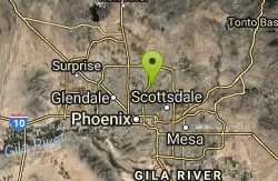
Mystery Loop
Phoenix, Arizona
2.0 miles EThe trail is a nice combination of technical rock trail, washes, and climbs. There is a large network of trails to make the ride longer or shorter depending upon your needs. These trails cross over...
Mountain Bike 1.9 mi
Ruth Hamilton Trail
Phoenix, Arizona
2.0 miles SEHike and Mountain Bike near Phoenix, Arizona
Hike, Mountain Bike 1.7 mi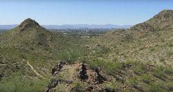
Quartz Ridge Trail
Phoenix, Arizona
2.4 miles SEThis is a very popular trail on weekend mornings. Casual hikers can get great views of Phoenix with moderate effort. Good place to bring out of town visitors The Quartz Ridge Trail is a short,...
Hike, Mountain Bike 7.1 mi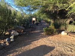
Trail 100
Phoenix, Arizona
2.9 miles EMountain Bikers and Hikers in Phoenix, Arizona can rejoice in the challenge that is Trail 100. Trail 100, or Charles M. Christensen Memorial Trail, is a little over 14 miles out and back in the...
Hike, Mountain Bike 3.6 mi
Charles M. Christiansen Memorial Trail
Phoenix, Arizona
2.9 miles EPhoenix, Arizona is home to some of the best and largest city parks in the country and the Charles M. Christiansen Memorial Trail is a great introduction to this fantastic park system. Also known as...
Hike, Horseback, Mountain Bike
Shaw Butte and Charles M Christiansen Loop Trail
Phoenix, Arizona
3.1 miles NWWhen you say "North Mountain," I think most Arizonans know where it is or can find it. When you say "Shaw Butte," it seems like you get a lot more questioning glances and "huh?". Shaw...
Hike, Mountain Bike
Scarlett Canyon
Phoenix, Arizona
7.8 miles NScarlett Canyon trail (not officially named) is an unmarked trail adjacent to the Scarlett Canyon residential neighborhood. This is a 3 mile loop trail considered to be easy to...
Hike, Horseback, Mountain Bike, Rock Climb
Indian Bend Bike Trail
Scottsdale, Arizona
8.6 miles EIndian Bend Wash Greenbelt is a urban, concrete paved path, primarily used for biking and walking/jogging, in Scottsdale, Arizona. This point A to point B, 11 mile long trail takes you past parks,...
Hike, Mountain Bike
Double Butte Loop Trail
Phoenix, Arizona
8.7 miles SEDouble Butte Loop Trail is one of the trails within Papago Park in Phoenix, Arizona. The Double Butte Loop Trail is a natural trail that traverses the circumference of both the small butte...
Hike, Mountain Bike
Papago Park Area
Phoenix, Arizona
8.7 miles SEPapago Park offers a large area for mountain bikers, consisting of 5 beginner-intermediate loops and a dirt jump area for experts. Much of the area has a mix of loose dirt and rolling hills, so the...
Mountain Bike
Glendale Canal
Glendale, Arizona
9.9 miles WHike, Horseback, and Mountain Bike near Glendale, Arizona
Hike, Horseback, Mountain Bike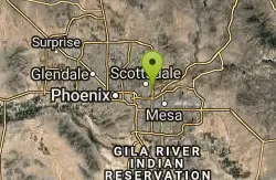
Papago Park Area Mountain Bike Trail
Scottsdale, Arizona
10.1 miles SEMountain Bike near Scottsdale, Arizona
Mountain Bike 2.0 mi
Loma and Canal Trails
Tempe, Arizona
10.2 miles SETrails open to mountain biking and hiking that wind through the Papago Park in Tempe, Arizona. The Loma Trail winds around lots of uphill and downhill paths, and leads to a park with a small lake and...
Hike, Mountain Bike 5.7 mi
Taliesin/Quartz Loop
Scottsdale, Arizona
10.3 miles EA quick loop that has a couple difficult climbs depending on which way you take it. Leads to a cool viewpoint and has a ton of flowing singletrack. A fun rocky trail through neighborhoods in...
Mountain Bike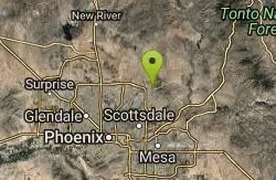
Gateway Loop
Scottsdale, Arizona
11.3 miles NEThe trailhead has water, bathrooms, etc. The trail starts off shared with other short walking trails and such, then quickly becomes a steep and rocky ascent. The climb is challenging...
Mountain Bike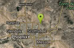
Phoenix Mcdowell / Wingate Pass / Bell Pass
Scottsdale, Arizona
11.3 miles NEThe trailhead has water, bathrooms, etc. The trail starts off shared with other short walking trails and such, then quickly becomes a steep and rocky ascent, with some nice flowing...
Mountain BikeNearby Campsites

Lower Salt River Nature Trail
Fort McDowell, Arizona
21.2 miles EThe Lower Salt River Nature Trail is a scenic walk to take at the Tonto National Forest. This trail provides stunning views as you walk alongside the Salt River. This rustic trail is older and less...
Camp, Hike
Buckhorn Campground Nature Trail
Apache Junction, Arizona
24.4 miles ECamp and Hike near Apache Junction, Arizona
Camp, Hike


