


Twin Lakes Recreation Area
Wilcox
Camp, Hike, and Swim
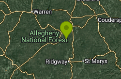
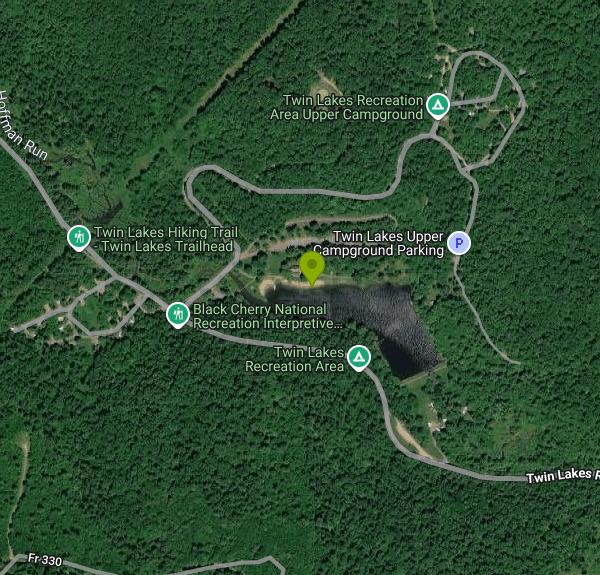
Twin Lakes Recreation Area is a U.S. Forest Service day-use area and campground in the Allegheny National Forest, managed by the Marienville Ranger District and located in Jones Township in northern Elk County, Pennsylvania. The swimming water is a 10-acre impoundment on Hoffman Run, a stocked trout stream, held back by a dam the Civilian Conservation Corps built in 1936. Before that the ground was a company settlement of the McKean Chemical Company, which made wood alcohol here until the 1920s, and an older splash dam stood where the current dam is. The planned second lake was never built. The site sits in hardwood forest roughly 7 km northwest of Wilcox and about the same distance southeast of Kane.
From Kane, the Forest Service routes drivers south on State Route 321 for about 6 miles, right (west) on T361 for 0.2 mile, right onto the narrow Dahoga Road for 2.5 miles to Twin Lakes Road (FR 191), then 2 miles north to the entrance. The usual entrance road passes under a railroad bridge with a 10-foot clearance, so taller rigs should come in on Dahoga Road from the Wilcox side. Recreation.gov also lists a PennDOT detour for camping rigs over 5 tons. Gravel parking areas serve the beach and picnic grounds.
The swim beach is on the north shore of the lake, just below the bathhouse. The Forest Service describes a sand beach with buoys marking off a swimming area about 100 feet by 60 feet, and lists the beach as accessible. The lake is small, stream-fed and sits at roughly 1,700 feet in shaded hills, so the water runs cool well into June. No depth figures are published; stay inside the buoys. There are no lifeguards. The Allegheny National Forest says it does not employ lifeguards at any of its beaches and swimming is at your own risk. Dogs are not allowed on the beach. Under Forest Order 09-19-17-10, motorboats are banned on the lake, and from May 1 through September 30 fishing is prohibited along the beach from the easternmost buoy to the Hoffman Run inlet. The Forest Service also says no boating of any kind is allowed on the lake.
Day use is free. The Forest Service recreation page says no fees are required for the site, and it lists the volunteer Friends of Twin Lakes group as the on-site contact (814-389-3019). The listed season of use is April 1 to October 31, and Jones Township says the bathhouse pavilion, swimming and picnic areas open from May to September. Outside that window the Forest Service shows the site as closed. Recreation.gov notes that drinking water has been unavailable while the Friends group and the forest work to restore water and sewage service. A recent Forest Service project to upgrade the water and wastewater systems and replace two fishing piers is listed as completed, but bring your own water and check with the Marienville Ranger District (814-927-6628) about the bathhouse before a trip.
The rest of the site includes upper and lower camping loops (48 single sites, a double site and two group sites for up to 50 people), electric hookups in the lower loop, pavilions, playgrounds, picnic tables, grills and an accessible fishing pier. A hardened path circles the lake, and the 1.6-mile Black Cherry Interpretive Trail starts near the lower loop. From it, the Twin Lakes Trail runs 15.8 miles west to the North Country National Scenic Trail, and the 5.6-mile Mill Creek Trail links south toward the Brush Hollow ski and bike loops, though parts of Mill Creek are no longer maintained.
More Information
Be courteous, informed, and prepared. Read trailhead guidelines, stay on the trail, and don't feed the wildlife.
Read More
- Plan Ahead and Prepare
- Travel & camp on durable surfaces
- Dispose of waste properly
- Leave what you find
- Minimize campfire impacts
- Respect wildlife
- Be considerate of other visitors
Directions
From Wilcox
- Head southeast toward AL-221 S (0.4 mi)
- Turn left onto AL-221 N (3.2 mi)
- Slight left onto AL-28 W (12.8 mi)
- Turn right (0.4 mi)
- Continue straight (161 ft)
- Turn left onto AL-5 N (8.4 mi)
- Turn left to stay on AL-5 N (49.9 mi)
- At the traffic circle, take the 2nd exit (226 ft)
- Continue onto AL-5 N/
AL-25 Truck N Continue to follow AL-5 N(18.8 mi) - Turn right onto US-11 N (2.9 mi)
- Slight right to merge onto I-20 E/
I-59 N (27.7 mi) - Take exit 124C on the left to merge onto I-65 N toward HuntsvilleEntering Tennessee(188 mi)
- Keep left to stay on I-65 N, follow signs for I-40 W/
Memphis/ Louisville (2.4 mi) - Take exit 208B for I-65 N toward I-24 W/
Louisville/ Clarksville (0.3 mi) - Continue onto I-65 N (1.8 mi)
- Keep left to stay on I-65 N, follow signs for I-24 W/
Clarksville/ Louisville Entering Kentucky(165 mi) - Take exit 131A to merge onto I-264 E (11.5 mi)
- Take exit 23A to merge onto I-71 N toward CincinnatiEntering Ohio(91.0 mi)
- Slight right to stay on I-71 N (signs for Columbus/
US-50 E) (0.8 mi) - Keep right to stay on I-71 N (1.3 mi)
- Continue onto I-71 N (103 mi)
- Take the I-71 N/
I-70 E exit toward Airport/ Cleveland/ Wheeling (0.4 mi) - Merge onto I-70 E (1.1 mi)
- Continue onto Exit 101B (0.2 mi)
- Take the I-71 N ramp to I-670/
Cleveland (0.6 mi) - Continue onto I-71 N (101 mi)
- Take the exit onto I-76 E/
US-224 E toward Akron (18.3 mi) - Keep right to continue on I-76 E, follow signs for Akron (1.9 mi)
- Keep right to stay on I-76 E, follow signs for Akron (3.2 mi)
- Keep left to stay on I-76 E (36.7 mi)
- Keep left to continue on I-80 E (4.4 mi)
- Keep left to stay on I-80 E, follow signs for OH-11 N/
New York City Entering Pennsylvania(73.5 mi) - Take exit 60 for PA-66 N toward Shippenville (0.5 mi)
- Continue onto PA-66 N (50.6 mi)
- Turn right onto Hemlock Ave (0.6 mi)
- Turn right onto PA-321 S (5.8 mi)
- Turn right onto T361/
Twin Lakes Rd Continue to follow Twin Lakes Rd(2.3 mi) - Turn right (492 ft)
- Turn rightDestination will be on the right(417 ft)
Other Swimming Holes and Hiking Trails Nearby

Kiasutha Recreation Area
Kane
13.7 miles NWForest Service swim beach and picnic lawn on the Kinzua Creek arm of the Allegheny Reservoir, northwest of Kane. Open May 24 to September 1, $5 per vehicle day-use fee, no lifeguards.
Camp, Canoe, Hike, Kayak, Swim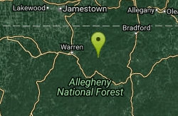
Elijah Rock
Bradford, Pennsylvania
17.1 miles NWSwim near Bradford, Pennsylvania
Swim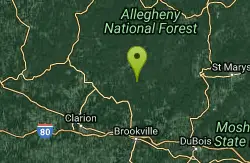
Loleta
Sigel, Pennsylvania
22.2 miles SWSwim near Sigel, Pennsylvania
Swim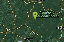
Kellettville
Tionesta, Pennsylvania
26.3 miles WAn attractive, isolated National Forest campground along Tionesta Creek — the water is shallow and best for water play and tubing, with possibly a deeper swimming spot just north of the bridge.
Swim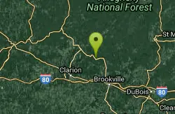
Cook Forest State Park
Cooksburg, Pennsylvania
30.0 miles SWSwim near Cooksburg, Pennsylvania
Swim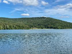
Quaker Lake Beach
Salamanca
30.6 miles NQuaker Beach is the guarded swim beach on Quaker Lake in the Quaker Area of Allegany State Park, open only from late June to Labor Day while lifeguards are on duty. New York State Parks charges a $7 vehicle use fee in season, and the lake has closed for h
Camp, Canoe, Hike, Kayak, Swim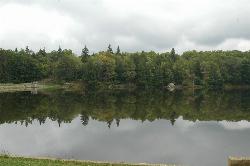
Parker Dam State Park
Penfield
31.5 miles SEA 20 acre CCC built lake in the Clearfield County woods with a real sand beach, five feet deep at the buoy line, open late May to mid September and free to use. No lifeguards, boat rentals next door, and the 1985 tornado scar a short walk away.
Camp, Canoe, Hike, Kayak, Mountain Bike, Swim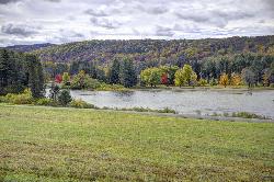
Red House Beach
Salamanca
33.7 miles NRed House Beach is the lifeguarded sand beach on Red House Lake, the 110 acre impoundment at the center of Allegany State Park's Red House Area. Swimming runs late June into early September during posted hours, with a $7 vehicle fee at the gate and weekly
Camp, Canoe, Hike, Kayak, Swim
Tionesta
Tionesta, Pennsylvania
36.9 miles WSwim near Tionesta, Pennsylvania
Swim
Salamanca
Salamanca, New York
38.2 miles NSwim near Salamanca, New York
Swim
Hammersley Hole
Renovo, Pennsylvania
46.6 miles EA serious 12-mile round-trip hike in Pennsylvania backcountry to a small cascade and a deep mid-summer swimming hole in the remote Hammersley Fork creek.
SwimNearby Campsites
Kiasutha Recreation Area
Kane
13.7 miles NWForest Service swim beach and picnic lawn on the Kinzua Creek arm of the Allegheny Reservoir, northwest of Kane. Open May 24 to September 1, $5 per vehicle day-use fee, no lifeguards.
Camp, Canoe, Hike, Kayak, Swim
Quaker Lake Beach
Salamanca
30.6 miles NQuaker Beach is the guarded swim beach on Quaker Lake in the Quaker Area of Allegany State Park, open only from late June to Labor Day while lifeguards are on duty. New York State Parks charges a $7 vehicle use fee in season, and the lake has closed for h
Camp, Canoe, Hike, Kayak, Swim
Parker Dam State Park
Penfield
31.5 miles SEA 20 acre CCC built lake in the Clearfield County woods with a real sand beach, five feet deep at the buoy line, open late May to mid September and free to use. No lifeguards, boat rentals next door, and the 1985 tornado scar a short walk away.
Camp, Canoe, Hike, Kayak, Mountain Bike, Swim
Red House Beach
Salamanca
33.7 miles NRed House Beach is the lifeguarded sand beach on Red House Lake, the 110 acre impoundment at the center of Allegany State Park's Red House Area. Swimming runs late June into early September during posted hours, with a $7 vehicle fee at the gate and weekly
Camp, Canoe, Hike, Kayak, Swim


