


4 locations
Add Location
 Full Listing
Show more
Cave
Last visited on 19 May 2017
Full Listing
Show more
Cave
Last visited on 19 May 2017
 Full Listing
Show more
Cave
Last visited on 19 May 2017
Full Listing
Show more
Cave
Last visited on 19 May 2017
0.3 mi
Full Listing
Show more
Rock Climb
Last visited on 3 Jun 2017
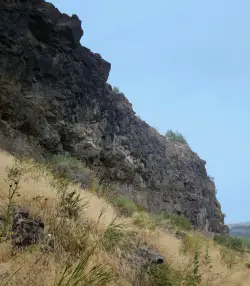
Pointless Crag
Ririe, Idaho
6.8 miles E of Ririe, IdahoCourtesy of Dean Lords, Route Setter deanlords.blogspot.com
- NO MORE BOLTING as of 5/2012 requested by the Bureau of Land Management.
- The BLM has asked us NOT to park on the road below the cliff. Please use the obvious parking area next to the river before reaching the cliff. The parking area is 2.7 miles up the South Fork Rd on the right from where you turn off of the Ski Hill Road.
- Some of the 1st bolts are high off the ground and require climbing through suspect rock to clip. PLEASE don't trust the stone and protect yourself by clipping the first bolt from the ground with a stick clip.
- Many top anchors are equipped with carabiners for convenience and safety with these short routes. They are not yours to take home! Use them for lowering only. If you are going to top-rope or run lead laps, please use your own quickdraws at the anchors until the last lap, then lower off the fixed biners.
- The rock on most routes is suspect and the climber is not responsible for maintaining awareness of all persons on the ground. If you get whacked by falling rock, it's your own fault. Belay, cheer, observe, socialize in a safe place. Take it seriously and speak up if you see someone in harms way. The climber isn't looking out for your safety... you are. Take it seriously. Serious.
- Rattlesnakes, ticks, and mosquito's. Nothing more needs to be said.
Routes from Left to Right
| Route | Difficulty |
| Black Betty | 5.12b |
| 50 yard gap | |
|---|---|
| Head on a Silver Platypus | 5.10a |
| Sleepwalker | 5.10d |
| 4-Alarm Fire | 5.10b |
| Hoppe Hill | 5.10c |
| Hustle and Flow | 5.12d |
| Goat Meal | 5.11a |
| Hungry Eyes | 5.9 |
| Stingray | 5.10c/d |
| 30 yard gap | |
| Orbit | 5.11a |
| 20 yard gap | |
| Rock-in My Sports Bra | 5.9 |
| Disappearing Hat Trick | 5.10a |
| Lords-a-Leaping (AKA 5.7 Crack) | 5.7 |
| Black Bear | 5.12a |
| What's the Point? | 5.11b |
| 11 O'clock | 5.10a |
| Team Trailer | 5.8 |
| The Bicycle Thief | 5.10a |
| Alien Pod | 5.7 |
The routes are marked on the map but are not the exact GPS. They are in the right order and should get you fairly close to the right routes.
Civil Defense Caves
Rexburg, Idaho
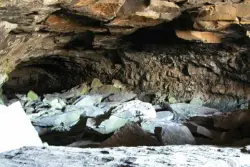
23.0 miles N of Rexburg, IdahoThe caves are large lava tubes. The name comes from the cold war era when they were anticipated as a safe area in the case of an attack. The entrance is pretty bouldery and does require a small amount of agility. Once in, it's easy enough for even little kids. Off the entrance, there are two main tubes. The right is pretty easy, the left is a little more difficult but does have bats. The right tube is mostly a flat gravely floor with a very large arched ceiling with rocks and boulders here and there. There's plenty of room to run around. College kids often play glow in the dark tag and other similar night games out here. It's pretty well patroled due to the high interest. At the end is a little more like caverns that you can crawl around through.
The caves are pretty cold year round. You're even likely to find some ice near the entrance. You'll want to bring jackets, lights, and good footwear. Sadly there is quite a bit of broken glass throughout the caves.
The dirt road up to the caves is very rocky and often washed out. You probably want to drive something with pretty good clearance.
The caves are closed October through April to protect the bat habitat.
Rexburg Area Ice Caves
Rexburg, Idaho
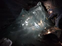
29.1 miles N of Rexburg, IdahoNot to be mistaken with the Civil Defense Caves (which are near by), the Ice Caves are about an hour North outside of Rexburg. The Ice Caves were originally formed as lava tubes. The shape of the caves traps cold winter air in the cave and forms large areas of ice on the floor and beautiful ice crystals on the walls and ceiling. The ice remains frozen year round and makes for an awesome time. The ice caves are a few hundred yards deep and require good footwear, warm clothes and a flashlight to navigate. There is often a good amount of water near the entrance. There's a bridge of rocks across the area but you may get a little wet getting in the cave. There are areas where you'll need a rope to be able to ascend portions of ice. Please do not light fires or introduce any other heat source into the caves.
0.6 mi
 Full Listing
Show more
Dive, Hike, Mountain Bike, Snowshoe, Swim
Last visited on 5 Nov 2016
Full Listing
Show more
Dive, Hike, Mountain Bike, Snowshoe, Swim
Last visited on 5 Nov 2016
Packsaddle Lake
Tetonia, Idaho
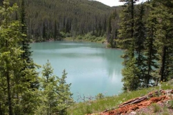
9.3 miles W of Tetonia, IdahoPacksaddle Lake is a little-known gem tucked into the Big Hole Mountains west of Tetonia, Idaho — a small, cold, tree-ringed mountain lake with a rope swing, a hidden-away feel, and glimpses of the Tetons on the way in. It sees a fraction of the crowds of the more famous Teton-side lakes, which is a big part of its charm, but earning that solitude takes a rough drive and a steep little hike.
Getting there is the crux. The access road is genuinely rough — a high-clearance or four-wheel-drive vehicle is strongly recommended, and drivers of cars and minivans report needing some creative maneuvering to pick their way up. About 0.4 miles below the trailhead the road takes a steep, washed-out turn, and there are good pull-offs where you can simply park and walk the rest. From the upper trailhead it's a short but steep descent of around 300 feet in under half a mile down to the water; you'll spot the lake from the top of the trail, and switchbacks make the grade manageable.
At the lake you'll find a small camp area on the eastern shore and a rope swing out over the water — swing out far enough, since the lake shallows and drops off quickly near the edge, and the water is bracingly cold. It's a fun spot to swim, float (bring an inflatable if you can), picnic, and cool off after the hike in. Mountain bikers can also reach the lake by a longer, climbing singletrack from the lower trailhead that serves up beautiful Teton views before dropping to the water.
A few seasonal notes: the mosquitoes can be fierce up top in early summer (they ease off down by the lake), so bring repellent, and water levels drop as the season goes on. Snow lingers on the high road into early summer and returns in fall — more than one group has gotten a vehicle stuck in an early- or late-season snow squall up here.
The Big Hole Mountains that cradle the lake are a quieter, lower range just west of the Tetons, laced with trails and dotted with small lakes — a locals' playground for hiking, mountain biking, and hunting that rarely feels crowded. Packsaddle is one of its little treasures: a place to swing off the rope, float away an afternoon, cast for the occasional trout, or pitch a tent for a low-key overnight under the stars. On the drive and hike in, the reward is those signature Teton views rising to the east over the intervening ridges.
Come prepared for backcountry conditions: there are no facilities, so carry plenty of water, sun protection, and everything you'll need, and pack out all your trash. For those willing to brave the road, Packsaddle Lake is a rewarding, off-the-radar escape in the quiet Big Hole Mountains.
×


