


5 locations
Add Location
 Full Listing
Show more
Camp, Canoe, Dive, Kayak, Sled, Swim
Last visited on 27 Apr 2020
Full Listing
Show more
Camp, Canoe, Dive, Kayak, Sled, Swim
Last visited on 27 Apr 2020
0.6-2.0 mi
 Full Listing
Show more
Camp, Cave, Hike
Last visited on 27 Apr 2020
Full Listing
Show more
Camp, Cave, Hike
Last visited on 27 Apr 2020
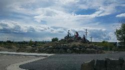
North Menan Butte ('R' Mountain)
Menan, Idaho
4.5 miles N of Menan, IdahoThe North Menan Butte is more commonly known to the locals and college students as R Mountain. Many kids know it better as Ou'R' Mountain. The butte is a rare and unique geological area and provides a great volcanic hike.
There's a paved parking lot and a vault toilet at the West trailhead. The first few hundred yards are well-maintained gravel and sand paths and the further you get, the less defined the trail gets, though it is relatively easy to find and follow. The switchback trails (South and West) are marked by sections of log fences. Towards the top of the West switchbacks, there's a chain handrail. It gets a little steep so you'll want some shoes with some grip. The sand on the rock makes it pretty slippery in the steeper parts. You'll get better grip after a good rain. Once you get up to the top, there's an informational placard. From there, it's easy to hike the rim and get an awesome view of the valley including Rexburg, Henry's Fork, and the Snake River.
It's a great hike for a small family or just a quick hike for a date. Even going up the West switchbacks and around rim, including the 'R', and back down the same way is only 3.5 miles (longest route) so you can do it pretty quick if you want. There's so much to look at that you could also spend hours climbing rocks, exploring caves, and playing around "The Ampitheater". If you just want to get to the 'R' as quickly as possible, you can do the hike in as little as 2 miles roundtrip.
Distances:
- West trailhead up the face to the rim: 0.5 miles
- West trailhead up the switchbacks to the rim: 0.75 miles
- West trailhead, from reaching the rim to 'R': 1 mile
- South trailhead to the rim: 0.3 miles
- South trailhead, from reaching the rim to 'R': 0.75 mile
- Through the caldera: 0.6 miles
- Around the rim: 2 miles
- Rim to 'R': 500 feet
There are no fees. Camping is allowed up to 5 nights but fires must be in an elevated fire pan and all the ash must be packed out.
Posted regulations:
- No motorized vehicle use
- Discharging of weapons or fireworks is prohibited
- Open fires are permitted only with an approved elevated fire pan and ash removal
- Burning pallets, tires, wire, plastic, glass, metal, magnesium, or hazardous material is prohibited
- Cutting or damaging vegitation is prohibited
- 5-day camping limit
Jefferson County Lake (AKA Rigby Lake)
Rigby, Idaho
2.0 miles N of Rigby, IdahoJefferson County Lake — known to everyone in the area simply as Rigby Lake — is a beloved man-made swimming lake and county park just outside Rigby, Idaho, about a 20-minute drive from Idaho Falls or Rexburg. In a landlocked stretch of eastern Idaho, it's the closest thing to a day at the beach: a broad sandy shoreline, warm-but-refreshing water, floating docks, and a summer crowd of families making the most of the season.
Jefferson County has invested heavily in the park over the years, and it shows. A wide sandy beach runs along much of the south shore — perfect for sandcastles and burying kids up to their necks — and a line of buoys separates the shallow, protected swimming area from the open water beyond. Out on the west end sit two floating docks, the big draw for many visitors: they're anchored over deep water that's great for jumping and diving, and one dock has a slide that launches you out over the lake. Beyond the buoys, the open water fills with canoes, kayaks, and paddleboards, and rentals are often available on site if you didn't bring your own.
The amenities round out a full family day: two playgrounds, sand volleyball courts, large and small covered pavilions, restrooms, a seasonal food truck, and a campground on the north end for those who want to stay the night. It's well maintained and genuinely set up for a crowd, yet regulars note that even on a packed weekend the water itself rarely feels crowded — you can usually walk right up to the dock slide without much of a wait.
A few practical details. The park charges a modest day-use fee — currently around $5 per vehicle (walk-in or bike-in about $3), or a $30 season pass (not valid for camping) — and it's generally open daily from about 9 a.m. to 10 p.m. Because the lake is filled with irrigation water, the season is weather- and water-dependent: it typically fills enough for swimming around June 1 and stays good through about the end of September before it's drawn down for the year.
Come summer, bring what makes a beach day: sunscreen, chairs or a canopy for the grassy area above the sand, and floats or inner tubes, which reviewers say really add to the fun. The water tends to run cool but comfortable — refreshing without being shivery. And the lake has a fun second life in the cold months: once it's drawn down and frozen, the basin becomes a popular local sledding spot, with no fee to park in winter. However you catch it, Rigby Lake is a genuine eastern-Idaho institution — a little slice of the beach in the middle of the high desert.
0.2-0.5 mi
 Full Listing
Show more
Camp, Hike, Mountain Bike, Sled
Last visited on 20 Apr 2020
Full Listing
Show more
Camp, Hike, Mountain Bike, Sled
Last visited on 20 Apr 2020
Eagle Park
Rexburg, Idaho
0.9 miles N of Rexburg, IdahoEagle Park is a little urban oasis. Once you drive in to this cottonwood forest along the river, you may forget that you're still inside Rexburg city limits. You can camp, picnic, throw rocks in the river, fish, mountain bike, or just go for a walk along the trail or road. All sites have picnic tables, fire rings, and tent pads. Just off the main parking lot is a nicely mowed grassy area that is a popular dog park. On the West end of the parking lot, you'll find a multi-use trail that will take you almost the entire length of the park.
Mountain Biking/Hiking/Walking
The trail system at Eagle Park is maintained in part by Free Arenas. If you have any would like to get involved or just want to share your thoughts on how to improve it, email trailbuilding@freearenas.com.
Tenderfoot is primarily a mountain bike trail. The trail runs back behind most of the campsites. While it's built for mountain bikes, it's usually great for a nice quiet walk as well, and arguably the best way to see the park. This 0.5 mile trail is rated Easy but is about as tough as an easy trail can get. It's pretty mellow but does have a couple of very short ups.
Taut-line is cut into the slope along the fence line. It begins on the embankment at the West end of the campground and goes for 0.4 miles before meeting back up with Tenderfoot. The Northwest section is the longest section of trail in Eagle Park and is cut into a steep slope above marsh and ponds. It is generally downhill from the West end but has plenty of up and down. Towards the middle of the trail, there is a berm and a couple of table top jumps. The section South of the Tenderfoot junction was an Eagle Project completed by Ian Hoffman and his volunteer crew. The trail continues to cut up and down the side hill with a fun rock berm and a rock garden. The end drops in to connect back to Tenderfoot right near the junction with Bugler. The trail is a one-way trail from West to East and has short climbs and fun decents. Because it's much higher than the Tenderfoot Trail it parallels, Taut-line does not flood and actually bypasses the flood areas of Tenderfoot. Because the trail does go along a steep slope on the West end, remember to fall uphill. This trail is rated Intermediate.
Bugler drops off the Tenderfoot Trail and runs down and around a small pond just off the main lawn. There's a few decents, climbs, and berms adding a little bit of speed and a little more difficulty.
Jamboree drops off the Eagle Park Road near campsite 19 and continues down along the river to the old campsite 14 that's now a disc golf basket. This trail rolls back and forth through a trough of sorts with some jumps along the edges and potential for many more. It seeps ground water when the water is higher and is completely flooded in May/June when the river is really high. When it's dry though, it rides decently fast and is a lot of fun!
Skills Park Along the Tenderfoot Trail and just off the lawn is a skills park built as an Eagle Scout project by Erik Hurst and other volunteers. It features a large wrap-around berm on the north end, raised skinnies made of 2x8, 2x6, and 2x4 treated lumber, a ladder a-frame, a rock garden, and a see-saw.
While not all trails are intended to bi-directional and multi-use, they are all used as such so please be aware of others on the trail.
Looking for a little longer hike or ride? Go to the Northwest end of the park and you'll find an old embankment road that follows the airport fence line to the Nature Park. It's pretty popular to loop both parks together.
Sledding
There's some mounds above a bench that can be used as a sledding hill area just off the main grassy area. It's a terraced hill with a couple set runs and then quite a bit of open hill as well. Elevation is only about 20 feet from top to bottom but there's plenty to keep kids busy for awhile. There's even a more difficult run that includes jumps and drops for snowboards. The terrace trails are better when the snow's a little bit icier but the small hills are great for little kids that wnat to avoid the more popular hill at Smith Park
Camping
Picnicking is free but there is a fee for camping. Overnight camping fee is $10.00 per space paid via rexburg.org. All fees are used for future picnic tables, restrooms and other park improvements. The camp fee for boy scout troops may be waived as long as they perform an approved 1 hour service project to the park while camped here. Picking up garbage and pulling weeds are always approved. Weeds that need pulled include hounds tongue, cocklebur, bull thistle, and the occasional stinging nettle.
Posted Eagle Park Rules
- No RVs in park
- No motorcycles, scooters, or ATVs on park roads
- 7 day camping limit
- Tents only on designated tenting pads
- Fires in designated fire pits only. No non-burnable items in firepits.
- No smoking, tobacco, or alcoholic beverages
- Pets on leashes only. (All pet droppings to be put in bags for droppings)
- All garbage to be put in garbage cans. Pack it in - Pack it out.
- No firearms, firecrackers, or explosives
- Avoid loud music and noises — Be respectful of other campers
To reserve an entire shelter, call City Hall at 359-3020. Reservation fee is $25 per half day.
This is a community service project of Free Arenas, the Madison Lions Club, Trails of Madison County, the City of Rexburg, and numerous Eagle Scouts in the Yellowstone District of the Grand Teton Council, BSA. Constructed 2001-2005.
Please respect the flora and fauna and practice the Outdoor Code. This park only exists because of volunteer service from many in the community. Please, don't be afraid to help out by collecting some hounds tongue, cocklebur, and bull thistle. If you're looking for ideas for a bigger service project, contact trailbuilding@freearenas.com
0.4-0.7 mi
 Full Listing
Show more
Mountain Bike, Sled
Last visited on 20 Apr 2020
Full Listing
Show more
Mountain Bike, Sled
Last visited on 20 Apr 2020
Rexburg Bike Park
Rexburg, Idaho
0.8 miles NE of Rexburg, IdahoIt's a small but great bike park for all ages; if you are a beginner, then this is the bike park to go to. The mounts are a decent size and approximately 4-6 mounts in different sizes for the kids. Want to spend time with friends and/or family while doing something awesome? Do your kids have nothing to do? Come to the Rexburg bike park!
Located in the back of the water park Rexburg Rapids, the Rexburg bike park is a fun place for people of all ages to ride their bikes during the open season.
There are mounts of many different sizes (small, medium and a few large ones.) Being bored is not cool! Bring your family and friends, have a cookout and ride mounts with your bike! Always wear protective equipment before riding.
By the way, do you love sledding in the winter? Also, in the winter time, the mounts are covered with snow; which makes for great sledding with family and friends. Come and have fun!
0.1-0.3 mi
Full Listing
Show more
Disc Golf
Last visited on 1 Apr 2020
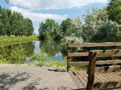
Rexburg Nature Park
Rexburg, Idaho
0.8 miles NW of Rexburg, IdahoRexburg Nature Park:
Life can be stressful, annoying, or just not good. Sometimes, it takes a moment to simply get away from the non-sense of this world; to gather yourself and seek peace and tranquility. That option is around the corner; you drive and see a trail, so you park and walk on the trail. As you walk, there's trees and sunlight shining on the leaves. You walk further and see a pond with ducks (both green and brown) and families sitting on the green grass with their kids; they watch, feed the ducks and take pictures with a smile on their face.
You go back to your vehicle and reminisce what you saw. Close to the south fork of the Teton River, is a nature park that isn't crowded with college students or infested with incoming traffic but a 15 acre park that was made so you can take your family or acquaintances for a picnic or a social gathering and enjoy; you also have the option to ride your bike or to jog on the trails.
The park is next to the Claire Boyle skate park, a beautiful golf course next to the fairgrounds and a 9 hole Frisbee golf course.
Features:
-Playground for the kids
-Fishing ponds ( A valid fishing license is required); fishing ponds for children as well.
-Wildlife and wildflowers
For more information and questions:
| Phone | 208-359-3020 Ext. 0 |
|
customerservices@rexburg.org |
×


