White Rim Trail
Moab, Utah
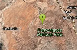
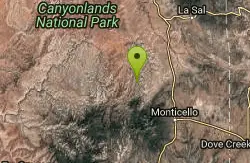
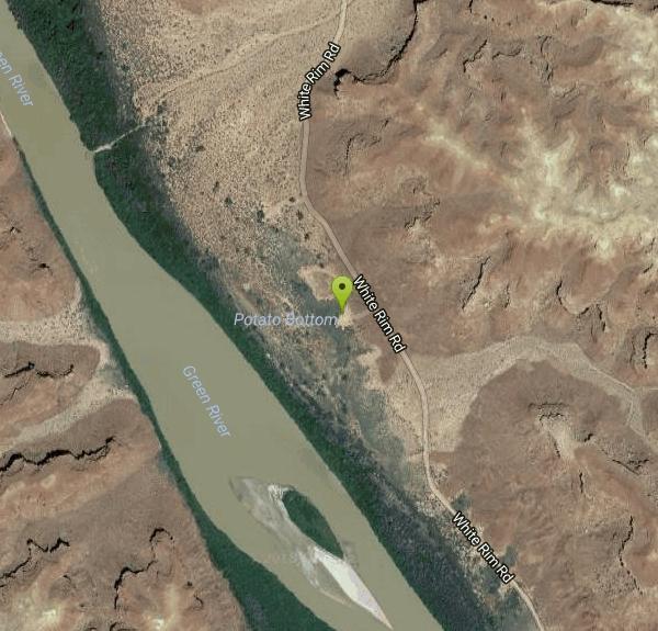
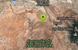
| Address: | ~Potato Bottom Campground A, Moab, UT 84532, USA |
| GPS: |
38°25'47.2"N 110°0'34.5"W Maps | Directions |
| State: | Utah |
| Trail Length: | 103.00 miles |
| MTB Difficulty: | Beginner |
| Trail Type: | Loop |
| MTB Trail Type: | 4x4 Trail |
Mountain Bike
The White Rim Trail is Utah's ultimate multi-day party trail. The trail is a 103-mile loop on jeep road through Canyonlands National Park. Technically, this trail is fairly easy. But the length (and a few stiff climbs) means you need to be in good condition to do the whole thing. The major climbs add up to 4000 vertical feet, but an altimeter or GPS unit that records every little up-and-down will give you about 6000 feet total.Most riders spend 3 or 4 days to ride this trail, spending the night at campgrounds. (Two days = Monster. One day = Lunatic.) You'll need a support vehicle for food, water, camping gear, and bike parts. (Even though there's little dangerous stuff, the length of this trail -- combined with sand -- means there's a good chance you'll need some on-trail repair.) You can ride the trail either direction. Most bikers ride clockwise, from the Schafer Trail around to the Green River. This direction tends to be a little nicer, because it puts most of the sand on the downhill slopes. There are four big hills with over 1000 feet elevation gain, but you get to do one of them downhill as you drop into the canyon on the first day. A three-day trip gives you one major climb each day. Courtesy of Singletracks.com
More Information
Add ResourceNever modify trail features. Ride trails when they're dry enough that you won't leave ruts. Speak up when you see others on the trail and always yield to hikers, horses, and others coming uphill. Always ride on the established trail.
Read More- Plan Ahead and Prepare
- Travel & camp on durable surfaces
- Dispose of waste properly
- Leave what you find
- Minimize campfire impacts
- Respect wildlife
- Be considerate of other visitors
Directions
From Moab, Utah
- Head west on E Center St toward N Main St (266 ft)
- Turn right onto US-191 N/N Main StContinue to follow US-191 N(11.0 mi)
- Turn left onto UT-313 W (12.3 mi)
- Turn right onto BLM 129/Mineral Canyon Rd (14.6 mi)
- Turn left onto White Rim Rd (12.0 mi)
- Turn right onto Potato Bottom Campground A (187 ft)
Other Mountain Bike Trails Nearby
Horsethief Trail System
Moab, Utah
15.1 miles NEA network of loops and trails near Navajo Rocks, 7 Up, and Mag 7 in Moab, including the 7-mile point-to-point Chisholm Trail.
Mountain Bike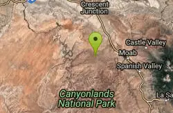
Horsethief Campground
Moab, Utah
15.1 miles NEA new network of loops at Horsethief Campground near Moab — the first trails are complete, with longer connections to other area trails still in progress.
Mountain Bike
Navajo Rocks
Moab, Utah
15.2 miles NEA brand-new 9-mile intermediate loop of slickrock, sandy singletrack, and unique rock formations — with acres of cryptobiotic soil to keep pristine.
Mountain Bike
Dead Horse Point State Park
Moab, Utah
15.3 miles EMountain biking and camping at 5,900 feet amid old tales and legends — Dead Horse Point State Park delivers high-desert riding with plenty to keep outdoor enthusiasts busy.
Mountain Bike
Mag 7
Moab, Utah
15.4 miles NESeven trails combining singletrack and 4x4 roads through classic Moab terrain — Bull Run, Gold Bar, Golden Spike, Poison Spider, Portal, and more await.
Mountain Bike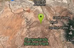
Chisholm
Moab, Utah
15.5 miles NEOne of the most flowy trails in the Moab area — sandstone and dirt through pinon-juniper forest with rock work, narrow ledges, and a wooden bridge.
Mountain Bike
Gemini Bridges
Moab, Utah
15.9 miles NEA mountain bike route to two breathtaking arches spanning a canyon near Moab — a mix of gravel roads and trail that rewards with dramatic views and a natural lunch spot.
Mountain Bike
7 Up
Moab, Utah
16.4 miles NEA highly scenic Moab route mixing singletrack and doubletrack from the Magnificent 7 trailhead to the Monitor/Merrimac overlook — rideable in either direction as a shuttle or out-and-back.
Mountain Bike
Bull Run
Moab, Utah
16.9 miles NEThe upper leg of the Mag 7 route with great views, wicked exposure, and plenty of slickrock — less technical than the lower sections but still a thrilling ride.
Mountain Bike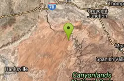
June's Bottom
Green River, Utah
17.1 miles NWAn incredibly scenic closed-to-motors ride through Utah's San Rafael Desert, 30 miles south of Green River — locally known, well worth the trip over graded county road.
Mountain Bike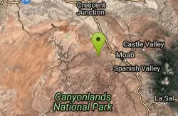
Getaway
Moab, Utah
17.5 miles NEA singletrack connector near the upper end of Gemini Bridges Road in Moab — works as an alternate Mag 7 start, a 4x4 road loop, or a standalone out-and-back ride.
Mountain Bike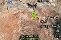
Coney Islands
Moab, Utah
18.8 miles NEAn intermediate Moab ride with a 6% average grade, short steep pitches up to 20%, and a high point of 5,610 feet with some technical difficulty.
Mountain Bike
Big Lonely
Moab, Utah
18.8 miles NEAn intermediate Moab ride across a sandstone ridge and cross-country dirt with a 45-degree slickrock climb — highest point at 5,600 feet with a 250-foot elevation range.
Mountain Bike
Big Mesa
Moab, Utah
18.8 miles NEA technical 9-mile mountain bike loop with cliff-wall climbs, rock ledges, and slickrock slabs — part of the Navajo Rocks Trail System near Moab, Utah.
Mountain Bike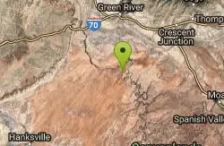
Itchy And Scratchy
Green River, Utah
20.7 miles NSlickrock and doubletrack through the San Rafael desert with Green River canyon views, a 1,000-foot-deep chasm, and Fremont Indian petroglyphs in Bull Bottom.
Mountain Bike
Long Canyon 4x4 Road
Moab, Utah
20.9 miles NEA scenic 4x4 canyon road near Moab with a workout-level climb, a huge sandstone slab spanning the road with just enough gap to squeeze through — something different from the usual slickrock.
Mountain Bike
Big Chief Loop
Monticello, Utah
21.6 miles EA beginner-friendly loop with fantastic views near Monticello — the Great Pyramid Loop on a cruiser is manageable, while the Big Chief Loop adds one carry-worthy climb.
Mountain Bike
Gold Bar Rim
Moab, Utah
21.6 miles NEA rugged Moab Jeep trail with sand and step-ups along the rim — connects to Poison Spider or Portal Trail for a one-way shuttle adventure.
Mountain Bike
Rockstacker
Moab, Utah
21.7 miles EOnly 1.7 miles but intensely technical — the 'Red Line Trail' rolls across a slickrock bench toward Jackson's Trail, demanding the skills of the very best riders on Amasa Back near Moab.
Mountain Bike
Poison Spider Mesa
Moab, Utah
22.8 miles EA technically and physically demanding Moab classic across slickrock, babyheads, bedrock ledges, deep sand, and loose terrain — with an optional Portal Trail descent that demands full attention on cliff-edge singletrack.
Mountain Bike