


June's Bottom
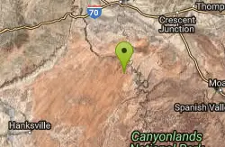
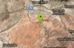
Green River, Utah
| Address: | ~Co Rd 1025, Green River, UT 84525, USA |
| GPS: |
38°39'15.4"N 110°8'33.0"W Maps | Directions |
| State: | Utah |
| Trail Length: | 15.00 miles |
| MTB Difficulty: | Intermediate |
| Trail Type: | Other |
Mountain Bike
June's Bottom is an incredibly scenic ride through Utah's San Rafael Desert. Located 30 miles South of Green River, Junes Bottom is well worth the trip over 30 miles of county maintained graded road. This route has recently been closed to all MOTORIZED vehicles. Please stay on the designated route, and respect the historical significance of June's Bottom, this way the BLM will keep the trail open to mountain bikers! I've included all of my GPS waypoints, because as far as I know, this trail as I've posted it here cannot be found on any other websites or in any guidebooks. I had the opportunity to ride this trail with MECCA So now you too can enjoy this ride the same way the "locals" do!! Courtesy of Singletracks.com
Never modify trail features. Ride trails when they're dry enough that you won't leave ruts. Speak up when you see others on the trail and always yield to hikers, horses, and others coming uphill. Always ride on the established trail.
Read More- Plan Ahead and Prepare
- Travel & camp on durable surfaces
- Dispose of waste properly
- Leave what you find
- Minimize campfire impacts
- Respect wildlife
- Be considerate of other visitors
Directions
From Green River, Utah
- Head west on E Main St toward Solomon St (0.1 mi)
- Turn left at the 3rd cross street onto S Long St (0.3 mi)
- Turn left onto Green River Ave (0.1 mi)
- Turn right onto Airport Rd (0.4 mi)
- Continue onto County Rd (2.0 mi)
- Turn left (3.3 mi)
- Continue onto Lower San Rafael Rd (9.0 mi)
- Slight right (0.7 mi)
- Sharp left onto Lower San Rafael Rd (14.8 mi)
- Continue onto Co Rd 1025 (1.2 mi)
- Continue straight (387 ft)
- Slight left onto Co Rd 1025 (0.9 mi)
- Slight left to stay on Co Rd 1025Destination will be on the right(95 ft)

Other Mountain Bike Trails Nearby
Itchy And Scratchy
Green River, Utah
3.9 miles NSlickrock and doubletrack through the San Rafael desert with Green River canyon views, a 1,000-foot-deep chasm, and Fremont Indian petroglyphs in Bull Bottom.
Mountain Bike
White Rim Trail
Moab, Utah
17.1 miles SEA legendary 103-mile Canyonlands loop on jeep roads with 4,000 feet of climbing — most riders take 3 to 4 days and bring a support vehicle for this Utah classic.
Mountain Bike
Gemini Bridges
Moab, Utah
18.0 miles EA mountain bike route to two breathtaking arches spanning a canyon near Moab — a mix of gravel roads and trail that rewards with dramatic views and a natural lunch spot.
Mountain Bike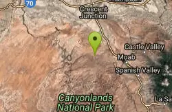
Bull Run
Moab, Utah
18.4 miles EThe upper leg of the Mag 7 route with great views, wicked exposure, and plenty of slickrock — less technical than the lower sections but still a thrilling ride.
Mountain Bike
Horsethief Campground
Moab, Utah
18.5 miles EA new network of loops at Horsethief Campground near Moab — the first trails are complete, with longer connections to other area trails still in progress.
Mountain Bike
Horsethief Trail System
Moab, Utah
18.5 miles EA network of loops and trails near Navajo Rocks, 7 Up, and Mag 7 in Moab, including the 7-mile point-to-point Chisholm Trail.
Mountain Bike
Navajo Rocks
Moab, Utah
18.6 miles EA brand-new 9-mile intermediate loop of slickrock, sandy singletrack, and unique rock formations — with acres of cryptobiotic soil to keep pristine.
Mountain Bike
Big Lonely
Moab, Utah
19.3 miles EAn intermediate Moab ride across a sandstone ridge and cross-country dirt with a 45-degree slickrock climb — highest point at 5,600 feet with a 250-foot elevation range.
Mountain Bike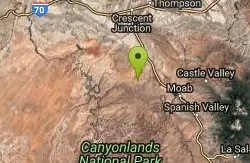
Coney Islands
Moab, Utah
19.3 miles EAn intermediate Moab ride with a 6% average grade, short steep pitches up to 20%, and a high point of 5,610 feet with some technical difficulty.
Mountain Bike
Big Mesa
Moab, Utah
19.3 miles EA technical 9-mile mountain bike loop with cliff-wall climbs, rock ledges, and slickrock slabs — part of the Navajo Rocks Trail System near Moab, Utah.
Mountain Bike
Chisholm
Moab, Utah
19.3 miles EOne of the most flowy trails in the Moab area — sandstone and dirt through pinon-juniper forest with rock work, narrow ledges, and a wooden bridge.
Mountain Bike
Mag 7
Moab, Utah
19.7 miles ESeven trails combining singletrack and 4x4 roads through classic Moab terrain — Bull Run, Gold Bar, Golden Spike, Poison Spider, Portal, and more await.
Mountain Bike
Bartlett Wash
19.7 miles E
Easy aerobic access to a huge expanse of slickrock with ledges to drop, bowls to ride, and open views — explore freely and make your way back at your own pace.
Mountain Bike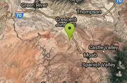
Hidden Canyon-blue Hills Loop
20.3 miles E
A clockwise loop combining Hidden Canyon 4x4 road and Blue Hills road — a GPS track is invaluable for navigating the many junctions on this Utah mountain bike trail.
Mountain Bike
7 Up
Moab, Utah
20.4 miles EA highly scenic Moab route mixing singletrack and doubletrack from the Magnificent 7 trailhead to the Monitor/Merrimac overlook — rideable in either direction as a shuttle or out-and-back.
Mountain Bike
Getaway
Moab, Utah
21.0 miles EA singletrack connector near the upper end of Gemini Bridges Road in Moab — works as an alternate Mag 7 start, a 4x4 road loop, or a standalone out-and-back ride.
Mountain Bike
Monitor & Merrimac/Courthouse Pasture
Moab, Utah
22.5 miles EA guided-tour favorite near Moab with dinosaur bones, wildlife, dramatic rock formations, and slickrock riding through Courthouse Pasture.
Mountain Bike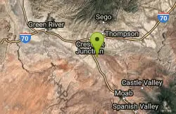
Klondike Bluffs
23.8 miles NE
A complex trail system of slickrock, singletrack, and 4x4 roads at Klondike Bluffs near Moab stretching for miles in all directions along a dry wash valley.
Mountain Bike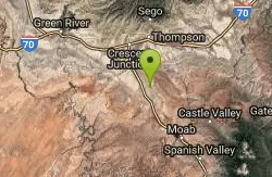
Baby Steps
Moab, Utah
24.5 miles ENewer Moab singletrack that spurs off Klondike Bluffs with a fun mix of doubletrack, slickrock, and singletrack — great as an out-and-back or a loop.
Mountain Bike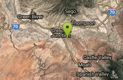
Mega Steps
24.5 miles NE
Sandy start leads to slickrock climbing and twisty ridgetop singletrack through pines and boulders with fantastic views of Salt Valley and Arches National Park beyond.
Mountain Bike


