


Albion Falls
Hamilton, Ontario

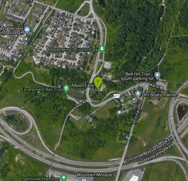
| Address: | 885 Mountain Brow Blvd, Hamilton, ON L8W 1R6, Canada |
| GPS: |
43°12'1.4"N 79°49'10.7"W Maps | Directions |
| State: | Ontario |
| Trails/Routes: | 0.3 mi |
Hike
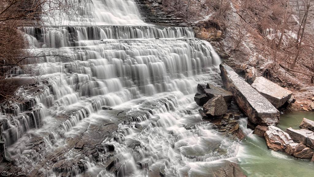
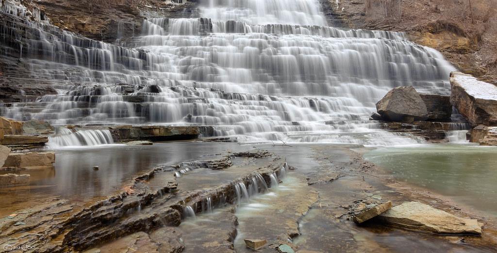
Albion Falls is located just outside of Hamilton, Ontario, Canada and is one of the most scenic hikes in Eastern Canada just outside of a large city. It is frequently visited from people all over Canada because of its beauty. It is a very short hike from the parking area at only about 0.5 miles (600 meters). The falls have both an upper and lower viewing point for more access for hikers to enjoy the beauty of the falls. Since the hike is so short, the difficulty is not high and it is a great place to take the whole family to if you find yourself in Hamilton wanting to enjoy the beautiful surroundings on the Niagara Escarpment.
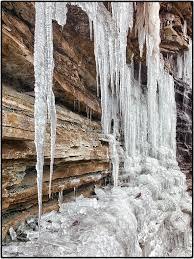
The best time to hike this trail is from April to September, even though the trail is accessible all year. It is also a great place to go see in the mid-fall months because the colors of the maple leaves around the falls add to its serene beauty. Many people also like to make the short hike in the winter to see the falls frozen over during the frigid Canadian winters. If you decide to do this, take caution because trail conditions can get very icy in the winter months.
Albion Falls is one of the highlights in the Hamilton area and if you find yourself wanting to get away from the hustle and bustle of the city, escape to this amazing place.
More Information
Albion Falls - The Most Photogenic Waterfall in Hamilton
Albion Falls is a 19m high 18m wide waterfall with a rippling characteristic that makes us think that it’s the prettiest waterfall in Hamilton, Ontario, Canada.
https://www.world-of-waterfalls.com/waterfalls/canada-albion-falls/Albion Falls - Tourism Hamilton
This wide cascade tumbles over the Niagara Escarpment and is one of our most popular.
https://tourismhamilton.com/albion-falls/Be courteous, informed, and prepared. Read trailhead guidelines, stay on the trail, and don't feed the wildlife.
Read More
- Plan Ahead and Prepare
- Travel & camp on durable surfaces
- Dispose of waste properly
- Leave what you find
- Minimize campfire impacts
- Respect wildlife
- Be considerate of other visitors
Directions
From Hamilton, Ontario
- Head south toward Main St W/
Hamilton Regional Rd 8 (17 m) - Turn right toward Main St W/
Hamilton Regional Rd 8 (32 m) - Turn right toward Main St W/
Hamilton Regional Rd 8 (32 m) - Turn right onto Main St W/
Hamilton Regional Rd 8 (0.9 km) - Turn right onto Wellington St S (0.1 km)
- Slight right to stay on Wellington St S (0.3 km)
- Turn left onto Young St (0.2 km)
- Turn right onto Victoria Ave S (0.2 km)
- Turn left onto Charlton Ave E (0.2 km)
- Sharp right toward Sherman AccessClosed 7:00 – 9:00 AMTurn is not allowed Mon–Fri 6:50 – 9:10 AM(56 m)
- Continue onto Sherman Access (3.1 km)
- Take the ramp onto Kenilworth Access (0.9 km)
- Turn right onto Mountain Brow Blvd (84 m)
- Turn left at the 1st cross street to stay on Mountain Brow Blvd (0.1 km)
- Continue straight to stay on Mountain Brow Blvd (2.3 km)
- Turn left to stay on Mountain Brow BlvdDestination will be on the left(1.7 km)

Other Hiking Trails Nearby

Eramosa Karst
Hamilton, Ontario
1.0 miles SEUnderground caves, streams, meadows, and forests make up this unique conservation area in Hamilton's Stoney Creek — perfect for hiking, nature appreciation, and education.
Cave, Hike
Borers Falls
Hamilton, Ontario
8.5 miles NWA graceful 15-metre curtain waterfall fed by Borer's Creek in the Dundas conservation area, flowing year-round.
Hike
Inflow Bike & Skatepark
Hamilton, Ontario
9.3 miles NWA 10,000-square-foot indoor BMX, freestyle scooter, skateboarding, and inline skating facility in Hamilton, Ontario — dedicated to alternative sports for youth and adults ages 8 and up.
Hike, Rock Climb, Swim
Grimley Grist Mill
Hamilton, Ontario
10.8 miles NWCanoe, Hike, and Horseback near Hamilton, Ontario
Canoe, Hike, Horseback
Beamers Falls Conservation Area
Grimsby, Ontario
12.3 miles EThe highest point of the Niagara Escarpment, Beamer Falls Conservation Area is a beautiful and scenic natural landmark — once part of a local family farm, now preserved for all.
Hike
Balls Falls Conservation Area
Lincoln, Ontario
22.5 miles ESpectacular Niagara Escarpment vistas, two waterfalls, wildlife, and interactive conservation exhibits make Ball's Falls a unique eco-tourism experience in Lincoln, Ontario.
Hike
Short Hills Provincial Park
Pelham, Ontario
27.8 miles EThe Niagara Region's largest provincial park, built on a glacially formed kame moraine with steep valleys carved by meltwater — a unique geological and natural landscape to explore near Pelham, Ontario.
Canoe, Cross-country Ski, Hike, Horseback, Mountain Bike
St. Lawrence Seway Land & Ruins
Niagara-on-the-Lake, Ontario
32.2 miles EA 37-kilometre multi-use trail running along the 1000 Islands Parkway corridor, concurrent with the Waterfront Trail, from Gananoque to Butternut Bay near Brockville.
Hike, Horseback, Mountain Bike
Wainfleet Quarry
Port Colborne, Ontario
34.0 miles SEA former 1800s limestone quarry on the site of a 300-million-year-old paleozoic sea, now a conservation area with dramatic limestone shores and clear, calm water for sunbathing — no entry fee.
Canoe, Cross-country Ski, Hike, Horseback, Mountain Bike
Cave Of The Winds / Niagara Gorge Wooden Stairs
Niagara Falls, Ontario
38.0 miles EGuided wooden boardwalks and stairs put you within 15 feet of Bridal Veil Falls at the base of Niagara Gorge — expect to be completely soaked on the Hurricane Deck.
Cave, Hike, Mountain Bike, Rock Climb
Niagara Gorge - Steel Stairs
Niagara Falls, Ontario
39.1 miles EThe largest developed bouldering area in southern Ontario, with hundreds of clustered boulders and over 700 established problems ranging from easy to extremely hard — a world away from Niagara Falls tourism.
Cave, Hike
Sherkston Quarry
Port Colborne, Ontario
41.6 miles SEA former quarry lake inside a full-service Lake Erie resort gives swimmers a unique deep-water experience with beach amenities close to Toronto and Buffalo.
Camp, Canoe, Cross-country Ski, Hike, Horseback, Mountain Bike


