


Eramosa Karst
Hamilton, Ontario

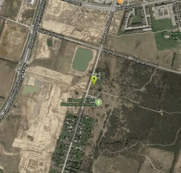
| Address: | 432 Highland Rd W, Hamilton, ON L8J Canada |
| GPS: |
43°11'16.2"N 79°48'42.8"W Maps | Directions |
| State: | Ontario |
Cave and Hike
The Eramosa Karst is the Hamilton Conservation Authority's newest conservation area. Filled with underground caves and streams, meadows and forests, this is one of the watershed's unique natural gems. Eramosa Karst is located in the south western section of Stoney Creek area of Hamilton. A perfect location for hiking, nature appreciation, and education, Eramosa Karst is a one-of-a-kind property in Hamilton's natural inventory.
More Information
Eramosa Karst Conservation Area - Hamilton Conservation Authority
Open 7 days a week, from sunrise to sunset, unless otherwise posted. Location & Contact Details Activities & Amenities Hiking & Recreation Trails More than 7-kilometres of trails, boardwalks, and bridges take you through escarpment forests, meadows, unique geological formations, and a beautiful natural amphitheatre. Interpretive panels throughout display facts about the area’s natural inventory […]
https://conservationhamilton.ca/conservation-areas/eramosa-karst/Be courteous, informed, and prepared. Read trailhead guidelines, stay on the trail, and don't feed the wildlife.
Read More
- Plan Ahead and Prepare
- Travel & camp on durable surfaces
- Dispose of waste properly
- Leave what you find
- Minimize campfire impacts
- Respect wildlife
- Be considerate of other visitors
Directions
From Hamilton, Ontario
- Head east on Main St W/Hamilton Regional Rd 8 toward MacNab St S (1.0 km)
- Turn right onto Wellington St S (0.1 km)
- Slight left onto Claremont Access (1.7 km)
- Keep left to stay on Claremont Access (0.2 km)
- Continue onto Upper James St (3.0 km)
- Take the Lincoln M. Alexander Parkway E ramp (0.4 km)
- Merge onto Lincoln M. Alexander Pkwy E (6.2 km)
- Take the Stone Church road/Mud Street exit (0.2 km)
- Keep right, follow signs for Stone Church Road East (0.6 km)
- Continue onto Upper Red Hill Valley Pkwy (0.2 km)
- Turn left onto Highland Rd W (0.4 km)
- Turn right at the 1st cross street onto Upper Mt Albion RdDestination will be on the left(0.2 km)
Upper Mount Albion Road is closed at Rymal Road. You can still access Upper Mount Albion and the Eramosa Karst from Highland Road.
With more than four kilometres of trails, boardwalks and bridges take you through escarpment forests and meadows, unique geological formations and a beautiful natural amphitheatre. Interpretive panels throughout display facts about the area's natural inventory and history.
Other Hiking Trails and Caves Nearby

Albion Falls
Hamilton, Ontario
1.0 miles NWA short, 0.5-mile hike to a spectacular tiered waterfall on the Niagara Escarpment near Hamilton — with upper and lower viewing points, family-friendly difficulty, and stunning fall foliage.
Hike
Borers Falls
Hamilton, Ontario
9.4 miles NWA graceful 15-metre curtain waterfall fed by Borer's Creek in the Dundas conservation area, flowing year-round.
Hike
Inflow Bike & Skatepark
Hamilton, Ontario
10.1 miles NWA 10,000-square-foot indoor BMX, freestyle scooter, skateboarding, and inline skating facility in Hamilton, Ontario — dedicated to alternative sports for youth and adults ages 8 and up.
Hike, Rock Climb, Swim
Grimley Grist Mill
Hamilton, Ontario
11.6 miles NWCanoe, Hike, and Horseback near Hamilton, Ontario
Canoe, Hike, Horseback
Beamers Falls Conservation Area
Grimsby, Ontario
11.9 miles EThe highest point of the Niagara Escarpment, Beamer Falls Conservation Area is a beautiful and scenic natural landmark — once part of a local family farm, now preserved for all.
Hike
Balls Falls Conservation Area
Lincoln, Ontario
22.0 miles ESpectacular Niagara Escarpment vistas, two waterfalls, wildlife, and interactive conservation exhibits make Ball's Falls a unique eco-tourism experience in Lincoln, Ontario.
Hike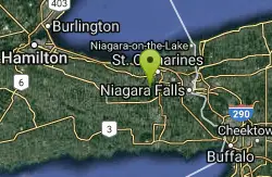
Short Hills Provincial Park
Pelham, Ontario
27.2 miles EThe Niagara Region's largest provincial park, built on a glacially formed kame moraine with steep valleys carved by meltwater — a unique geological and natural landscape to explore near Pelham, Ontario.
Canoe, Cross-country Ski, Hike, Horseback, Mountain Bike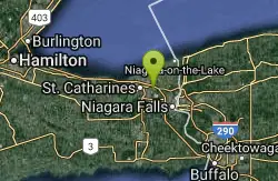
St. Lawrence Seway Land & Ruins
Niagara-on-the-Lake, Ontario
31.8 miles EA 37-kilometre multi-use trail running along the 1000 Islands Parkway corridor, concurrent with the Waterfront Trail, from Gananoque to Butternut Bay near Brockville.
Hike, Horseback, Mountain Bike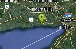
Wainfleet Quarry
Port Colborne, Ontario
33.1 miles SEA former 1800s limestone quarry on the site of a 300-million-year-old paleozoic sea, now a conservation area with dramatic limestone shores and clear, calm water for sunbathing — no entry fee.
Canoe, Cross-country Ski, Hike, Horseback, Mountain Bike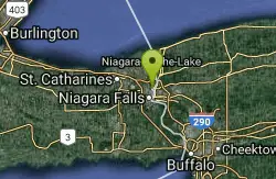
Cave Of The Winds / Niagara Gorge Wooden Stairs
Niagara Falls, Ontario
37.5 miles EGuided wooden boardwalks and stairs put you within 15 feet of Bridal Veil Falls at the base of Niagara Gorge — expect to be completely soaked on the Hurricane Deck.
Cave, Hike, Mountain Bike, Rock Climb
Niagara Gorge - Steel Stairs
Niagara Falls, Ontario
38.6 miles EThe largest developed bouldering area in southern Ontario, with hundreds of clustered boulders and over 700 established problems ranging from easy to extremely hard — a world away from Niagara Falls tourism.
Cave, Hike
Sherkston Quarry
Port Colborne, Ontario
40.8 miles SEA former quarry lake inside a full-service Lake Erie resort gives swimmers a unique deep-water experience with beach amenities close to Toronto and Buffalo.
Camp, Canoe, Cross-country Ski, Hike, Horseback, Mountain Bike


