


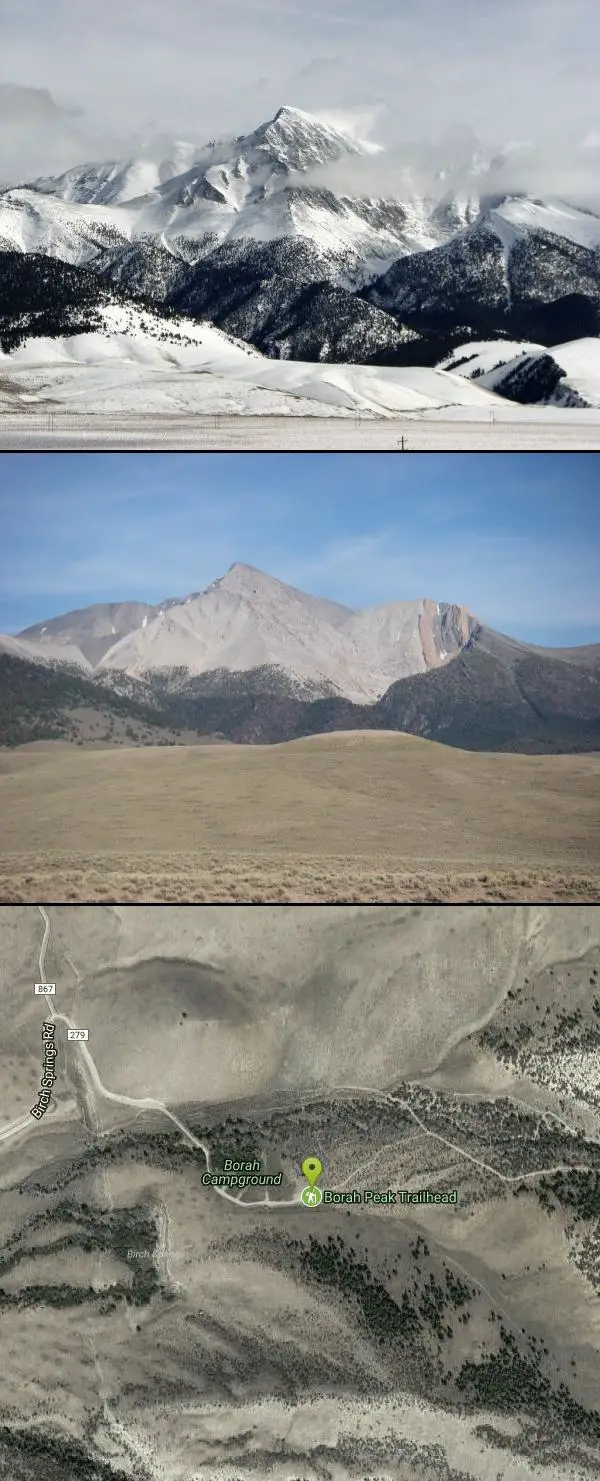
Borah Peak
Mackay, Idaho

| Address: | Mackay, ID 83251, USA |
| GPS: |
44°7'57.1"N 113°50'4.1"W Maps | Directions |
| State: | Idaho |
| Trails/Routes: | 7.9 mi |
Hike
This is the highest peak in all of Idaho, standing 12,662 ft along the Lost River Range. There are several routes that can be taken in order to reach the summit with different levels of difficulty depending on the season. Mount Borah has been summited every month of the year, though the best season to climb is late summer or early fall.
The most common route used in climbing Mount Borah is Southwest "Chicken-out" Ridge. This is a Class 3-4 route, and if going in the summer/fall does not require any advanced or additional equipment. The trail starts through a pine forest and sage brush area. After the forested area, climbers will then go through some switchbacks as they make their way towards "Chicken-out" Ridge. The crux of the trail begins around 11,200 ft in elevation and at this point climbers must scramble, or use their hands on the steep trail, through the crux. There is a lot of exposure along the "Chicken-out" Ridge and for inexperienced climbers, this is the point where many turn back. For more experienced climbers, this part might not seem too bad and leave them wondering if they really have climbed through the worst section. While scrambling up the ridge, the last portion will have climbers scramble down. Exercise caution through this area because a snow knife-edge is present most of the year. Past this ridge the slope becomes a variety of different rocks, from scree and talus to bare slabs and ledges. At the top of Mount Borah is a registry, so feel free to sign it after reaching the top!
Other routes to the summit require either a lot of experience, or additional equipment, or in most cases both. Mount Borah is a great mountain to climb because there is something for every climber. Other routes include North Face Direct, North Face (traverse), Psycho Therapy, Borah Borah Borah, Northeast Ridge, Hidden Couloir, East Face Dye/Boyer, Dirty Traverse, East Face Direct, East Face-Northeast Ridge Variation, South Couloir, and Northwest Ridge.
More Information
Borah Peak or Mount Borah Weather Forecast (3859m)
Borah Peak or Mount Borah, Bitterroot Range, Rocky Mountains (USA), United States Mountain weather forecast for 3859m. Detailed 6 day mountain weather forecast for climbers and mountaineers.
https://www.mountain-forecast.com/peaks/Borah-Peak-Mount-Borah/forecasts/3859Climbing Borah Peak: The worst 12 hours you’ll ever love
It’s long, steep and punishing. You’ll swear that you’ll never do it again. But for people who love Idaho’s outdoors and are willing to prepare properly, it’s an experience of a lifetime. One you may even want to repeat.
https://www.idahostatesman.com/outdoors/hiking/article146551509.htmlMount Borah Information Page
This page contains information on hiking up Borah Peak, Idaho’s highest mountain. You’ll find links, frequently asked questions, maps, photos, etc…
https://idahosummits.com/borah_feature/borah.htmMount Borah: Peak Information and Climbing Guide - IDAHO: A Climbing Guide
This great peak is situated in the Lost River Range located in the Challis National Forest. At 12,662 feet, it is Idaho’s highest peak and is usually called “Mount Borah,” or just “Borah” by Idahoans. Borah is one of seven 12ers in the Lost River Range. Borah is a complex and attractive mountain with relatively good rock. Even if it … Continue reading →
https://www.idahoaclimbingguide.com/bookupdates/mount-borah-12655/Salmon-Challis National Forest
The Salmon-Challis National Forest covers over 4.3 million acres in east-central Idaho.
https://www.fs.usda.gov/r04/salmon-challisBe courteous, informed, and prepared. Read trailhead guidelines, stay on the trail, and don't feed the wildlife.
Read More- Plan Ahead and Prepare
- Travel & camp on durable surfaces
- Dispose of waste properly
- Leave what you find
- Minimize campfire impacts
- Respect wildlife
- Be considerate of other visitors
Directions
From Mackay, Idaho
- Head southeast toward Main St (118 ft)
- Turn left onto Main St (128 ft)
- Turn left at the 1st cross street onto US-93 N/Custer StContinue to follow US-93 N(20.3 mi)
- Turn right onto Birch Springs Rd (2.9 mi)
- Turn right to stay on Birch Springs Rd (0.4 mi)


Other Hiking Trails Nearby
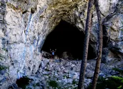
Hidden Mouth Cave
Moore, Idaho
22.8 miles SEA surprisingly large lava cave with three chambers and a secret back exit — reached by quad or a quarter-mile steep hike above Moore, Idaho.
Cave, Hike 1.1-4.1 mi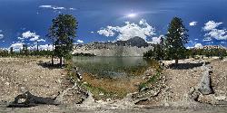
Meadow Lake
Leadore, Idaho
32.9 miles NEA remote alpine lake in the Sawtooth Wilderness, tucked in the Sawtooth Mountains with no maintained trails and accessible only with a wilderness permit — $10–$20 per night to camp nearby.
Camp, Canoe, Hike 0.3 mi
Birch Creek Charcoal Kilns
Leadore, Idaho
34.6 miles ESixteen remarkably intact 20-foot beehive brick kilns stand in remote Idaho as relics of an 1880s silver-mining operation that employed 200 workers for barely three years.
Hike
North Crater Flow
Arco, Idaho
48.7 miles SHike near Arco, Idaho
Hike 0.5 mi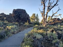
Devil's Orchard Trail
Visitors Center, Craters of the Moon National Monument
49.3 miles SA paved, wheelchair-accessible trail through cinder beds and ancient North Crater wall fragments, with exhibits on protecting this fragile volcanic environment.
Hike 0.4 mi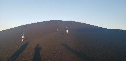
Inferno Cone
Visitors Center, Craters of the Moon National Monument
49.7 miles SA steep climb up Inferno Cone at Craters of the Moon, rewarded with panoramic views of the Great Rift, Snake River Plain, and Pioneer Mountains — and on clear days, the Tetons 100 miles away.
Hike 1.8 mi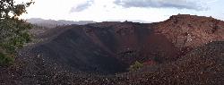
North Crater Trail
Visitors Center, Craters of the Moon National Monument
49.7 miles SA one-way trail through North Crater and Big Craters at Craters of the Moon — dropping into a volcanic crater mouth and ending at Spatter Cones, with fragile lava formations off-limits to protect.
Hike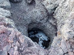
Snow Cone
Visitors Center, Craters of the Moon National Monument
49.7 miles SHike near Visitors Center, Craters of the Moon National Monument
Hike 0.1 mi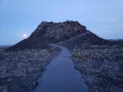
Spatter Cones
Visitors Center, Craters of the Moon National Monument
49.7 miles SMiniature volcanoes formed by lobbed molten lava blobs at Craters of the Moon — a must-see feature that symbolizes this unique national monument; stay on trails to protect the delicate spatter cones.
Hike 1.0-1.3 mi
Caves Trail
Visitors Center, Craters of the Moon National Monument
49.8 miles SCave and Hike near Visitors Center, Craters of the Moon National Monument
Cave, HikeNearby Campsites
Meadow Lake
Leadore, Idaho
32.9 miles NEA remote alpine lake in the Sawtooth Wilderness, tucked in the Sawtooth Mountains with no maintained trails and accessible only with a wilderness permit — $10–$20 per night to camp nearby.
Camp, Canoe, Hike
Galena Lodge
Ketchum, Idaho
44.7 miles SWA community-owned historic lodge 23 miles north of Sun Valley, open summer and winter as a hub for hikers, bikers, Nordic skiers, and snowshoers with rentals and great food.
Camp, Cross-country Ski, Snowshoe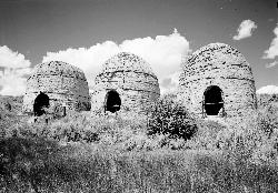
Birch Creek
Leadore, Idaho
46.3 miles EA campground along Birch Creek with 25 developed sites, picnic tables, fire rings, and restrooms — plus great fishing for brook, rainbow, and brown trout in the creek and nearby Caribou-Targhee access.
Camp
Lava Flow Campground
Arco, Idaho
48.4 miles SA campground surrounded by a young lava flow near the Craters of the Moon visitor center and popular trails — 42 first-come sites at $15/night during main season.
Camp


