Boulder Valley Ranch
Boulder, Colorado
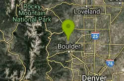
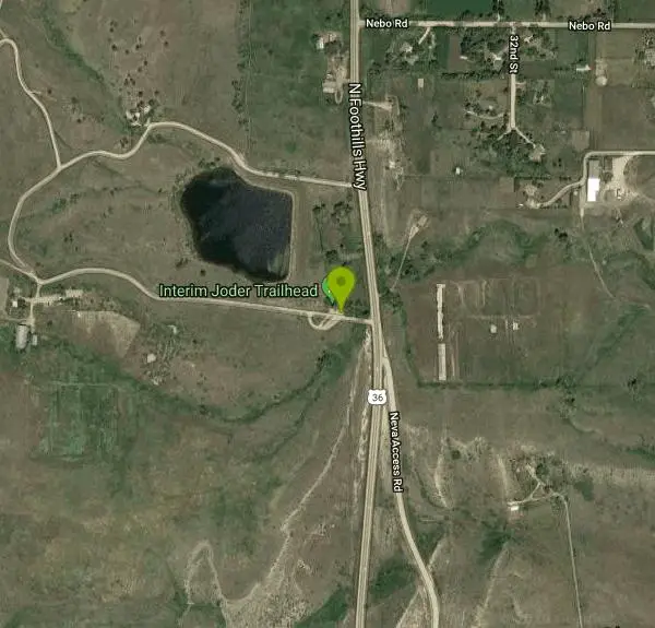
| Address: | ~7528 US-36, Boulder, CO 80302, USA |
| GPS: |
40°6'36.5"N 105°16'57.3"W Maps | Directions |
| State: | Colorado |
| Trail Length: | 7.00 miles |
| MTB Difficulty: | Beginner |
| Trail Type: | Network |
| MTB Trail Type: | Singletrack |
Mountain Bike
A working cattle ranch that has multiple trails - some are open to bikes. Combination dirt road, doubletrack, and singletrack. There is a lot of singletrack along the dirt roads. One moderate climb/decent with waterbars. Good views of the plains, mountains, and Boulder Valley. From the Foothills trailhead, take Eagle Trail to Boulder Reservoir. Turn around, and connect with Sage Trail, back to Eagle Trail and return. Courtesy of Singletracks.com
More Information
Boulder Valley Ranch
Boulder Valley Ranch is a singletrack mountain bike trail in Boulder, Colorado. View maps, videos, photos, and reviews of Boulder Valley Ranch bike trail in Boulder.
http://www.singletracks.com/bike-trails/boulder-valley-ranch/Never modify trail features. Ride trails when they're dry enough that you won't leave ruts. Speak up when you see others on the trail and always yield to hikers, horses, and others coming uphill. Always ride on the established trail.
Read More
- Plan Ahead and Prepare
- Travel & camp on durable surfaces
- Dispose of waste properly
- Leave what you find
- Minimize campfire impacts
- Respect wildlife
- Be considerate of other visitors
Directions
From Boulder, Colorado
- Head south on 19th St toward Arapahoe Ave (138 ft)
- Turn right at the 1st cross street onto Arapahoe Ave (0.4 mi)
- Turn right onto Broadway (3.5 mi)
- Turn left onto US-36 W (3.2 mi)
- Turn leftDestination will be on the right(203 ft)
Other Mountain Bike Trails Nearby
Hall Ranch
Boulder, Colorado
2.9 miles NA physically and technically demanding loop near Boulder that climbs through rough singletrack, a valley meadow, and switchbacks on Bitterbrush and Nelson Loop trails.
Mountain Bike
Bald Mountain Trail
Boulder, Colorado
5.3 miles SWA short, steep trail on Bald Mountain with a spectacular summit view — ride counter-clockwise to avoid the technical uphill section, and keep an eye out for mountain lions.
Mountain Bike
Chapman Drive
Boulder, Colorado
6.3 miles SA 940-foot climb up the backside of Flagstaff Mountain on a 1930s CCC dirt road, with vintage stone bridges and views north to Longs Peak — downhill access added in April 2013.
Mountain Bike
Picture Rock Trail
Lyons, Colorado
7.0 miles NAccess to Heil Valley Ranch trails past old buildings and a shot-up car, with the option to extend through Wild Turkey, Ponderosa, and the top-of-ranch loops.
Mountain Bike
CU Dirt Jumps
Boulder, Colorado
7.2 miles SA compact 0.75-mile jump network with dirt jumps for all levels — from beginners catching their first air to advanced riders launching big.
Mountain Bike
Heil Valley Ranch
Boulder, Colorado
7.9 miles NOver 13.5 miles of bike-legal singletrack at Heil Valley Ranch near Boulder with characteristic Front Range rockiness, serious flow on the descents, and amazing views from the ridge top.
Mountain Bike
Ceran Saint Vrain Loop
Ward, Colorado
8.6 miles WFairly easy trails in a scenic valley near Ward with some technical sections along steep drops — plenty of exploring possible, but the area can be confusing; expect company on weekends.
Mountain Bike
Lobo Trail
Longmont, Colorado
10.4 miles EA graded double-track trail (with some paved greenway) following train tracks diagonally across the Front Range from Longmont to Boulder.
Mountain Bike
Davidson Mesa
Louisville, Colorado
11.0 miles SEA small network of tame trails linking together in various ways across the mesa — the steepest trail is still manageable, making this a great ride for kids.
Mountain Bike
Dirty Bismarck
Boulder, Colorado
11.1 miles SA classic mountain bike loop on smooth gravel and mild singletrack — an easy technical ride with a great aerobic punch if you push the pace through Boulder's greenbelt trails.
Mountain Bike
Marshall Mesa Area
Boulder, Colorado
11.1 miles SA mix of single and doubletrack with minimal climbing and no technical sections — smooth enough by day and perfectly suited for a mellow night ride.
Mountain Bike
Coalton Trail
Boulder, Colorado
11.4 miles SA mild, mostly flat connector trail near Boulder with one short steep hill — useful for linking the Meadowlark Trail and High Plains Trail.
Mountain Bike
Coulson Gulch
Lyons, Colorado
11.8 miles NWA sweet descent to the North Saint Vrain River, then a couple of miles following the river upstream — easy to follow, with optional connections to Button Rock Preserve.
Mountain Bike
Bunce School Road To T33 Crash Site
Lyons, Colorado
11.9 miles WA mostly Class 2 doubletrack ride near Lyons, Colorado with a middle Class 4 stretch — leading to a WWII T-33 jet crash site with large aluminum fragments still visible on the ground.
Mountain Bike
Doudy Draw Trail
Boulder, Colorado
11.9 miles SA 1.7-mile trail meandering through open ponderosa pine savannah south of Boulder — connecting to Flatirons Vista and the South Spring Brook Loop Trail.
Mountain Bike
Marshall Road Open Spaces
Superior, Colorado
12.6 miles SEA beginner and recovery-friendly mountain bike route near Superior through open space connecting to Eldorado Canyon, with a canal bridge start, a descent to Highway 93, and optional loop via jeep road.
Mountain Bike
Flatirons Vista
12.8 miles S
A quick, smooth trail near Boulder with great Flatirons views throughout — connects easily to Dowdy Draw, Community Ditch, and the broader Boulder trail network for a longer ride.
Mountain Bike
Greenbelt Plateau
12.8 miles S
An extremely mild coarse-gravel trail with gentle climbs and almost no rocks — ideal for introducing kids to off-road riding or shaking off road legs.
Mountain Bike
Buchanan Pass
Lyons, Colorado
12.8 miles WA 4.5-mile singletrack that drops to a creek crossing and follows it to the wilderness boundary — or loop it with the 4x4 road and Buchanan Pass for technical descents.
Mountain Bike
High Plains Trail
Superior, Colorado
14.0 miles SENon-technical high plains singletrack west of Superior connecting Coalton Trail to Marshal Mesa, with prairie grass, wildflowers, Flatirons views, a cool ditch crossing, and fast flowing new trail segments.
Mountain Bike