


Brittlebush Trail
Phoenix, Arizona

| Address: | Brittlebush Trail |
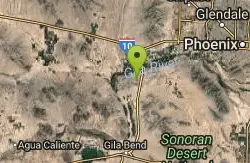
| GPS: |
33°2'23.8"N 112°33'39.6"W Maps | Directions |
| State: | Arizona |
| Trail Length: | 6.00 miles |
| MTB Difficulty: | Beginner |
| Trail Type: | Network |
| MTB Trail Type: | Singletrack |
Trails Pet Friendly
Hike and Mountain Bike
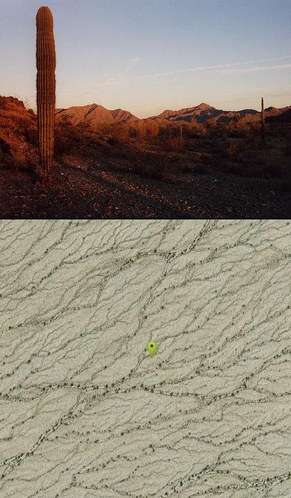
Brittlebush trail is a flat, 12-mile round trip, out-and-back trail in the heart of the Maricopa Wilderness. It's best used from November - April, and should be avoided in the Summer months due to the lack of shade, and its remote location.
The path passes between two low rocky hills, then bends left to skirt another hill, before heading cross country through the creosote flats towards the mountains. The trail looks like an old road in this section. After a bit of walking, the trail reaches the mountains and enters a wide sandy wash (note: you will skirt a prominent mountain just to the right, if you look closely you may see some circular faded petroglyphs on the burnished rock of this hill, please do not disturb). After following the wash for a while, you will come to a brown plastic 'Trail' sign on the left. The path bends left at this point and climbs up into the desert, becoming easy to follow once again. The trail winds its way through the desert for a while, then drops down a short rocky hill into a wash (6 miles). This wash is the Margies Cove Trail. If you have another car spotted at the east or west entrances, turn right or left respectively, otherwise, return the way you came (12 miles).
More Information
Never modify trail features. Ride trails when they're dry enough that you won't leave ruts. Speak up when you see others on the trail and always yield to hikers, horses, and others coming uphill. Always ride on the established trail.
Read MoreBe courteous, informed, and prepared. Read trailhead guidelines, stay on the trail, and don't feed the wildlife.
Read More- Plan Ahead and Prepare
- Travel & camp on durable surfaces
- Dispose of waste properly
- Leave what you find
- Minimize campfire impacts
- Respect wildlife
- Be considerate of other visitors
Directions
From Phoenix, Arizona
- Head west on W Washington St toward 1st Ave (315 ft)
- Turn left onto S 1st Ave (0.6 mi)
- S 1st Ave turns slightly right and becomes S Central Ave (0.8 mi)
- Turn left onto W Maricopa Fwy (0.5 mi)
- Take the ramp on the left onto I-17 S/US-60 E (1.9 mi)
- Merge onto I-10 E/US-60 E (4.8 mi)
- Keep left at the fork to stay on I-10 E (9.7 mi)
- Take exit 164 for AZ-347 S/Queen Creek Rd (0.4 mi)
- Turn right onto AZ-347 S/N John Wayne Pkwy/E Queen Creek RdContinue to follow AZ-347 S/N John Wayne Pkwy(14.7 mi)
- Turn right onto AZ-238 W/W Smith Enke RdContinue to follow AZ-238 W(20.2 mi)
- Continue onto W Maricopa Rd (9.3 mi)
- Turn right (3.2 mi)
- Turn right (1.5 mi)
- Turn left (0.5 mi)
- Turn right (1.0 mi)
From Phoenix drive west on Maricopa Road #238 to between mileposts 10 & 11 (11 is to the east). Turn north on a good dirt road marked with a wooden 'Trail' sign. You will soon pass a large sign for the Sonoran Desert National Monument. Drive 1.3 miles to an old coral, follow the brown plastic 'Trail' signs into the coral then to the left. Stay straight at the junction where the Butterfield Stage Route Trail branches to the right. After another 1.8 miles turn right (following the signs), and 2 miles later stay to the right once again (straight will bring you to a non-functional watering hole for game). In less than a mile you will reach the trailhead parking area next to some low rocky hills.Courtesy of toddshikingguide.com

Other Mountain Bike Trails and Hiking Trails Nearby
Buckeye Hills Regional Park
Buckeye, Arizona
17.5 miles NBiking is primitive. The park has restrooms but no running water or electricity.
Mountain Bike
Black jack
Goodyear, Arizona
21.6 miles NExtreme terrain, advance riders only.
Mountain Bike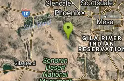
Quartz Peak Trail
21.6 miles NE
Hike near
Hike 3.6 mi
Toothaker Trail
Goodyear, Arizona
25.3 miles NEToothaker is an easy roller coaster of a trail. It crosses numerous washes ranging from small to large and can be a tad loose and/or rocky in some sections. The end reward is a nice view of Rainbow...
Hike, Horseback, Mountain Bike
Dysart Trail
Goodyear, Arizona
25.3 miles NE$6 entry fee per car.
Hike, Horseback, Mountain Bike
Rainbow Valley to Toothaker Loop Trail
Goodyear, Arizona
25.3 miles NEEstrella Mountain Regional Park has many trails within it, a great beginner to intermediate friendly trail is the Rainbow Valley to Toothaker Loop Trail. This 6.6 mile hike is mostly flat with a few...
Hike, Horseback, Mountain Bike
Estrella Mountain Park
Goodyear, Arizona
25.3 miles NENice mix of singletrack and doubletrack. One way loops, long loop and tech loop. A few mild climbs and some mild rock gardens, just let it ride. There is a lot of loose rocks on the...
Mountain Bike 2.9 mi
Coldwater Trail
Goodyear, Arizona
25.4 miles NEThe Cold Water Trail #27 is a seldom visited, remote backcountry destination along the backdrop of the rugged Verde Rim with healthy mixed vegetation and unique geology. The trail was originally used...
Hike, Horseback, Mountain Bike 13.8 mi
Butterfield to Gadsen Loop Trail
Goodyear, Arizona
25.4 miles NEAs with other trails in Estrella, the trail is wide and the surface tends to be rather benign, varying from mostly smooth, to occasionally strewn with small rocks, sandy in the washes. Butterfield...
Hike, Horseback, Mountain Bike 1.0 mi
Quail Trail
Goodyear, Arizona
25.8 miles NEQuail Trail is the access trail from the Nature Center to the main trail system. It is a pretty steep climb, but smooth and steady. Quail Trail is a spur trail in the Estrella Mountain...
Hike, Horseback, Mountain Bike
Baseline Trail
Goodyear, Arizona
26.1 miles NEThe Baseline trail is a 2.6 mile loop at Estrella Mountain Regional Park. This listing is based on access from a spur trail (33.378981, -112.371072) off of the Gila trail. Access is...
Hike 8.3 mi
Estrella Mountains Competitive Track
Tolleson, Arizona
26.7 miles NEThe third competitive track in the Maricopa County Regional Park system, located in Estrella Mountain Regional Park, was completed in February 2000. The track consists of two loops totaling 13 miles....
Hike, Horseback, Mountain Bike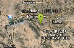
Alta Trail And Bajada Trail
Phoenix, Arizona
31.3 miles NEHike near Phoenix, Arizona
Hike 12.6 mi
National Trail
Phoenix, Arizona
31.3 miles NENational Trail is the gem of South Mountain and home to the infamous Waterfall. It’s a local favorite as well as a destination trail for MTB snowbirds. Like most trails in the Sonoran...
Hike, Mountain Bike 4.8 mi
Lost Creek Petroglyph Trail
Buckeye, Arizona
31.4 miles NStarting at Verrado's trailhead, the trail heads a short ways to a petroglyph site. While a little rocky at times, the trail is easy. To deter vandals, a very necessary fence with barbed-wire has...
Hike, Mountain Bike
Verrado
Buckeye, Arizona
31.4 miles NTechnical, good climbs, lots of open roads to add cardio loops as well.
Mountain Bike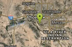
South Mountain Park / National Trail
Phoenix, Arizona
31.8 miles NENational trail can be acended or decended. Both require expert skills and fitness. You cannot and will not find a climb this technical, challenging and fun in AZ. It will kick your...
Mountain Bike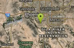
South Mountain Pyramid Trail
Phoenix, Arizona
32.2 miles NEHike near Phoenix, Arizona
Hike
Pyramid Trail
Phoenix, Arizona
32.3 miles NEHike near Phoenix, Arizona
Hike 1.2 mi
Ma-Ha-Tauk Trail
Phoenix, Arizona
34.2 miles NEMa-Ha-Tauk Trail can be found in South Mountain Park in Phoenix. This is a 2.5 mile, out-and-back trail. Aside from a short section of steeper incline in the first part of the hike, this is an...
Hike, Horseback


