


Rainbow Valley to Toothaker Loop Trail
Goodyear, Arizona

| Address: | ~Toothaker Trail, Goodyear, AZ 85338, USA |
| GPS: |
33°22'13.6"N 112°22'21.5"W Maps | Directions |
| State: | Arizona |
| Trail Length: | 6.60 miles |
| Trail Type: | Loop |
| Hike Difficulty: | Intermediate |
| Elevation Gain: | 620 feet |
Trails Pet Friendly Bicycles
Hike, Horseback, and Mountain Bike
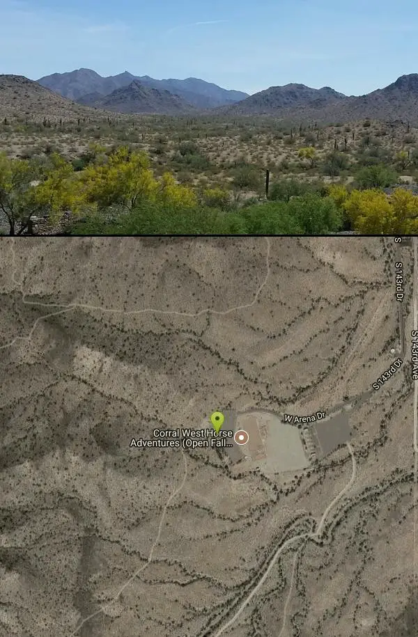
Estrella Mountain Regional Park has many trails within it, a great beginner to intermediate friendly trail is the Rainbow Valley to Toothaker Loop Trail. This 6.6 mile hike is mostly flat with a few steep sections on the Rainbow Valley Trail.
The trailhead for both the Rainbow Valley and Toothaker Hiking Trails is located across from the park’s Rodeo Arena. Starting the loop on the Rainbow Valley Trail, the first 3/4-mile of the hike crosses a shallow valley, as it works its way towards the park’s northern hills.
For the next mile and a half, the path winds flatly along the sides of these hills. Scenic views of Goodyear, its airport and the distant peaks of the White Tank Mountains span generously to the north. At about 2.5 miles, the Rainbow Valley Trail gently descends the hillsides, crosses a soft sandy wash, and begins to curve back towards the heart of the park.
The views shift graciously from suburban vistas to stretches of flat desert rimmed by distant purple mountains. Ascending between two hills, the path steepens for a bit as it continues winding into the park’s interior. A tall, boulder laden crest marks the highest point of the Rainbow Valley and Toothaker Hiking Trail Loop. From the top of the boulders, lengthy views of the Estrella Mountain’s undulating interior hills stretch in every direction From this point on the Rainbow Valley and Toothaker Hiking Trail Loop mildly descends and then evens out.
The Rainbow Valley Trail ends at a T-intersection with the Toothaker. Turning left, the path remains flat as it moves along the side of a deeply carved wash.
With the exception of one brief wash crossing, the Rainbow Valley and Toothaker Hiking Trail’s last two miles are easy and even, moving across the valley floor. Occassional mountain bikers should be expected as the trail is shared usage and ideal riding territory.Courtesy of azutopia.com
Note: There is a $6 entry fee for Estrella Mountain Regional Park.
More Information
Never modify trail features. Ride trails when they're dry enough that you won't leave ruts. Speak up when you see others on the trail and always yield to hikers, horses, and others coming uphill. Always ride on the established trail.
Read MoreBe courteous, informed, and prepared. Read trailhead guidelines, stay on the trail, and don't feed the wildlife.
Read More- Plan Ahead and Prepare
- Travel & camp on durable surfaces
- Dispose of waste properly
- Leave what you find
- Minimize campfire impacts
- Respect wildlife
- Be considerate of other visitors
Directions
From Goodyear, Arizona
- Head west on W Western Ave toward S Litchfield Rd (157 ft)
- Turn left at the 1st cross street onto S Litchfield Rd (0.7 mi)
- Turn right onto MC 85 (1.2 mi)
- Turn left onto S Bullard Ave (2.0 mi)
- Turn right onto W Vineyard Ave (0.4 mi)
- Turn left onto Casey Abbot Dr N (1.0 mi)
- Continue onto S 143rd Dr (1.0 mi)
- Keep right to continue on W Arena DrDestination will be on the right(0.3 mi)

Other Mountain Bike Trails, Hiking Trails, and Horseback Trails Nearby

Dysart Trail
Goodyear, Arizona
0.0 miles SE$6 entry fee per car.
Hike, Horseback, Mountain Bike
Estrella Mountain Park
Goodyear, Arizona
0.0 miles ENice mix of singletrack and doubletrack. One way loops, long loop and tech loop. A few mild climbs and some mild rock gardens, just let it ride. There is a lot of loose rocks on the...
Mountain Bike 3.6 mi
Toothaker Trail
Goodyear, Arizona
0.0 miles SEToothaker is an easy roller coaster of a trail. It crosses numerous washes ranging from small to large and can be a tad loose and/or rocky in some sections. The end reward is a nice view of Rainbow...
Hike, Horseback, Mountain Bike 13.8 mi
Butterfield to Gadsen Loop Trail
Goodyear, Arizona
0.2 miles EAs with other trails in Estrella, the trail is wide and the surface tends to be rather benign, varying from mostly smooth, to occasionally strewn with small rocks, sandy in the washes. Butterfield...
Hike, Horseback, Mountain Bike 2.9 mi
Coldwater Trail
Goodyear, Arizona
0.2 miles EThe Cold Water Trail #27 is a seldom visited, remote backcountry destination along the backdrop of the rugged Verde Rim with healthy mixed vegetation and unique geology. The trail was originally used...
Hike, Horseback, Mountain Bike
Baseline Trail
Goodyear, Arizona
0.8 miles NThe Baseline trail is a 2.6 mile loop at Estrella Mountain Regional Park. This listing is based on access from a spur trail (33.378981, -112.371072) off of the Gila trail. Access is...
Hike 1.0 mi
Quail Trail
Goodyear, Arizona
0.9 miles NWQuail Trail is the access trail from the Nature Center to the main trail system. It is a pretty steep climb, but smooth and steady. Quail Trail is a spur trail in the Estrella Mountain...
Hike, Horseback, Mountain Bike 8.3 mi
Estrella Mountains Competitive Track
Tolleson, Arizona
3.4 miles EThe third competitive track in the Maricopa County Regional Park system, located in Estrella Mountain Regional Park, was completed in February 2000. The track consists of two loops totaling 13 miles....
Hike, Horseback, Mountain Bike
Black jack
Goodyear, Arizona
4.0 miles SWExtreme terrain, advance riders only.
Mountain Bike 4.8 mi
Lost Creek Petroglyph Trail
Buckeye, Arizona
12.4 miles NWStarting at Verrado's trailhead, the trail heads a short ways to a petroglyph site. While a little rocky at times, the trail is easy. To deter vandals, a very necessary fence with barbed-wire has...
Hike, Mountain Bike
Verrado
Buckeye, Arizona
12.4 miles NWTechnical, good climbs, lots of open roads to add cardio loops as well.
Mountain Bike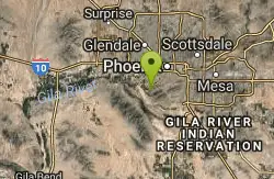
South Mountain Park / National Trail
Phoenix, Arizona
12.5 miles ENational trail can be acended or decended. Both require expert skills and fitness. You cannot and will not find a climb this technical, challenging and fun in AZ. It will kick your...
Mountain Bike 12.6 mi
National Trail
Phoenix, Arizona
13.5 miles ENational Trail is the gem of South Mountain and home to the infamous Waterfall. It’s a local favorite as well as a destination trail for MTB snowbirds. Like most trails in the Sonoran...
Hike, Mountain Bike
Alta Trail And Bajada Trail
Phoenix, Arizona
13.5 miles EHike near Phoenix, Arizona
Hike
Quartz Peak Trail
14.1 miles SE
Hike near
Hike
South, Bajada, Mule Deer Loop Trail
Waddell, Arizona
15.4 miles NWSouth - Bajada - Mule Deer Loop is a 4.1 mile loop trail located near Waddell, Arizona that offers the chance to see wildlife. The trail is rated as moderate and is accessible from...
Hike, Horseback, Mountain Bike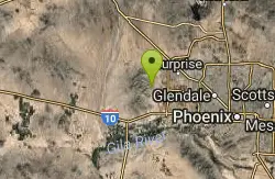
White Tanks Regional Park Trails
Waddell, Arizona
15.4 miles NWI have not ridden these trails yet, but I was surprised that they were not listed yet on the ST's database. There are 28 miles of multi-use trails in the park, not including the park's...
Mountain Bike
Goat Camp Trail
Buckeye, Arizona
15.7 miles NWGoat Camp Trail is a well-liked mountain biking and hiking trail in White Tank Mountain Regional Park. This is a 16 mile out-and-back trail that is rated as advanced due to the length, as well as the...
Hike, Mountain Bike 1.2 mi
Ma-Ha-Tauk Trail
Phoenix, Arizona
15.8 miles EMa-Ha-Tauk Trail can be found in South Mountain Park in Phoenix. This is a 2.5 mile, out-and-back trail. Aside from a short section of steeper incline in the first part of the hike, this is an...
Hike, Horseback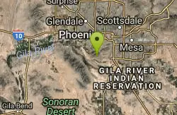
South Mountain Pyramid Trail
Phoenix, Arizona
16.4 miles EHike near Phoenix, Arizona
HikeNearby Campsites

Lower Salt River Nature Trail
Fort McDowell, Arizona
42.7 miles EThe Lower Salt River Nature Trail is a scenic walk to take at the Tonto National Forest. This trail provides stunning views as you walk alongside the Salt River. This rustic trail is older and less...
Camp, Hike
Buckhorn Campground Nature Trail
Apache Junction, Arizona
44.0 miles ECamp and Hike near Apache Junction, Arizona
Camp, Hike


