


Indian Bend Bike Trail
Scottsdale, Arizona

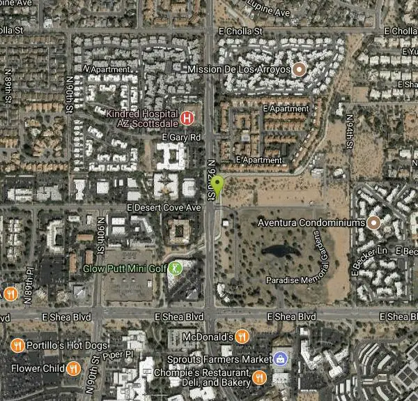
| Address: | ~10901-10965 N 92nd St, Scottsdale, AZ 85260, USA |
| GPS: |
33°35'7.6"N 111°52'56.8"W Maps | Directions |
| State: | Arizona |
| Trail Length: | 11.00 miles |
| Trail Type: | Point A to B |
| Hike Difficulty: | Intermediate |
Picnic Tables Pet Friendly
Hike and Mountain Bike
Indian Bend Wash Greenbelt is a urban, concrete paved path, primarily used for biking and walking/jogging, in Scottsdale, Arizona.
This point A to point B, 11 mile long trail takes you past parks, lakes, and golf courses; compared to the usually dry, rocky, desert terrain in most of Arizona, this particular area provides different scenery as it is lush, green, and beautiful.
The trail goes through residential neighborhoods and there are a number of street crossings and sections where the trail is located alongside major roadways. There are underpasses for crossing some of the major roadways.
The trail is wheelchair accessible, pet friendly, and kid friendly, making it an ideal trail for anybody and everybody.
More Information
Indian Bend Wash Greenbelt
Enjoy Scottsdale’s scenic Indian Bend Wash Greenbelt, a lush, 11-mile oasis with multi-use paths, lakes, parks, and golf courses, perfect for outdoor recreation and connecting with nature.
https://www.scottsdaleaz.gov/parks/greenbeltNever modify trail features. Ride trails when they're dry enough that you won't leave ruts. Speak up when you see others on the trail and always yield to hikers, horses, and others coming uphill. Always ride on the established trail.
Read MoreBe courteous, informed, and prepared. Read trailhead guidelines, stay on the trail, and don't feed the wildlife.
Read More
- Plan Ahead and Prepare
- Travel & camp on durable surfaces
- Dispose of waste properly
- Leave what you find
- Minimize campfire impacts
- Respect wildlife
- Be considerate of other visitors
Directions
From Scottsdale, Arizona
- Head north on N Scottsdale Rd toward E Indian School Rd (276 ft)
- Turn right at the 1st cross street onto E Indian School Rd (2.2 mi)
- Turn left to merge onto AZ-101 Loop N (6.0 mi)
- Take exit 41 for Shea Blvd (0.4 mi)
- Turn right onto E Shea Blvd (signs for Shea Boulevard) (0.5 mi)
- Turn left onto N 92nd StDestination will be on the right(0.2 mi)

Other Mountain Bike Trails and Hiking Trails Nearby

Taliesin/Quartz Loop
Scottsdale, Arizona
2.7 miles NEA quick loop through the McDowell Sonoran Preserve with a couple of difficult climbs, a cool viewpoint, and flowing singletrack with jump and transition opportunities.
Mountain Bike 
Sunrise
Scottsdale, Arizona
4.2 miles EA sweet little loop trail in Scottsdale with a gradual climb, fun descent, and nice views of Scottsdale and Phoenix — watch out for cacti and bring plenty of water on this exposed, sun-baked ride.
Mountain Bike 
Gateway Loop
Scottsdale, Arizona
4.5 miles NA steep, rocky ascent from a well-equipped trailhead with water and bathrooms, linking to Tom's Thumb, Wingate Pass, and Bell Pass trails in the McDowell Mountains.
Mountain Bike 
Phoenix Mcdowell / Wingate Pass / Bell Pass
Scottsdale, Arizona
4.6 miles NA challenging Scottsdale mountain bike trail with a steep rocky ascent from a well-equipped trailhead and flowing singletrack descents, with links to Tom's Thumb, Dixie Mine, and the McDowell Loop.
Mountain Bike 
Tom's Thumb Trail South
Scottsdale, Arizona
4.6 miles NHike near Scottsdale, Arizona
Hike 
Saguaro Loop and Nature Trail
Scottsdale, Arizona
4.6 miles NThe Saguaro Loop and Nature Trail is one of the friendliest introductions to the Sonoran Desert anywhere in the Phoenix area, an easy loop in Scottsdale's McDowell Sonoran Preserve that packs classic...
Hike 
Tom's Thumb to Bell Pass
Scottsdale, Arizona
4.6 miles NHike and Mountain Bike near Scottsdale, Arizona
Hike, Mountain Bike 
Horseshoe Loop Hike
Scottsdale, Arizona
4.6 miles NThe Horseshoe Loop is one of the easiest and most rewarding walks in Scottsdale's McDowell Sonoran Preserve, a gentle 1.7-mile circuit from the Gateway Trailhead that delivers proper Sonoran Desert...
Hike 
Gateway and Tom's Thumb Loop Trail
Scottsdale, Arizona
4.6 miles NA roughly 10.5-mile loop linking Gateway, Bell Pass, and Windgate trails in Scottsdale — featuring a steep Bell Pass climb with views described simply as amazing.
Hike, Horseback, Mountain Bike 
Gatewa-Prospector-Thompson Peak Road Trail
Scottsdale, Arizona
4.6 miles NHike near Scottsdale, Arizona
Hike 
Inspiration Point
Scottsdale, Arizona
4.6 miles NA wooded canyon with mixed trail and campground options — take it as a loop or a top-to-bottom shuttle mountain bike ride through beautiful scenery near Logan, Utah.
Hike, Mountain Bike 0.6 mi
Horseshoe Trail
Scottsdale, Arizona
4.9 miles NA short, fun singletrack full of quick turns shaped by washes and rocks — javelinas, deer, and the occasional bobcat add wildlife thrills near Scottsdale.
Hike, Horseback, Mountain Bike 3.6 mi
Charles M. Christiansen Memorial Trail
Phoenix, Arizona
5.7 miles WA 10.7-mile wilderness trail through the Phoenix Mountain Preserve with great valley views, gentle climbs, nice singletrack, and only 200 feet of elevation gain — very beginner friendly.
Hike, Horseback, Mountain Bike 7.1 mi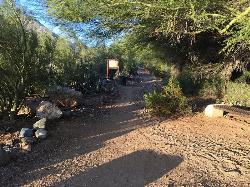
Trail 100
Phoenix, Arizona
5.7 miles WA 14-mile out-and-back hike and MTB trail through Phoenix Mountain Preserve with 1,570 feet of elevation, easy-to-follow markers, cacti, wildflowers, and several side paths to explore.
Hike, Mountain Bike 4.6 mi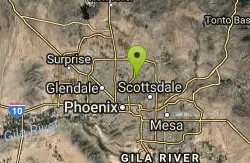
Mystery Loop
Phoenix, Arizona
6.6 miles WTechnical rock trail, wash crossings, and climbs on the Mystery Loop in Phoenix's North Mountain Preserve — connects to Trail 100 and Christiansen, Perl Charles, and Irregular Link trails for extended adventures.
Mountain Bike 
Sunrise Peak via Sunrise Trail
Scottsdale, Arizona
6.6 miles ESunrise Peak is one of the most rewarding summit hikes in the McDowell Sonoran Preserve, the vast protected desert straddling the McDowell Mountains northeast of Scottsdale and north of Fountain...
Hike 2.6 mi
L.V. Yates Trail (#8)
Phoenix, Arizona
6.7 miles WA rocky, technical trail near Phoenix with large rocks and gullies from torrential rains — two ravines separated by saddles with no ridge hiking, some hike-a-bike sections.
Hike, Horseback, Mountain Bike 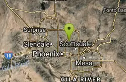
L.V. Yates to "Two Bit" Peak Loop
Phoenix, Arizona
6.7 miles WAn unmarked Phoenix preserve loop where some trails require navigation skills — best in spring after rainfall, with beautiful surrounding scenery and no water or shade on route.
Hike, Horseback 1.0-1.2 mi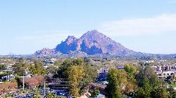
Camelback Mountain
Phoenix, Arizona
6.9 miles SWTwo summit trails at Camelback Mountain — the steep 1.23-mile Echo Canyon Trail and the slightly easier 1.4-mile Cholla Trail — both with fantastic valley views.
Hike, Rock Climb 
Sonoran Trail Fountain Hills
Fountain Hills, Arizona
7.4 miles NEHike near Fountain Hills, Arizona
HikeNearby Campsites

Lower Salt River Nature Trail
Fort McDowell, Arizona
13.1 miles EA 2-mile beginner loop alongside the Salt River in Tonto National Forest, with worn markers that keep things adventurous — watch for wild horses and spring cactus blooms.
Camp, Hike 
Buckhorn Campground Nature Trail
Apache Junction, Arizona
17.0 miles SECamp and Hike near Apache Junction, Arizona
Camp, Hike


