


5 Campsites near Cool, CA 95614
first prev 1 next lastShowing Campsites within 50 miles Distance miles of Cool, CA 95614, USA City, Zip, or Address

Lake Clementine Trail Loop
Auburn, California
2.2 miles NWFour connected trails loop around Lake Clementine on the North Fork American River — wheelchair accessible, pet friendly, and great for fishing, camping, and family summer outings.
Camp, Canoe, Hike, Kayak, Mountain Bike, Swim
North Fork Falls
Colfax, California
31.4 miles NEClear water, cliff-jumping pools, and waterfalls at Sierra Nevada's North Fork Falls — a summer hike to two deep pools with 10-to-25-foot cliffs ready for leaping.
Camp, Hike, Swim
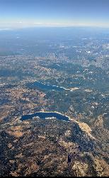
Hell Hole Reservoir
Georgetown
34.5 miles EA 4,630 foot Rubicon River reservoir in the Eldorado National Forest, 51 miles and two hours east of Georgetown, where the boat ramp cove is the only drivable shoreline and the lake drops over 100 feet by September.
Camp, Canoe, Hike, Kayak, Swim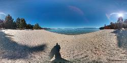
Lester Beach
South Lake Tahoe
49.8 miles ELester Beach is the sandy main swim beach at D. L. Bliss State Park on Lake Tahoe's west shore, with clear, cold, shallow water and a $10 per vehicle day-use fee in season.
Camp, Canoe, Hike, Kayak, Swim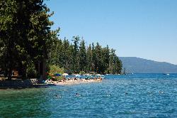
Sugar Pine Point Beach
Tahoma
49.8 miles EA quarter-mile walk from the parking lot puts you on a sand beach at the foot of Ed Z'berg Sugar Pine Point State Park, where General Creek meets Lake Tahoe and the water runs clear enough to read the bottom. It is also genuinely cold, even in August.
Camp, Hike, Kayak, Swim


