


Sugar Pine Point Beach
Tahoma
Camp, Hike, Kayak, and Swim
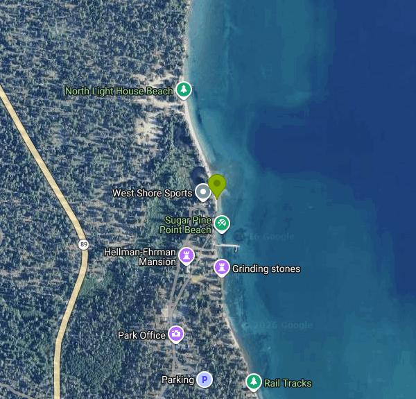
The swim beach at Ed Z'berg Sugar Pine Point State Park sits on the west shore of Lake Tahoe, just over a mile from Tahoma and ten miles south of Tahoe City on Highway 89. It is a ribbon of coarse sand running in front of the park's old boathouses, with General Creek arriving at the lake just to the south. The park covers 2,314 acres and holds close to two miles of Tahoe frontage, making it the largest California state park on the lake.
Getting to the water takes a walk. California State Parks puts the lakefront at roughly a quarter mile from the day-use parking lot, and there is no vehicle access past that point, so coolers and chairs come in on foot. Parking is $10 per vehicle per day and the fee applies year round. When the entrance kiosk is unstaffed you pay yourself at the self-payment station. The park is open sunrise to sunset.
The water is the reason to come and also the thing people underestimate. Tahoe's surface sits above 6,200 feet, the lake runs 1,645 feet deep at its deepest point, and it never freezes. What that means at the beach is that an August afternoon can be hot on the sand while the lake itself stays cold enough to cut your first swim short. The park's own brochure says it plainly: the water is extremely cold, swim with appropriate caution. Clarity is the payoff. On a calm morning you can stand waist deep and count stones on the bottom, and from shore the color steps from pale green over the sand shelf to hard blue where it deepens.
The beach and the pier are both open to swimmers. Jumping and diving off the pier are not allowed, which is worth knowing before you walk out on it. Parts of the shoreline near the boathouses are armored with rounded granite, so water shoes earn their place getting in. West Shore Sports runs the park's aquatic equipment rentals at the day-use area if you want a kayak or a paddleboard for the afternoon.
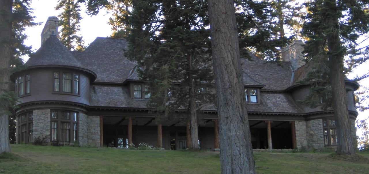
Everything else here is close together. Pine Lodge, the 1903 Hellman-Ehrman Mansion, stands on the lawn set back from the sand, and house tours run from late May through the end of September for a separate fee. A nature center near the mansion keeps bird, lake ecology and wildflower exhibits. The Edward F. Dolder Nature Trail loops through the Edwin L. Z'berg Nature Preserve and passes Sugar Pine Point Light, the highest operating maritime navigational light in the world by elevation. That light is its own feature well north along the shore and is not the swimming area.
Two rules catch people out. Dogs are banned from the beaches and from every dirt trail in the park, with access limited to paved areas, developed picnic and day-use areas, and campsites. Black bears also work the campground and day-use areas regularly, so nothing edible stays in an unattended cooler on the sand. The park campground has 175 sites and stays open all year as conditions permit, which makes this one of the few Tahoe swim beaches you can walk to from your tent in the shoulder season.
More Information
Be courteous, informed, and prepared. Read trailhead guidelines, stay on the trail, and don't feed the wildlife.
Read More
- Plan Ahead and Prepare
- Travel & camp on durable surfaces
- Dispose of waste properly
- Leave what you find
- Minimize campfire impacts
- Respect wildlife
- Be considerate of other visitors
Directions
From Tahoma
- Head southeast on CA-89 S/
W Lake Blvd toward Wilson Ave Continue to follow CA-89 S(1.4 mi) - Turn left onto Ca State Park Rd (0.2 mi)
- Slight left to stay on Ca State Park RdRestricted usage roadClosed 8:00 AM – 5:00 PM(0.3 mi)
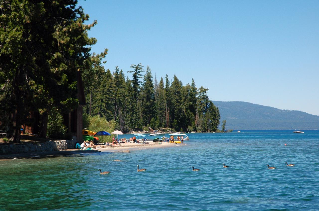
 The sand beach at Sugar Pine Point, with the North Boat House at the tree line and rental kayaks sta courtesy of DimiTalen (talk · contribs)↗ (CC BY-SA 3.0↗)
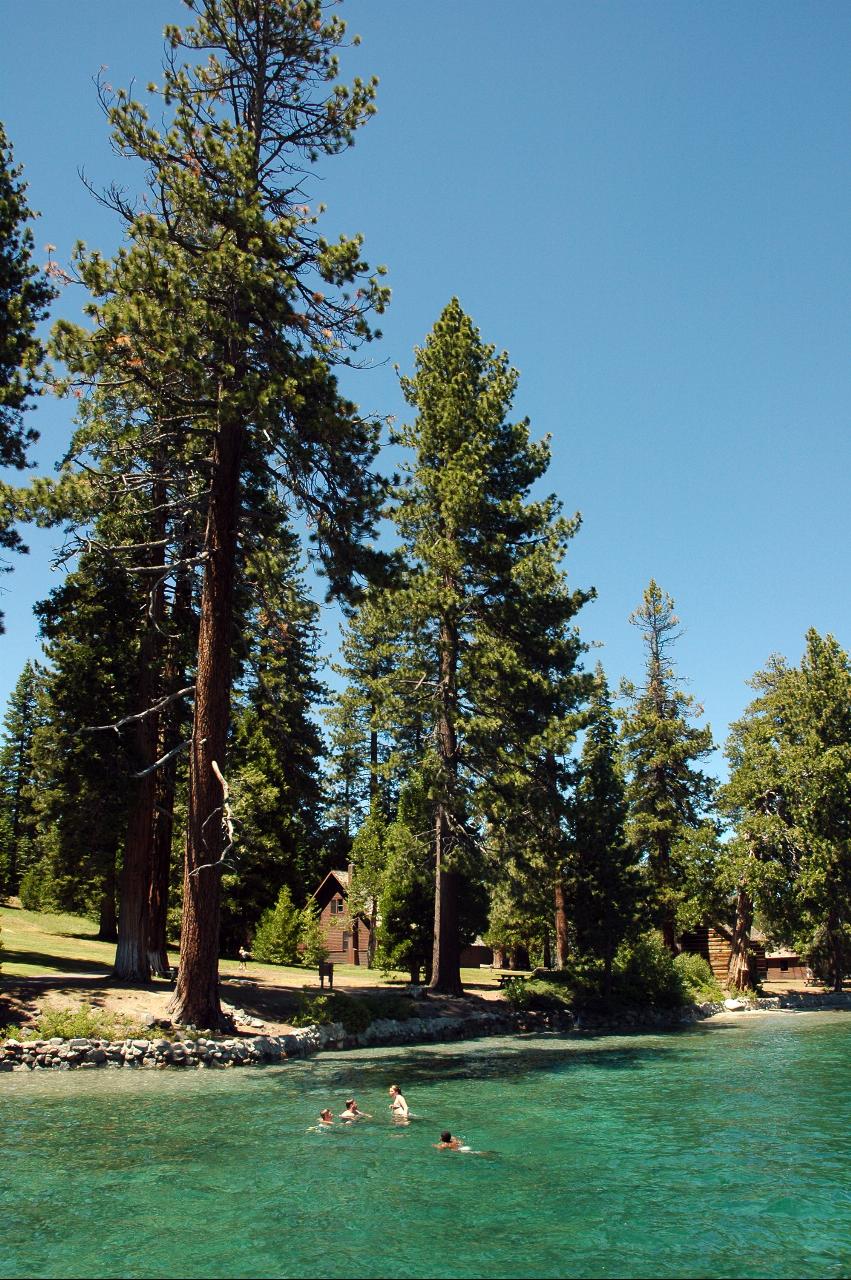
 Swimmers in the clear shallows off the park lawn courtesy of DimiTalen↗ (CC BY-SA 3.0↗)
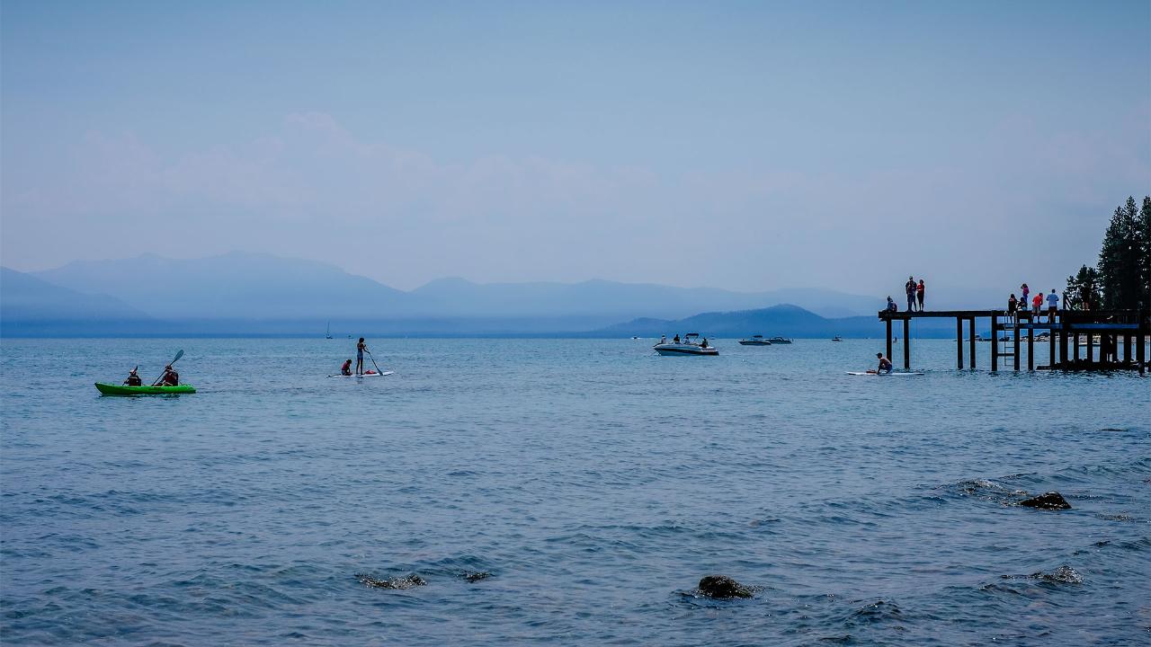
 Kayakers and paddleboarders off the park pier on a hazy summer afternoon courtesy of Oscar Vasquez / California Department of Parks and Recreation↗ (Public domain↗)
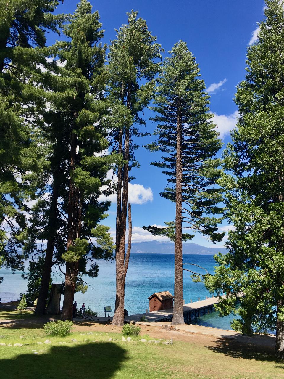
 The pier and boathouse from the lawn above the beach, the shallow shelf pale green against deeper bl courtesy of Srishti Sethi↗ (CC BY-SA 4.0↗)
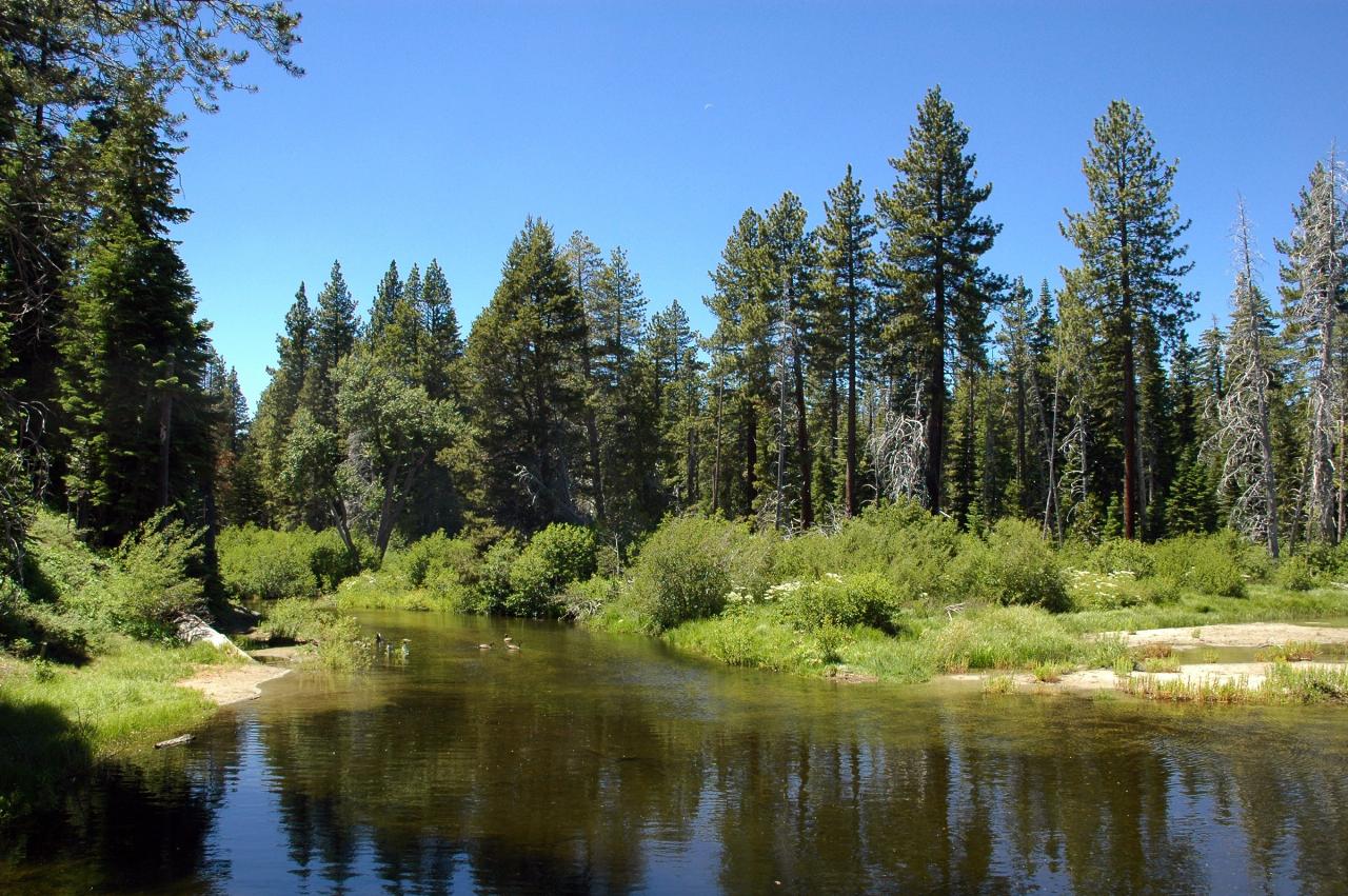
 General Creek just upstream of where it empties into Lake Tahoe at the south end of the day-use beac courtesy of DimiTalen↗ (CC BY-SA 3.0↗)
 Pine Lodge, the 1903 Hellman-Ehrman Mansion, on the lawn set back from the sand courtesy of Mistshine↗ (CC BY-SA 3.0↗)
Other Swimming Holes, Hiking Trails, and Kayaking Areas Nearby
Zephyr Cove Park
Glenbrook, Nevada
9.6 miles ESix tennis courts, disc golf, a sledding hill, a beach, and a fishing pond all at one free park make Zephyr Cove one of Lake Tahoe's most versatile family hangouts.
Camp, Canoe, Disc Golf, Hike, Horseback, Kayak, Swim 1.5 mi
Skunk Harbor
Carson City, Nevada
11.0 miles NEA forest service road hike from the 28 freeway to a secluded beach area near Carson City with mountain views, a historic building, and a marker — dogs welcome.
Hike 4.1 mi
Shirley Lake Canyon Trail
Olympic Valley, California
12.1 miles NWA 2.5-mile hike from Squaw Valley Village past streams and waterfalls to a pure Sierra lake — rocky near the top, with a free gondola ride back down from High Camp as a reward.
Hike, Swim 0.4 mi
Glen Alpine Falls
South Lake Tahoe, California
12.3 miles SA roadside waterfall near Lake Tahoe — wider than it is tall — with roadside parking, a scenic overlook, and the option to scramble down the rocks for a closer look.
Hike
Shirley Canyon
Olympic Valley, California
12.7 miles NWShirley Canyon is widely regarded as one of Lake Tahoe's finest half-day hikes, a spectacular climb up a granite canyon that rises straight out of the base of the Palisades Tahoe ski resort in...
Hike
Tahoe Area
Olympic Valley, California
13.2 miles NWSwim near Olympic Valley, California
Swim
Heath Falls Overlook Trail
Truckee, California
24.3 miles NWHike and Swim near Truckee, California
Hike, Swim
Palisades Creek Trail
Truckee, California
24.3 miles NWA difficult Sierra Nevada trail past Palisade Falls — one of the tallest on the American River — with views of Devils Peak, alpine lakes, and 2,000 feet of elevation gain.
Hike, Swim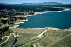
Boca Reservoir Hidden Beach
Truckee, California
25.3 miles NSandy informal beaches on the northeast shore of Boca Reservoir above Truckee, free to use, windy in the afternoons, and drawn down hard by the end of summer.
Camp, Canoe, Kayak, Kiteboard, Swim
North Fork Falls
Colfax, California
33.6 miles NWClear water, cliff-jumping pools, and waterfalls at Sierra Nevada's North Fork Falls — a summer hike to two deep pools with 10-to-25-foot cliffs ready for leaping.
Camp, Hike, Swim
Reno Area
McGill, Nevada
36.1 miles NESwim near McGill, Nevada
Swim
Wingfield Park
Reno, Nevada
36.1 miles NEAn oasis in downtown Reno where manmade dams and natural rock formations turn the Truckee River into a playground for swimming, kayaking, tubing, and rafting.
Kayak, Swim 5.6 mi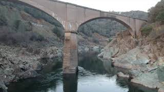
Quarry Trail
Cool, California
49.9 miles WA riverside hike along an old limestone railway line to a dramatic amphitheater quarry — wildflowers peak April through June, and the historic railway story (scrap metal for WWII) adds a fascinating layer.
HikeNearby Campsites
Zephyr Cove Park
Glenbrook, Nevada
9.6 miles ESix tennis courts, disc golf, a sledding hill, a beach, and a fishing pond all at one free park make Zephyr Cove one of Lake Tahoe's most versatile family hangouts.
Camp, Canoe, Disc Golf, Hike, Horseback, Kayak, Swim
Boca Reservoir Hidden Beach
Truckee, California
25.3 miles NSandy informal beaches on the northeast shore of Boca Reservoir above Truckee, free to use, windy in the afternoons, and drawn down hard by the end of summer.
Camp, Canoe, Kayak, Kiteboard, Swim
North Fork Falls
Colfax, California
33.6 miles NWClear water, cliff-jumping pools, and waterfalls at Sierra Nevada's North Fork Falls — a summer hike to two deep pools with 10-to-25-foot cliffs ready for leaping.
Camp, Hike, Swim


