


Hell Hole Reservoir
Georgetown
Camp, Canoe, Hike, Kayak, and Swim
Hell Hole Reservoir sits at 4,630 feet in the Georgetown Ranger District of the Eldorado National Forest, about 10 miles west of Lake Tahoe. Placer County Water Agency created it by plugging the Rubicon River canyon with the 410 foot Lower Hell Hole Dam, finished in 1966 after the first dam collapsed on December 23, 1964. At full pool the lake is a crescent roughly three and a half miles long, filled with granite snowmelt off the Rubicon.
Getting there is most of the commitment. From Georgetown it is 22 miles east on Wentworth Springs Road, then 29 miles northeast on Forest Highway 2, the Eleven Pines Road, which drops into the Rubicon canyon on tight switchbacks before climbing back out to the lake. Call it 51 miles and close to two hours. The Forest Service lists both legs as open on its Georgetown district road and trail status page, last updated July 14, 2026. The Blacksmith Flat connector (14N23, Forest Road 25) from Ralston over to Forest Road 2 is still listed as inaccessible from storm damage, so the Foresthill side is not a shortcut. Forest wide, dirt roads and trails are closed January 1 through at least March 31, and snow holds the upper road well past that in most years. The Forest Service does not recommend trailers on any of it.
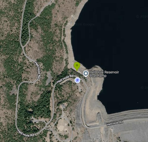
There is exactly one drivable shoreline, the launch ramp at the far west end of the lake, about a third of a mile north of the dam, with gravel parking beside it. Parking and launching are free. The Forest Service lists swimming among the activities here, and the cove at the ramp is the practical place to get in. There is no lifeguard, no marked swim area and no beach anywhere on the reservoir. Hell Hole Campground is not waterfront: it sits near 5,200 feet on the bluff, roughly 500 vertical feet above the lake, and the Forest Service map marks it as an overlook. The way to the water is back out to the road.
Plan around the drawdown, because it is severe. PCWA filled to 4,630.71 feet on April 15, 2026 and was down to 4,521 feet by September 23. In December 2024 the lake bottomed out at 4,487.9 feet, roughly 142 feet below full. The existing concrete ramp ends at elevation 4,530 feet, which the lake routinely falls below in late summer, and in July 2026 the state signed off on a PCWA project to replace it and extend it 262 feet further downslope to 4,505 feet. A separate spillway job will add 18 pneumatic crest gates and raise the weir three feet to 4,633 feet, targeted for winter 2027. Expect construction, and expect stumps, boulders and old roadbed to surface as the water pulls back.
Hell Hole Campground has 10 walk-in tent sites at $10 each, first come first served, vault toilets, no potable water. The Forest Service cut the fee in half because of the water, so bring your own or a filter. It also states plainly that it does not test water quality on open water here and flags mercury contamination. The general season is May 15 to November 1, with June through October the realistic window, and water gets shut off September 30. Upper Hell Hole Campground, three miles southeast at the head of the lake, is free and reachable only by boat or on foot, and boat-in dispersed camping is allowed along the shore. There are bears in this basin and no bear boxes at the sites. Hell Hole is on the Forest Service golden mussel list as of April 14, 2026, so clean, drain and dry anything that goes in the water.
More Information
Be courteous, informed, and prepared. Read trailhead guidelines, stay on the trail, and don't feed the wildlife.
Read More
- Plan Ahead and Prepare
- Travel & camp on durable surfaces
- Dispose of waste properly
- Leave what you find
- Minimize campfire impacts
- Respect wildlife
- Be considerate of other visitors
Directions
From Georgetown
- Head west on Volta Pl NW toward Cashell Alley (0.1 mi)
- Turn left onto 34th St NW (0.3 mi)
- Turn right onto M St NW (226 ft)
- Turn left onto Francis Scott Key Brg/
Key Bridge Entering Virginia(0.3 mi) - Continue onto N Ft Myer Dr (256 ft)
- Turn right to merge onto George Washington Mem Pkwy (8.0 mi)
- Take the exit onto I-495 N toward MarylandEntering Maryland(4.0 mi)
- Slight left onto I-270 N (31.4 mi)
- Take exit 32 to merge onto I-70 W toward HagerstownEntering Pennsylvania(76.7 mi)
- Take the US-30 E exit toward I-70 W/
Harrisburg/ McConnellsburg/ New Stanton/ Pennsylvania Turnpike (312 ft) - Turn right onto US-30 E/
S Main St (0.2 mi) - Turn right onto the I-70 ramp to Harrisburg/
New Stanton/ I-76 Toll road(397 ft) - Continue onto I-70 WToll road(1.5 mi)
- Take the exit onto I-70 W/
I-76 W toward Pittsburgh Continue to follow I-76 WToll roadEntering Ohio(184 mi) - Continue onto I-80 WToll road(154 mi)
- Take exit 64 for I-75 S toward DaytonToll road(1.4 mi)
- Take exit 195 A for OH-795 toward Perrysburg/
Millbury (0.2 mi) - Turn left onto OH-795 W (1.5 mi)
- Turn right onto E Boundary St (0.3 mi)
- Turn left onto State Rte 65 S/
E Front St (1.4 mi) - Continue onto US-20 WPass by KFC (on the right in 1.3 mi)(2.7 mi)
- Take the ramp onto I-80 W/
I-90 W Toll road(56.4 mi) - Keep left to stay on I-80 W/
I-90 W Toll roadEntering Indiana(139 mi) - Take exit 21 for I-80 W/
I-94 W toward IN-51 S (0.9 mi) - Merge onto I-94 W/
I 80 E Continue to follow I-80 WToll roadEntering Illinois(22.8 mi) - Keep right to stay on I-80 W, follow signs for IowaToll road(24.3 mi)
- Slight left (4.9 mi)
- Keep left (0.2 mi)
- Continue straight (1.3 mi)
- Merge onto I-80 W (114 mi)
- Take the exit to stay on I-80 W toward DavenportEntering Iowa(192 mi)
- Take exit 124 for University Ave toward Clive (0.5 mi)
- Turn right onto University Ave (3.8 mi)
- Turn left onto Grand Prairie Pkwy (2.0 mi)
- Take the ramp onto I-80 WEntering Nebraska(124 mi)
- Continue straight to stay on I-80 WEntering Wyoming(571 mi)
- Keep left to stay on I-80 WEntering Utah(353 mi)
- Take exit 123B-A for I-15 S/
UT-201 W toward W Valley/ Las Vegas (0.5 mi) - Take the ramp to UT-201 W (0.2 mi)
- Take the UT-201 W ramp (1.1 mi)
- Continue onto UT-201 W (16.8 mi)
- Merge onto I-80 WParts of this road may be closed at certain times or daysPassing through NevadaEntering California(594 mi)
- Take exit 121 for Auburn Ravine Rd toward Foresthill (0.2 mi)
- Turn left onto Auburn Ravine Rd (453 ft)
- Continue onto Foresthill Rd (16.7 mi)
- Turn right onto Mosquito Ridge Rd (30.7 mi)
- Turn right to stay on Mosquito Ridge Rd (1.5 mi)
- Turn left to stay on Mosquito Ridge Rd (1.1 mi)
- Turn right to stay on Mosquito Ridge Rd (1.6 mi)
- Turn left to stay on Mosquito Ridge Rd (0.7 mi)
- Continue straight (3.3 mi)
- Turn right (0.6 mi)
- Turn right onto Forest Rte 48 (3.1 mi)
- Turn left onto Hell Hole RdDestination will be on the left(2.1 mi)
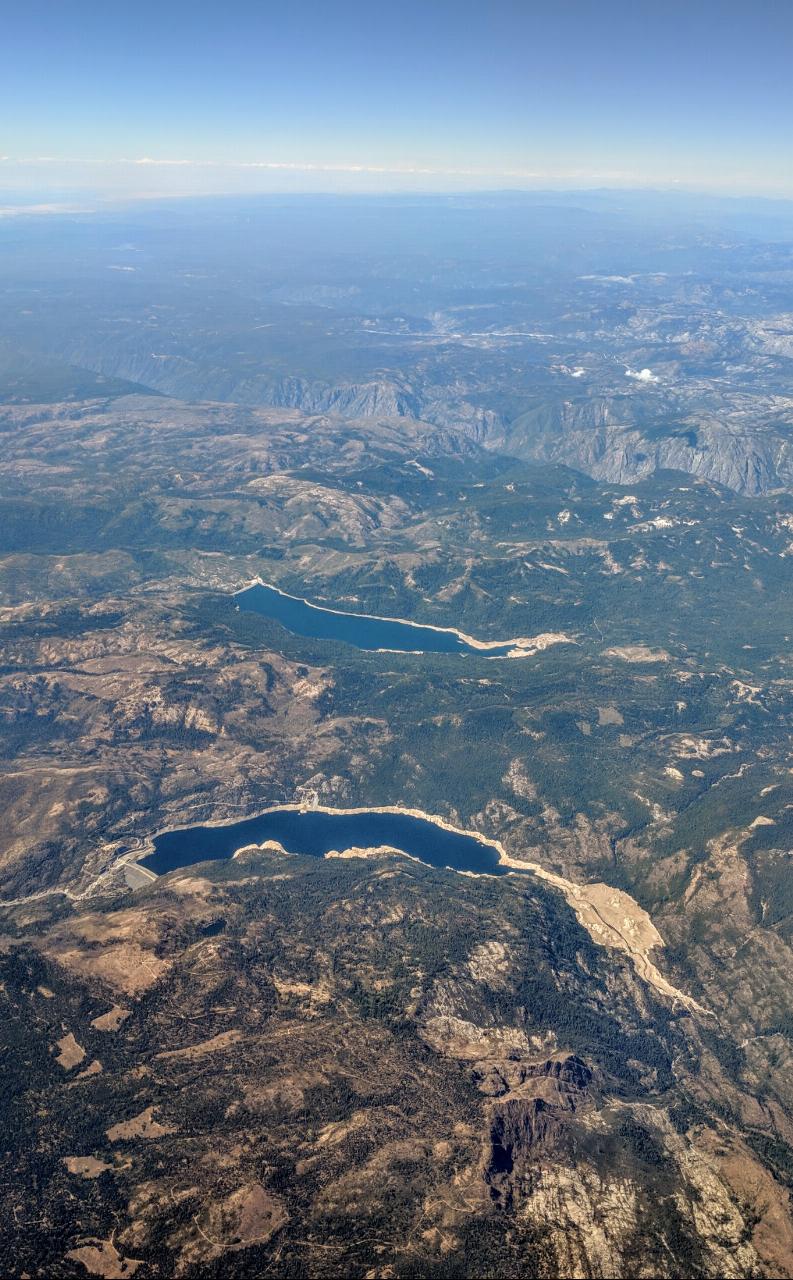
 Hell Hole Reservoir in the foreground with French Meadows Reservoir beyond, from the south southeast courtesy of Dicklyon↗ (CC BY-SA 4.0↗)
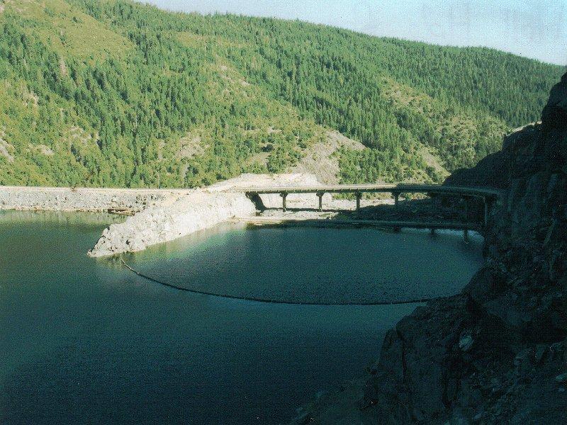
 Log boom and concrete structure at the west end of the reservoir near Lower Hell Hole Dam, July 2005 courtesy of Marcia Wright↗ (Public domain↗)
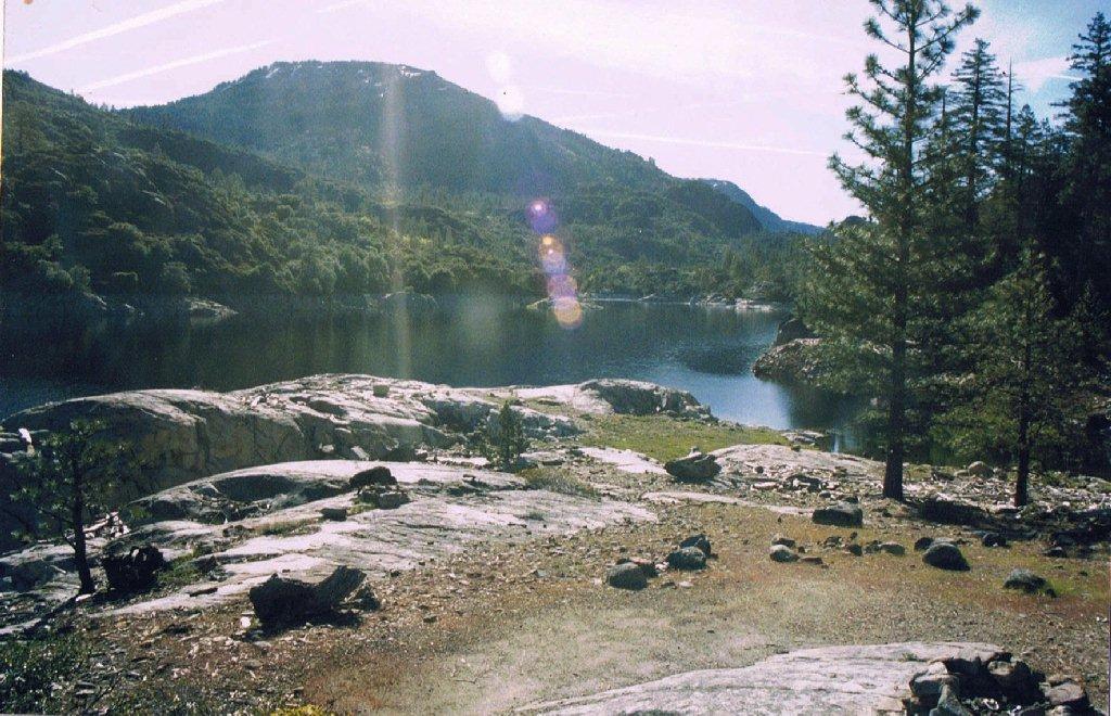
 Driftwood piled at the upper arm of the reservoir, with granite benches left bare by the seasonal dr
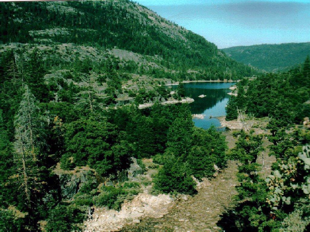
 The upper end of Hell Hole, where the shoreline is bare granite and the water pulls back off it thro courtesy of Marcia Wright↗ (CC BY 3.0↗)
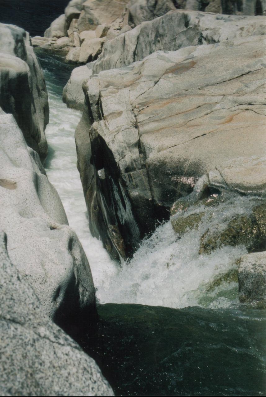
 The Rubicon River dropping through a granite cataract on its way into the reservoir, May 2005. courtesy of Marcia Wright↗ (CC BY 3.0↗)
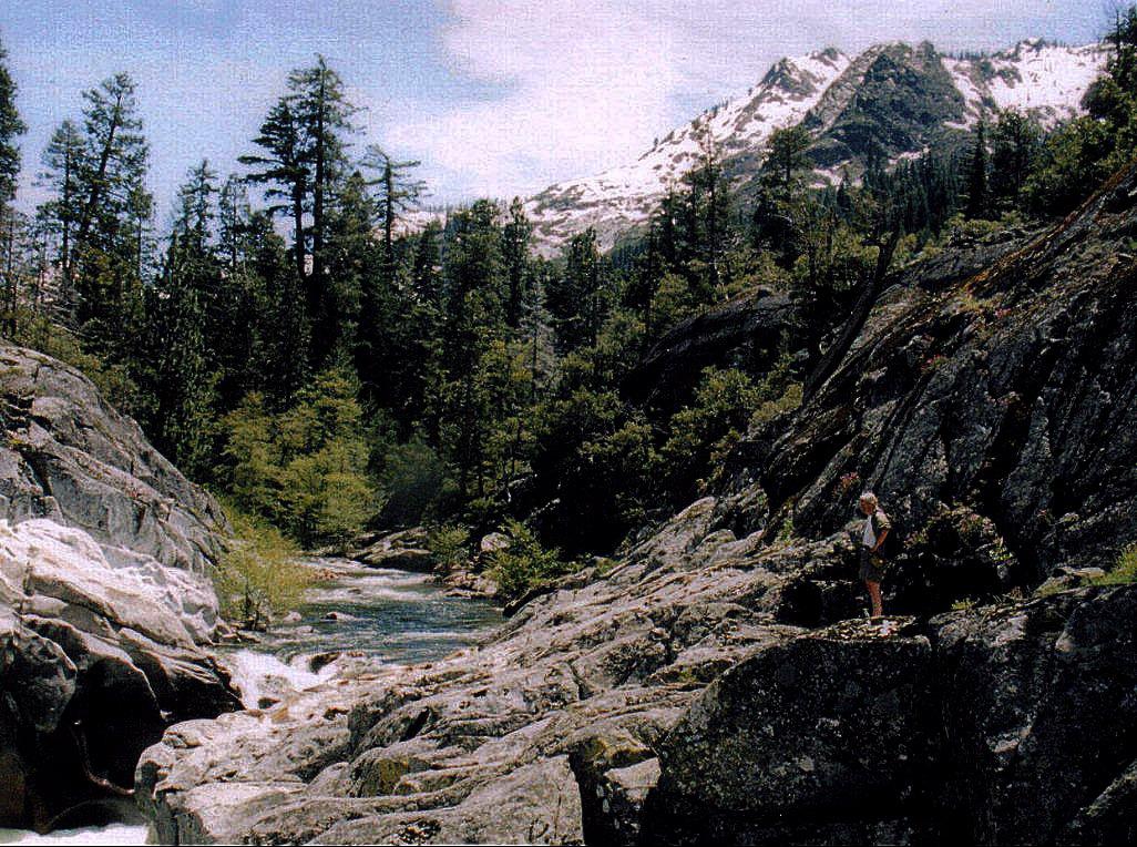
 Spring runoff on the Rubicon above the reservoir, May 2005. courtesy of Marcia Wright↗ (CC BY 3.0↗)
 A site at Upper Hell Hole, the free boat-in and hike-in campground three miles southeast at the head courtesy of Marcia Wright↗ (CC BY 3.0↗)
Other Swimming Holes, Hiking Trails, Canoeing Areas, and Kayaking Areas Nearby
Tahoe Area
Olympic Valley, California
12.4 miles NESwim near Olympic Valley, California
Swim
Shirley Canyon
Olympic Valley, California
13.2 miles NEShirley Canyon is widely regarded as one of Lake Tahoe's finest half-day hikes, a spectacular climb up a granite canyon that rises straight out of the base of the Palisades Tahoe ski resort in...
Hike 4.1 mi
Shirley Lake Canyon Trail
Olympic Valley, California
13.2 miles NEA 2.5-mile hike from Squaw Valley Village past streams and waterfalls to a pure Sierra lake — rocky near the top, with a free gondola ride back down from High Camp as a reward.
Hike, Swim
Sugar Pine Point Beach
Tahoma
16.2 miles EA quarter-mile walk from the parking lot puts you on a sand beach at the foot of Ed Z'berg Sugar Pine Point State Park, where General Creek meets Lake Tahoe and the water runs clear enough to read the bottom. It is also genuinely cold, even in August.
Camp, Hike, Kayak, Swim
Palisades Creek Trail
Truckee, California
16.6 miles NA difficult Sierra Nevada trail past Palisade Falls — one of the tallest on the American River — with views of Devils Peak, alpine lakes, and 2,000 feet of elevation gain.
Hike, Swim
Heath Falls Overlook Trail
Truckee, California
16.6 miles NHike and Swim near Truckee, California
Hike, Swim
North Fork Falls
Colfax, California
19.8 miles NWClear water, cliff-jumping pools, and waterfalls at Sierra Nevada's North Fork Falls — a summer hike to two deep pools with 10-to-25-foot cliffs ready for leaping.
Camp, Hike, Swim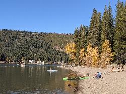
China Cove Beach
Truckee
19.9 miles NEChina Cove Beach is the sandy, shallow corner at the west end of Donner Memorial State Park, on the south shore of Donner Lake outside Truckee. California State Parks runs it, access is open to anyone paying the 10 dollar day use parking fee, and there is
Camp, Canoe, Hike, Kayak, Swim 0.4 mi
Glen Alpine Falls
South Lake Tahoe, California
22.2 miles SEA roadside waterfall near Lake Tahoe — wider than it is tall — with roadside parking, a scenic overlook, and the option to scramble down the rocks for a closer look.
Hike
Zephyr Cove Park
Glenbrook, Nevada
25.5 miles ESix tennis courts, disc golf, a sledding hill, a beach, and a fishing pond all at one free park make Zephyr Cove one of Lake Tahoe's most versatile family hangouts.
Camp, Canoe, Disc Golf, Hike, Horseback, Kayak, Swim 1.5 mi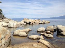
Skunk Harbor
Carson City, Nevada
26.3 miles EA forest service road hike from the 28 freeway to a secluded beach area near Carson City with mountain views, a historic building, and a marker — dogs welcome.
Hike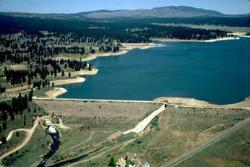
Boca Reservoir Hidden Beach
Truckee, California
30.3 miles NESandy informal beaches on the northeast shore of Boca Reservoir above Truckee, free to use, windy in the afternoons, and drawn down hard by the end of summer.
Camp, Canoe, Kayak, Kiteboard, Swim 5.6 mi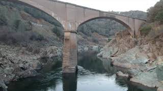
Quarry Trail
Cool, California
34.3 miles WA riverside hike along an old limestone railway line to a dramatic amphitheater quarry — wildflowers peak April through June, and the historic railway story (scrap metal for WWII) adds a fascinating layer.
Hike 1.2-2.7 mi
Lake Clementine Trail Loop
Auburn, California
34.9 miles WFour connected trails loop around Lake Clementine on the North Fork American River — wheelchair accessible, pet friendly, and great for fishing, camping, and family summer outings.
Camp, Canoe, Hike, Kayak, Mountain Bike, Swim
American River Confluence
Auburn, California
34.9 miles WThe Confluence — where the North and Middle Forks of the American River meet below Foresthill Bridge — is Auburn's favorite swimming and rafting hub.
Hike, Horseback, Kayak, Rock Climb, Swim, Whitewater 0.1 mi
Edwards Crossing
Nevada City, California
35.7 miles NWDeep blue water, rock cliffs, and a sandy beach on the Yuba River — with a half-mile walk from the parking lot and cliff jumping spots up to 20 feet deep.
Hike, Swim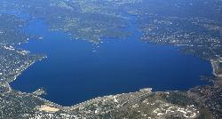
Granite Bay Main Beach
Granite Bay, California
44.7 miles SWThe largest sand beach on Folsom Lake, guarded in summer, twenty five minutes from downtown Sacramento at the end of Douglas Boulevard.
Canoe, Hike, Kayak, Swim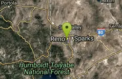
Reno Area
McGill, Nevada
45.1 miles NESwim near McGill, Nevada
Swim
Wingfield Park
Reno, Nevada
45.2 miles NEAn oasis in downtown Reno where manmade dams and natural rock formations turn the Truckee River into a playground for swimming, kayaking, tubing, and rafting.
Kayak, SwimNearby Campsites
Sugar Pine Point Beach
Tahoma
16.2 miles EA quarter-mile walk from the parking lot puts you on a sand beach at the foot of Ed Z'berg Sugar Pine Point State Park, where General Creek meets Lake Tahoe and the water runs clear enough to read the bottom. It is also genuinely cold, even in August.
Camp, Hike, Kayak, Swim
North Fork Falls
Colfax, California
19.8 miles NWClear water, cliff-jumping pools, and waterfalls at Sierra Nevada's North Fork Falls — a summer hike to two deep pools with 10-to-25-foot cliffs ready for leaping.
Camp, Hike, Swim
China Cove Beach
Truckee
19.9 miles NEChina Cove Beach is the sandy, shallow corner at the west end of Donner Memorial State Park, on the south shore of Donner Lake outside Truckee. California State Parks runs it, access is open to anyone paying the 10 dollar day use parking fee, and there is
Camp, Canoe, Hike, Kayak, Swim
Zephyr Cove Park
Glenbrook, Nevada
25.5 miles ESix tennis courts, disc golf, a sledding hill, a beach, and a fishing pond all at one free park make Zephyr Cove one of Lake Tahoe's most versatile family hangouts.
Camp, Canoe, Disc Golf, Hike, Horseback, Kayak, Swim
Boca Reservoir Hidden Beach
Truckee, California
30.3 miles NESandy informal beaches on the northeast shore of Boca Reservoir above Truckee, free to use, windy in the afternoons, and drawn down hard by the end of summer.
Camp, Canoe, Kayak, Kiteboard, Swim 1.2-2.7 mi
Lake Clementine Trail Loop
Auburn, California
34.9 miles WFour connected trails loop around Lake Clementine on the North Fork American River — wheelchair accessible, pet friendly, and great for fishing, camping, and family summer outings.
Camp, Canoe, Hike, Kayak, Mountain Bike, Swim


