


Caspian Lake Public Beach
Greensboro

Canoe, Kayak, and Swim
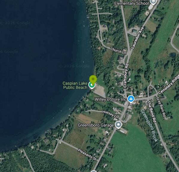
Caspian Lake Public Beach (the town lists it as Caspian Public Beach) is the free public swimming beach at the south end of Caspian Lake in Greensboro, Vermont. The land belongs to the Hardwick Electric Department, which also owns the old concrete dam beside it, and day-to-day operation falls to the Caspian Lake Beach Committee, a volunteer group funded by the towns of Greensboro and Hardwick with help from the Greensboro Association. Caspian is a deep, clear lake (state bathymetry shows depths past 140 feet), and the beach sits right where Greensboro Brook leaves the lake.
The beach is on Beach Road in Greensboro village, directly across from Willey's Store, so it is easy to find. A free parking lot sits between the road and the lawn. The same lot serves the Hardwick Electric boat ramp next to the beach, so expect trailers coming and going, and leave the ramp lane and the driveway by the cedar hedge clear.
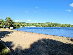
The swim area is a short stretch of sand that drops into the lake, with a buoyed section set out each summer by volunteers. The bottom is sand mixed with rocks, and a few large boulders inside and just outside the swim area are well known to local kids (they have nicknames like Big Yellow and Little Yellow). Committee records describe a seasonal beach attendant from mid-June to Labor Day, not lifeguards, so plan on swimming unguarded. Because the lake is so deep, the water off the beach is cooler than in the shallow ponds nearby, especially early in the summer. Red Cross swim lessons through Teach America to Swim are held here for two weeks each July, with subsidized rates for Hardwick residents.
There is no entry fee and no resident sticker; Greensboro's town website describes it simply as a free public beach. The committee has worked with an 11 PM closing time after a parking lot accident, so treat it as a daytime and evening spot. The beach runs a carry-out trash policy: the barrels were pulled and you are expected to take your garbage home. The restrooms are seasonal and the septic system is pumped on a schedule, so do not count on them outside summer.
Lake level matters here. In drought summers the lake has fallen to about 11 inches below the spillway, which left a long wade to deeper water and exposed rocks that are normally covered, and boaters had to back well off the end of the ramp. In wet springs the opposite happens and the water has risen over the top of the dam. The dam itself has been rated in poor condition and its future is under discussion, and a clean water project led by the Orleans County Natural Resources Conservation District is drafting plans for rain gardens, walkways and parking changes at the beach, so expect some construction in coming seasons. Watch for goose droppings on the lawn, and note that wake boats may not launch at this ramp.
Beyond swimming, the lawn has picnic tables, charcoal grills, shade trees and granite benches facing the water. The ramp makes it a convenient place to put in a canoe or kayak and paddle the shoreline, and the village store, library and Willey Beach Park trail are a few minutes' walk away.
More Information
Caspian beach clean water project community forum held - The Hardwick Gazette
GREENSBORO – Light attendance of less than 10 people at a community forum to learn about a clean water project for the Caspian Lake public beach gave those at the Highland Center for the Arts, September 25, a chance to share their concerns and ideas. Greensboro resident Will Marlier,[Read More...]
https://hardwickgazette.org/2025/10/07/caspian-beach-clean-water-project-community-forum-held/Drought conditions affect Caspian Lake users - The Hardwick Gazette
GREENSBORO – Caspian Lake’s historically low water levels have been the subject of much conversation in a town that depends on the lake to draw summer visitors. With the lake more than 12 inches below its eight-year average on September 1, and 18 inches below its spring level this[Read More...]
https://hardwickgazette.org/2025/09/02/drought-conditions-affect-caspian-lake-users/Parks, Lakes & Trails – Greensboro, VT
The GCC has developed maps to encourage more people to make use of our public trails. Click here for a map that includes an overview of all of the public walking trails in town. You can also find detailed maps of each trail below. The maps are in pdf format so can be used online or printed out to take with you. They can also be uploaded into a trail map App such as Avenza so you can see your location on the trail as you walk it.
https://greensborovt.gov/parks-lakes-trails/
- Plan Ahead and Prepare
- Travel & camp on durable surfaces
- Dispose of waste properly
- Leave what you find
- Minimize campfire impacts
- Respect wildlife
- Be considerate of other visitors
Directions
From Greensboro
- Head south on N Greene St toward W Market St (10 ft)
- Turn left onto W Market St (0.4 mi)
- Turn right onto Murrow BlvdMay be closed at certain times or days(0.5 mi)
- Turn left onto E Gate City Blvd (3.1 mi)
- Turn left onto the I-40 E/
I-85 BUS N ramp to Burlington/ Durham (0.2 mi) - Merge onto I-40 E (34.1 mi)
- Keep left to continue on I-85 N (9.4 mi)
- Keep left to stay on I-85 N, follow signs for Durham/
Petersburg Entering Virginia(131 mi) - Merge onto I-95 N (26.8 mi)
- Keep left to stay on I-95 N (55.4 mi)
- Take the exit on the left toward I-95 Express LanesToll roadMay be closed at certain times or days(0.2 mi)
- Continue onto I-95 Express LanesToll roadParts of this road may be closed at certain times or days(36.6 mi)
- Continue onto I-395 Express LanesToll roadParts of this road may be closed at certain times or days(7.9 mi)
- Keep right to continue on I-395 Express Lanes NToll roadMay be closed at certain times or daysEntering District of Columbia(1.6 mi)
- Take the Interstate 395 N exit toward Capitol Hill/
Verizon Centre/ Nationals Pk Toll roadMay be closed at certain times or days(0.3 mi) - Merge onto I-395 N (0.9 mi)
- Continue straight onto I-695 E (1.9 mi)
- Take exit 2B for State Hwy 295 N toward US-50 (0.5 mi)
- Merge onto State Hwy 295Entering Maryland(4.3 mi)
- Continue onto MD-201 (335 ft)
- Continue onto Baltimore-Washington Pkwy (18.7 mi)
- Continue onto MD-295 N/
Baltimore-Washington Pkwy (8.7 mi) - Take the Harbor Tunnel Thrwy/
I-895 N exit Toll road(0.2 mi) - Merge onto I-895 NToll road(10.4 mi)
- Merge onto I-95 NToll roadEntering Delaware(48.6 mi)
- Slight left to stay on I-95 NToll road(10.0 mi)
- Keep right to continue on I-295 NEntering New Jersey(6.4 mi)
- Keep left to continue on US-40 E/
NJ Turnpike, follow signs for Atlantic City (0.9 mi) - Continue onto NJ Tpke/
NJ Turnpike (1.6 mi) - Slight left to stay on NJ TpkeToll roadParts of this road may be closed at certain times or days(47.1 mi)
- Slight left to stay on NJ Tpke (signs for New Jersey Tpke)Toll road(2.2 mi)
- Continue onto I-95 N/
NJ Tpke Toll road(54.0 mi) - Keep left to stay on I-95 N, follow signs for I-80 W/
Lincoln Tunnel Toll road(6.5 mi) - Keep left to stay on I-95 N (6.4 mi)
- Keep right to stay on I-95 N, follow signs for George Washington Brg/
Fort Lee (3.2 mi) - Continue straight to stay on I-95 N (signs for GW Bridge (Lower Level)) (0.1 mi)
- Keep right to stay on I-95 N, follow signs for US-1 N/
US-9 N/ George Washington Bridge (0.4 mi) - Continue onto US-9 N (456 ft)
- Continue onto I-95 Lower Level N/
U.S. 1 Lower Level N Toll roadEntering New York(1.5 mi) - Keep right to continue on Cross Bronx Expy/
I-95 Lower Level N/ Trans-Manhattan Expy/ U.S. 1 Lower Level N (0.8 mi) - Cross Bronx Expy/
I-95 Lower Level N/ Trans-Manhattan Expy/ U.S. 1 Lower Level N turns right and becomes I-95 N/ Cross Bronx Expy (0.1 mi) - Take exit 1C-D to merge onto I-87 N toward Albany (7.1 mi)
- Take exit 4 toward Cross Cnty Pkwy (453 ft)
- Merge onto Central Park Ave (0.1 mi)
- Slight right onto the Cross County Pkwy ramp (404 ft)
- Take the ramp to Hutchinson Pkwy (0.2 mi)
- Merge onto Cross County Pkwy (1.9 mi)
- Keep left to stay on Cross County Pkwy, follow signs for N Hutchinson Pkwy/
Merritt Pkwy (1.2 mi) - Merge onto Hutchinson Riv Pkwy N (6.4 mi)
- Keep left to stay on Hutchinson Riv Pkwy NEntering Connecticut(4.4 mi)
- Continue onto CT-15 N (63.9 mi)
- Take the exit on the left onto I-91 NEntering Massachusetts(47.4 mi)
- Slight left to stay on I-91 N (signs for Greenfield)Entering Vermont(177 mi)
- Take exit 21 to merge onto US-2 W toward VT-15 (9.6 mi)
- Turn right onto VT-15 W (10.4 mi)
- Turn right onto VT-16 N (4.7 mi)
- Turn left onto The Bend Rd (2.6 mi)
- Turn left onto East St (381 ft)
- Turn left onto Breezy Ave (121 ft)
- Turn right onto Beach Rd (0.1 mi)
- Turn rightDestination will be on the left(72 ft)


Other Swimming Holes, Canoeing Areas, and Kayaking Areas Nearby
Elmore State Park Beach
Lake Elmore
11.6 miles WSandy, shallow swim beach at the north end of Lake Elmore in Elmore State Park, Vermont, with a CCC-built beach house, boat rentals and a $5 adult day-use fee.
Camp, Canoe, Hike, Kayak, Swim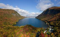
Southwest Cove
Westmore
16.2 miles NEA sand beach at the southwest corner of Lake Willoughby in Willoughby State Forest, reached by a short trail from the south end lots. Free, cold, clear water, no lifeguards, and long used as a clothing-optional beach.
Canoe, Hike, Kayak, Swim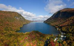
Lake Willoughby South Beach
Westmore
16.3 miles NEA free public beach at the south tip of Lake Willoughby in Westmore, Vermont, with the cliffs of Mount Pisgah and Mount Hor rising on either side of deep, clear, cold water.
Canoe, Hike, Kayak, Swim
Wrightsville Beach
Middlesex
21.9 miles SWSand swim beach on Wrightsville Reservoir north of Montpelier, run by a four-town recreation district. Small day fee ($4 adults in 2025), no lifeguard, open late May through Labor Day.
Canoe, Hike, Kayak, Swim
Swiftwater Bridge
Bath, New Hampshire
35.1 miles SESwim near Bath, New Hampshire
Swim
Weare
Bath, New Hampshire
35.1 miles SESwimmable river pools up to 4 feet deep along a Weare, New Hampshire roadside, including a 30-foot-wide section with a rope swing — rocky terrain means caution is advised, especially for small children.
Swim
Horseshoe Falls
Lincoln, New Hampshire
43.4 miles SECLOSED. Private Property. Closed to the public due to vandalism. Please take better care of areas we're permitted to use.
Swim
Falling Waters
Lincoln, New Hampshire
43.4 miles SESwim near Lincoln, New Hampshire
Swim
Lincoln Area
Lincoln, New Hampshire
43.4 miles SEA cluster of swimming options near the busy tourist town of Lincoln, New Hampshire — some spots clothing-optional; see local listings for details.
Swim
Burton Island State Park
St. Albans
46.2 miles WCar-free Burton Island in Lake Champlain has a rocky, unguarded swim area by the marina, reached by the state's 10-minute Island Runner ferry from Kill Kare State Park. State day-use and ferry fees apply.
Camp, Canoe, Hike, Kayak, Swim
Blanchard Beach at Oakledge Park
Burlington
46.4 miles WSandy, shallow city beach on Lake Champlain in Burlington's Oakledge Park. Free on foot or bike, $3/hour parking May through October, no lifeguards, and frequent algae checks in summer.
Hike, Swim
Leddy Beach
Burlington
47.4 miles WFree city swimming beach on Lake Champlain at Leddy Park in Burlington's New North End, with free parking, a sandy shore and daily water monitoring in summer, but no lifeguards.
Hike, Swim
Fantastic beach
Magog, Québec
48.0 miles NA sandy beach on the shores of Lac Ste. Anne about 60 km west of Edmonton, drawing up to 3,000 visitors on busy summer weekends with shallow, family-friendly water.
Swim
Kancamagus Area
Lincoln, New Hampshire
48.4 miles SESwim near Lincoln, New Hampshire
SwimNearby Campsites
Elmore State Park Beach
Lake Elmore
11.6 miles WSandy, shallow swim beach at the north end of Lake Elmore in Elmore State Park, Vermont, with a CCC-built beach house, boat rentals and a $5 adult day-use fee.
Camp, Canoe, Hike, Kayak, Swim
Maple Haven Campground
Woodstock, New Hampshire
45.0 miles SEA private 28-acre campground tucked in the heart of New Hampshire's White Mountains with breathtaking views, untouched nature, and both indoor and outdoor camping options.
Camp
Burton Island State Park
St. Albans
46.2 miles WCar-free Burton Island in Lake Champlain has a rocky, unguarded swim area by the marina, reached by the state's 10-minute Island Runner ferry from Kill Kare State Park. State day-use and ferry fees apply.
Camp, Canoe, Hike, Kayak, Swim


