


Little Blackfoot Meadows Loop
Elliston, Montana
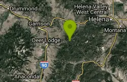
| Address: | ~Usfs 227, Elliston, MT 59728, USA |
| GPS: |
46°25'35.4"N 112°29'7.5"W Maps | Directions |
| State: | Montana |
| Trail Length: | 15.00 miles |
| MTB Difficulty: | Intermediate |
| Trail Type: | Loop |
| MTB Trail Type: | Singletrack |
Mountain Bike
This trail has very high quality singletrack, but that won't be apparent at first. Begin with a ride up the doubletrack on the Little Blackfoot Meadows trail (FST 329). After a while, the doubletrack will turn into singletrack, albeit wide singletrack. There is a bridge across the creek, after which, the singletrack becomes narrower and much sweeter. Eventually, there will be another creek crossing after which the singletrack becomes even better. The climb is gradual, with a few steep bursts, but nothing too tough. The forest is unusually lush by Montana standards and the singletrack is of consistently high quality--mostly firm packed soft dirt and pine needles with few technical obstacles. After a few miles, the trail will fork with 329 continueing right to Little Blackfoot Meadows. If you're not up for a killer climb, go to the meadows and turn around for a very sweet downhill. If you're in for the 15 mile loop with a murderous climb, take the left fork (FST 362 to FST 359). The climb isn't too bad at first but then gets very steep and the surface changes to soft dirt/sand which has been powdered by the equestrians--there will be a couple dismounts as you hit very steep, soft switchbacks. Either the trail has been rerouted or the USGS quad is inaccurate--don't worry; just follow the most obvious route. The trail gets very narrow as it sees little use. Ignore the branches to possible campsites. Eventually, the trail does turn back downhill. Here, it gains a few technical spots with one particularly nasty rock garden that will test your nerve and your suspension. Shortly after the rocks, be on the lookout for the Larabee Gulch trail (FST 359) that Tees off to the left. This will be a relatively flat, baby head infested piece of narrow singletrack for about a mile, then you will begin the descent back to the road--make sure your brakes are in working order as you will lose altitude fast and the trail has some sandy and off-camber spots where you'd rather carry some speed. The singletrack then gets real primo again--enjoy the plummet. The trail will then dead end at the Little Blakfoot River next to FSR 227 a couple miles from where you started. Unfortunately, there's no bridge here--get your feet wet, hit the road and ride back up the hill to your car. Courtesy of Singletracks.com
More Information
Little Blackfoot Meadows Loop Mountain Bike Trail in Elliston/helena, Montana - Directions, Maps, Ph
Little Blackfoot Meadows Loop is a singletrack mountain bike trail in Elliston/helena, Montana. View maps, videos, photos, and reviews of Little Blackfoot Meadows Loop bike trail in Elliston/helena.
http://www.singletracks.com/bike-trails/little-blackfoot-meadows-loop/Never modify trail features. Ride trails when they're dry enough that you won't leave ruts. Speak up when you see others on the trail and always yield to hikers, horses, and others coming uphill. Always ride on the established trail.
Read More
- Plan Ahead and Prepare
- Travel & camp on durable surfaces
- Dispose of waste properly
- Leave what you find
- Minimize campfire impacts
- Respect wildlife
- Be considerate of other visitors
Directions
From Elliston, Montana
- Head east on W Main St toward Burns St (276 ft)
- Turn right onto Burns St (262 ft)
- Turn left onto US-12 E (0.9 mi)
- Turn right onto Little Blackfoot River Rd (4.2 mi)
- Turn right onto Little Blackfoot River Rd/NF-227-B1Continue to follow Little Blackfoot River Rd(0.7 mi)
- Little Blackfoot River Rd turns slightly left and becomes NF-227 (0.1 mi)
- Continue onto Little Blackfoot River Rd (2.6 mi)
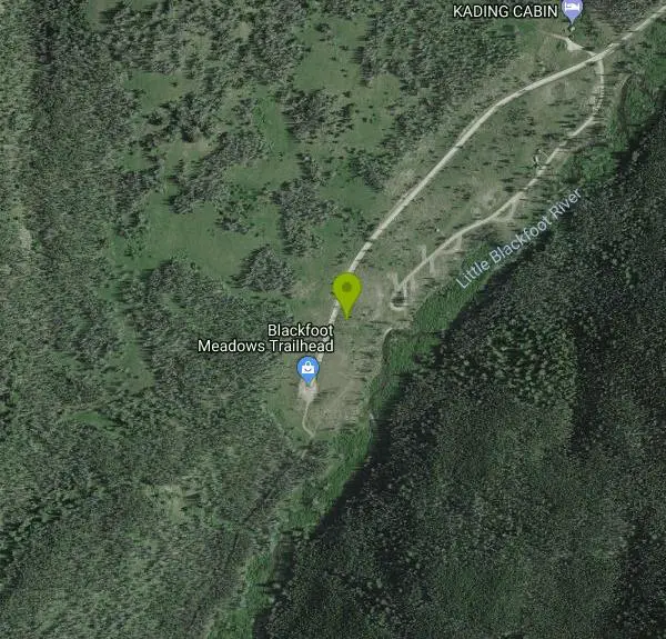
- Slight right onto Little Blackfoot River Rd/Usfs 227Destination will be on the left(5.1 mi)
Other Mountain Bike Trails Nearby
Mt Helena Ridge
Helena, Montana
19.6 miles NEA rolling singletrack ridge ride above Helena with meadow-to-forest transitions, a fast descent on the Show Me the Horse trail, and sweeping views of the valley.
Mountain Bike 
Mt Helena
Helena, Montana
19.6 miles NEA fantastic urban trail network right next to Helena with dozens of trail miles, technical options, and summit views — connect to Mt. Helena Ridge for even more riding.
Mountain Bike 
Rawhide Creek
Boulder, Montana
23.2 miles SEAn ATV and mountain bike doubletrack route that passes impressive granite rock formations and includes some very steep pitches, though the overall grade stays fairly manageable.
Mountain Bike 
Muskrat Creek
Boulder, Montana
23.3 miles EA punishing 7-mile climb with roots, rocks, and creek crossings that rewards you with a screaming, naturally flowing downhill back to the trailhead.
Mountain Bike 
Maud S. Canyon
Butte, Montana
31.9 miles SA fun, fast, easy mountain bike ride near Butte tracing Maud S Canyon to the Continental Divide Trail, with aspen groves, wildlife, and an optional spur toward the Our Lady of the Rockies statue.
Mountain Bike 
Homestake To Pipestone Pass
Butte, Montana
35.3 miles SButtery smooth singletrack with rock features through a bouldery landscape near Butte — a 5-mile intermediate climb to a Butte vista and a fast, stout descent to Pipestone Pass. Plan for a 10 or 19.5-mile ride.
Mountain Bike 
Spire Rock
Whitehall, Montana
36.2 miles SA mountain bike route in the Pipestone area near Whitehall — a veritable maze of trails pointing toward the Tobacco Root Mountains, with doubletrack, singletrack, and impressive scenery to explore.
Mountain Bike 
Spring Hill Campground and Picnic Area
Anaconda, Montana
36.9 miles SWA scenic mountain campground beside Warm Springs Creek in Beaverhead-Deerlodge National Forest, with 28 sites, great trout fishing, and Georgetown Lake just 8 miles away.
Camp, Hike, Horseback, Mountain Bike, Swim 
Beaver Ponds
Butte, Montana
38.8 miles SA serious singletrack adventure above Butte with a brutal initial climb rewarded by flowy riding, a beautiful descent, and a marshy meadow crossing before a superb final drop.
Mountain Bike 
Toll Canyon
Butte, Montana
39.5 miles SA mountain bike ride near Butte starting with a moderate climb, singletrack at the top, a steep switchback descent, and a gradual 3-mile return — combine with the Beaver Ponds loop for a 15-mile figure eight.
Mountain Bike 
CDT: Highland
Butte, Montana
42.5 miles SA spectacular loop on the Continental Divide Trail through the Mt. Haggin Wildlife Management Area, with the Pintlar Range as your backdrop and very little traffic outside of hunting season.
Mountain Bike 
Dry Creek Loop
Wise River, Montana
45.4 miles SWA spectacular Continental Divide Trail loop through the Mt. Haggin Wildlife Management Area with the Pintlar Range as your backdrop and very little traffic outside of hunting season.
Mountain BikeNearby Campsites
Lost Creek State Park
Anaconda, Montana
29.0 miles SWCamp near Anaconda, Montana
Camp
Spring Hill Campground and Picnic Area
Anaconda, Montana
36.9 miles SWA scenic mountain campground beside Warm Springs Creek in Beaverhead-Deerlodge National Forest, with 28 sites, great trout fishing, and Georgetown Lake just 8 miles away.
Camp, Hike, Horseback, Mountain Bike, Swim 
Flint Creek Campground
Philipsburg, Montana
41.2 miles WA free 3-acre campground in Beaverhead-Deerlodge National Forest next to Flint Creek, with 15 fire-pit sites and fishing for brown, cutthroat, and rainbow trout — bring your own drinking water.
Camp


