


Lost Creek State Park
Anaconda, Montana
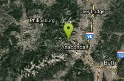
| Address: | 6449-6523 Lost Creek Rd, Anaconda, MT 59711, USA |
| GPS: |
46°12'33.5"N 113°0'12.1"W Maps | Directions |
| State: | Montana |
Waterfalls Streams Trails State Park
Camp
More Information
Add Resource
- Plan Ahead and Prepare
- Travel & camp on durable surfaces
- Dispose of waste properly
- Leave what you find
- Minimize campfire impacts
- Respect wildlife
- Be considerate of other visitors
Directions
From Anaconda, Montana
- Head east on E 4th St toward Chestnut Stbirch St (0.6 mi)
- Continue straight onto Anaconda Smelter Rd (161 ft)
- Slight left toward MT-1 S/E Park Ave (0.1 mi)
- Turn left toward MT-1 S/E Park Ave (223 ft)
- Sharp right onto MT-1 S/E Park AveContinue to follow MT-1 S(1.9 mi)
- Turn left onto MT-48 N (0.3 mi)
- Turn left onto Galen Rd (1.9 mi)
- Turn left onto Lost Creek Rd (7.1 mi)
- Turn leftDestination will be on the right(338 ft)

Other Arenas Nearby
Spring Hill Campground and Picnic Area
Anaconda, Montana
8.1 miles WA scenic mountain campground beside Warm Springs Creek in Beaverhead-Deerlodge National Forest, with 28 sites, great trout fishing, and Georgetown Lake just 8 miles away.
Camp, Hike, Horseback, Mountain Bike, Swim 
Spring Hill Picnic Area
Anaconda, Montana
8.3 miles Wnear Anaconda, Montana

Flint Creek Campground
Philipsburg, Montana
14.4 miles WA free 3-acre campground in Beaverhead-Deerlodge National Forest next to Flint Creek, with 15 fire-pit sites and fishing for brown, cutthroat, and rainbow trout — bring your own drinking water.
Camp 
Dry Creek Loop
Wise River, Montana
19.9 miles SA spectacular Continental Divide Trail loop through the Mt. Haggin Wildlife Management Area with the Pintlar Range as your backdrop and very little traffic outside of hunting season.
Mountain Bike 
Whiskey Gulch at Montana Tech
Butte, Montana
25.2 miles SEA big-shot free disc golf course in Historic Uptown Butte with holes stretching nearly 800 feet, installed by Montana Tech College, sharing the site with a mountain bike course.
Disc Golf 
Copper Mountain
Butte, Montana
26.7 miles SEA hilly, grassy disc golf course built atop Butte's old city dump — keep a close eye on your disc in the tall grass and wind.
Disc Golf 
Little Blackfoot Meadows Loop
Elliston, Montana
28.9 miles NEA high-quality singletrack mountain bike trail near Elliston through unusually lush Montana forest, with a gradual climb, two creek crossings, and a choice between a sweet out-and-back or a 15-mile loop with a tough climb.
Mountain Bike 
Maud S. Canyon
Butte, Montana
30.6 miles SEA fun, fast, easy mountain bike ride near Butte tracing Maud S Canyon to the Continental Divide Trail, with aspen groves, wildlife, and an optional spur toward the Our Lady of the Rockies statue.
Mountain Bike 0.6 mi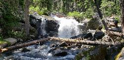
Pintler Falls
Wise River, Montana
31.9 miles SWPintler Falls is a peaceful backcountry waterfall in the Anaconda-Pintler Wilderness of southwestern Montana, a reward at the end of a pretty forest-and-creek hike in the high mountains of the...
Hike 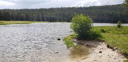
Pintler Lake Campground and Picnic Area
Wise River, Montana
33.1 miles SWPintler Lake Campground and Picnic Area is a tiny, free, wonderfully remote campground on the edge of a small mountain lake in the Beaverhead-Deerlodge National Forest of southwestern Montana, at the...
Camp, Canoe, Kayak, Swim 
Eagle's Nest at Sagebrush Flats
Butte, Montana
34.7 miles SEA challenging disc golf course with shot variety including blind holes, dog legs, open holes, and tight tunnel shots — bring the map; this redesigned layout rewards preparation.
Disc Golf 
Homestake To Pipestone Pass
Butte, Montana
34.7 miles SEButtery smooth singletrack with rock features through a bouldery landscape near Butte — a 5-mile intermediate climb to a Butte vista and a fast, stout descent to Pipestone Pass. Plan for a 10 or 19.5-mile ride.
Mountain Bike 
Beaver Ponds
Butte, Montana
35.9 miles SEA serious singletrack adventure above Butte with a brutal initial climb rewarded by flowy riding, a beautiful descent, and a marshy meadow crossing before a superb final drop.
Mountain Bike 
Toll Canyon
Butte, Montana
36.5 miles SEA mountain bike ride near Butte starting with a moderate climb, singletrack at the top, a steep switchback descent, and a gradual 3-mile return — combine with the Beaver Ponds loop for a 15-mile figure eight.
Mountain Bike 0.1 mi
Canyon Creek Charcoal Kilns
Melrose, Montana
37.2 miles STwenty remarkably preserved brick-dome charcoal kilns from the 1880s silver-mining boom stand as a ghost of a multi-million-dollar industry that vanished by 1915.
Hike 
CDT: Highland
Butte, Montana
37.6 miles SEA spectacular loop on the Continental Divide Trail through the Mt. Haggin Wildlife Management Area, with the Pintlar Range as your backdrop and very little traffic outside of hunting season.
Mountain Bike 
Spire Rock
Whitehall, Montana
40.4 miles SEA mountain bike route in the Pipestone area near Whitehall — a veritable maze of trails pointing toward the Tobacco Root Mountains, with doubletrack, singletrack, and impressive scenery to explore.
Mountain Bike 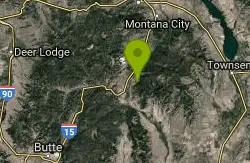
Rawhide Creek
Boulder, Montana
46.2 miles EAn ATV and mountain bike doubletrack route that passes impressive granite rock formations and includes some very steep pitches, though the overall grade stays fairly manageable.
Mountain Bike 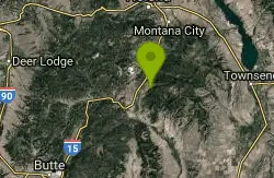
Muskrat Creek
Boulder, Montana
47.0 miles EA punishing 7-mile climb with roots, rocks, and creek crossings that rewards you with a screaming, naturally flowing downhill back to the trailhead.
Mountain Bike 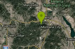
Mt Helena Ridge
Helena, Montana
48.3 miles NEA rolling singletrack ridge ride above Helena with meadow-to-forest transitions, a fast descent on the Show Me the Horse trail, and sweeping views of the valley.
Mountain BikeNearby Campsites
Spring Hill Campground and Picnic Area
Anaconda, Montana
8.1 miles WA scenic mountain campground beside Warm Springs Creek in Beaverhead-Deerlodge National Forest, with 28 sites, great trout fishing, and Georgetown Lake just 8 miles away.
Camp, Hike, Horseback, Mountain Bike, Swim
Flint Creek Campground
Philipsburg, Montana
14.4 miles WA free 3-acre campground in Beaverhead-Deerlodge National Forest next to Flint Creek, with 15 fire-pit sites and fishing for brown, cutthroat, and rainbow trout — bring your own drinking water.
Camp
Pintler Lake Campground and Picnic Area
Wise River, Montana
33.1 miles SWPintler Lake Campground and Picnic Area is a tiny, free, wonderfully remote campground on the edge of a small mountain lake in the Beaverhead-Deerlodge National Forest of southwestern Montana, at the...
Camp, Canoe, Kayak, Swim 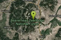
Lake Agnes
Glen, Montana
48.6 miles SA steep 1.5-mile climb through dense timber leads to 99-acre Agnes Lake, with sandy driftwood-covered beaches tucked in the Pioneer Mountains of southwestern Montana.
Camp, Hike, Mountain Bike


