


Cedar Creek Falls
Ramona, California
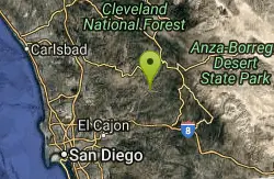
| GPS: |
32°59'23.6"N 116°43'47.4"W Maps | Directions |
| State: | California |
Hike and Swim
Cedar Creek Falls is one of San Diego County's most spectacular natural wonders — an 80-foot waterfall that plunges into a large, deep pool nicknamed the “Devil's Punchbowl,” hidden in the rugged backcountry hills east of Ramona. Tucked into the chaparral-covered canyons of the Cleveland National Forest, it's a stunning reward at the end of a challenging desert hike and a magnet for hikers looking to cool off in the pool below.
Plan ahead: a permit is required, and the safety rules here are serious and strictly enforced. Only 75 permits are issued per day through Recreation.gov (about $6, for up to five people) — they're not sold on-site, and there's little cell signal at the trailhead, so buy yours in advance. All cliffs above and around the falls are closed to climbing, jumping, and diving. That rule exists because people have died here — a teenager's fatal fall in 2011 led to the closures and the permit system. Alcohol is prohibited throughout the area.
The hike itself demands respect. The trail to the falls (via either the San Diego River Gorge route from the Ramona side or the Saddleback approach) is steep and fully exposed, dropping into the canyon on the way in — which means a hot, strenuous climb back out. Heat is the real danger: most of the fatalities and the many rescues here are heat-related. Hike early in the morning, carry far more water than you think you'll need (plus snacks and electrolytes), wear sun protection, and avoid the trail entirely on hot summer days.
The cooler months, roughly October through May, are by far the best and safest time to visit, and the falls run fullest after winter and spring rains (the flow can slow to a trickle by late summer). Respect the permit system, the cliff closures, and the desert heat, and Cedar Creek Falls rewards you with one of Southern California's most dramatic backcountry waterfalls.
More Information
San Diego River Gorge Trail - Cleveland National Forest (USFS)
We’re here to help you dream up your next trip, figure out the details, and reserve experiences at over 3,600 facilities and 103,000 individual sites across the country.
https://www.fs.usda.gov/r05/cleveland/recreation/trails/san-diego-river-gorge-trailBe courteous, informed, and prepared. Read trailhead guidelines, stay on the trail, and don't feed the wildlife.
Read More
- Plan Ahead and Prepare
- Travel & camp on durable surfaces
- Dispose of waste properly
- Leave what you find
- Minimize campfire impacts
- Respect wildlife
- Be considerate of other visitors
Directions
From Ramona, California
- Head east on Montecito Rd toward Main St (0.3 mi)
- Turn left at the 1st cross street onto Main St (1.5 mi)
- Continue onto CA-78 E/Julian Rd (20.2 mi)
- Turn right onto Pine Hills Rd (1.6 mi)
- Turn right onto Eagle Peak Rd (10.9 mi)
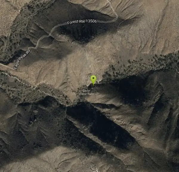
Entrance to the Cedar Creek Falls Permit Area may be accessed by the east access located near Julian, CA off of the Eagle Peak Road or by the west access located in Ramona, CA off of the Thornbush Road.
Other Swimming Holes and Hiking Trails Nearby
Lake Cuyamaca
Julian, California
8.4 miles EThis 110-acre lake at 4,600 ft in an oak-and-pine forest offers an easy San Diego escape into 26,000 acres of Cuyamaca Rancho State Park wilderness.
Canoe, Hike, Kayak
Noble Canyon Trail
Pine Valley, California
15.4 miles SEPine and oak woodlands with wildflowers, mountain views, an 1880s gold mine ruin, and a popular shared trail — bring lots of water, hats, and boots; conditions are very hot and dry in summer.
Hike
San Felipe Hills
Julian, California
16.9 miles NEThe San Felipe Hills are a mountain range within the Anza-Borrego Desert State Park in the Colorado Desert, in eastern San Diego County, California.
Hike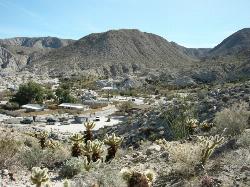
Agua Caliente County Park
Julian, California
24.8 miles EA 910-acre county park with three geothermically heated pools — including an indoor 102°F therapeutic spa — plus hiking trails, cabin rentals, and 140 campsites, open Labor Day to Memorial Day.
Camp, Cave, Hike, Hot Springs, Swim
Oak Grove/High Point Trail
Warner Springs, California
27.4 miles NA steep but rewarding trail in the Palomar District near Warner Springs with great views of the San Jacinto and San Gorgonio Mountains and optional 5-mile extension to the High Point Lookout. Bring lots of water.
Hike, Mountain Bike
Borrego Springs, CA, USA
Borrego Springs, California
27.6 miles NESwim near Borrego Springs, California
Swim
Beach Trail at Torrey Pines
San Diego, California
30.7 miles WA steep, 3/4-mile trail to Flat Rock and the beach at Torrey Pines — few trees, narrow final entry with steps, and coastal cobbles to navigate if you walk back along the shore.
Hike, Swim
Dripping Springs Trail/Agua Tibia Wilderness
Temecula, California
35.7 miles NWA strenuous Agua Tibia Wilderness trail with immediate climbing, long switchbacks, and a high-elevation traverse — best in fall, winter, or spring; carry water and skip summer visits.
Hike
Elephant Trees
Borrego Springs, California
35.9 miles EElephant Trees are rare, cold-sensitive tropical trees reaching only 10 feet tall, with stout trunk and branches resembling elephant legs, thin flaky bark, and tiny oblong leaves — found at their northernmost range in Borrego Springs.
Hike
Apple Canyon via Devil's Slide (shuttle hike)
Mountain Center, California
49.1 miles NHike near Mountain Center, California
Hike


