


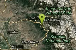
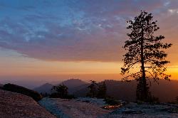
Chimney Rock
Tulare County, California
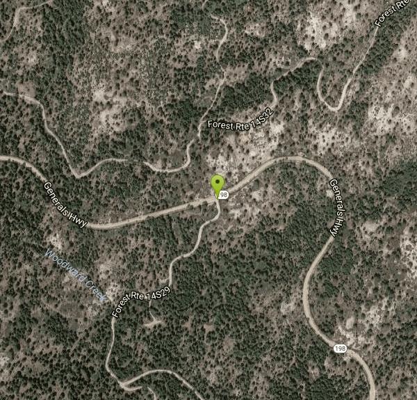
| Address: | Forest Rte 14S29, California, USA |
| GPS: |
36°41'13.2"N 118°51'37.4"W Maps | Directions |
| State: | California |
Rocks Restrooms Picnic Tables Lakes Rivers Waterfalls Wildflowers Ponds
Rock Climb
One of the best places to go rock climbing in Sequoia National Park! There are a variety of routes that can be climbed here, with the routes ranging from 5.8-5.10. There are six granite formations that offer many different climbs from 1 pitch to 700 feet. The most popular route to climb is Chimney Rock Spire with 13 routes available to climb.
The area is closed from January 1 through August 1 for Falcon nesting.
Popular Routes
Duet: 5.8+, Trad, 3 Pitches, 200'
Wall of Early Morning Fright: 5.9, Trad, 2 Pitches, 300'
He's Got Marty Feldman Eyes: 5.10a, Trad, Sport, 2 Pitches, 300'
Kitty from Hell: 5.10d, Trad, 4 Pitches, 500'
More Information
- Plan Ahead and Prepare
- Travel & camp on durable surfaces
- Dispose of waste properly
- Leave what you find
- Minimize campfire impacts
- Respect wildlife
- Be considerate of other visitors
Directions
From Tulare County, California
- Head southwest on Mallard Ln toward Campbell Creek Dr (0.3 mi)
- Turn left onto Campbell Creek Dr (1.9 mi)
- Turn right onto Ave 176/M-176 (0.1 mi)
- Turn right to stay on Ave 176/M-176 (5.6 mi)
- Merge onto Rd 276 (2.3 mi)
- Continue onto Ave 196 (6.4 mi)
- Turn right onto CA-65 N (5.4 mi)
- Turn right onto Rd 204/N Spruce AveContinue to follow Rd 204(4.4 mi)
- Continue onto 14th Ave E/S Spruce RdContinue to follow S Spruce Rd(3.5 mi)
- Turn right onto CA-198 E (8.2 mi)
- Turn left onto CA-216 W (0.6 mi)
- Turn right onto Dry Creek Dr (1.9 mi)
- Continue onto Dry Creek Dr (5.5 mi)
- Continue straight to stay on Dry Creek Dr (10.4 mi)
- Turn right onto CA-245 N (0.9 mi)
- Turn right onto Whitaker Forest Rd (1.0 mi)
- Keep left to continue on Hogback Dr (4.6 mi)
- Turn right onto CA-245 N (4.1 mi)
- Turn right onto CA-180 E (4.5 mi)
- Turn right onto CA-198 W (9.0 mi)
- Turn right onto Forest Rte 14S29 (20 ft)
Other Rock Climbing Walls Nearby
Sequoia National Park
Sequoia National Park, California
9.5 miles SEWalk through the park and you will feel like an ant as the Giant Sequoia trees tower over you. When people think of Sequoia National Park, they immediately think of the trees the park gets its...
Backpack, Camp, Hike, Rock Climb, Swim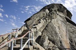
Moro Rock
Tulare, California
11.0 miles SEHike through the mountains of Sequoia National Park and you will come to Moro Rock, which offers views of the Great Western Divide. With 400 laddered stpes, you will feel like you are standing on...
Hike, Rock ClimbNearby Campsites
Sequoia National Park
Sequoia National Park, California
9.5 miles SEWalk through the park and you will feel like an ant as the Giant Sequoia trees tower over you. When people think of Sequoia National Park, they immediately think of the trees the park gets its...
Backpack, Camp, Hike, Rock Climb, Swim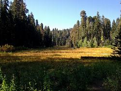
Crescent Meadow in Sequoia National Park
Sequoia National Park, California
11.0 miles SECrescent Meadows is a gentle and easy hiking area, making it perfect for families. Inside the meadow area, visitors will see many of the large Sequoias and Redwoods, as well as a variety of...
Camp, Hike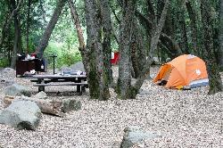
Hidden Falls Campground
Springville, California
31.5 miles SHidden Falls Campground is a small walk-in campground that is situated along the side of the Tule River. The drive to the campground is quite scenic. After you pass through the town of Springville...
Camp, Hike, Swim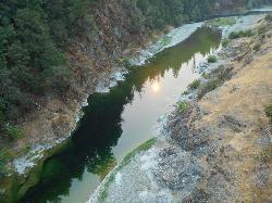
Standish Hickey Area
Lakeshore, California
45.0 miles NStandish-Hickey is an inland river canyon that runs along Highway 101 just 180 miles from San Fransisco. It's home to a two-mile stretch of the south fork on Eel River, where many...
Backpack, Camp, Hike, Kayak, Swim


