


Moro Rock
Tulare, California
| Address: | Moro Rock - Sequoia National Park, Sequoia National Park, 1 Way Road, Tulare, CA 93262, USA |
| GPS: |
36°32'48.8"N 118°45'56.0"W Maps | Directions |
| State: | California |
Trails Rocks National Park Restrooms Picnic Tables Lakes Rivers Waterfalls Streams Glaciers Wildflowers Ponds
Hike and Rock Climb
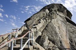
Hike through the mountains of Sequoia National Park and you will come to Moro Rock, which offers views of the Great Western Divide. With 400 laddered stpes, you will feel like you are standing on top of the world.
The trail is about a quarter of a mile long, and the rock itself rises about 6,725 ft in elevation. There is a way for visitors to drive up to a parking lot where visitors will only have to hike about 300 ft to the top. The trail is not very wide, but should be hiked single-file. Along the trail there are a few ledges that might make the faint of heart a little worried, but they pass quickly! Stopping along the trail to catch a breath will reward visitors with amazing views. Along the trail there are information panels providing some history about the rock and surrounding areas, a little science about how the rock was formed, and a list of visible summits from Moro Rock.
The rock is also open to rock climbers, however during the summer the area is closed off for falcon nesting. There are many routes to climb, anywhere from 5.7 to 5.12. The rock is made from the same granite as Yosemite's Half Dome, and is mainly free climbing with some aid routes as well.
More Information
Sequoia National Park Itinerary
This Sequoia National Park Itinerary will help you get started as you plan your vacation to Sequoia National Park.
https://www.justgotravelstudios.com/collections/national-park-itineraries/products/sequoia-national-park-itinerary?ref=9zpxis0diinRock Climbing in Moro Rock (SEKI), Sequoia & Kings Canyon NP
Find rock climbing routes, photos, and guides for every state, along with experiences and advice from fellow climbers.
https://www.mountainproject.com/area/106056834/moro-rock-sekiBe courteous, informed, and prepared. Read trailhead guidelines, stay on the trail, and don't feed the wildlife.
Read More
- Plan Ahead and Prepare
- Travel & camp on durable surfaces
- Dispose of waste properly
- Leave what you find
- Minimize campfire impacts
- Respect wildlife
- Be considerate of other visitors
Directions
From Tulare, California
- Head north on S J St toward W Tulare Ave (3.7 mi)
- Merge onto CA-99 N (4.5 mi)
- Take exit 96 to merge onto CA-198 E toward Visalia/Sequoia National Park (57.7 mi)
- Turn right onto Crescent Meadow Rd (82 ft)
- Turn right to stay on Crescent Meadow Rd (1.2 mi)
- Slight right (302 ft)
- Turn right (0.4 mi)
- Slight rightDestination will be on the right(105 ft)


Other Rock Climbing Walls and Hiking Trails Nearby
Crescent Meadow in Sequoia National Park
Sequoia National Park, California
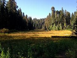
1.0 miles NEA gentle loop through giant Sequoias in Sequoia National Park, with the rare chance to stand inside a burnt-out Chimney Tree and peek into Tharp's Cabin — a historic homestead built inside a fallen giant.
Camp, Hike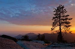
Sequoia National Park
Sequoia National Park, California
2.4 miles NGeneral Sherman — the world's largest tree by volume at 275 feet tall — anchors a national park full of giant sequoias, meadow walks, and black bear sightings.
Backpack, Camp, Hike, Rock Climb, Swim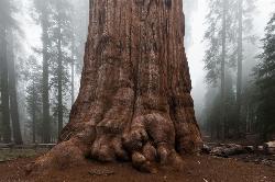
General Sherman Tree in Sequoia National Park
Three Rivers, California
2.5 miles NStanding 275 feet tall and over 36 feet wide at the base, General Sherman is the world's largest tree by volume — about 2,000 years old and accessible by free shuttle or two walking trails in Sequoia National Park.
Hike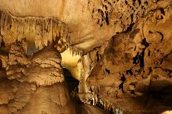
Crystal Cave
Three Rivers, California
4.3 miles NWGuided tours through Crystal Cave's marble passages, stalactites, underground streams, and glittering formations — including lantern tours and a 4-to-6-hour adventure crawl inside Sequoia National Park.
Hike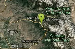
Chimney Rock
Tulare County, California
11.0 miles NWSix granite formations in Sequoia NP offer routes from 5.8 to 5.10 — Chimney Rock Spire alone has 13 routes, but the area is closed January through August 1 for falcon nesting.
Rock Climb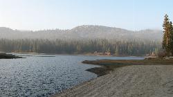
Hume Lake Sandy Cove Beach
Hume, California
18.3 miles NWAn 87 acre lake at 5,250 feet in the Sequoia National Forest, held back by the first multiple arch dam ever built, with swimming off sandy coves and no motorboats.
Camp, Canoe, Hike, Kayak, Swim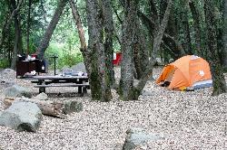
Hidden Falls Campground
Springville, California
20.7 miles SA walk-in campground along the Tule River near Sequoia Forest, with a 30-foot waterfall, seasonal swimming holes, and granite Indian Bathtubs carved by Native Americans.
Camp, Hike, Swim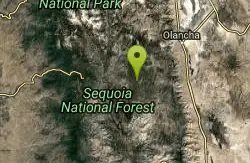
Monache mountain
Inyokern, California
41.5 miles SEA 9,367 ft peak near Lone Pine in the heart of California's Sierra Nevada — ranked among the top mountain summits in the state.
Camp, Hike, Mountain BikeNearby Campsites
Crescent Meadow in Sequoia National Park
Sequoia National Park, California
1.0 miles NEA gentle loop through giant Sequoias in Sequoia National Park, with the rare chance to stand inside a burnt-out Chimney Tree and peek into Tharp's Cabin — a historic homestead built inside a fallen giant.
Camp, Hike
Sequoia National Park
Sequoia National Park, California
2.4 miles NGeneral Sherman — the world's largest tree by volume at 275 feet tall — anchors a national park full of giant sequoias, meadow walks, and black bear sightings.
Backpack, Camp, Hike, Rock Climb, Swim
Hume Lake Sandy Cove Beach
Hume, California
18.3 miles NWAn 87 acre lake at 5,250 feet in the Sequoia National Forest, held back by the first multiple arch dam ever built, with swimming off sandy coves and no motorboats.
Camp, Canoe, Hike, Kayak, Swim
Hidden Falls Campground
Springville, California
20.7 miles SA walk-in campground along the Tule River near Sequoia Forest, with a 30-foot waterfall, seasonal swimming holes, and granite Indian Bathtubs carved by Native Americans.
Camp, Hike, Swim
Monache mountain
Inyokern, California
41.5 miles SEA 9,367 ft peak near Lone Pine in the heart of California's Sierra Nevada — ranked among the top mountain summits in the state.
Camp, Hike, Mountain Bike
Bush Creek Campground
Kernville, California
43.2 miles SA campground between several Kern River swimming holes with modern showers, a clubhouse, shaded trails, and fishing — open year-round and rarely crowded.
Camp, Kayak, Swim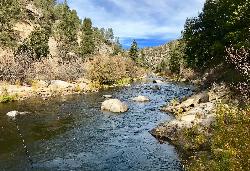
Limestone Campground
Kernville, California
43.5 miles SA rustic oak-and-pine-shaded campground on the Kern River near a swimming hole, horse trails, kayaking, and white water rafting — no cell service, no crowds.
Camp, Kayak, Swim


