


Coles Point Day Use Area
Hot Springs
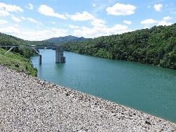
Canoe, Hike, Kayak, and Swim
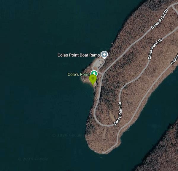
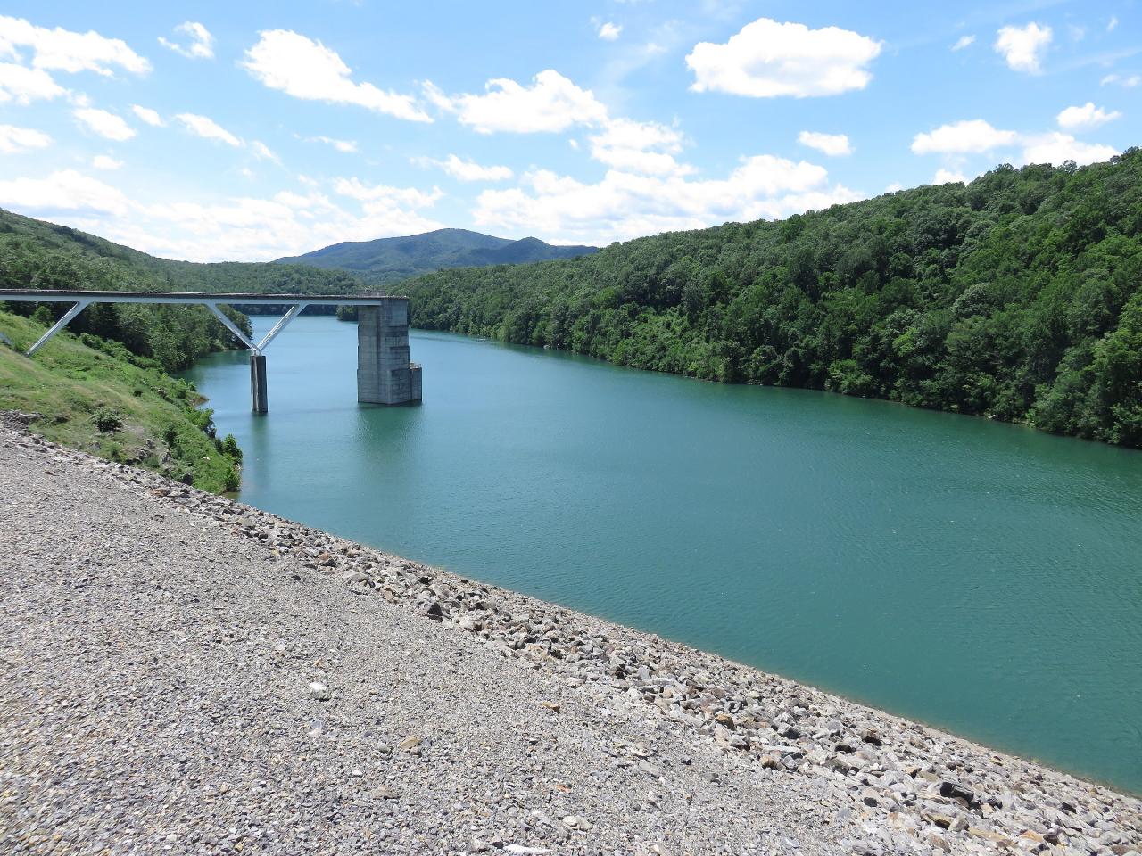
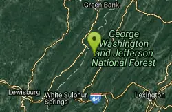
Coles Point Day Use Area, on the southern end of Lake Moomaw, belongs to the James River and Warm Springs Ranger District of the George Washington and Jefferson National Forests. It sits on a wooded peninsula in Alleghany County just west of Gathright Dam, the Army Corps of Engineers dam that holds back the Jackson River to form the 2,530-acre lake. The site combines a small sand swimming beach with two boat ramps, two fishing docks, two picnic shelters and an open field for games.
Most visitors come up from Covington. From I-64 Exit 16A, follow US 220 north about 5.5 miles, turn left on Route 687 (Jackson River Turnpike) for about 3.2 miles, then left on Route 641 (Indian Draft Road), which becomes Route 666. After about 4.2 miles turn right at the three-way intersection onto Route 605 and drive 4.5 miles, past the Morris Hill Campground entrance and across the top of Gathright Dam. Coles Point Drive then loops out onto the peninsula, with paved parking near the boat ramp and beach. Hot Springs and the ranger district office are about 8 miles away in a straight line but much farther by road, and Covington has the closest groceries and gas.
The beach is a short strip of placed sand on a small cove on the point, with the swim area just off the shore and a bathhouse nearby. The Forest Service does not publish water depths for the swim area or list lifeguards, so plan on swimming at your own risk and keep children within reach. Lake Moomaw is managed as a cold-water lake that holds trout in its deeper layers. The surface warms in summer while the deep water stays cold, and much of the shoreline around Coles Point is rocky and steep, so expect the bottom to fall away beyond the sand. There is no river current at this end of the lake, but the two boat ramps sit close by, so stay inside the swim area and watch for boats.
The site is open from Memorial Day weekend through Labor Day weekend. Day use costs $5 per vehicle, and the America the Beautiful interagency passes and the George Washington and Jefferson National Forests seasonal day use pass cover it (Senior and Access pass holders get half off). A Virginia State Parks pass does not. As of October 2026 the Forest Service lists both Coles Beach and Bolar Beach as closed for the season, reopening for the 2027 season. In winter the road from the dam to the point is not plowed.
Dogs must stay on a leash no longer than 6 feet anywhere in the recreation area, and the forest's bear food storage order applies, so keep coolers and trash in your vehicle. The Forest Service also has a hunting prohibition in place around Lake Moomaw. Drinking water is turned on only during the open season.
Beyond the beach, the 1-mile Morris Hill Bike Trail and the 3-mile Fortney Loop Trail are close by, and a concrete path from the boat launch lot leads to an accessible overlook with a view up the lake. Anglers fish the rocky shoreline around Coles Point for smallmouth bass, and birders use the point in winter to scan the open water for mergansers and grebes. The Corps runs a visitor center at Gathright Dam, and Morris Hill Campground, a short drive back toward the dam, is the nearest place to camp.
More Information
Coles Point, George Washington & Jefferson National Forest - Recreation.gov
Explore Coles Point in George Washington & Jefferson National Forest, Virginia with Recreation.gov. Coles Point Picnic Shelters are tucked in a small opening surrounded by a hardwood forest. Opportunities abound for hiking, photography, nature study, birding a
https://www.recreation.gov/camping/campgrounds/233190Coles Point, Virginia boat ramp and access | How's Your River
Public boat ramp and water access at Coles Point on Jackson River - Lake Moomaw in Virginia. Map, directions, nearby USGS conditions, and amenities.
https://howsyourriver.com/access_sites/coles-pointGeorge Washington and Jefferson National Forests | Coles Point Day Use Area | Forest Service
Coles Point at Lake Moomaw boasts picnic shelters, two fishing docks, two boat ramps and a swimming beach. Multiple opportunities for everyone including hiking, photography, nature study, birding and viewing wildlife. Coles Point is perched along the shores of the southern end of Lake Moomaw, providing convenient access to boating, fishing, swimming and relaxing on the beach. The picnic area has an open field for games like Frisbee and soccer. The 1-mile Morris Hill Bike Trail is popular among hikers and bikers. The 3-mile Fortney Loop Trail is open to hiking along a path with several switchbacks.
https://www.fs.usda.gov/r08/gwj/recreation/coles-point-day-use-areaGeorge Washington and Jefferson National Forests | Lake Moomaw Recreation | Forest Service
Lake Moomaw is a popular outdoor recreation destination offering multiple campgrounds, swim beaches, boating ramps, fishing piers and scenic trails. Popular with boaters and anglers, the 2,530-acre cold-water lake sits along the Jackson River in the mountains of the Alleghany Highlands where it boasts over 40 miles of undeveloped shoreline.Visitors can plan to base their adventures at recreation sites at the northern end of Lake Moomaw in Bath County or in the southern end of Lake Moomaw in Alleghany County.
https://fs.usda.gov/r08/gwj/recreation/lake-moomaw-recreationLake Moomaw (Alleghany Co.) — Birding Virginia
Lake Moomaw is the second largest reservoir in western Virginia. From Coles Point, a good scope will provide commanding views of almost the entirety of the lake that falls within Alleghany County. On cold winter days, you may have the lake all to yourself. Common Merganser is reliable here, while Re
https://birdingvirginia.org/alleghany/hotspots/lake-moomaw-alleghany-coLake Moomaw | Virginia DWR
Notice Regarding Scheduled Website Maintenance on June 23
https://dwr.virginia.gov/vbwt/sites/lake-moomaw/Lake Moomaw | Virginia DWR
Lake Moomaw, known for its trout fishery and warmwater fishing opportunities, is the second largest impoundment in western Virginia.
https://dwr.virginia.gov/waterbody/lake-moomaw/Be courteous, informed, and prepared. Read trailhead guidelines, stay on the trail, and don't feed the wildlife.
Read More
- Plan Ahead and Prepare
- Travel & camp on durable surfaces
- Dispose of waste properly
- Leave what you find
- Minimize campfire impacts
- Respect wildlife
- Be considerate of other visitors
Directions
From Hot Springs
- Head north on Central Ave toward Ouachita Ave (0.2 mi)
- Turn right onto Spring St (0.9 mi)
- Turn left onto E Grand AvePass by Red Roof Inn Hot Springs (on the left in 0.3 mi)(16.0 mi)
- Continue onto US-70 E (6.8 mi)
- Merge onto I-30 E/
US-70 E via the ramp to Little Rock Continue to follow I-30 E(26.9 mi) - Take exit 138A for I-440 E toward L.R. National Airport/
L.R. River Prt/ Memphis (1.0 mi) - Continue onto I-440 E (9.0 mi)
- Take exit 11 to merge onto I-40 E toward Memphis (121 mi)
- Keep left to stay on I-40 E, follow signs for Memphis/
Nashville Entering Tennessee(9.9 mi) - Continue straight to stay on I-40 E (signs for Nashville) (8.1 mi)
- Keep left to stay on I-40 E, follow signs for Nashville (198 mi)
- Take exit 208A for I-65 S/
I-40 E toward Huntsville/ Knoxville (0.2 mi) - Continue onto I-40 E/
I-65 S (2.0 mi) - Keep left to continue on I-40 E, follow signs for I-24 E/
Knoxville/ Chattanooga (1.0 mi) - Take exit 211A toward Knoxville/
Chattanooga (0.3 mi) - Continue onto I-24 E/
I-40 E (1.7 mi) - Slight left onto I-40 E (208 mi)
- Take exit 421 on the left for I-81 N toward Bristol (0.7 mi)
- Continue onto I-81 NEntering Virginia(156 mi)
- Keep left to stay on I-81 N (68.8 mi)
- Take exit 150 B for US-220 N toward Fincastle (0.4 mi)
- Slight right onto US-220 N (34.2 mi)
- Slight right onto the US-220 N ramp to US-60/
I-64/ Covington/ Lexington (0.2 mi) - Merge onto US-220 S/
US-60 Business E/ Grafton St Continue to follow US-220 S/(0.6 mi)Grafton St - Turn left onto the I-64 W/
US-60 W/ US-220 S ramp to Covington (0.2 mi) - Merge onto I-64 W/
US-220 N/ US-60 W (10.9 mi) - Take exit 16A toward Covington/
Hot Springs (0.2 mi) - Turn left onto US-220 N/
US-60 W Continue to follow US-220 N(5.1 mi) - Turn left onto VA-687 (3.2 mi)
- Turn left onto State Rte 641 (0.6 mi)
- Turn right onto State Rte 666 (3.2 mi)
- Turn left to stay on State Rte 666 (0.5 mi)
- Turn right onto State Rte 605 (3.1 mi)
- Continue onto Coles Point DrDestination will be on the right(1.2 mi)
Other Swimming Holes, Hiking Trails, Canoeing Areas, and Kayaking Areas Nearby
Blowing Springs
Warm Springs, Virginia
9.2 miles NESwim near Warm Springs, Virginia
Swim
Humpback Bridge
Covington, Virginia
11.0 miles SSwim near Covington, Virginia
Swim
Jefferson Pools
Warm Springs, Virginia
12.6 miles NENatural hot springs bubble up at 96–98°F through the rock floor of centuries-old wooden bathhouses, with segregated men's and women's pools and optional bathing suits.
Swim
Watoga State Park
White Sulphur Springs, West Virginia
14.6 miles NWSwim near White Sulphur Springs, West Virginia
Swim
Blue Bend Recreation Area
White Sulphur Springs
16.2 miles WA free swimming hole on a wide bend of Anthony Creek at a 1930s CCC-built Forest Service recreation area in the Monongahela National Forest, about 12 miles north of White Sulphur Springs.
Camp, Hike, Swim
Cowpasture River Area
Millboro, Virginia
16.3 miles ESwim near Millboro, Virginia
Swim
Roaring Run
Eagle Rock, Virginia
17.0 miles SSwim near Eagle Rock, Virginia
Swim
Longdale
Clifton Forge, Virginia
18.2 miles SESwim near Clifton Forge, Virginia
Swim
Knapp Creek Area
Webster Springs, West Virginia
18.6 miles NSwim near Webster Springs, West Virginia
SwimBullpasture Gorge
Williamsville, Virginia
27.5 miles NEBullpasture Gorge is a wild and beautiful river canyon in the remote western highlands of Virginia, where the Bullpasture River carves a dramatic gorge through Highland County near Williamsville. A...
Canoe, Hike, Kayak, Whitewater
Williams River Area
White Sulphur Springs, West Virginia
31.4 miles NWSeveral swimming holes in and near the Cranberry Wilderness of West Virginia's Monongahela National Forest — bathing suits optional.
Swim
North Creek Area
Mount Solon, Virginia
33.8 miles SESeveral swimming holes tucked into Jefferson National Forest offer very private dips, with some naturally secluded spots near I-81 and others openly exposed at Jennings Creek.
Swim
Ben Salem Wayside
Lexington, Virginia
34.3 miles SESwim near Lexington, Virginia
Swim
Anvil Rock
Alderson, West Virginia
37.5 miles SWSwim near Alderson, West Virginia
Swim
Arnold Valley Pool
Natural Bridge Station, Virginia
37.6 miles SEArnold Valley Pool is a secluded Blue Ridge swimming hole near Natural Bridge Station, VA, with a 12-foot pool, natural slide, and rope swing.
Swim
Cranberry River Area
Cedarville, West Virginia
39.3 miles NWSwim near Cedarville, West Virginia
Swim
Panther Falls
Amherst, Virginia
40.7 miles SEPanther Falls is one of the most popular swimming holes in the central Virginia mountains, a broad, boulder-framed cascade on the Pedlar River just east of the Blue Ridge Parkway near Buena Vista and...
Swim
Elk River Area
Masontown, West Virginia
41.9 miles NSwim near Masontown, West Virginia
Swim
Big Marys Creek Slide
Vesuvius, Virginia
42.0 miles EA natural waterslide that launches you into a swimming hole below, with waterfalls and cool water in the Virginia hills — wear swimwear and foot protection, and check depth first.
Swim
St. Mary's Falls
Raphine, Virginia
47.4 miles EBlue-green water and unique low rock formations set the scene at this cascading waterfall swimming hole in St. Mary's Wilderness — a 4.4-mile out-and-back hike through George Washington National Forest.
Hike, Swim


