


Bullpasture Gorge
Williamsville, Virginia
| GPS: |
38°12'47.9"N 79°35'28.7"W Maps | Directions |
| State: | Virginia |
Restrooms
Canoe, Hike, Kayak, and Whitewater
Bullpasture Gorge is a wild and beautiful river canyon in the remote western highlands of Virginia, where the Bullpasture River carves a dramatic gorge through Highland County near Williamsville. A favorite of whitewater paddlers and hikers alike, it's the scenic centerpiece of the Highland Wildlife Management Area — rugged, uncrowded, and full of mountain character.
For paddlers, the gorge offers about three miles of exciting whitewater, with rapids ranging up to Class III, IV, and even V at higher flows — a serious run best left to experienced kayakers and rafters with the skills to match. For everyone else, foot trails wind through the gorge and over Bullpasture Mountain, including a dramatic cable suspension footbridge across the river, and the stocked trout waters draw anglers from across the region.
A couple of important access notes. Because this is a state Wildlife Management Area, everyone 17 and up needs a valid access credential to visit — a Virginia hunting, fishing, or boating license, a DWR access permit, or a Restore the Wild membership. Reaching parts of the gorge also requires fording the Bullpasture River, which can be dangerous at high flows, so use caution and stay out when the water is up. During hunting seasons, wear blaze orange for safety.
Spring brings the biggest water for paddling, while summer and fall are lovely for hiking and fishing. Come prepared for the backcountry, watch the river levels, and pack out everything you bring in. For whitewater thrills or a quiet mountain hike, Bullpasture Gorge is one of western Virginia's hidden gems.
More Information
Bullpasture Gorge
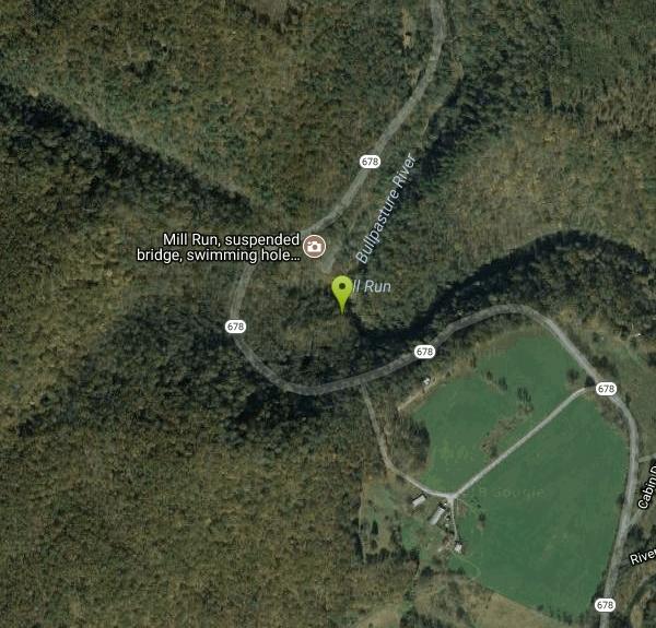
Bullpasture is a large boulder strewn mountain stream that holds both warmwater and cold water fish. Go west of Staunton on Route 250 until you reach McDowell. You will cross the Bullpasture entering McDowell. The road divides immediately - bear left. Stay on the road about 10 miles until you hit the gorge - you'll know when you reach it - there are steep mountain sides on the right side of the road and a drop to the river on the left and more mountain walls on the far side. The river will start to show Stocked Virginia trout waters signs. From the other direction, wend your way from Route 39 towards Williamsville. The Bull is stocked here and the gorge begins just upstream. Accomodations are in Monterey just up the road from McDowell.
https://www.virginia.org/listing/bullpasture-gorge/6587/Bullpasture Gorge | American Whitewater
National Whitewater Inventory
https://www.americanwhitewater.org/content/River/view/river-detail/4374/mainHighland Wildlife Management Area – Bullpasture Gorge and Mountain | Virginia DWR
Notice Regarding Scheduled Website Maintenance on June 23
https://dwr.virginia.gov/vbwt/sites/highland-wma-bullpasture-gorge-and-mountain/Be courteous, informed, and prepared. Read trailhead guidelines, stay on the trail, and don't feed the wildlife.
Read More
- Plan Ahead and Prepare
- Travel & camp on durable surfaces
- Dispose of waste properly
- Leave what you find
- Minimize campfire impacts
- Respect wildlife
- Be considerate of other visitors
Directions
From Williamsville, Virginia
- Head west on State Rte 614 toward State Rte 678 (39 ft)
- Turn right onto State Rte 678 (2.0 mi)

Other Hiking Trails, Canoeing Areas, Kayaking Areas, and Whitewater Rapids Nearby

North River Gap
Mount Solon, Virginia
25.5 miles NEA free recreation area with an easy 2.4-mile river gorge hike through lush forest, a wading and swimming spot in the North River, and primitive campsites for $5 a night.
Camp, Hike, Swim 
Natural Chimneys
Mount Solon, Virginia
29.2 miles ETowering vertical limestone formations draped in trees and vines, with shallow river swimming holes, 2.5 miles of hiking and biking trails, and a well-equipped 135-site campground.
Camp, Hike, Mountain Bike, Swim 
St. Mary's Falls
Raphine, Virginia
33.2 miles SEBlue-green water and unique low rock formations set the scene at this cascading waterfall swimming hole in St. Mary's Wilderness — a 4.4-mile out-and-back hike through George Washington National Forest.
Hike, Swim 
High Falls
Elkins West, Virginia
38.1 miles NA 7.5-mile moderate hike or mountain bike ride in West Virginia leading to a spectacular waterfall with a swimming hole below — or skip the hike and ride the train in from Bemis for about $10.
Hike, Swim 
Shoe Creek
Roseland, Virginia
40.2 miles SETwo miles of Class III-V rapids and multiple surrounding creeks for kayakers and rafters, plus a high-clearance off-road trail for 4WD adventurers along Shoe Creek in Virginia.
Whitewater 
Pauls Creek
Nellysford, Virginia
44.3 miles SEA quick 1.2-mile hike along Paul's Creek leads to a cascading waterfall and a natural water slide — stones smoothed by the water let visitors slide right into the swimming hole below.
Hike, Swim 
Seneca Falls
Seneca Rocks, West Virginia
44.5 miles NA moderately difficult 3.5-mile forested hike to Seneca Falls — a cascade encircling a clear pool with a sloping rocky beach where you can swim right beneath the falls.
Hike, Swim 6.1 mi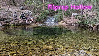
Rip Rap Hollow
Crozet, Virginia
44.9 miles EA 50-foot, mountain-fed swimming hole on a difficult 10-mile Shenandoah Valley loop that also passes Chimney Rock and a scenic waterfall — cold, clear, and worth the effort.
Hike, Swim 15.7 mi
Sugar Hollow
Crozet, Virginia
45.8 miles EAn 11-mile loop starting and ending at Sugar Hollow Reservoir, passing Blue Hole and Rip Rap swimming holes — a hiker's way to combine challenge with a cool dip in Shenandoah.
Hike, Swim 
Mint Springs Valley Park
Crozet, Virginia
47.7 miles ETwo small lakes with sandy beaches, miles of forested hiking and mountain biking trails, a sand volleyball pit, and a playground — all in an eight-acre valley park near Crozet, Virginia.
Hike, Mountain Bike, SwimNearby Campsites
North River Gap
Mount Solon, Virginia
25.5 miles NEA free recreation area with an easy 2.4-mile river gorge hike through lush forest, a wading and swimming spot in the North River, and primitive campsites for $5 a night.
Camp, Hike, Swim
Natural Chimneys
Mount Solon, Virginia
29.2 miles ETowering vertical limestone formations draped in trees and vines, with shallow river swimming holes, 2.5 miles of hiking and biking trails, and a well-equipped 135-site campground.
Camp, Hike, Mountain Bike, Swim


