


Colorado Trail: Kenosha Pass To Breckenridge
Jefferson, Colorado
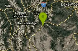
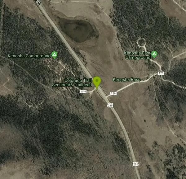
| Address: | ~Forest Rd 849, Jefferson, CO 80456, USA |
| GPS: |
39°24'46.4"N 105°45'31.5"W Maps | Directions |
| State: | Colorado |
| Trail Length: | 33.00 miles |
| MTB Difficulty: | Advanced |
| Trail Type: | Other |
| MTB Trail Type: | Singletrack |
Mountain Bike
Begin at Kenosha Pass trailhead. Best to get an early start if possible, as this trail took us much longer than we thought it would. The trail out of Kenosha is fairly easy and definitely scenic. It has a balance of uphill and downhill, although it does climb more as you get closer to the Georgia Pass area. This section is very lush and can be pretty treacherous when wet as there are many roots on parts of the trail that made for some slow going. Weather is unpredictable here too, so plan for bad weather!The ascent up to Georgia Pass is more or less an easy climb, although the altitude (you are just above treeline) and strong winds may add some excitement for you. Once at the top, the views on both sides make the climb worthwhile and you will definitely want to bring a camera to record your journey. It is about 12 miles from Kenosha to the top, and may take about 3 hours depending on your ability. Technically, this section was not that hard.The backside of the pass is where things start to get interesting. Once off the pass, you will immediately hit some great singletrack downhill and the climb up is forgotten. However, after a few miles you will run into some rocky sections of large boulders in the trail that will probably slow you down quite a bit. Roots are quite common in this section as well...and can also take their toll. We ran out of water (we carry 3L Camelbaks) about 6 miles below the pass, so make sure you take a water filter out there!The CO Trail has been re-routed in one key place, and instead of following the road down for almost the entire length of the trail (as it appears on older maps), it now has a significant climb added in. If you have an up-to-date map, you will see this climb about 10-12 miles down from Georgia Pass. Be prepared as it is about 1000' over 1.5 miles and was quite difficult after having ridden in high altitude and having about 22 miles of trail behind us. It is a long steady climb to be sure, and you will be cursing the CO Trail folks for adding this section in...until you start going down again. This is some of the best singletrack you will encounter on the CO Trail anywhere from this point back to Denver. From the top of this ascent, almost all the way to Hwy 9, there are fantastic descents, easy and scenic forest sections, and just a few short climbs thrown in to keep you honest. Just great riding for the last 10 or so miles.Once into Breckenridge, it is about a 4 mile ride up the bike path (south) until you get into the business part of town. You can ride to wherever you arranged to meet your friends. Have a nice meal, then jump in the car, head back to Kenosha (approx. 1 hour by car) to get your other vehicle, and call it a day. It took us about 8 hours to do the 32 trail miles...but we had some rain which made things extra slick and slow in a few places. A good weather day might cut that time somewhat. As with most any trail, you will want to bring a good map with you (we used the Latitude 40, Summit County Trails map). Courtesy of Singletracks.com
More Information
Colorado Trail: Kenosha Pass To Breckenridge Mountain Bike Trail in Breckenridge, Colorado - Directi
Colorado Trail: Kenosha Pass To Breckenridge is a singletrack mountain bike trail in Breckenridge, Colorado. View maps, videos, photos, and reviews of Colorado Trail: Kenosha Pass To Breckenridge bike trail in Breckenridge.
http://www.singletracks.com/bike-trails/colorado-trail-kenosha-to-breckenridge/Never modify trail features. Ride trails when they're dry enough that you won't leave ruts. Speak up when you see others on the trail and always yield to hikers, horses, and others coming uphill. Always ride on the established trail.
Read More
- Plan Ahead and Prepare
- Travel & camp on durable surfaces
- Dispose of waste properly
- Leave what you find
- Minimize campfire impacts
- Respect wildlife
- Be considerate of other visitors
Directions
From Jefferson, Colorado
- Head northeast on US Hwy 285 N toward Michigan Creek Rd (4.4 mi)
- Turn left onto Colorado TrailDestination will be on the left(43 ft)
Other Mountain Bike Trails Nearby
Colorado Trail: Kenosha Pass To Lost Creek Wilderness Bound
Jefferson, Colorado
0.0 miles EA 6.5-mile-each-way Colorado Trail ride from Kenosha Pass to the Lost Creek Wilderness boundary — flowy, fast descents with tacky dirt and technical climbs make this a totally awesome outing.
Mountain Bike
Burning Bear Trail
Grant, Colorado
4.3 miles NA challenging out-and-back mountain bike climb near Grant reaching 10,800 feet — steep, rocky, and loose from both ends with relentless terrain throughout.
Mountain Bike
Colorado Trail: Kenosha Pass To Lost Creek Wi
Bailey, Colorado
6.1 miles NEA 13-mile out-and-back on the Colorado Trail from Kenosha Pass to the Lost Creek Wilderness boundary — fast, flowy downhills with tacky dirt and technical climbs on a classic Colorado singletrack.
Mountain Bike
Guniella Pass Camping - No Fees
Grant, Colorado
6.3 miles NEA 17-site campground split into two loops in a spruce forest west of Denver, with 10 RV-friendly sites, tent pads, fire grates, picnic tables, restrooms, and water — no fees.
Camp, Mountain Bike
Bruno Gulch / South Park Trail #600
Dillon, Colorado
7.9 miles NA steep, rocky singletrack climb up Bruno Gulch connecting to South Park Trail near Dillon — lush forest, fine singletrack, and great scenery reward the effort.
Mountain Bike
Geneva Basin Ski Resort Trail
Dillon, Colorado
7.9 miles NA mountain bike ride near Dillon connecting singletrack, old 4x4 trails, and the runs of an abandoned ski resort — where old runs spell 'ski' when viewed from the top of Bierstadt.
Mountain Bike
Argentine Pass
Idaho Springs, Colorado
18.9 miles NA historic mountain bike route following the old Argentine Central railroad grade to the ghost town of Waldorf, with access to Argentine Pass beyond.
Mountain Bike
Bakerville Loveland Valley Trail
Silver Plume, Colorado
19.4 miles NA nearly all-downhill 12-mile shuttle from Loveland Valley to Georgetown along a historic trail with great Continental Divide views and vintage stone bridges along the way.
Mountain Bike
Colorado Trail: Redskin Mountain
Bailey, Colorado
19.8 miles EA mix of Colorado Trail singletrack and forest roads near Bailey — mostly downhill for the first 5 miles, with Gashouse and Miller Gulch trails rounding out a solid if route-complex loop.
Mountain Bike
Pavilion Point Loop
Georgetown, Colorado
21.1 miles NA training ride classic from Georgetown combining pavement, doubletrack, and swooping singletrack with a 5-mile, 1,500-foot climb to a 7-mile Argentine Railroad Grade downhill.
Mountain Bike
Empire Pass
Georgetown, Colorado
21.1 miles NA mile-long singletrack former stagecoach road linking Georgetown and Empire, with options to extend up to Empire Pass and onward toward Democrat and Republican Mountains.
Mountain Bike
Pavilion Point / Silverdale / Silver Creek / Empire Pass
Georgetown, Colorado
21.2 miles NA big technical loop near Georgetown through historic mining camps on old wagon roads, mule trails, and railroad grades — best ridden counterclockwise.
Mountain Bike
Blackjack / Raspberry Ridge
Pine, Colorado
22.6 miles EA gnarly black diamond freeride trail at Buffalo Creek with drops up to five feet, steep chutes, chunky rock gardens, and double-black-diamond features that demand respect.
Mountain Bike
Cub Creek Trail
Evergreen, Colorado
22.7 miles NEWide singletrack through loose gravel that climbs into the Mt. Evans Wilderness boundary — a significant uphill first stretch with a good five miles of riding before the turnaround.
Mountain Bike
Buffalo Creek
Pine, Colorado
23.4 miles EAn epic mountain bike loop near Pine with a steady climb up Buffalo Creek Road, slickrock on Baldy Trail, and screaming singletrack descents on Charlie's Cutoff and Sandy Wash.
Mountain Bike
Barbour Fork Loop
Idaho Springs, Colorado
23.5 miles NEA tough but rewarding loop with insane climbs, killer downhills, open meadows, and aspen forests — route-finding is tricky on Van Eden property, so a GPS track helps.
Mountain Bike
Baldy Trail
Pine, Colorado
23.8 miles EA loop trail that pairs with Gashouse Gulch for a 6-mile ride from the Gashouse trailhead or stretches to 9 miles via Redskin Creek Trail from Meadows Campground.
Mountain Bike
Maxwell Falls
Evergreen, Colorado
24.2 miles NEA steep, rocky, technical climb that rewards the suffer with a descent that makes it all worthwhile — link with Cub Creek for extra mileage.
Mountain Bike
Hicks Mountain
Evergreen, Colorado
24.6 miles NEAn old road ride through flat-then-overgrown terrain near Evergreen, ending with a quarter-mile hike to a cliff overlooking Upper Bear Creek — the return trip is the real reward.
Mountain Bike
Flying J Ranch
Conifer, Colorado
25.0 miles ESuper easy singletrack with a clockwise Shadow Pine loop that feels longer on the descent than what you earned on the climb — perfect for true beginners on the Front Range.
Mountain BikeNearby Campsites
Guniella Pass Camping - No Fees
Grant, Colorado
6.3 miles NEA 17-site campground split into two loops in a spruce forest west of Denver, with 10 RV-friendly sites, tent pads, fire grates, picnic tables, restrooms, and water — no fees.
Camp, Mountain Bike
Fulford Cave
Basalt, Colorado
48.3 miles WA large sandstone cave near Meeker carved by an underground river, with a lake several hundred meters inside and caverns only reachable by underwater diving — free to explore.
Camp, Cave


