


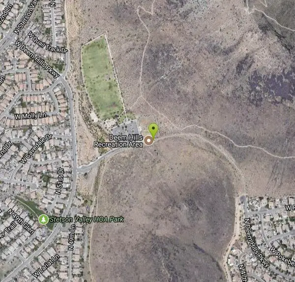
Deem Hills Circumference Trail with Summit
Phoenix, Arizona

| Address: | ~26606 N Deem Hills Pkwy, Phoenix, AZ 85085, USA |
| GPS: |
33°43'37.8"N 112°9'55.2"W Maps | Directions |
| State: | Arizona |
| Trail Length: | 3.90 miles |
| Elevation Gain: | 597.00 feet |
| Hike Difficulty: | Intermediate |
| Trail Type: | Loop |
Pet Friendly
Hike
Deem Hills is one of the newer parks in Phoenix to open (2010) and as such a lot of people still don't know it's there. This means that it has much more of a secluded feel then some of the more well established trails around. It IS popular with mountain bikers though so be on the lookout for them as they like the more sparse feel as well. The main park entrance is in the Stetson Hills community with the nearest cross streets of 51st Ave and Happy Valley Rd. Deem Hills is really 2 hills in one with a just under 6 mile circumference trail around both. The trail itself is actually pretty nice and well cut through the desert but be aware that it can still be pretty loose in places, probably because it is so new. For an average hiker it's a very nice hike but for a beginner there are inclines that might seem a bit tough in places, especially if you head up to the summit (the Ridgeline Trail). The summit has a couple nice overlooks where you can take some pictures and is challenging enough to be worth the effort but this isn't really a workout type of hike. After all you're only gaining about 600 ft total. Avoiding the Ridgeline Trail cutting through the middle on part of the Basalt Trail cuts about a mile off the distance making this side great for a quick 3 mile exercise. Courtesy of AllTrails.com
More Information
Add ResourceBe courteous, informed, and prepared. Read trailhead guidelines, stay on the trail, and don't feed the wildlife.
Read More- Plan Ahead and Prepare
- Travel & camp on durable surfaces
- Dispose of waste properly
- Leave what you find
- Minimize campfire impacts
- Respect wildlife
- Be considerate of other visitors
Directions
From Phoenix, Arizona
- Head west on W Washington St toward 1st Ave (1.2 mi)
- Continue onto W Adams St (0.8 mi)
- Turn right onto N Black Canyon Hwy (75 ft)
- Take the ramp on the left onto I-17 N/US-60 WContinue to follow I-17 N(17.9 mi)
- Take exit 218 for Happy Valley Road (0.2 mi)
- Merge onto N Black Canyon Hwy (0.2 mi)
- At the traffic circle, take the 3rd exit onto W Happy Valley Rd (0.3 mi)
- At the traffic circle, take the 1st exit and stay on W Happy Valley Rd (2.9 mi)
- Turn right onto N 51st Ave (0.3 mi)
- Continue onto N Stetson Valley Pkwy (0.3 mi)
- Turn right onto W Deem Hills Pkwy (0.5 mi)
- Turn right (0.2 mi)
Other Hiking Trails Nearby
Deem Hills Circumference Trail
Phoenix, Arizona
0.1 miles NWDeem Hills s a 10.5 mile loop trail located near Phoenix, Arizona. The trail is rated as moderate and primarily used for mountain biking.
Hike, Horseback, Mountain Bike
Deem Hills East Trail
Phoenix, Arizona
1.3 miles EDeem Hills is one of the newer parks in Phoenix to open (2010) and as such a lot of people still don't know it's there. This means that it has much more of a secluded feel then some of...
Hike
Deem Hills Inner Loop
Phoenix, Arizona
1.3 miles EHike and Mountain Bike near Phoenix, Arizona
Hike, Mountain Bike
Palisade to Basalt to Circumference Trail Loop
Phoenix, Arizona
1.3 miles EHike near Phoenix, Arizona
Hike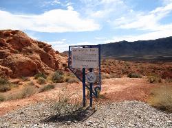
Arrowhead Point Trail
Glendale, Arizona
2.2 miles SArrowhead Trail is a 2.4 mile hiking and mountain biking trail within Thunderbird Conservation Park. This trail is manageable enough for beginners, but offers enough challenge for more experienced...
Hike, Mountain Bike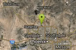
Thunderbird H-2 Trail
Glendale, Arizona
2.2 miles SThe trail is great for hiking and normally takes 1-3 hours. This is a nice, steady, non-strenuous, climb to the summit for anyone who is somewhat active. The type of incline where you...
Hike
Thunderbird H-1 H-2 H-3 Loop Trail
Glendale, Arizona
2.2 miles SHike and Mountain Bike near Glendale, Arizona
Hike, Mountain Bike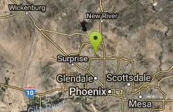
H-1 to H-4 Trails Loop
Glendale, Arizona
3.0 miles SWThunderbird Park in Glendale, AZ consists of 5 H-Trails, named so because of the Hedgpeth Hills through which they wind. H-1: One-Way - 5.0 miles H-1a: Loop trail - 2.5 miles - 400...
Hike, Mountain Bike
Union Peak Loop
Phoenix, Arizona
4.0 miles EHike near Phoenix, Arizona
Hike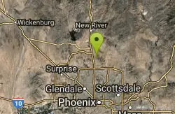
Hawk's Nest/Desert Tortoise/Dixie Mountain Loop
Phoenix, Arizona
4.0 miles EA nice moderate trail through great desert scenery crossing creeks and twisting and turning around the hills. Provides a loop opportunity between Hawk's Nest Trail, Valle Verde Trail,...
Hike, Horseback, Mountain Bike
Hawk's Nest Trail and Dixie Mountain Loop
Phoenix, Arizona
4.0 miles EModerate Trail providing access from the Car Park to all other trails. Directly links to Desert Tortoise Trail and Dixie Mountain Loop. Good hiking shoes/boots recommended....
Hike, Horseback, Mountain Bike
Dixie Mountain Loop Trail
Phoenix, Arizona
4.0 miles EThe main loop trail at Phoenix's Sonoran Preserve provides plenty of options for either a short walk or a longer hike. The elevation gain is accumulated through small ups-and-downs along the...
Hike, Horseback, Mountain Bike
Dixie Mountain Loop with Two Summits
Phoenix, Arizona
4.0 miles EHike, Horseback, and Mountain Bike near Phoenix, Arizona
Hike, Horseback, Mountain Bike 2.8 mi
Desert Tortoise
Phoenix, Arizona
4.0 miles EAt just over a mile long, Desert Tortoise is a doubletrack connector to the Valle Verde Trail. Very good hiking area with a good range of difficulty levels. Starts with a short climb from the...
Hike, Mountain Bike
Western Vista Trail
Phoenix, Arizona
4.0 miles EFairly difficult short Trail to one of the summits on the Dixie Mountain Loop. Great views from the top as well as a birds eye view of the gravel pit below.
Hike
Dixie Summit Trail
Phoenix, Arizona
4.0 miles EA steep and difficult short trail using many switchbacks to get to the summit. You will be rewarded with spectacular views of the surrounding area.
Hike
Bobcat Trail - Sonoran Preserve
Phoenix, Arizona
4.8 miles NEBobcat Trail is a short, easy trail, often used for connecting to other bigger trails in the Sonoran Desert Preserve. This is a 2 mile out-and back trail. There isn't much of a parking...
Hike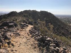
Sunrise Mountain Trail
Peoria, Arizona
4.8 miles WThe Sunrise Mountain Trail can be found within the suburban area of Peoria, Arizona; it is made of up 3 sequential loops; each loop harder than the last. The trail is easy to find, as...
Hike, Mountain Bike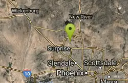
West Wing Mountain Advanced Trail
Peoria, Arizona
4.9 miles WHike near Peoria, Arizona
Hike
Sidewinder-Ocotillo-West Loop
Phoenix, Arizona
6.8 miles NEThis loop starts at Carefree Hwy and 7th Ave, be aware there is limited parking at the trailhead. The Ocotillo part of the trail is relatively flat and the Sidewinder part has some good...
Hike, Horseback, Mountain BikeNearby Campsites

Lower Salt River Nature Trail
Fort McDowell, Arizona
31.6 miles SEThe Lower Salt River Nature Trail is a scenic walk to take at the Tonto National Forest. This trail provides stunning views as you walk alongside the Salt River. This rustic trail is older and less...
Camp, Hike
Buckhorn Campground Nature Trail
Apache Junction, Arizona
36.0 miles SECamp and Hike near Apache Junction, Arizona
Camp, Hike


