


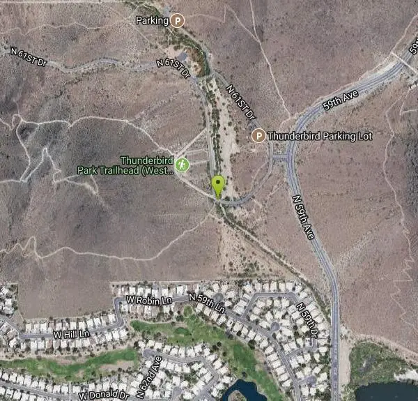
H-1 to H-4 Trails Loop
Glendale, Arizona
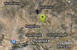
| Address: | ~N 60th Ave, Glendale, AZ 85310, USA |
| GPS: |
33°41'20.6"N 112°11'25.1"W Maps | Directions |
| State: | Arizona |
| Trail Length: | 2.10 miles |
| Elevation Gain: | 423.00 feet |
| Hike Difficulty: | Beginner |
| Trail Type: | Loop |
Pet Friendly
Hike and Mountain Bike
Thunderbird Park in Glendale, AZ consists of 5 H-Trails, named so because of the Hedgpeth Hills through which they wind. H-1: One-Way - 5.0 miles H-1a: Loop trail - 2.5 miles - 400 foot elevation gain - H-2: One-Way - 1.35 miles - 385 foot elevation gain (accessed via H-1 trail) - ascends Pinnacle Peak - connects with the H-1 to form a loop H-3: One-Way - 2.6 miles - 550 foot elevation gain - 1.5 hours est time - connects with the H-1 to form a loop H-4: One-Way - 1.3 miles - 350 foot elevation gain - .1.5 hours est time - connects with the H-1 via spur trail H-4a or H-4b to form a loop H-5: One-Way - 0.75 miles There are a number of "spur trails" that connect the various main trails. Although the trails are described as "Out and Back" or "One-Way" and the distances show that scenario, most people the use this trail network take a combination of trails that form an overall loop. To get one's true distance traveled, a pedometer is needed. Overall, there are a total of over 20 miles of trails in the network through the Hedgpeth Hills. Courtesy of AllTrails.com
Last updated September 30, 2017
More Information
Add ResourceNever modify trail features. Ride trails when they're dry enough that you won't leave ruts. Speak up when you see others on the trail and always yield to hikers, horses, and others coming uphill. Always ride on the established trail.
Read MoreBe courteous, informed, and prepared. Read trailhead guidelines, stay on the trail, and don't feed the wildlife.
Read More- Plan Ahead and Prepare
- Travel & camp on durable surfaces
- Dispose of waste properly
- Leave what you find
- Minimize campfire impacts
- Respect wildlife
- Be considerate of other visitors
Directions
From Glendale, Arizona
- Head northwest on US-60 W/Grand Ave toward W Myrtle Ave (5.5 mi)
- Turn right onto N 91st Ave (0.2 mi)
- Take the Arizona 101 Loop N ramp (0.5 mi)
- Merge onto AZ-101 Loop N (6.8 mi)
- Take exit 19 for 59th Ave (0.3 mi)
- Merge onto W Beardsley Rd (433 ft)
- Turn left onto N 59th Ave (1.6 mi)
- Turn left onto N 60th Ave (194 ft)
- Turn left to stay on N 60th Ave (0.1 mi)
Other Mountain Bike Trails and Hiking Trails Nearby
Dixie mountain
Glendale, Arizona
0.8 miles WGreat network of trails including some beginner to intermediate. Connect as many loops as you want to get the desired distance or connect to the north Sonoran preserve via connector...
Mountain Bike
Thunderbird H-1 H-2 H-3 Loop Trail
Glendale, Arizona
0.9 miles NEHike and Mountain Bike near Glendale, Arizona
Hike, Mountain Bike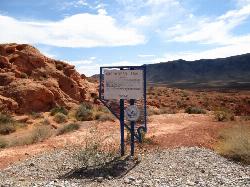
Arrowhead Point Trail
Glendale, Arizona
0.9 miles NEArrowhead Trail is a 2.4 mile hiking and mountain biking trail within Thunderbird Conservation Park. This trail is manageable enough for beginners, but offers enough challenge for more experienced...
Hike, Mountain Bike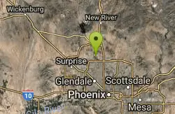
Thunderbird H-2 Trail
Glendale, Arizona
0.9 miles NEThe trail is great for hiking and normally takes 1-3 hours. This is a nice, steady, non-strenuous, climb to the summit for anyone who is somewhat active. The type of incline where you...
Hike
Thunderbird Park
Phoenix, Arizona
2.1 miles NThis trail is very rocky. Bring plenty of water because there is no shaded areas and it gets hot in Arizona. Overall a fun trail. I used a hard tail with a head shock but took it...
Mountain Bike
Sonoran Preserve North
Phoenix, Arizona
2.1 miles NNice rolling single track with many steep sustained climbs and fun flawy downhills. No technical features but good fitness is needed. If you do all the climbs and loops can get in over...
Mountain Bike
Deem Hills Circumference Trail with Summit
Phoenix, Arizona
3.0 miles NEDeem Hills is one of the newer parks in Phoenix to open (2010) and as such a lot of people still don't know it's there. This means that it has much more of a secluded feel then some of...
Hike
Deem Hills Circumference Trail
Phoenix, Arizona
3.0 miles NEDeem Hills s a 10.5 mile loop trail located near Phoenix, Arizona. The trail is rated as moderate and primarily used for mountain biking.
Hike, Horseback, Mountain Bike
Deem Hills East Trail
Phoenix, Arizona
4.1 miles NEDeem Hills is one of the newer parks in Phoenix to open (2010) and as such a lot of people still don't know it's there. This means that it has much more of a secluded feel then some of...
Hike
Deem Hill
Phoenix, Arizona
4.1 miles NEThe trail starts out going north around the mountain then heads uphill and gives you some good inclines with switch backs. Total incline is approximately 650'. The trail is rocky and...
Mountain Bike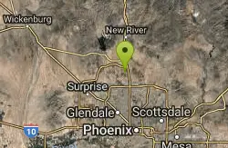
Deem Hills Inner Loop
Phoenix, Arizona
4.1 miles NEHike and Mountain Bike near Phoenix, Arizona
Hike, Mountain Bike
Palisade to Basalt to Circumference Trail Loop
Phoenix, Arizona
4.1 miles NEHike near Phoenix, Arizona
Hike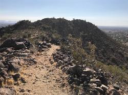
Sunrise Mountain Trail
Peoria, Arizona
4.4 miles NWThe Sunrise Mountain Trail can be found within the suburban area of Peoria, Arizona; it is made of up 3 sequential loops; each loop harder than the last. The trail is easy to find, as...
Hike, Mountain Bike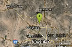
West Wing Mountain Advanced Trail
Peoria, Arizona
4.5 miles NWHike near Peoria, Arizona
Hike
Glendale Canal
Glendale, Arizona
5.0 miles SHike, Horseback, and Mountain Bike near Glendale, Arizona
Hike, Horseback, Mountain Bike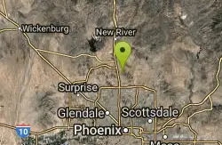
Sonoran Trail
Phoenix, Arizona
6.4 miles NEThe Sonora Trail is smooth, but hilly, and has a 10-12 mile loop course that is well marked at intersections. This ride is suitable for many levels, but beginners should have good...
Mountain Bike
Union Peak Loop
Phoenix, Arizona
6.4 miles NEHike near Phoenix, Arizona
Hike
Hawk's Nest/Desert Tortoise/Dixie Mountain Loop
Phoenix, Arizona
6.4 miles NEA nice moderate trail through great desert scenery crossing creeks and twisting and turning around the hills. Provides a loop opportunity between Hawk's Nest Trail, Valle Verde Trail,...
Hike, Horseback, Mountain Bike
Hawk's Nest Trail and Dixie Mountain Loop
Phoenix, Arizona
6.4 miles NEModerate Trail providing access from the Car Park to all other trails. Directly links to Desert Tortoise Trail and Dixie Mountain Loop. Good hiking shoes/boots recommended....
Hike, Horseback, Mountain Bike
Dixie Mountain Loop with Two Summits
Phoenix, Arizona
6.4 miles NEHike, Horseback, and Mountain Bike near Phoenix, Arizona
Hike, Horseback, Mountain BikeNearby Campsites

Lower Salt River Nature Trail
Fort McDowell, Arizona
32.1 miles EThe Lower Salt River Nature Trail is a scenic walk to take at the Tonto National Forest. This trail provides stunning views as you walk alongside the Salt River. This rustic trail is older and less...
Camp, Hike
Buckhorn Campground Nature Trail
Apache Junction, Arizona
36.1 miles SECamp and Hike near Apache Junction, Arizona
Camp, Hike


