


Dos Rios Swimming Hole
Dos Rios, California
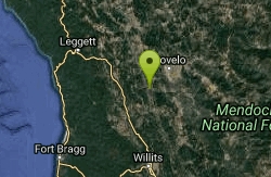
| Address: | Dos Rios, CA, USA |
| GPS: |
39°42'52.6"N 123°21'8.8"W Maps | Directions |
| State: | California |
Swim
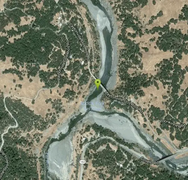
Dos Rios, Spanish for "two rivers," sits at the wild confluence of the Middle Fork and the mainstem of the Eel River in the remote backcountry of northern Mendocino County, California, roughly east and a little north of Willits. It's a place defined by moving water and deep isolation: two rushing forks of a federally protected Wild and Scenic river meeting in a rugged, sparsely populated canyon, with clear green swimming holes strung along both the mainstem and the Middle Fork. For those willing to make the drive into this far corner of the North Coast, it rewards with cool, quiet swims and some of the most beautiful undeveloped river scenery in the state.
The swimming is the everyday draw. Summer flows drop and warm into inviting pools along the gravel bars and bedrock ledges of both rivers, and the highest public use tends to cluster downstream near the Eel River Work Center and Eel River Campground, where trails and dirt roads give access to the water. Away from those spots, the canyon is big and empty enough that a little exploration on foot can turn up a pool all to yourself. The water is clearest and most swimmable from mid to late summer, once spring runoff has passed and the river settles into its warm-season rhythm.
Dos Rios is also a storied gateway for paddlers. The confluence is the classic put-in for a multi-day wilderness rafting and kayaking trip down the Eel River Canyon to Alderpoint, a remote springtime run through country with almost no road access, best attempted by experienced boaters when flows are right. That same remoteness is what keeps the whole area feeling untouched.
Because this is deep, roadless-feeling backcountry, it deserves a cautious, self-reliant approach. The Eel and its forks swing from a powerful, cold torrent in spring runoff to gentle summer pools, and conditions vary hugely by season, so it's worth reading the water carefully before swimming and staying well clear of the current during high flows. Services are scarce, cell coverage is spotty at best, and summer heat in the inland canyon can be intense.
Plan Dos Rios as the remote outing it is: come with a full tank of gas, plenty of water and food, sun protection, sturdy footwear for the rocky banks, and a map, since navigation apps can be unreliable out here. Let someone know your plans, keep a close eye on children and weaker swimmers around the moving water, and pack out everything you bring. The payoff for the effort is a genuinely wild two-rivers swim in one of California's last big, quiet river canyons.
More Information
California Creeks - Main Eel River
Springtime of a cold snowy year is an ideal time to run the main Eel. Although flows might be low, Memorial Day offers a good long weekend. As long as the middle fork Eel contributes moderate flows from snowmelt, this stretch remains runnable in canoes or kayaks, sometimes well into June. The water is greener and swimming better at low flows, but float times are longer. A train track follows the river, but was shut down (permanently?) in 1998. Railroad debris in the channel often detracts from the scenery, but could be considered historic.
https://www.cacreeks.com/eel-main.htmPrograms: National Conservation Lands: California: Eel Wild and Scenic River | Bureau of Land Manage
The Eel River makes up the state’s third-largest watershed and flows through rugged interior mountains and fog-shrouded coastal rain-forest. The river supports one of California’s largest wild salmon and steelhead runs as well as its largest remaining old-growth redwood forests.The BLM manages Dos Rios, the popular put-in place for rafters and kayakers making the four-day run through the famous Eel River canyon to Alderpoint. The South Fork is a remote Class IV run through the Elkhorn Ridge Wilderness Area.The Eel River has received both state (1972) and federal (1981) wild and scenic river
https://www.blm.gov/programs/national-conservation-lands/california/eel-wsr
- Plan Ahead and Prepare
- Travel & camp on durable surfaces
- Dispose of waste properly
- Leave what you find
- Minimize campfire impacts
- Respect wildlife
- Be considerate of other visitors
Directions
From Dos Rios, California
- Head southeast on Laytonville Dos Rios RdDestination will be on the right(0.2 mi)
Other Swimming Holes Nearby
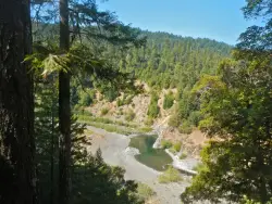
Standish-Hickey SRA Swimming Hole
Leggett, California
23.3 miles NWA California Redwood belt swimming hole on the South Fork of the Eel River — hike a quarter mile from Redwood Campground to a large pool popular for fishing, floating, and cliff jumping.
Camp, Hike, Swim
Navarro Area
Lakeshore, California
41.5 miles SWSwim near Lakeshore, California
Swim
Stony Gorge Reservoir
Elk Creek, California
44.9 miles ESandy beaches against oak-and-chaparral foothills frame this mid-sized low-elevation reservoir, where warm calm water is ideal for waterskiing, jet skiing, and paddling.
Camp, Canoe, Hike, Swim
Forest Glen
Forest Glen, California
45.7 miles NCamp and Swim near Forest Glen, California
Camp, Swim
Garden Club Grove
Myers Flat, California
49.3 miles NWFollow the Eel River through Redwood State Park to a secluded swimming pool that few visitors know about — park roadside and hike down to the riverbank for a quiet summer afternoon.
SwimNearby Campsites
Standish-Hickey SRA Swimming Hole
Leggett, California
23.3 miles NWA California Redwood belt swimming hole on the South Fork of the Eel River — hike a quarter mile from Redwood Campground to a large pool popular for fishing, floating, and cliff jumping.
Camp, Hike, Swim
Stony Gorge Reservoir
Elk Creek, California
44.9 miles ESandy beaches against oak-and-chaparral foothills frame this mid-sized low-elevation reservoir, where warm calm water is ideal for waterskiing, jet skiing, and paddling.
Camp, Canoe, Hike, Swim
Forest Glen
Forest Glen, California
45.7 miles NCamp and Swim near Forest Glen, California
Camp, Swim


