Neon Canyon and Golden Cathedral
Escalante, Utah
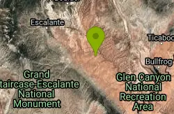
| Address: | Golden Cathedral Trailhead, Utah, USA |
| GPS: |
37°35'35.2"N 111°13'6.1"W Maps | Directions |
| State: | Utah |
Backpack, Canyoneer, and Hike
The Golden Cathedral is a unique hiking destination within lower Neon Canyon in the Grand Staircase-Escalante area. The Cathedral is locates just over 3/4 of a mile up Neon Canyon from its confluence at the Escalante River, and consists of a great, domed pour-off from upper Neon Canyon, where the water has dug three separate pothole arches into the overhang. When the sun is overhead, the daylight shines down through the arches in great, golden columns.
More Information
Hiking Guide: Golden Cathedral
Overview Grand-Staircase Escalante has no shortage of exceptional hikes, but the Golden Cathedral has to be in my top five. At the lower end of Neon Canyon, near its confluence with the Escalante River, your journey’s end brings you to three arches formed by potholes that had their bottoms erode away. This has resulted in a magnificent natural attraction, where beams of afternoon light shine down through the arches onto a shallow pool of water. The 9-mile out-and-back hike is challenging. You will need good navigation skills and be prepared to wade across the Escalante River. Quick Facts Distance: 9 miles
https://backobeyond.blog/hiking-guide-golden-cathedral/Hiking in Utah | Utah.com
The best way to experience the diverse landscapes of Utah is by hiking through them. Find information on hiking trails in Utah here.
https://www.utah.com/things-to-do/outdoor-recreation/hiking-backpacking/Be courteous, informed, and prepared. Read trailhead guidelines, stay on the trail, and don't feed the wildlife.
Read More
- Plan Ahead and Prepare
- Travel & camp on durable surfaces
- Dispose of waste properly
- Leave what you find
- Minimize campfire impacts
- Respect wildlife
- Be considerate of other visitors
Directions
From Escalante, Utah
- Head east on UT-12 E/
W Hwy 12/ W Main St/ W Sr 12 toward S Center St Continue to follow UT-12 E(5.0 mi) - Turn right onto BLM200/
Hole In The Rock Rd/ Hole-in-the-Rock-Trail (16.5 mi) - Turn left onto BLM240/
Egypt Rd Continue to follow BLM240(9.5 mi)
The trailhead is located on the overlook in the Egypt area, off of the Hole-in-the-Rock Road. The road leaves the Hole-in-the-Rock Road and heads east before swinging up toward the north and overlooking the cliffs of Egypt.

Other Hiking Trails, Canyons, and Backpacking Trails Nearby
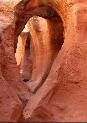
Peek-a-boo Gulch
Escalante, Utah
8.0 miles SA fun slot canyon hike in Grand Staircase-Escalante with named rock formations you can see straight through — often hiked as a 3.5-mile loop with neighboring Spooky Gulch.
Hike 4.9 mi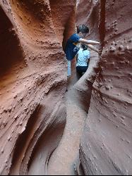
Spooky Gulch
Escalante, Utah
8.0 miles SA short slot canyon hike near Escalante with sections so narrow they're genuinely 'spooky' — sandy trails, stagnant water pools, and flash flood awareness required.
Hike 20.4 mi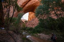
Coyote Gulch
Escalante, Utah
16.7 miles SEA remote 26-mile backpacker's slot canyon near Escalante with a flowing river, natural arches including Coyote Natural Arch and Jacob Hamblin Arch, and nights under the stars.
Backpack, Canyoneer, Hike 5.7 mi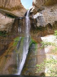
Lower Calf Creek Falls
Boulder, Utah
17.5 miles NWA stunning 126-foot waterfall at the end of an easy 6-mile canyon hike rewards with a cool swimming pool framed by cottonwood trees and ancient petroglyphs.
Hike, Swim 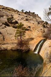
Upper Calf Creek Falls
Boulder, Utah
22.0 miles NWUpper Calf Creek Falls is a stunning desert oasis hidden in the slickrock country of Grand Staircase-Escalante National Monument, between Escalante and Boulder, Utah. An 87-foot waterfall pours over...
Hike, Swim 12.1 mi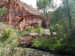
Escalante River
Escalante, Utah
23.2 miles NWThe Escalante River is the wild green thread running through the heart of the Grand Staircase-Escalante National Monument, and hiking it is one of the signature experiences of southern Utah's...
Hike, Horseback 0.1-0.3 mi
Mossy Cave
Tropic, Utah
49.3 miles WAn easy mile-long trail past red rock hoodoos, a mossy cave with a summer waterfall and winter icicle curtain, and a charming stream to wade through in water shoes.
Hike