


137 Hiking Trails near Arrowhead Point Trail
first prev 1 2 3 4 5 6 7 next lastShowing Hiking Trails within 50 miles Distance miles of 5461-5499 W Pinnacle Peak Rd, Glendale, AZ 85310, USA City, Zip, or Address
South Mountain Pyramid Trail
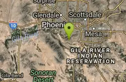
Phoenix, Arizona
27.6 miles SHike near Phoenix, Arizona
Hike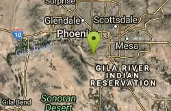
Pyramid Trail
Phoenix, Arizona
27.6 miles SHike near Phoenix, Arizona
Hike
Fountain Hills Park
Fountain Hills, Arizona
27.8 miles EFountain Park is a 1.3 mile loop trail located near Phoenix, Arizona ( in Fountain Hills) and is good for all skill levels. The trail is primarily used for hiking and is accessible...
Hike 1.5 mi

The Saddle
Mesa, Arizona
31.4 miles SESaddle trail is an intermediate mountain biking trail that connects to the greater Hawes trail network. The trail is 1.5-2mi long and it offers beautiful views of the neighboring Salt River and Red...
Hike, Mountain Bike 7.5 mi
Hawe's Loop
Mesa, Arizona
31.4 miles SEMost of the trails in the Phoenix metropolitan area were originally built by mountain bikers, and the Hawe's loop trail system and trail are no exeptions. This trail features fantastic...
Hike, Mountain Bike 2.1 mi
Lower Salt River Nature Trail
Fort McDowell, Arizona
31.6 miles EThe Lower Salt River Nature Trail is a scenic walk to take at the Tonto National Forest. This trail provides stunning views as you walk alongside the Salt River. This rustic trail is older and less...
Camp, Hike
Desert Trails Bike Park
Mesa, Arizona
31.7 miles SEHike and Mountain Bike near Mesa, Arizona
Hike, Mountain Bike
Riparian Preserve at Water Ranch Trail
Gilbert, Arizona
34.4 miles SEThe Riparian Preserve is an urban park with a series of loop trails surrounding seven ponds stocked with fish and birds. It is located at 2757 E. Guadalupe Road, Gilbert AZ. Several...
Canoe, Hike
Quartz Peak Trail
34.6 miles S
Hike near
Hike
Buckhorn Campground Nature Trail
Apache Junction, Arizona
35.7 miles SECamp and Hike near Apache Junction, Arizona
Camp, Hike 1.5 mi
Moon Rock Loop
Apache Junction, Arizona
36.2 miles SELocated within the larger Usery Mountain Regional Park, the Moon Rock loop is a fast and smooth trail that adds 1.3 miles to the more famous Blevins Trail. Although the Moon Rock loop is not known as...
Hike, Horseback, Mountain Bike 1.7 mi
Levee Trail
Mesa, Arizona
36.3 miles SELocated within the Usery Mountain Regional Park, the Levee trail is named so because it mostly follows the top of levee, running parallel to a large section of the channel trail and a Phoenix...
Hike, Horseback, Mountain Bike
Crismon Wash Trail
Mesa, Arizona
36.6 miles SEThe Crismon Wash Trail is 1.8 mile trail that is accessible from the south at the Crismon road trailhead. It is also accessible from the Blevins train to the north. There are several...
Hike, Horseback, Mountain Bike 1.4 mi
Ballantine Trail
Rio Verde, Arizona
39.6 miles Ethis trail looks a lot better once it moves away from the highway. A somewhat strenuous climb reveals a landscape of knuckle-and-joint, mica-imbedded boulders, deep gorges and a battalion of regal...
Hike
Siphon Draw Trailhead to Flatiron
Apache Junction, Arizona
43.5 miles EThe Siphon Draw Trail up to Flatiron is a beautiful trail within the Lost Dutchman State Park. It is a 5.5 mile, there and back trail near Apache Junction, Arizona. It is a more advanced hike with...
Hike 3.7 mi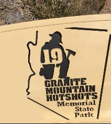
Granite Mountain Hotshots Memorial
Yarnell, Arizona
48.8 miles NWFrom the Observation Deck, you can see the Fatality Site 400’ below and the Town of Yarnell to the east. Additional interpretive signage outlines the tragic events of the Yarnell Hill Fire. A...
Hike 5.4 mi
Denton Trail #69
Tonto Basin, Arizona
49.6 miles EFrom FR 421, the trail climbs steadily up the east face of the mountain. Some sections are quite steep. The trail eventually tops out at 5,760 feet elevation and then descends to Big Pine Flat for...
Hike, Mountain Bike


