


137 Hiking Trails near Dreamy Draw Loop Trail
first prev 1 2 3 4 5 6 7 next lastShowing Hiking Trails within 50 miles Distance miles of 8611 N Dreamy Draw Dr, Phoenix, AZ 85028, USA City, Zip, or Address

Thompsons Peak
Fountain Hills, Arizona
15.8 miles EHike near Fountain Hills, Arizona
Hike
Dixie Mine
Fountain Hills, Arizona
15.8 miles EMcDowell Mountain Regional Park 16300 McDowell Mountain Park Dr. MMRP Arizona 85255 Ph: 480-471-0173 Fax: 602-372-8507 [email protected] Mailing...
Hike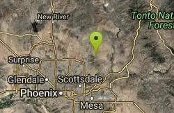
Tom's Thumb, Feldspar, and Marcus Landslide Loop
Scottsdale, Arizona
15.9 miles NEHike near Scottsdale, Arizona
Hike
Tom's Thumb Trail
Scottsdale, Arizona
15.9 miles NETom's Thumb Trail is a popular trail on the McDowell Sonoran Preserve due to its unique thumb-like granite rock formation. This is a 4.7 out-and-back, intermediate trail because of its 1,200...
Hike, Mountain Bike, Rock Climb 2.2 mi
Marcus Landslide Trail
Scottsdale, Arizona
15.9 miles NEThe Marcus Landslide Trail is named after ASU professor Melvin Marcus, a renouned geographer, after the discovery and recognition of the interesting geographical area in 2002. More than 500,000...
Hike, Horseback, Mountain Bike, Rock Climb
Corona Loop
Phoenix, Arizona
16.3 miles SThis is a good hike, take plenty of water and a map or gps would be a very good ideal. I went up the day after we got over a inch of rain so lot of places were washed out. i looked like...
Hike
Sidewinder-Ocotillo-West Loop
Phoenix, Arizona
16.5 miles NThis loop starts at Carefree Hwy and 7th Ave, be aware there is limited parking at the trailhead. The Ocotillo part of the trail is relatively flat and the Sidewinder part has some good...
Hike, Horseback, Mountain Bike
Tower Road - Sonoran Preserve
Phoenix, Arizona
16.5 miles NShort and steep (.6 mile each way) out and back asphalt road to the radio tower.
Hike
Corona de Loma Trail
Phoenix, Arizona
16.7 miles Squick climb to the top of Buena Vista lookout. Great view of the east vally
Hike
Sunrise Mountain Trail
Peoria, Arizona
17.0 miles NWThe Sunrise Mountain Trail can be found within the suburban area of Peoria, Arizona; it is made of up 3 sequential loops; each loop harder than the last. The trail is easy to find, as...
Hike, Mountain Bike
Telegraph Pass Trail
Phoenix, Arizona
17.2 miles STelegraph Pass Trail is a 2.3 mile beginner friendly, out-and-back trail in South Mountain Park in Phoenix. The first third or so of Telegraph Trail is paved, making it wheelchair...
Hike 6.1 mi
Goat Hill via Telegraph Pass Trail
Phoenix, Arizona
17.2 miles SThe views from the top of Goat Hill are awesome on a clear day as you can enjoy a 360 view. Telegraph Trail is kind of a sidewalk part of the after that a little bit rocky until you reach the summit...
Hike
West Wing Mountain Advanced Trail
Peoria, Arizona
17.2 miles NWHike near Peoria, Arizona
Hike
Pima and Dynamite Trail
Scottsdale, Arizona
17.3 miles NEPima and Dynamite is an area with a network of trails for hiking, but more popularly for mountain biking, in North Scottsdale, Arizona. The area feautures a variety of trails for...
Hike, Mountain Bike
Jane Rau Brown's Canyon Trail
Scottsdale, Arizona
17.3 miles NEThe Jane Rau Brown Canyon Trail was named after Jane Rau Brown, one of the pioneers of the McDowell Sonoran Conservancy, for her determination and passion in preserving the desert and the park....
Hike, Horseback, Mountain Bike
Brown Ranch Trail to Cone Mountain Trail
Scottsdale, Arizona
17.4 miles NEHike near Scottsdale, Arizona
Hike 12.6 mi
National Trail
Phoenix, Arizona
17.5 miles SNational Trail is the gem of South Mountain and home to the infamous Waterfall. It’s a local favorite as well as a destination trail for MTB snowbirds. Like most trails in the Sonoran...
Hike, Mountain Bike
Alta Trail And Bajada Trail
Phoenix, Arizona
17.5 miles SHike near Phoenix, Arizona
Hike
Clay Mine Trail
Cave Creek, Arizona
18.2 miles NClay Mine Trail is a 1.6 mile out-and-back, beginner friendly trail in Cave Creek Regional Park. This is a trail that is very close to the Visitor Center. It's not too difficult but there...
Hike
Fountain Park Trail
Fountain Hills, Arizona
18.4 miles EFountain views, Four Peaks view, desert vegetation, close to coffee! The trail is well groomed and well marked. It parallels some house as you begin to go up the first hill. About 15...
Hike, Mountain Bike


