


Goat Hill via Telegraph Pass Trail
Phoenix, Arizona

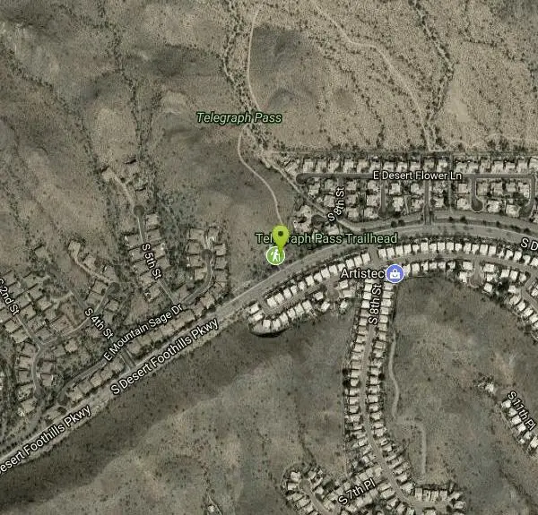
| Address: | ~14251 S Desert Foothills Pkwy, Phoenix, AZ 85048, USA |
| GPS: |
33°19'3.1"N 112°3'59.0"W Maps | Directions |
| State: | Arizona |
| Trail Length: | 5.70 miles |
| Trail Type: | Out & Back |
| Hike Difficulty: | Beginner |
| Elevation Gain: | 1276 feet |
| Trails/Routes: | 3.1 mi |
Pet Friendly
Hike
Goat Hill, reached via the Telegraph Pass Trail, is a rewarding summit hike in Phoenix's beloved South Mountain Park — one of the largest municipal parks in the country. The payoff is the view: on a clear day, the top of Goat Hill serves up a sweeping 360-degree panorama over the Valley of the Sun and the surrounding desert ranges.
The route starts out mellow — the lower Telegraph Pass Trail is smooth and almost sidewalk-like — before turning rockier as you climb toward the summit road and the final push to the top. It's a moderate outing that packs a big scenic reward into a relatively short distance, popular with locals for sunrise and sunset hikes.
This is exposed Sonoran Desert with very little shade, so the usual desert rules apply in force: go early or late in the warm months, carry plenty of water, and wear sun protection and real trail shoes for the rocky sections.
Watch for cyclists on the shared trails, and enjoy one of Phoenix's best bang-for-your-effort viewpoints — especially glorious as the city lights flicker on at dusk.
More Information
Add ResourceBe courteous, informed, and prepared. Read trailhead guidelines, stay on the trail, and don't feed the wildlife.
Read More
- Plan Ahead and Prepare
- Travel & camp on durable surfaces
- Dispose of waste properly
- Leave what you find
- Minimize campfire impacts
- Respect wildlife
- Be considerate of other visitors
Directions
From Phoenix, Arizona
- Head west on W Washington St toward 1st Ave (315 ft)
- Turn left onto S 1st Ave (397 ft)
- Turn left onto W Jefferson St (2.1 mi)
- Turn right onto the ramp to Tucson (0.3 mi)
- Merge onto I-10 E (6.3 mi)
- Keep left at the fork to stay on I-10 E (4.8 mi)
- Take exit 159 for Ray Road (0.5 mi)
- Turn right onto E Ray Rd (3.6 mi)
- Turn right onto E Chandler Blvd (1.7 mi)
- Turn right onto S Desert Foothills Pkwy (1.3 mi)
- Turn right (89 ft)
- Turn rightDestination will be on the left(26 ft)

Other Hiking Trails Nearby

Telegraph Pass Trail
Phoenix, Arizona
0.0 miles NWA 2.3-mile beginner-friendly trail in South Mountain Park with petroglyphs, saguaro views of metropolitan Phoenix, and a paved first section that's wheelchair accessible.
Hike 0.8-1.1 mi
Kiwanis Trail to Telegraph Pass Lookout
Phoenix, Arizona
1.7 miles NA short, beginner-friendly hike in South Mountain near Phoenix winding through a small canyon to Telegraph Pass — best enjoyed at sunrise or just before sunset for near-constant shade.
Hike, Mountain Bike 
Pyramid Trail
Phoenix, Arizona
2.2 miles SWHike near Phoenix, Arizona
Hike 2.5 mi
Hidden Valley from Buena Vista Trail
Phoenix, Arizona
2.2 miles NESurprisingly quiet and natural for a trail right on Phoenix's southern border, Hidden Valley winds through granite boulders, saguaro cacti, and sandy washes with lizards and the occasional chuckwalla.
Hike, Mountain Bike 
South Mountain Pyramid Trail
Phoenix, Arizona
2.2 miles SWThe Pyramid Trail is one of the classic hikes in South Mountain Park and Preserve, the enormous Phoenix municipal park that sprawls across the mountains on the southern edge of the city. Climbing...
Hike 2.5 mi
Holbert Trail to Dobbins Lookout
Phoenix, Arizona
2.4 miles NSouth Mountain's Holbert Trail climbs challenging switchbacks to Dobbins Lookout, delivering sweeping city and TV-tower views from the rooftop of Phoenix's urban mountain park.
Hike 
Holbert-Hidden Valley-Mormon Trail Shuttle
Phoenix, Arizona
2.4 miles NA 6.5-mile intermediate shuttle hike on South Mountain from ancient petroglyphs and a Hidden Valley rock playground to panoramic canyon and city views at Promontory Point.
Hike, Mountain Bike 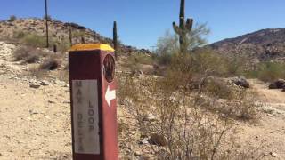
Max Delta
Phoenix, Arizona
2.5 miles NA 2.7-mile beginner trail near South Mountain Preserve with mine foundations, a standing brick fireplace, and Phoenix Valley views — remnants of a gold mine active in the early 1900s.
Hike 
Corona de Loma Trail
Phoenix, Arizona
3.0 miles EA quick trail climb to Buena Vista Lookout in Phoenix with great views of the east valley — a short, rewarding hike on the Corona de Loma Trail.
Hike 1.2 mi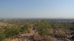
Ma-Ha-Tauk Trail
Phoenix, Arizona
3.0 miles NWA mostly easy 2.5-mile out-and-back trail in South Mountain Park connecting to many other trails, with views of downtown Phoenix and the Estrella Mountains — dogs welcome on leash.
Hike, Horseback 
Corona Loop
Phoenix, Arizona
3.2 miles EA Phoenix desert hike with nice trails that are mostly unmarked — bring a map or GPS, plenty of water, and expect a washed-out path after heavy rain.
Hike 
Old Man Trail
Phoenix, Arizona
3.4 miles NEA city-maintained trail in Phoenix's South Mountain Park open until 11 p.m. — entrance gates close at 7 p.m. but the trail itself stays accessible into the evening.
Hike 2.3 mi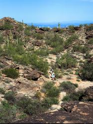
Hidden Valley Trail Via Mormon Trail
Phoenix, Arizona
3.9 miles NEA 2–4 mile hike through Phoenix's South Mountain featuring Fatman's Pass, a natural rock tunnel, petroglyphs, dry waterfalls, and sweeping desert views.
Hike, Mountain Bike 
Alta Trail And Bajada Trail
Phoenix, Arizona
4.6 miles WHike near Phoenix, Arizona
Hike 12.6 mi
National Trail
Phoenix, Arizona
4.6 miles WNational Trail at South Mountain is Phoenix's premier mountain bike destination — home to the infamous Waterfall feature, petroglyphs, saguaro cactus, and increasingly technical terrain east of Buena Vista Lookout.
Hike, Mountain Bike 2.1 mi
Marcos de Niza & Pima
Phoenix, Arizona
5.6 miles NEA hidden gem in South Mountain Park — attack the ridgeline on the Marcos de Niza trail, connect to the National Trail fire road, and jog home for a killer loop.
Hike 
South Mountain Trails (Desert Classic Trail)
Phoenix, Arizona
5.6 miles NEHike and Mountain Bike near Phoenix, Arizona
Hike, Mountain Bike 
South Mountain National Trail
Phoenix, Arizona
5.6 miles NEA scenic traverse of South Mountain Park from east to west, passing Hidden Valley, petroglyphs, abandoned mines, and multiple lookouts — with spectacular Phoenix valley views throughout.
Hike, Mountain Bike 
National to Hidden Valley to Mormon Loop
Phoenix, Arizona
5.6 miles NEHike near Phoenix, Arizona
Hike 
Pima Wash Trail to West Loop
Phoenix, Arizona
5.6 miles NEHike near Phoenix, Arizona
HikeNearby Campsites

Buckhorn Campground Nature Trail
Apache Junction, Arizona
27.9 miles NECamp and Hike near Apache Junction, Arizona
Camp, Hike 2.1 mi
Lower Salt River Nature Trail
Fort McDowell, Arizona
28.2 miles NEA 2-mile beginner loop alongside the Salt River in Tonto National Forest, with worn markers that keep things adventurous — watch for wild horses and spring cactus blooms.
Camp, Hike


