


70 Hiking Trails near Pelican Creek Nature Trail
first prev 1 2 3 4 next lastShowing Hiking Trails within 50 miles Distance miles of US-16, Yellowstone National Park, WY 82190, USA City, Zip, or Address

Mammoth/Gardiner Back Road
Mammoth Hot Springs, Yellowstone National Park
33.2 miles NWThe only road open in Yellowstone National Park is Highway 89 at Gardiner, Montana to park Headquarters at Mammoth Hot Springs and from Mammoth Hot Springs to Silver Gate and Cooke City, Montana.
Hike, Mountain Bike 7.9 mi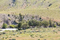
Rescue Creek Trail
Mammoth Hot Springs, Yellowstone National Park
35.5 miles NWRescue Creek Trail is an 8 mile hike that crosses the Montana/Wyoming boarder. This double trail makes for a leisurely hike through beautiful hills and colorful yellow green grasslands. This trail,...
Hike 1.9 mi
Terraced Falls
Grant Village, Yellowstone National Park
38.3 miles SW3.6 mile easy out and back trail. 430 ft Elevation gain. The trailhead is off Ashton-Flagg Ranch Road along Yellowstone's South border. Ashton-Flagg Ranch Road is closed during the winter.
Hike 15.9-16.6 mi
Union Falls & Ouzel Pool
Grant Village, Yellowstone National Park
41.8 miles SWBackpack, Hike, Hot Springs, and Swim near Grant Village, Yellowstone National Park
Backpack, Hike, Hot Springs, Swim 1.1 mi
Fish Lake
Ashton, Idaho
41.8 miles SWHike near Ashton, Idaho
Hike
Cave Falls of Yellowstone
Ashton, Idaho
42.8 miles SWThis campgrond is situated on the banks of Fall River in Wyoming along the south border of Yellowstone National Park. Cave Falls Campground has 23 single site units and a terrific area for...
Camp, Hike 14.8-30.2 mi
Mr. Bubbles Hot Spring
Old Faithful, Yellowstone National Park
44.2 miles SWMr. Bubbles is one of the few places you can actually soak in the thermal waters of Yellowstone National Park. The Bechler area of Yellowstone is one of the best kept secrets of the otherwise densely...
Hike, Hot Springs
Big Springs
Island Park, Idaho
44.2 miles WThere's also a great little walking trail along the river with placards that tell about the ecosystem and history of the area. There's about a 1/2 mile that's paved and then a 1/2 mile...
Camp, Hike 17.5 mi

Tear Drop Lake
Ashton, Idaho
44.5 miles SWNestled in the Targhee National Forest just off of Ashton's Fish Creek Road, this tear drop shaped lake is a family adventure waiting to happen. The lake isn't very big but it is teeming with...
Camp, Canoe, Hike, Kayak, Mountain Bike, Swim 10.1 mi
Sky Rim Trail to Sheep Mountain
Big Sky, Montana
49.2 miles NWSky Rim Trail to Sheep Mountain is a challenging hike with stunning and famous views. This 10 mile out-and-back trail starts at Dailey Creek Trailhead (WK1). The trail follows Dailey Creek over...
Backpack, Hike


