


Sky Rim Trail to Sheep Mountain
Big Sky, Montana

| Address: | Daily Creek Trailhead WK1, Gallatin Gateway, MT 59730, USA |
| GPS: |
45°2'7.2"N 111°6'50.9"W Maps | Directions |
| State: | Montana |
| Trails/Routes: | 10.1 mi |
Backpack and Hike
Sky Rim Trail to Sheep Mountain is a challenging hike with stunning and famous views. This 10 mile out-and-back trail starts at Dailey Creek Trailhead (WK1). The trail follows Dailey Creek over gentle slopes and through beautiful fields until it connects with Sky Rim Trail. Sky Rim Trail lead hikers up mountain ridges coming to some of the highest peaks in Yellowstone, including Big Horn Peak and Sheep Mountain Peak. These mountains are both named for the big horn sheep that frequent the area, and hikers should keep their eyes peeled to spot them. The sweeping views of Yellowstone and sightings of much of the park's more hidden wildlife make this hike well worth the challenging climb.
This trail has no water access, and hikers should haul all necessary food and water in and out with them. Hikers hoping to camp overnight need to obtain a permit and must obey all Yellowstone's back country camping rules and safety regulations. Hikers should always hike in groups of three or more and carry easily accessible bear spray. Hikers should be on the lookout for wildlife and always maintain a safe distance from any spotted wildlife.
More Information
Dailey Creek Trailhead (WK1) (U.S. National Park Service)
Dailey Creek Trailhead (WK1)
https://www.nps.gov/places/000/dailey-creek-trailhead-wk1.htmSky Rim Trail | Visit Montana
Length: 21 miles Trail Begins: Dailey Creek Traihead Trail Ends: Dailey Creek Traihead The Sky Rim Trail provides the best prolonged dose of mountain scenery in Yellowstone. As it follows the boundary ridge of the park the trail offers exciting views of mountain ranges in all directions, as well as traveling to the summit of two mountains itself.
https://visitmt.com/listing/sky-rim-trail-9670Be courteous, informed, and prepared. Read trailhead guidelines, stay on the trail, and don't feed the wildlife.
Read More
- Plan Ahead and Prepare
- Travel & camp on durable surfaces
- Dispose of waste properly
- Leave what you find
- Minimize campfire impacts
- Respect wildlife
- Be considerate of other visitors
Directions
From Big Sky, Montana
- Head south on Two Moons Rd toward Lone Mountain Trail (167 ft)
- Turn left onto Lone Mountain Trail (2.9 mi)
- Turn right onto US-191 S/
Gallatin Rd Destination will be on the left(19.2 mi)
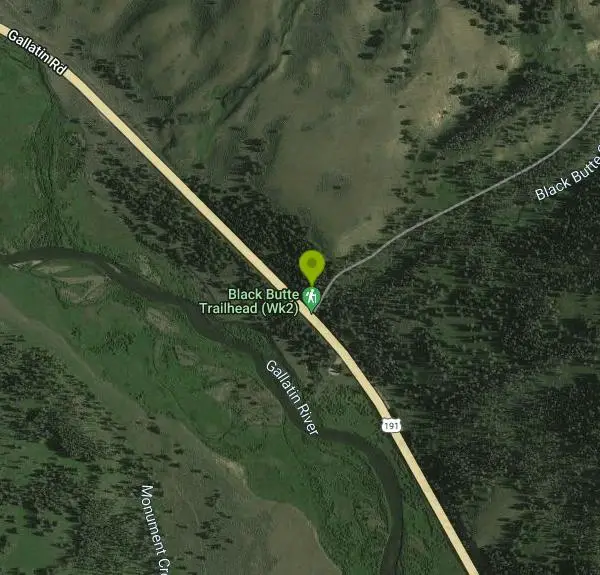


Other Hiking Trails and Backpacking Trails Nearby
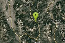
Daly Creek
Gallatin Gateway, Montana
1.5 miles NWA 5.2-mile out-and-back trail good for all skill levels near Gallatin Gateway, Montana, primarily used for hiking and accessible from May through October.
Hike 
Ousel Falls
Gallatin Gateway, Montana
18.0 miles NWA 1.7-mile out-and-back trail near Big Sky, Montana, leading through forest to a beautiful waterfall — accessible from May through October for a rewarding short hike.
Hike, Rock Climb, Swim 7.8 mi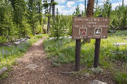
Osprey Falls Trail
Mammoth Hot Springs, Yellowstone National Park
20.2 miles EAn 8-mile out-and-back near Mammoth Hot Springs hiking green meadows and burned forest to the rim of Sheepeater Canyon and a breathtaking 150-foot waterfall on the Gardner River.
Hike 4.0 mi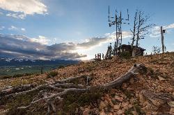
Bunsen Peak Trail
Mammoth Hot Springs, Yellowstone National Park
20.2 miles EA moderately difficult 4.6-mile hike to Bunsen Peak with a 1,300-foot climb and sweeping views of Mammoth Hot Spring Terraces, Swan Lake Flats, and the Gallatin Mountains.
Hike 2.0 mi
Snow Pass Trail
Yellowstone National Park Wyoming
20.3 miles EA moderately difficult 2.4-mile out-and-back with 700 feet of gain near Mammoth Hot Springs, passing impressive boulder hoodoos and ending at a secluded mountain valley — hike in groups and carry bear spray.
Backpack, Hike 8.1 mi
Sepulcher Mountain Trail
Mammoth Hot Springs, Yellowstone National Park
20.5 miles EAn 11-mile loop from Mammoth Hot Springs to the 9,652-foot peak of Sepulcher Mountain, passing colorful meadows, aspen forests, and stunning views of Electric Peak — with frequent bighorn, moose, and grizzly sightings.
Hike 5.3 mi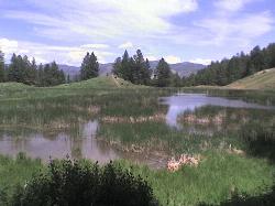
Beaver Ponds Trail
Mammoth, Yellowstone National Park
20.5 miles EA 5-mile loop above Mammoth Hot Springs with beaver ponds of varying sizes, elk, wildflowers, birds, and occasional bear sightings — a perfect morning or evening hike.
Hike 0.1-5.3 mi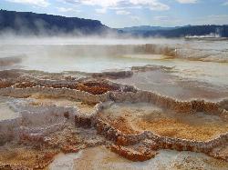
Mammoth Hot Springs
Mammoth, Yellowstone National Park
20.5 miles EColorful limestone terraces covered in glistening hot-spring water, a 1-mile boardwalk with 300 feet of elevation, elk in the parking lot, and an easy family-friendly loop — Yellowstone's showiest geology.
Camp, Hike 7.9 mi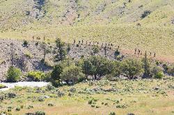
Rescue Creek Trail
Mammoth Hot Springs, Yellowstone National Park
20.6 miles EA level, well-marked 8-mile point-to-point hike across the Montana-Wyoming border through colorful grasslands near Yellowstone, with frequent bighorn sheep, pronghorn, and elk sightings.
Hike 
Mammoth/Gardiner Back Road
Mammoth Hot Springs, Yellowstone National Park
20.6 miles EThe only road open into Yellowstone in winter runs from Gardiner, Montana through park headquarters at Mammoth Hot Springs and east to Silver Gate and Cooke City.
Hike, Mountain Bike 4.0 mi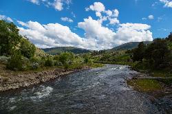
Lava Creek Trail
Mammoth Hot Springs, Yellowstone National Park
21.0 miles EA 4.2-mile hike along scenic Lava Creek to the 60-foot tiered Undine Falls, with distant Mammoth Hot Springs views, meadows, Mount Everts, and frequent elk and bison sightings.
Hike 0.8 mi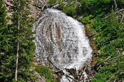
Wraith Falls Trail
Mammoth Hot Springs, Yellowstone National Park
24.8 miles EA less-than-a-mile family-friendly hike near Mammoth Hot Springs to the unique fan-shaped 79-foot Wraith Falls — open year-round and easy for all skill levels.
Hike 7.4 mi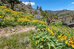
Blacktail Deer Creek to Yellowstone River Trail
Mammoth Hot Springs, Yellowstone National Park
26.0 miles EA 7-mile out-and-back trail dropping through green fields and boulder formations to waterfall views along the Yellowstone River, with a suspension bridge connecting onward trails.
Hike 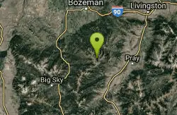
Hyalite Creek Trail
Gallatin Gateway, Montana
27.2 miles NAn 11-mile hike with 11 waterfalls and frequent black bear sightings — dogs on leashes are common on the trail, and timeshare activity rules apply on certain days.
Hike, Horseback, Mountain Bike 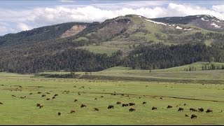
Forces of the Northern Range
Mammoth, Yellowstone National Park
27.3 miles EA half-mile boardwalk on Yellowstone's Blacktail Deer Plateau with mountain peak displays, a wildlife primer, and a view-packed introduction to the Northern Range's forces of nature.
Hike 0.8 mi
Harlequin Lake Trail
Madison, Yellowstone National Park
29.5 miles SA half-mile stroll through peaceful pine forest leads to a lily-pad-covered lake frequented by Harlequin ducks and other waterfowl — quiet and uncrowded even in busy Yellowstone.
Hike 6.1 mi
Purple Mountain Trail
Madison, Yellowstone National Park
29.7 miles SEA quiet 6-mile out-and-back through dense Yellowstone forest, climbing 1,500 feet to the peak of Purple Mountain for panoramic views of the Madison and Gibbon rivers.
Hike 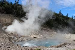
Beryl Spring / Emerald Spring
Norris, Yellowstone National Park
30.6 miles SEOne of Yellowstone's hottest thermal features, right off the Grand Loop Road — the water exceeds boiling point, making this a stunning roadside look-don't-touch volcanic wonder.
Hike 
Ice Lake Trail
Norris, Yellowstone National Park
32.3 miles SEA short, peaceful trail through forest regrown after the 1988 Yellowstone fires, leading to a pretty, tree-lined lake with young lodgepole pines thriving all around.
Hike 0.8-3.8 mi
Little Gibbon Falls
Norris, Yellowstone National Park
32.7 miles SEA family-friendly 4.5-mile Yellowstone loop reaches fishing and swimming spots along Gibbon Creek, with kid-safe trail, canoeing options, and bearspray-worthy backcountry feel.
Camp, Canoe, HikeNearby Campsites
Mammoth Hot Springs
Mammoth, Yellowstone National Park
20.5 miles EColorful limestone terraces covered in glistening hot-spring water, a 1-mile boardwalk with 300 feet of elevation, elk in the parking lot, and an easy family-friendly loop — Yellowstone's showiest geology.
Camp, Hike 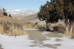
Mammoth Hot Springs Campground
Mammoth Hot Springs, Yellowstone National Park
20.9 miles EThe only year-round campground in Yellowstone, with 85 first-come sites at 5 miles from the North Entrance, walking distance to the famous Mammoth Hot Springs Terraces and nearby hiking and fishing.
Camp 
Indian Creek Campground Yellowstone
Mammoth Hot Springs, Yellowstone National Park
21.4 miles SEIndian Creek Campground is a quiet, wooded, tent-friendly Yellowstone campground near Mammoth Hot Springs, big on wildlife and peace.
Camp 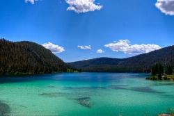
Wade Lake
Cameron, Montana
27.1 miles SWWade Lake is a hidden gem of southwestern Montana — a spring-fed mountain lake famous for its glassy, aquamarine water, tucked into a forested ravine at the southern end of the Gravelly Range....
Camp, Canoe, Kayak, Swim 
Norris Campground
Norris, Yellowstone National Park
29.0 miles SECentrally located in Yellowstone NP, this campground puts you within a short drive of Grand Canyon of the Yellowstone, Hayden Valley, Old Faithful, and Yellowstone Lake.
Camp 
Madison Campground
Madison, Yellowstone National Park
29.6 miles SEA partly wooded riverside campground at 6,800 feet in Yellowstone, close to Old Faithful and the geyser basins, with great fishing on the Madison River and 270-plus individual sites.
Camp 0.8-3.8 mi
Little Gibbon Falls
Norris, Yellowstone National Park
32.7 miles SEA family-friendly 4.5-mile Yellowstone loop reaches fishing and swimming spots along Gibbon Creek, with kid-safe trail, canoeing options, and bearspray-worthy backcountry feel.
Camp, Canoe, Hike 
Hellroaring Creek Trail
Yellowstone National Park
33.7 miles EA suspension bridge over the Yellowstone River leads to sandy creek-side beaches and a mild backcountry trail past Yellowstone's largest granite slab — great for all ages.
Camp, Hike, Swim 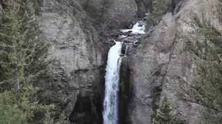
Tower Falls
Tower Junction, Yellowstone National Park
37.0 miles ETower Fall plunges 132 feet off Tower Creek in Yellowstone, framed by dramatic rock pinnacles — located about 3 miles south of Roosevelt Junction.
Camp, Hike 
Canyon Campground
Canyon Junction, Yellowstone National Park
37.0 miles SEA popular Yellowstone campground of 300-plus sites just minutes from the Grand Canyon of the Yellowstone and the Upper and Lower Falls, with hiking trails and North Rim Drive access right from camp.
Camp 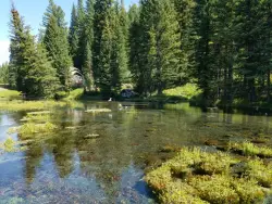
Big Springs
Island Park, Idaho
37.8 miles SA Big Springs campground shaded by Lodgepole Pines on Henry's Fork — with a 1-mile interpretive trail, fish feeding under the bridge, the historic Johnny Sack Cabin, and access to the Mesa Falls Scenic Byway.
Camp, Hike 14.8 mi
Biscuit Basin to Fairy Falls and Firehole Meadows
Old Faithful, Yellowstone National Park
39.1 miles SA nearly 15-mile backcountry hike starting at Biscuit Basin passes turquoise pools, a 70-foot waterfall, Firehole Meadows, Imperial Geyser, and three stunning blue lakes with rust-red shores.
Backpack, Camp, Hike 
Upper Coffee Pot Campground
Island Park, Idaho
39.6 miles SHenry's Fork of the Snake River winds through a lodgepole pine forest past this campground, offering fly-fishing for rainbow and brook trout and easy tubing and canoeing.
Camp, Canoe 
Slough Creek Campground
Tower Junction, Yellowstone National Park
39.9 miles EA small, popular Yellowstone campground right on Slough Creek where wolf packs are frequently spotted — sites fill fast, so arrive early.
Camp 0.9 mi
Buffalo River Campground
Island Park, Idaho
43.7 miles SAn easy, clear, and often warm float on the Buffalo River near Island Park, with slow enough current to paddle back upstream in a canoe or kayak after your run.
Camp, Canoe, Kayak, Swim 
Bridge Bay
Lake Village, Yellowstone National Park
48.1 miles SEA scenic campground on the western shore of Yellowstone Lake at 7,800 feet — wooded upper loops, open meadows, and a nearby marina store, though far from the park's main dining hubs.
Camp 
Fishing Bridge RV Campground
Lake Village, Yellowstone National Park
49.0 miles SEAn RV campground near the mouth of the Yellowstone River where visitors can watch White Pelicans, waterfowl, and trout from the historic Fishing Bridge — fishing from the bridge is no longer permitted.
Camp 
Pebble Creek Campground
Northeast Entrance, Yellowstone National Park
49.6 miles EA quiet campground tucked in Yellowstone's far northeast corner near Trout Lake and world-class Lamar and Soda Butte trout rivers — arrive before 11 a.m. to secure a spot.
Camp


