


Union Falls & Ouzel Pool
Bechler Ranger Station, Yellowstone National Park

| Address: | Forest Rd 025, Alta, WY 83414, USA |
| GPS: |
44°7'24.4"N 110°56'40.5"W Maps | Directions |
| State: | Wyoming |
| Trails/Routes: | 15.9-16.6 mi |
National Park
Backpack, Hike, Hot Springs, and Swim
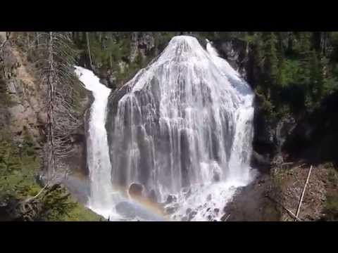
Union Falls is one of Yellowstone's hidden masterpieces — a wide, fan-shaped curtain of water around 250 feet tall, tucked deep in the park's remote Bechler region, the wild southwest corner known as Cascade Corner. Almost nobody driving the loop road ever lays eyes on it, and that's exactly the appeal: this one you earn on foot, well off the tourist track, and it rewards every mile.
The trek runs roughly 16 miles round trip, making it a big day hike or a wonderful overnight backpack. Most of the walking is gentle, threading through lodgepole forest and open meadows in classic Bechler fashion, with one memorable obstacle about a mile in: a ford of the Falls River. Early in the season that crossing runs swift and deep, but by mid-July it settles to a straightforward wade — bring shoes you can strap on and trekking poles for balance. Backcountry campsites a few miles in let you split the trip, soak in the scenery, and reach the falls fresh.
Then there's the bonus that makes this trip legendary: Ouzel Pool, also known as Scout Pool. A short side trip off the main trail — about a mile and a half each way — leads to a natural swimming hole fed by a warm spring, with a small waterfall pouring in over the lip. By late summer the water warms to something close to a tepid bath, a rare treat in the high country. The pool is roughly 20 feet across and seven feet deep, with a bedrock shelf for easy wading and a big rock that begs to be jumped from — cannonballs only, since it's too shallow to dive. Strong swimmers can paddle up under the falls and sit beneath the rush.
This is genuine Yellowstone backcountry, so come prepared and come respectful. It's grizzly country: carry bear spray, make noise, and store your food properly. The mosquitoes are serious in early summer, so pack repellent and a head net for June and early July. Overnight trips require a backcountry permit from the park, reservable in advance or at a ranger station, and there's no cell service back here — let someone know your route.
Timing makes or breaks this one. Mid-July through September is the sweet spot, when the Falls River ford is friendly, the bugs ease off, and the swimming is at its best. Earlier than that and high water can turn the crossing dangerous; later and the days get short for such a long round trip. Get an early start, pace yourself for the miles, and you'll come away with one of the most complete days Yellowstone has to offer — a thundering 250-foot waterfall and a warm, wild swimming hole, all in one walk. Few places reward the effort quite like this.
More Information
Yellowstone National Park Itinerary
This Yellowstone National Park Itinerary will help you get started as you plan your vacation to Yellowstone National Park.
https://www.justgotravelstudios.com/collections/national-park-itineraries/products/yellowstone-national-park-itinerary?ref=9zpxis0diinBackcountry Conditions - Yellowstone National Park (U.S. National Park Service)
This page provides a map and details conditions of trail status, closures, and known hazards.
https://www.nps.gov/yell/planyourvisit/situationreport.htmOuzel Pool
Ouzel Pool must not be missed if you are hiking to Union Falls! It only adds about 1.5 miles (2.4 km) to your hike. Somewhere above Ouzel Pool a warm spring feeds this creek. When I was on staff at Camp Loll, we called it Scout Pool. It’s a swimming hole that, by my estimation, is about seven feet (2 m) deep, and 20 feet (6 m) in diameter before continuing over ankle deep bedrock shelf and continuing downstream. There’s a large rock off to the right where you can jump into the pool. Strong swimmers find it challenging to swim upstream from the rock shelf towards the falls. At the falls, you can sit on rocks and lean back, letting the water rush over you. Inexperienced swimmers can enjoy Ouzel Pool by sitting on the bedrock shelf and dangling their feet into the pool. Early in the season, the waterflow is stronger and colder due to winter runoff. Later in the season (late-August and on), the waterflow is better with a water temperature more like tepid bath water. Caution! I highly discourage anyone from jumping anything but feet first into the pool. Cannonballs are usually your safest jumping entry. In late-June 2012, a youth leader injured himself by diving into the pool. Luckily for him, it was on a day of the week that Camp Loll staff was guiding scouts on hikes and they were able to radio to camp and call for help. He had to be carried about 2–3 miles (3–5 km) down to near the ranger’s cabin to a medical helicopter that transported him to a hospital in Rexburg, Idaho. His group was not attending Camp Loll. In 2012, I had to help a swimmer who tried to swim upstream to the falls. The water started pushing him under as he approached the falls.
https://tylerwangsgard.com/ouzel-poolUnion Falls
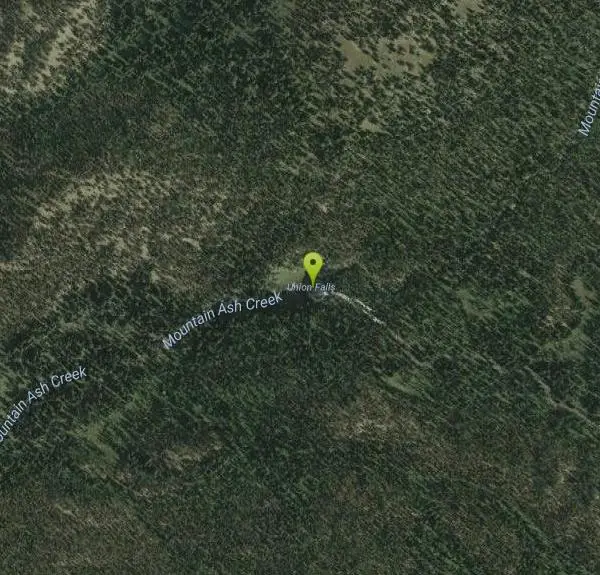
Union Falls is second only to Lower Falls as the tallest waterfall in Yellowstone National Park. Towering at just over 260 ft/79 m, Union Falls is created by Mountain Ash Creek at its top, and an unnamed tributary at its left as they join together. A small island briefly divides Mountain Ash Creek near the top on the right. Make sure you take the time to visit and swim in Ouzel Pool. It’s well worth the extra time and effort and only adds about 1.5 miles (2.4 km) to your hike. I hiked to Union Falls more than a dozen times when I was on staff at Camp Loll and five times since. My record from trailhead to Union Falls and back to the trailhead (15 mi/24 km) was four hours with a friend the summer after graduating high school. Oh, to be 18 again... At a much more reasonable pace, I plan on taking my own family in late-Summer 2020. Note The two closest backpacking campsites to Union Falls are 9U4 and 9U5. Backcountry campsites are only available with a reservation and backcountry permit. No permit is required for day hikes to Union Falls. Cell service is non-existent. Be careful! Take it SLOW on the Ashton-Flagg Ranch road. I had two flat tires in one trip on that road! River ford numbers mentioned below are totals for round trip hikes. How to Get There Most of the trailheads that access Union Falls are on the Ashton-Flagg Ranch (Grassy Lake) Road. Nearly every year, this dirt road only becomes passable after the Camp Loll staff clears away the final snow drifts as they push their way into camp at the beginning of each summer. The road is definitely rough in spots and impassable until mid- to late-June. A small car can drive this road in dry conditions if taking it slow. Grassy Lake Trailhead This is the eastern-most route and starts from Grassy Lake Dam to Union Falls and is probably the easiest to find. It joins the Cascade Creek trail just before fording the Falls River. A backcountry campsite (9F2) is available near this ford. I’m not sure of the distance as I’ve never done it but is probably just a little longer than the Cascade Creek route. Two river fords (Falls River twice) Cascade Creek Trailhead The Cascade Creek trailhead (9K5) is a little more than one mile (1.6 km) west of Grassy Lake Dam and 17 miles (27 km) west of Flagg Ranch. A pretty good description of this trail is found in my June 2005 article below. This is probably the shortest of all—but not by much. From the Cascade Creek trailhead, it is about 15 miles (24 km) round trip hike and is moderate to difficult due to its length, a couple of climbs, and two river fords that have to be done twice—hiking in and hiking out. If you have time and energy, you can also see Terraced Falls (130 ft/40 m) if you head west on the trail on the south side of the Cascade Creek ford. It will add just under 3 miles to your hike. Four river fords (Cascade Creek twice, Falls River twice) Fish Lake Trailhead The Fish Lake trailhead (9K3) is just over six miles west of Grassy Lake on the Ashton-Flagg Ranch road. The trailhead access road requires high clearance vehicles. This route is about 17 miles (27 km) round trip to Union Falls. It has less elevation gain than the Cascade Creek trailhead route, but is still moderately difficult due to the farther distance. Backcountry campsite 9F1 is near the Falls River ford, while 9U1 is just past the first Mountain Ash Creek ford. 9U2 and 9U3 are on each side of the second Mountain Ash creek ford. We used this trailhead in our 50-mile hike of the Cascade Corner (see article below). I also used this trailhead when guiding my brother-in-law and three of his kids. Six river fords (Falls River twice, Mountain Ash Creek four times) Other Trailheads Union Falls is also accessible from the Mountain Ash Creek trail via the South Boundary and Bechler River trails, Anyone coming from these routes will most likely be overnight backpackers. These are the western-most and longest routes. The South Boundary route starts at Cave Falls and joins the Fish Lake route on the south side of the Falls River. Eight river fords (Falls river four times, Mountain Ash Creek four times) The Bechler River route comes along the Mountain Ash Creek trail from the Bechler River’s “Rocky Ford” trail or East Bechler Meadows trail and joins the Fish Lake route on the north side of Mountain Ash Creek. River fords vary based on your route but once it reaches the point where it joins the Fish Lake route there’s only two fords (Mountain Ash Creek twice)
https://tylerwangsgard.com/union-fallsUnion Falls - Hike 734
Union Falls has to be one of the most spectacular waterfalls in Yellowstone National Park, but because of its inaccessibility, you’ll share it with few others. It is formed by two creeks coming together (thus the name Union Falls) and fans out into a beautiful and complex waterfall as it drops 250ft in a dazzling […]
https://hike734.com/trip/union-falls/Union Falls - Unique Waterfall in Yellowstone’s Bechler Area
Union Falls is a unique 260ft waterfall in Yellowstone’s remote Bechler Region (i.e. the Cascade Corner) on a 16-mile hike with an option to swim at Ouzel Pool.
https://www.world-of-waterfalls.com/waterfalls/yellowstone-union-falls/Union Falls Trail - Countdown: 10 Days - Grand Teton National Park (U.S. National Park Service)
Many of the 3 million visitors to Yellowstone go and see the tallest falls in the park, Lower Falls on the Yellowstone River. However, lesser known but just as impressive is the second tallest falls. Union Falls, which derives its name from the fact that two rivers join just at the edge of the falls, is a spectacular 250 feet tall.
https://www.nps.gov/grte/blogs/union-falls-trail-countdown-10-days.htmBe courteous, informed, and prepared. Read trailhead guidelines, stay on the trail, and don't feed the wildlife.
Read More
Be careful. Pay attention to posted signs and always test the waters before you get in. Some hot springs can get up to boiling temperatures. Be sure to drink plenty of water to combat the dehydrating effect of the spring.
Be respectful of other soakers and the hot spring. Don't hog the pool. Camp at least 200 yards away and keep fires in designated areas. Keep your pets out of the water and never pee in thermal feature. Glass bottles should never go near a hot spring.

- Plan Ahead and Prepare
- Travel & camp on durable surfaces
- Dispose of waste properly
- Leave what you find
- Minimize campfire impacts
- Respect wildlife
- Be considerate of other visitors
Directions
From Bechler Ranger Station, Yellowstone National Park
- Head southwest toward Bechler Ranger Station Rd (131 ft)
- Turn right onto Bechler Ranger Station RdEntering Idaho(1.5 mi)
- Turn right onto E 1400 Rd N/
Cave Falls Rd/ NF-582 Continue to follow E 1400 Rd N/(11.7 mi)Cave Falls Rd - Turn left onto N 4500 E/
4525 E Continue to follow 4525 E(2.3 mi) - Turn left onto E 1200 Rd N/
Ashton-Flagg Ranch Rd Continue to follow Ashton-Flagg Ranch RdParts of this road may be closed at certain times or daysEntering Wyoming(17.3 mi) - Turn left onto Forest Rd 022 (0.3 mi)
- Slight right onto Forest Rd 023 (1.1 mi)
- Slight right onto Forest Rd 025 (486 ft)
Other Swimming Holes, Hiking Trails, Hot Springs, and Backpacking Trails Nearby
Fish Lake
Ashton, Idaho
0.0 miles SEHike near Ashton, Idaho
Hike 
Loon Lake
Ashton, Idaho
0.8 miles SLoon Lake is a small, lively mountain lake tucked into the Caribou-Targhee National Forest just off Ashton's Fish Creek Road, in the timbered high country of eastern Idaho near the gateway to...
Camp, Kayak, Swim 
Cave Falls of Yellowstone
Ashton, Idaho
3.0 miles NWA campground right on the Fall River along Yellowstone's south boundary puts you steps from legendary fishing, with fire rings and bear-proof boxes at each site.
Camp, Hike 1.9 mi
Terraced Falls
Grant Village, Yellowstone National Park
4.8 miles EAn easy 3.6-mile out-and-back hike to a tiered waterfall along the southern Yellowstone border — the trailhead is on the Ashton-Flagg Ranch Road, which closes in winter.
Hike 14.8-15.1 mi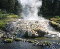
Mr. Bubbles Hot Spring
Old Faithful, Yellowstone National Park
5.3 miles WA remote 15-mile backcountry trek through Yellowstone's Bechler region to a rare wild soak fed by a thermal spring.
Hike, Hot Springs 
Horseshoe Lake
Ashton, Idaho
8.2 miles WA lily-pad-dotted lake hidden in the Targhee National Forest with a gradual beach entry perfect for wading, a floating dock for jumping, and no motorized boats.
Camp, Canoe, Dive, Swim 17.5 mi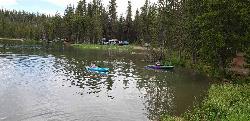
Tear Drop Lake
Ashton, Idaho
11.5 miles NWA small, lively lake in the Targhee forest for kayaking, swimming, and an easy loop trail — family fun with primitive lakeside camping.
Camp, Canoe, Hike, Kayak, Mountain Bike, Swim 
Porcupine Creek
Ashton, Idaho
13.9 miles WA backcountry hunting, fishing, camping, and swimming spot in Targhee National Forest, surrounded by forests, meadows, a creek, and unmarked trails — bear country, so pack and store food carefully.
Camp, Swim 
Bitch Creek Trestle
Tetonia, Idaho
15.7 miles SWA Rails-to-Trails railroad bridge converted into an easy family viewpoint above Bitch Creek — part of the 30-mile Ashton-Tetonia Trail with more trestle adventures nearby.
Hike 0.3-0.6 mi
Bear Gulch
Ashton, Idaho
17.1 miles WAn abandoned ski hill from 1969 with overgrown runs that still deliver great sledding — the lower run is fast and winding all the way down to the old ski lift.
Camp, Cross-country Ski, Hike, Sled 3.2-47.0 mi
Yellowstone Branch Line Trail
Ashton, Idaho
18.2 miles WA 39-mile trail from Warm River to the Montana border — open to backpackers, hikers, mountain bikers, horseback riders, and ATVs through the Targhee National Forest.
Backpack, Cross-country Ski, Hike, Horseback, Mountain Bike 
Mesa Falls
Ashton, Idaho
19.5 miles WUpper Mesa Falls drops 114 feet and spans 300 feet across the Henrys Fork — just 0.2 miles of paved walkway from the parking lot, with platforms, handrails, and morning rainbow mist.
Cross-country Ski, Hike, Kayak 2.6 mi
Lone Star Geyser Trail
Old Faithful, Yellowstone National Park
21.5 miles NA 4.8-mile round-trip trail through forest to a colorful geyser that erupts 30–45 feet into the air about every 3 hours — bikeable the entire way.
Hike, Mountain Bike 
Mt. Moran
Alta, Wyoming
21.6 miles SAt 12,610 feet, this dominant Teton peak rises 6,000 feet above Jackson Lake, with the Skillet Glacier plainly visible on its massive east face.
Hike 6.9 mi
Heart Lake Trail
Grant Village, Yellowstone National Park
21.7 miles NEAn 8-mile moderate hike to a remote backcountry lake with blue thermal pools, fumaroles, Rustic Geyser, and remarkable fishing for native cutthroat, mountain whitefish, and Arctic grayling.
Backpack, Camp, Hike, Hot Springs 2.1-11.5 mi
Lewis River Channel / Dogshead Loop
Grant Village, Yellowstone National Park
21.8 miles NEA serene hike along Lewis Channel to Shoshone Lake — the largest lake in the continental US without a road to it — with Teton views, driftwood shores, osprey, bald eagles, and ravens.
Canoe, Hike, Kayak 0.8 mi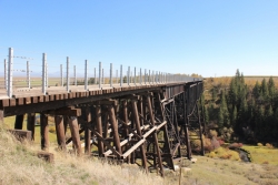
Conant Creek Pegram Truss Railroad Bridge
Ashton, Idaho
22.1 miles WA spectacular converted railroad bridge with jaw-dropping views of Conant Creek hundreds of feet below — part of the 30-mile Ashton-Tetonia Trail, with vivid spring and fall colors and Teton backdrop.
Hike 
Sheep Falls on Henry's Fork
Island Park, Idaho
23.2 miles WA 25-foot waterfall cascading through a narrow basalt chute on the North Fork of the Snake River — a pleasant, rarely crowded hike compared to nearby Mesa Falls.
Hike 6.2 mi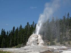
Howard Eaton Trail
Old Faithful, Yellowstone National Park
23.5 miles NA moderately difficult 6.5-mile there-and-back trail from Old Faithful through spruce-fir forest, past geysers and springs, culminating at the impressive Lonestar Geyser which erupts every three hours.
Hike 3.1 mi
Mallard Lake
Old Faithful, Yellowstone National Park
23.9 miles NA 10-mile roundtrip Yellowstone hike through changing scenery — pine forest, rocky terrain, and grassy meadows — arriving at a calm, wildflower-ringed lake with a bird's-eye view of Old Faithful.
HikeNearby Campsites
Loon Lake
Ashton, Idaho
0.8 miles SLoon Lake is a small, lively mountain lake tucked into the Caribou-Targhee National Forest just off Ashton's Fish Creek Road, in the timbered high country of eastern Idaho near the gateway to...
Camp, Kayak, Swim
Cave Falls of Yellowstone
Ashton, Idaho
3.0 miles NWA campground right on the Fall River along Yellowstone's south boundary puts you steps from legendary fishing, with fire rings and bear-proof boxes at each site.
Camp, Hike 
Sheep Falls on Fall River
Ashton, Idaho
7.9 miles WA local gem off Cave Falls Road where the river splits into multiple falls tumbling over each other — primitive campsites and beautiful views make it a great picnic stop.
Camp
Horseshoe Lake
Ashton, Idaho
8.2 miles WA lily-pad-dotted lake hidden in the Targhee National Forest with a gradual beach entry perfect for wading, a floating dock for jumping, and no motorized boats.
Camp, Canoe, Dive, Swim 17.5 mi
Tear Drop Lake
Ashton, Idaho
11.5 miles NWA small, lively lake in the Targhee forest for kayaking, swimming, and an easy loop trail — family fun with primitive lakeside camping.
Camp, Canoe, Hike, Kayak, Mountain Bike, Swim
Porcupine Creek
Ashton, Idaho
13.9 miles WA backcountry hunting, fishing, camping, and swimming spot in Targhee National Forest, surrounded by forests, meadows, a creek, and unmarked trails — bear country, so pack and store food carefully.
Camp, Swim 0.3-0.6 mi
Bear Gulch
Ashton, Idaho
17.1 miles WAn abandoned ski hill from 1969 with overgrown runs that still deliver great sledding — the lower run is fast and winding all the way down to the old ski lift.
Camp, Cross-country Ski, Hike, Sled 
Warm River Campground
Ashton, Idaho
18.1 miles WSlow-moving warm water and willow-lined banks make this campground a perfect spot for tubing, trout fishing, and peaceful mountain biking at 5,200 ft elevation.
Camp 0.1 mi
Lewis Lake Campground
Grant Village, Yellowstone National Park
19.1 miles NEYellowstone's third-largest lake draws canoeists, kayakers, and serious anglers, with a quiet campground open mid-June through early November on a first-come basis.
Camp, Canoe, Kayak 6.9 mi
Heart Lake Trail
Grant Village, Yellowstone National Park
21.7 miles NEAn 8-mile moderate hike to a remote backcountry lake with blue thermal pools, fumaroles, Rustic Geyser, and remarkable fishing for native cutthroat, mountain whitefish, and Arctic grayling.
Backpack, Camp, Hike, Hot Springs 14.8 mi
Biscuit Basin to Fairy Falls and Firehole Meadows
Old Faithful, Yellowstone National Park
25.0 miles NA nearly 15-mile backcountry hike starting at Biscuit Basin passes turquoise pools, a 70-foot waterfall, Firehole Meadows, Imperial Geyser, and three stunning blue lakes with rust-red shores.
Backpack, Camp, Hike 
Reunion Flat Campground
Alta, Wyoming
25.3 miles SCamp near Alta, Wyoming
Camp 3.8-6.4 mi
Table Rock / Table Mountain
Driggs, Idaho
25.4 miles SA big climb to 11,300 feet for arguably the finest view of the Grand Tetons — pick the steep Face or the gradual Huckleberry trail.
Camp, Hike 
Teton Canyon Campground
Alta, Wyoming
25.4 miles STeton Canyon Campground is the gateway to Alaska Basin, Table Rock, and the Teton Crest Trail — each site stocked with a picnic table, fire ring, and bear box.
Camp 
Grant Village
Grant Village, Yellowstone National Park
26.5 miles NENamed for President Grant near Yellowstone Lake's West Thumb, this village has lakeside dining, a geyser basin next door, campfire ranger programs, and tree-lined campsites steps from the water.
Camp, Canoe, Kayak 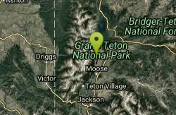
Jenny Lake Campground
Jackson Hole, WY
28.0 miles SETucked right at the base of the Tetons, this tent-only campground fills before 8 AM in summer for good reason — alpine beauty, quiet sites, and unbeatable Teton proximity.
Camp 0.9 mi
Buffalo River Campground
Island Park, Idaho
29.5 miles NWAn easy, clear, and often warm float on the Buffalo River near Island Park, with slow enough current to paddle back upstream in a canoe or kayak after your run.
Camp, Canoe, Kayak, Swim 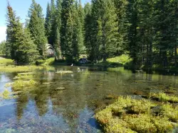
Big Springs
Island Park, Idaho
30.1 miles NWA Big Springs campground shaded by Lodgepole Pines on Henry's Fork — with a 1-mile interpretive trail, fish feeding under the bridge, the historic Johnny Sack Cabin, and access to the Mesa Falls Scenic Byway.
Camp, Hike 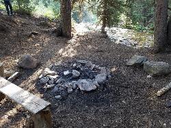
Darby Canyon Camping
Alta, Wyoming
31.3 miles SDispersed campsites with fire lays in scenic Darby Canyon — no official campground, just established spots in Wyoming wilderness. Leave No Trace and use existing rings only.
Camp 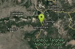
Upper Coffee Pot Campground
Island Park, Idaho
32.8 miles NWHenry's Fork of the Snake River winds through a lodgepole pine forest past this campground, offering fly-fishing for rainbow and brook trout and easy tubing and canoeing.
Camp, Canoe


