


6 Hiking Trails near Umpqua Hot Springs
first prev 1 next lastShowing Hiking Trails within 50 miles Distance miles of Umpqua Hot Springs near Clearwater, Oregon City, Zip, or Address
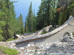
Cleetwood Cove Trail
Crater Lake National Park, Oregon
26.3 miles SEThe only legal shoreline access in Crater Lake National Park — a steep strenuous switchback hike to the water's edge, with cliff jumping options from about 20 feet into 38-50°F water.
Dive, Hike, Swim 2.4 mi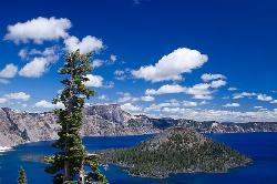
Wizard Island Summit Trail
Crater Lake National Park
27.3 miles SEReach one of the world's finest volcanic cinder cones by boat across Crater Lake, then hike 2.5 miles up lava rock to the Witches Cauldron crater at the summit.
Hike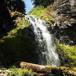
Plaikni Falls
Chiloquin, Oregon
31.4 miles SEAn easy, wheelchair-accessible 2-mile round-trip trail in Crater Lake National Park to a beautiful 20-foot waterfall surrounded by firs, hemlocks, and summer wildflowers.
Hike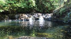
Cavitt Creek Falls Recreation Site
Glide
32.4 miles WA free BLM day-use area and small campground on Cavitt Creek, built around the deep green pool at the foot of an eight-foot waterfall 19 miles east of Roseburg. There is no lifeguard, and the pool is at its calmest and warmest from late July into Septembe
Camp, Hike, Swim
Pinnacles Valley Trail
Chiloquin, Oregon
35.9 miles SEThe Pinnacles Trail follows a canyon rim past hundreds of eerie volcanic spires in Crater Lake National Park's quiet southeast corner.
Hike
Eagle Rest
Lowell, Oregon
41.1 miles NA historic one-car viewpoint on the Historic Columbia River Highway designed by Samuel Lancaster, now rebuilt as part of a trail — once famous for watching early Bonneville Dam construction.
Canoe, Hike, Mountain Bike


