


6 Hiking Trails near Williams River Area
first prev 1 next lastShowing Hiking Trails within 50 miles Distance miles of Williams River Area near White Sulphur Springs, West Virginia City, Zip, or Address
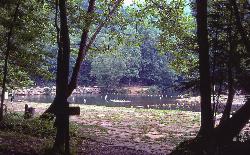
Blue Bend Recreation Area
White Sulphur Springs
30.5 miles SA free swimming hole on a wide bend of Anthony Creek at a 1930s CCC-built Forest Service recreation area in the Monongahela National Forest, about 12 miles north of White Sulphur Springs.
Camp, Hike, Swim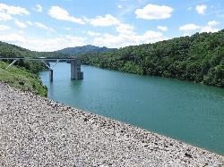
Coles Point Day Use Area
Hot Springs
31.4 miles SEForest Service day use area on the south end of Lake Moomaw near Gathright Dam, with a small sand swim beach, boat ramps and picnic shelters. Open Memorial Day to Labor Day, $5 per vehicle.
Canoe, Hike, Kayak, Swim
Bee Run Recreation Area Beach
Sutton
32.7 miles NWThe roped-off sand swim beach at the Corps of Engineers' Bee Run day use area on Sutton Lake, next to the marina just east of Sutton. A $5 per vehicle day use fee applies, paid by card at machines.
Camp, Canoe, Hike, Kayak, Swim
Sutton Lake Beach
Sutton
32.7 miles NWThe Corps of Engineers swim beach at Bee Run Day Use Area on Sutton Lake, a small roped-off sandy cove beside the marina near Sutton, West Virginia, with a $5 per vehicle day-use fee.
Camp, Canoe, Hike, Kayak, Swim
Bullpasture Gorge
Williamsville, Virginia
35.0 miles EBullpasture Gorge is a wild and beautiful river canyon in the remote western highlands of Virginia, where the Bullpasture River carves a dramatic gorge through Highland County near Williamsville. A...
Canoe, Hike, Kayak, Whitewater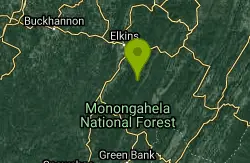
High Falls
Elkins West, Virginia
36.3 miles NEA 7.5-mile moderate hike or mountain bike ride in West Virginia leading to a spectacular waterfall with a swimming hole below — or skip the hike and ride the train in from Bemis for about $10.
Hike, Swim


