


High Falls
Elkins West, Virginia
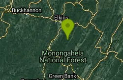
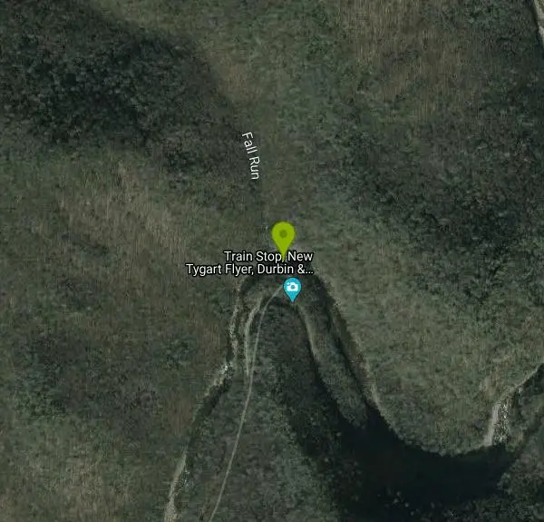
| Address: | High Falls Trail, Elkins, WV 26241, USA |
| GPS: |
38°44'57.3"N 79°45'12.5"W Maps | Directions |
| State: | Virginia |
Picnic Tables Rivers Waterfalls Streams Trails Rocks Pet Friendly Bicycles Restrooms
Hike and Swim
High falls is a beautiful waterfall located in West Virginia, and is a popular hike with a spectacular location. The hike is about 7 and a half miles long and takes a little over 4 hours. The trail is also a great place for mountain biking, and is marked as moderate for both hiking and biking. Some people like to backpack and camp near the waterfall overnight, but it isn't an amazing place to camp because your sleep will be disrupted consistently by passing trains. If you want to see the waterfall and swim there but don't want to hike, you can take the train in Bemis. It costs about 10 dollars for a round trip to and from Bemis to High Falls and the journey has one small stop in the middle for about 45 minutes. Many tourists choose to hike and take the train as this is a popular location. The best part about the hike is that you can cool off in the water below the waterfall and have a relaxing swim. This would be a great place for you if you like to get up early in the morning, hike, swim and eat lunch before hiking back down.
More Information
High Falls Hike - Wildell, West Virginia | MyHikes
Hike the High Falls trail in Glady, WV! This 7.4-mile hike in Monongahela National Forest features a stunning 20ft waterfall & mountain views
https://myhikes.org/trails/high-falls-hikeBe courteous, informed, and prepared. Read trailhead guidelines, stay on the trail, and don't feed the wildlife.
Read More
- Plan Ahead and Prepare
- Travel & camp on durable surfaces
- Dispose of waste properly
- Leave what you find
- Minimize campfire impacts
- Respect wildlife
- Be considerate of other visitors
Directions
From Elkins West, Virginia
- Head north on Henry Ave toward Randolph Ave/
Seneca Trail (72 ft) - Turn right onto Randolph Ave/
Seneca Trail Pass by Hardee's (on the left in 0.4 mi)(0.7 mi) - Turn left onto US-33 E (12.0 mi)
- Turn right onto Glady Road (9.4 mi)
- Turn left onto Bemis Rd (0.2 mi)
- Turn right onto Beulah Rd (2.9 mi)
- Continue onto Pub Rd 44 (413 ft)
- Pub Rd 44 turns slightly right and becomes Forest Rd 44 (1.0 mi)
Other Swimming Holes and Hiking Trails Nearby
Bemis Area
Volga, West Virginia
2.1 miles NWSwim near Volga, West Virginia
Swim 1.2 mi
Mule Hollow
Elkins, West Virginia
3.5 miles NA private pool in Shaver's Fork river with flat sunbathing rocks all around — quiet and secluded, reached by a mile walk along active train tracks (wear sturdy shoes).
Swim
Stuart
Elkins, West Virginia
12.0 miles NAn attractive, well-developed swimming spot in West Virginia with cool water, a sandy beach, and a safe, calm atmosphere — day use runs $3.
Swim
Upper Falls of Seneca Creek
Whitmer, West Virginia
14.9 miles EA 30-foot cascade tumbles into a deep green pool at the end of a 5-mile moderately challenging hike through beautiful creek and forest scenery in West Virginia.
Swim
Kumbrabow State Park
Valley Head, West Virginia
16.8 miles WSwim near Valley Head, West Virginia
Swim
Seneca Falls
Seneca Rocks, West Virginia
21.0 miles EA moderately difficult 3.5-mile forested hike to Seneca Falls — a cascade encircling a clear pool with a sloping rocky beach where you can swim right beneath the falls.
Hike, Swim
Otter Creek Area
Parsons, West Virginia
21.1 miles NA network of swimming spots in and around Otter Creek Wilderness in the Monongahela National Forest — remote, scenic, and clothing optional in some areas.
Swim
Cave Hole
Seneca Rocks, West Virginia
21.6 miles EA free, fee-free swimming hole on the North Fork South Branch Potomac River near Seneca Rocks, with blue-green water, a rocky beach, cliff reflections, and shaded alcoves — no diving.
Swim
Seneca Area
Shady Spring, West Virginia
21.6 miles ESwim near Shady Spring, West Virginia
Swim
Audra State Park
Volga, West Virginia
26.3 miles NWAn organized river swimming area at Audra State Park in West Virginia — a concrete pad beach with lifeguards in a scenic river setting. Fees apply.
Swim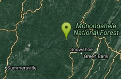
Elk River Area
Masontown, West Virginia
27.0 miles SWSwim near Masontown, West Virginia
Swim
Red Creek
Davis, West Virginia
27.4 miles NEA remote West Virginia canyon hides multiple waterfalls, natural water slides, and deep swimming pools along a 6.3-mile out-and-back through dramatic rock formations.
Camp, Hike, Kayak, Swim
Big Bend
Cabins, West Virginia
29.1 miles EA sandy-beached swimming hole on the Potomac River with deep enough water for splashing and a circular current perfect for tubing — plus a campground with showers and fire pits.
Swim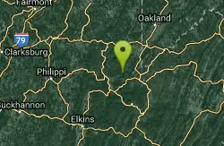
Horseshoe Bend Area
Webster Springs, West Virginia
31.0 miles NSwim near Webster Springs, West Virginia
Swim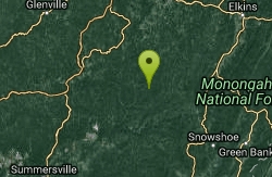
Holly River State Park
Webster Springs, West Virginia
31.7 miles WSwim near Webster Springs, West Virginia
Swim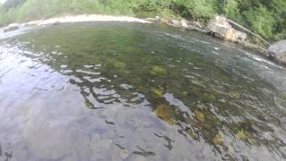
River Access Hole
Cabins, West Virginia
32.0 miles NEScenic forested rock formations and the rushing North Fork South Branch of the Potomac River offer wading, swimming, fly fishing, and float access — wear foot protection in the rocky riverbed.
Canoe, Kayak, Swim, Whitewater
Williams River Area
White Sulphur Springs, West Virginia
36.4 miles SWSeveral swimming holes in and near the Cranberry Wilderness of West Virginia's Monongahela National Forest — bathing suits optional.
SwimBullpasture Gorge
Williamsville, Virginia
38.1 miles SBullpasture Gorge is a wild and beautiful river canyon in the remote western highlands of Virginia, where the Bullpasture River carves a dramatic gorge through Highland County near Williamsville. A...
Canoe, Hike, Kayak, Whitewater
Petersburg Area
Parsons, West Virginia
39.8 miles NESwim near Parsons, West Virginia
Swim
Welton Park
Petersburg, West Virginia
39.8 miles NEA beautiful 29-acre riverside park on the Potomac River with beach and dock access, kayak and canoe put-in, picnic areas, campsites, a playground, and a growing holiday light show.
SwimNearby Campsites
Red Creek
Davis, West Virginia
27.4 miles NEA remote West Virginia canyon hides multiple waterfalls, natural water slides, and deep swimming pools along a 6.3-mile out-and-back through dramatic rock formations.
Camp, Hike, Kayak, Swim
North River Gap
Mount Solon, Virginia
41.9 miles SEA free recreation area with an easy 2.4-mile river gorge hike through lush forest, a wading and swimming spot in the North River, and primitive campsites for $5 a night.
Camp, Hike, Swim
Natural Chimneys
Mount Solon, Virginia
45.2 miles SETowering vertical limestone formations draped in trees and vines, with shallow river swimming holes, 2.5 miles of hiking and biking trails, and a well-equipped 135-site campground.
Camp, Hike, Mountain Bike, Swim


