


Hurricane River Beach (Pictured Rocks)
Grand Marais, Michigan

| GPS: |
46°39'51.6"N 86°9'43.2"W Maps | Directions |
| State: | Michigan |
Camp, Hike, and Swim
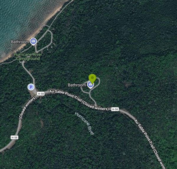
The Hurricane River comes out of the woods, spreads across a bar of sand and cobble, and slides into Lake Superior at the foot of a low bluff on the east end of Pictured Rocks National Lakeshore. The beach at the river mouth is the swimming spot for the Hurricane River Campground above it: stairs lead down from the lower loop to a long stretch of sand and smooth stones, the river makes a warm, shallow wading pool for kids before it hits the lake, and the big water beyond is as cold and clear as Superior gets. Late-summer surface temperatures at the beach reach the upper 60s on a good week; most of the season it is a quick-in, quick-out swim.
The campground has two loops, 11 sites on the lower loop near the water and 10 on the upper loop plus a group site, all reservable through recreation.gov at $25 a night from mid-May to mid-October, with a 36-foot vehicle limit. There are vault toilets and water spigots but no hookups or showers. Pictured Rocks charges a park entrance fee of $25 per vehicle, good for seven days, and the park is cashless. Leashed pets are allowed at this beach and campground.
The Lakeshore Trail, which here doubles as the North Country Trail, runs along the shore from the campground 1.5 miles east to the Au Sable Light Station, an 87-foot brick tower built in 1874 on Au Sable Point. The walk is flat and mostly under the trees, and at low water you pass the ribs and keel timbers of at least two wooden steamers wrecked on the point's sandstone reef in the 1800s, sticking out of the sand a few yards from the trail. The Park Service offers lighthouse tours in summer. West of the river the trail continues toward Twelvemile Beach and, farther on, the Pictured Rocks cliffs themselves.
Access is off Alger County Road H-58, the paved road that runs the length of the park, about 12 miles west of Grand Marais and 30 miles east of Munising. Grand Marais is the closer town for groceries, gas and a meal. Sable Falls and the Log Slide overlook are on the way in from Grand Marais and worth the stops.
Superior can turn from flat to breaking surf in an hour, and rip currents form at river mouths like this one when the wind is onshore. There are no lifeguards. Check the marine forecast and keep kids to the river and the shallows on windy days.
More Information
Camping at Pictured Rocks - Pictured Rocks National Lakeshore (U.S. National Park Service)
Pictured Rocks National Lakeshore has 3 drive-in campgrounds and 13 backcountry camping areas
https://www.nps.gov/piro/planyourvisit/camping.htmHurricane River Campground, Pictured Rocks National Lakeshore - Recreation.gov
Explore Hurricane River Campground in Pictured Rocks National Lakeshore, Michigan with Recreation.gov. Pictured Rocks National Lakeshore hugs the Lake Superior shoreline for more than 40 miles along Michigan's northern coast. Lake Superior is the largest, deepest
https://www.recreation.gov/camping/campgrounds/247603Be courteous, informed, and prepared. Read trailhead guidelines, stay on the trail, and don't feed the wildlife.
Read More
- Plan Ahead and Prepare
- Travel & camp on durable surfaces
- Dispose of waste properly
- Leave what you find
- Minimize campfire impacts
- Respect wildlife
- Be considerate of other visitors
Directions
From Grand Marais, Michigan
- Head west on County Rd H-58 W/
Carlson St toward Lake Ave Continue to follow County Rd H-58 WParts of this road may be closed at certain times or days(2.2 mi) - Turn right to stay on County Rd H-58 WParts of this road may be closed at certain times or days(9.4 mi)
- Turn right onto Lower Hurricane River RdMay be closed at certain times or daysDestination will be on the left(446 ft)
 A summer day at Hurricane River Beach courtesy of NPS↗ (Public domain↗)

 The beach at the mouth of the Hurricane River courtesy of NPS↗ (Public domain↗)

 The Hurricane River flowing into Lake Superior courtesy of NPS↗ (Public domain↗)

 Beach access from the Hurricane River Campground courtesy of NPS↗ (Public domain↗)

 Shipwreck timbers in the sand along the beach courtesy of NPS photo↗ (Public domain↗)
 Tent camping at Hurricane River Campground courtesy of NPS↗ (Public domain↗)
 Au Sable Light Station, a mile and a half east along the shore courtesy of Notorious4life (talk) (Uploads)↗ (CC0↗)

Other Swimming Holes and Hiking Trails Nearby

Sable Falls Beach
Grand Marais, Michigan
7.0 miles ELake Superior beach where Sable Creek reaches the lake below 75-foot Sable Falls, at the east end of Pictured Rocks National Lakeshore a mile from Grand Marais.
Hike, Swim 
Pictured Rocks
Shingleton, Michigan
21.4 miles SWA beautiful, little-used beach framed by the Pictured Rocks in Lake Superior's Pictured Rocks National Lakeshore — bathing suits may be optional.
Swim


