


Sable Falls Beach
Grand Marais, Michigan

| GPS: |
46°40'14.2"N 86°0'50.0"W Maps | Directions |
| State: | Michigan |
Hike and Swim
Sable Falls is the east gateway to Pictured Rocks, a 75-foot cascade dropping in steps through a sandstone gorge just off H-58 a mile west of Grand Marais. The falls get the crowd; the beach at the bottom is the reward. From the parking lot the trail descends 168 steps to the viewing platform, then continues another few hundred yards down the creek to the shore of Lake Superior, about four tenths of a mile each way. Sable Creek fans out across a beach of sand and cobbles, and the Grand Sable Dunes rise 300 feet straight out of the water to the west, a wall of sand perched on glacial banks that stretches five miles toward Au Sable Point.
Swimming here is Lake Superior swimming, which means cold. The water tops out in the upper 60s in late August on a warm year and is a good deal colder in June, and the creek mouth is a place where warm shallow water pools before it hits the lake. There is no lifeguard, and the National Park Service warns about rip currents on this shore whenever a north or northeast wind is pushing waves in. On a calm day it is a beautiful swim, with the dunes above and a beach that empties out as soon as you walk a few minutes from the creek. Pets are allowed on leash on this section of shoreline.
Pictured Rocks charges a per-vehicle entrance fee, payable online or at the Grand Sable Visitor Center, and the Sable Falls lot has seasonal flush toilets, drinking water and picnic tables. The lot is small and full by mid-morning on summer weekends; the overflow is the Grand Sable Visitor Center a half mile down H-58, connected by trail. The visitor center is also the trailhead for the Log Slide overlook and for the dune hikes.
Grand Marais is a good base: a harbor town of a few hundred people with a couple of restaurants, a brewery, a motel and the Woodland Park campground on the bay, plus the county's agate beach right in town. The North Country Trail follows the lakeshore through the park, and hikers day-tripping toward the Au Sable Light Station use the beach below Sable Falls as a start. Fall color on the dune bluffs peaks in early October, and a sunset from the beach with the dunes going orange is worth the cold feet.
More Information
Things To Do - Pictured Rocks National Lakeshore (U.S. National Park Service)
An official website of the United States government
https://www.nps.gov/piro/planyourvisit/things2do.htmBe courteous, informed, and prepared. Read trailhead guidelines, stay on the trail, and don't feed the wildlife.
Read More
- Plan Ahead and Prepare
- Travel & camp on durable surfaces
- Dispose of waste properly
- Leave what you find
- Minimize campfire impacts
- Respect wildlife
- Be considerate of other visitors
Directions
From Grand Marais, Michigan
- Head west on County Rd H-58 W/
Carlson St toward Lake Ave Continue to follow County Rd H-58 WParts of this road may be closed at certain times or days(1.4 mi) - Turn right onto Sable Falls RoadMay be closed at certain times or days(289 ft)
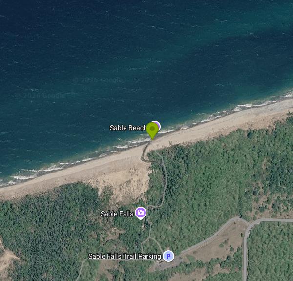 Sable Falls Beach with the Grand Sable Dunes behind courtesy of NPS↗ (Public domain↗)

 Sable Creek meeting Lake Superior at Sable Falls Beach courtesy of NPS↗ (Public domain↗)

 Sable Falls courtesy of Yinan Chen↗ (Public Domain↗)

 Sable Falls from the platform courtesy of Yinan Chen↗ (Public Domain↗)

 Sable Falls, Grand Marais courtesy of Joseph Gage from Yorkville, IL, USA↗ (CC BY-SA 2.0↗)
 The Grand Sable Banks above the beach courtesy of NMMIMAJ↗ (CC BY-SA 3.0↗)

Other Swimming Holes and Hiking Trails Nearby

Hurricane River Beach (Pictured Rocks)
Grand Marais, Michigan
7.0 miles WLake Superior beach where the Hurricane River comes out at Pictured Rocks, with a 22-site campground on the bluff, shipwreck timbers in the sand and the Au Sable Light a mile and a half east.
Camp, Hike, Swim 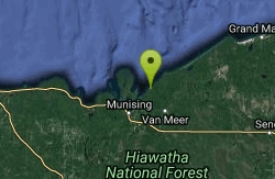
Pictured Rocks
Shingleton, Michigan
27.8 miles SWA beautiful, little-used beach framed by the Pictured Rocks in Lake Superior's Pictured Rocks National Lakeshore — bathing suits may be optional.
Swim


